

weatherwiz
-
Posts
81,138 -
Joined
-
Last visited
Content Type
Profiles
Blogs
Forums
American Weather
Media Demo
Store
Gallery
Everything posted by weatherwiz
-

Wounded Duck Strikes Back: Dec 26 & 27th Winter Storm Obs
weatherwiz replied to WxWatcher007's topic in New England
4.3” final northeast side of Springfield! Picked up another 2” after going to bed. Looks amazing outside -
Wounded Duck Strikes Back: Dec 26 & 27th Winter Storm Obs
weatherwiz replied to WxWatcher007's topic in New England
2.3" so just under an inch over the last hour. Hoping light snows will continue long enough to end up with 3". -
Wounded Duck Strikes Back: Dec 26 & 27th Winter Storm Obs
weatherwiz replied to WxWatcher007's topic in New England
been fun watching that across northeast PA. Wondering if that can even fill in some across the Lower Hudson. some nice s/w energy hanging back -
Wounded Duck Strikes Back: Dec 26 & 27th Winter Storm Obs
weatherwiz replied to WxWatcher007's topic in New England
For some reason I thought I went 4-7" here but I checked my map and I am in the 2-4" zone so I will hit that. -
Wounded Duck Strikes Back: Dec 26 & 27th Winter Storm Obs
weatherwiz replied to WxWatcher007's topic in New England
just measured 1.5" -
Wounded Duck Strikes Back: Dec 26 & 27th Winter Storm Obs
weatherwiz replied to WxWatcher007's topic in New England
yup still coming down nicely! unfortunately I don't think I'll hit my forecast here but this is fun regardless. -
Wounded Duck Strikes Back: Dec 26 & 27th Winter Storm Obs
weatherwiz replied to WxWatcher007's topic in New England
Been dumping but with poor snowgrowth but snowgrowth has improved! -
Wounded Duck Strikes Back: Dec 26 & 27th Winter Storm Obs
weatherwiz replied to WxWatcher007's topic in New England
I remember seeing that and thinking to myself that I am glad Friday is not a day I go into Branford lol. -
Wounded Duck Strikes Back: Dec 26 & 27th Winter Storm Obs
weatherwiz replied to WxWatcher007's topic in New England
Friend just called me. On the train into New Haven then has to drive to Meriden. Good luck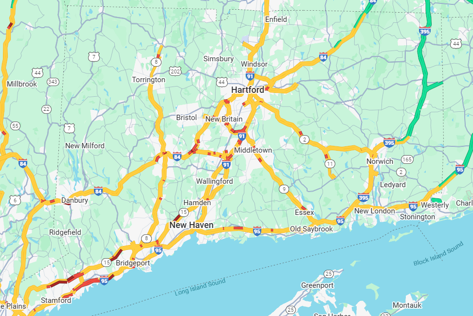
-
Wounded Duck Strikes Back: Dec 26 & 27th Winter Storm Obs
weatherwiz replied to WxWatcher007's topic in New England
For sure -
Wounded Duck Strikes Back: Dec 26 & 27th Winter Storm Obs
weatherwiz replied to WxWatcher007's topic in New England
Went to go wash dishes look outside 2 minutes later...everything is all covered!!!!! wooohoooo -
Wounded Duck Strikes Back: Dec 26 & 27th Winter Storm Obs
weatherwiz replied to WxWatcher007's topic in New England
yeah that back edge approaching quick. folks under the banding though are good for a bit though -
Wounded Duck Strikes Back: Dec 26 & 27th Winter Storm Obs
weatherwiz replied to WxWatcher007's topic in New England
was waiting for your post! This bodes well for me -
Wounded Duck Strikes Back: Dec 26 & 27th Winter Storm Obs
weatherwiz replied to WxWatcher007's topic in New England
I am right on the edge on some of the heavier echoes so it can't be too far away. -
Wounded Duck Strikes Back: Dec 26 & 27th Winter Storm Obs
weatherwiz replied to WxWatcher007's topic in New England
Still waiting here. I should be starting soon...I hope -
26th-27th event, coming at us like a wounded duck.
weatherwiz replied to Go Kart Mozart's topic in New England
Should be able to keep the banding going farther east...perhaps even some continued enhancement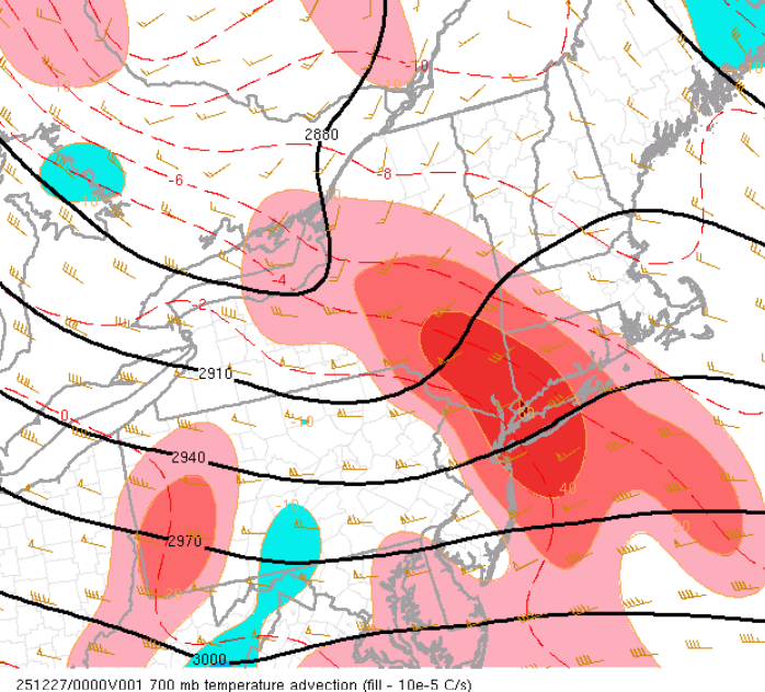
-
Wounded Duck Strikes Back: Dec 26 & 27th Winter Storm Obs
weatherwiz replied to WxWatcher007's topic in New England
I don't think that is necessarily indicating a change to sleet, I think its indicating that as the DGZ begins to dry out behind the banding and precipitation rates taper off, precip could end as a bit of sleet pellets but that isn't going to negatively impact totals. All of the accumulation will have occurred by then -
Wounded Duck Strikes Back: Dec 26 & 27th Winter Storm Obs
weatherwiz replied to WxWatcher007's topic in New England
Well if there is going to be thundersnow should start seeing reports very shortly -
26th-27th event, coming at us like a wounded duck.
weatherwiz replied to Go Kart Mozart's topic in New England
Cloud tops continuing to cool as well to the east which is a great sign -
26th-27th event, coming at us like a wounded duck.
weatherwiz replied to Go Kart Mozart's topic in New England
Awesome! God I hope I can get into this -
26th-27th event, coming at us like a wounded duck.
weatherwiz replied to Go Kart Mozart's topic in New England
yup...what was lost was negligible but that is what was going to happen...come in like a wall where the banding outside of the banding is a bit of a different story. Like I'm waiting for snow here despite being under some returns. will take a bit here until those heavier echoes push east -
26th-27th event, coming at us like a wounded duck.
weatherwiz replied to Go Kart Mozart's topic in New England
Scott is talking about dry air more towards eastern MA and his area...it wasn't a concern here -
Wounded Duck Strikes Back: Dec 26 & 27th Winter Storm Obs
weatherwiz replied to WxWatcher007's topic in New England
Nice 3" report from Danbury 30 min ago -
Wounded Duck Strikes Back: Dec 26 & 27th Winter Storm Obs
weatherwiz replied to WxWatcher007's topic in New England
The llvl dry air is/was always a concern farther northeast. Not western or central CT. It was always to saturate quickly -
26th-27th event, coming at us like a wounded duck.
weatherwiz replied to Go Kart Mozart's topic in New England
saw this pop up live on Radarscope!!! SUMMARY...Heavy snow bands will spread/develop southeast across upstate NY toward southern New England over the next few hours. Snow rates of 1-1.5"/hr are expected. DISCUSSION...Low-amplitude short-wave trough is progressing southeast across western NY/PA early this evening. Latest water-vapor imagery depicts a notable midlevel vort max southwest of Syracuse, and this is reflected well in radar data. Multiple heavy snow bands have developed ahead of this vort max, strongly influenced by low-level warm advection, extending across upstate NY into the lower Hudson Valley. Boundary layer moistening supports this with dew points now rising into the mid teens (F) where snow rates are increasing. Over the next few hours snow rates are expected to increase downstream across western CT and Long Island, largely in response to this well-defined short wave digging toward the northern Middle Atlantic. Snow rates of 1-1.5"/hr can be expected prior to the short wave passage.


