weatherwiz
-
Posts
81,150 -
Joined
-
Last visited
Content Type
Profiles
Blogs
Forums
American Weather
Media Demo
Store
Gallery
Everything posted by weatherwiz
-
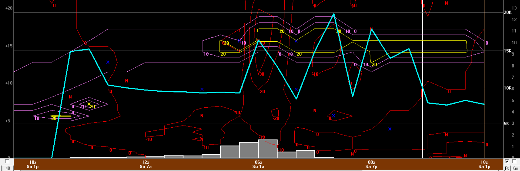
This one had a lot of flags present, plus we have a long-standing history of knowing how these events roll. Unless you’re into the heaviest banding for a longer duration, go low. Once again Bufkit, NAM, GFS, and HRRR (as we got into its range) did a phenomenal job illustrating how this would pan out. Now, bufkit isn’t the holy gospel, if the model doesn’t have banding go over that location say, well then it will be way off, however, that’s something you factor in when making a forecast. Anyways, just like last week, most locations on bufkit literally had 2-3 hours of heavy snow with rates ~1”+ per hour, outside that window rates were barely even 0.50” per hour and hardly even above 0.2”. QPF maps have to be used with extreme caution in these fast moving events too. You really have to nail down, of that QPF how much is being maximized efficiently?
-
Not sure I even ended up with 4-5” here but anyways, I think this storm went about as well as it could have forecasting wise. I love these storms because there are so many different processes involved and it really takes a good bit of time to digest everything and then try and simulate in your head how things will play out.
-
woah wtf happened to the radar
-
1” down https://imgur.com/a/6zkiytc
-
Now it’s dumping, snow growth improving big time. This is easily going to be 1”+ per hour stuff
-
Yeah one second nothing and the next it was heavy pixie dust
-
SNOW!!!! Finally!!!! it’s crappy flakes but it’s like pixie dust…heavy pixy dust
-
How in the hell is it not snowing here? This is absolutely BS…this is fooked. This is highway robbery
-
Not even a single flake yet
-
You can probably go to bed by 2
-
Still waiting here. If it’s doing anything it’s flurries. Have a kitty on my lap so can’t get up and get to the window for a closer look
-
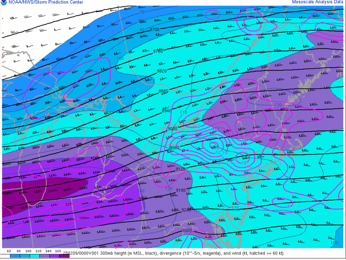
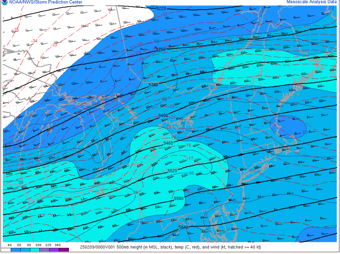
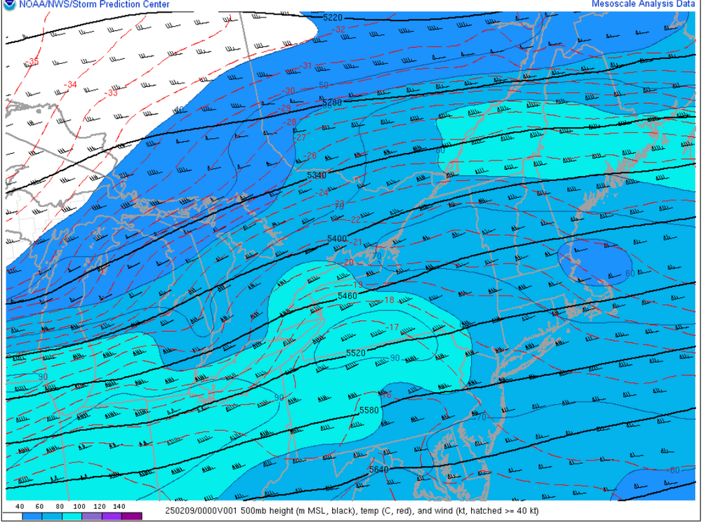
upper-level divergence is increasing and nose of strong mid-level jet streak punching in This should (hopefully aid in filling things in a bit more, especially south

-
Essentially, majority of the snow really falls in a 3 hour period (like 99.9%).
-
 It’s mesoanalysis time
 -
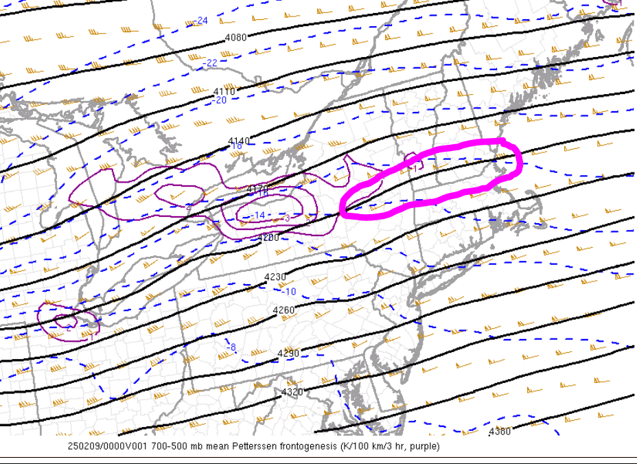
Looks like things could aligning great for the jackpot zone area. Be fun to watch that 700-500 area of fronto continue strengthening
-
I keep peeping out the window waiting to see flakes
-
Seems on track to me QPF expectation wise (generally in the 0.50" range). This is hauling way too quickly for anything upwards of 0.75"-1.00", especially since the duration of enhanced lift is short. Still thinking most see 4-5" with 7-8" for those under the extra goodies longer.
-
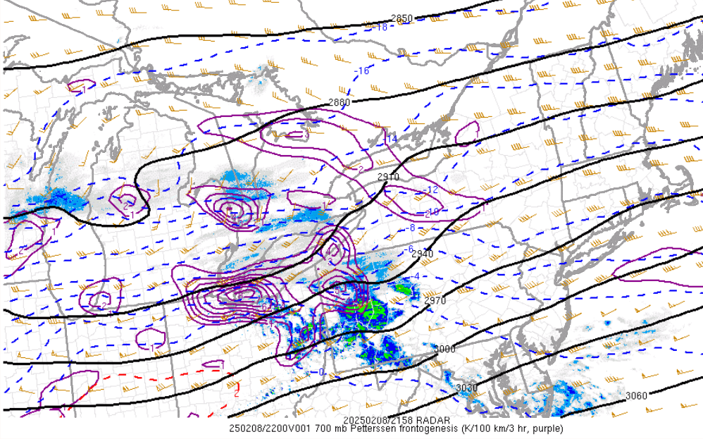
HRRR looks good and on track. But we radar and mesoanalysis now
-
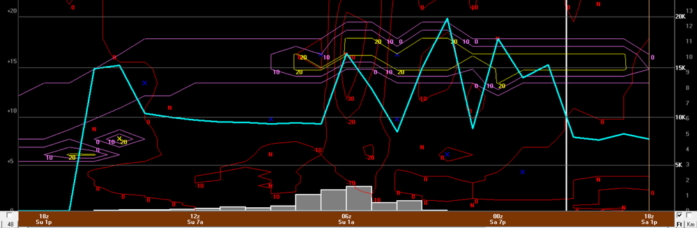
I don't think we'll see any lightning. Though I could be wrong...with bufkit soundings showing -40 ubar/sec into the DGZ that may be enough to net a few strikes.
-
One of the most fun part of storms unfolding...the fronto maps. Our 700 fronto is starting to get cranking
-
Hangs back some H7 fronto a bit longer down there?
-
The GFS looks good but I don't think it's THAT amazing. It's also pretty damn close with that warm nose into southern CT. I was looking for some soundings showing some epic crosshair sigs like what the NAM had when Ryan showed...haven't been able to locate anything yet. GFS doesn't seen any more epic than other models to me.
-
Hot off the presses 18z NAM bufkit for BDL. It will be RIPPING say 4-7z
-
Def most of the storm is certainly done by then. I think its just more of the fact of not losing sight of it. But yeah for most of us its getting slammed by the initial burst then a rapid decrease in intensity.
-
Yeah I was wondering if that dry slot would also be helping with enhanced forcing...that's a beast of a dry punch. The 12z NAM 800-600 fronto from fsu looked yummy