weatherwiz
-
Posts
81,150 -
Joined
-
Last visited
Content Type
Profiles
Blogs
Forums
American Weather
Media Demo
Store
Gallery
Everything posted by weatherwiz
-
It's too hard
-
This is true. They are extremely frustrating. I also like your idea of using 50 year versus 30 year.
-
I'm not a fan of comparing everything to 30-year averages either...or at least in a sense of having that be the #1 gospel to adhere to. If we're going to compare current to a 30 year period then it should also be compared to a much longer term average.
-
Who cares if cold is "normal" or that -10 or -15 isn't uncommon...IT DOESN'T CHANGE THE FACK THAT IT SUCKS!!!!! Normal can suck too 79°F are NORMAL in Florida during the summer but that doesn't mean it doesn't suck for those who hate it. 110°F is NORMAL in Phoenix and Las Vegas during the summer but that doesn't mean it doesn't suck for them. The New York Jets sucking is NORMAL but that doesn't make it any less painful for Jets fans each year.
-
Well folks, with winter headed towards its final stretch it is time to start looking forward to Spring and Summer which means three things; 1. Heat 2. Humidity 3. Convection Put all these three together and you can get some fun late Spring and Summer months with plenty of heat, humidity, and convection. In terms of severe convection, we're climatologically favored typically between mid-June and mid-July, however, we had had plenty of severe weather events in the past and some big ones during the late week of May and first week of June. While there hae been some significant localized severe weather the last several years, it has generally been rather mundane. Hopefully that changes this year. But we begin the countdown to May which is a beautiful transition month as we turn to deep Summer. The countdown: 99 days!!!
-
It seems like this winter has been dragging…just cold and boring. At this point I’m just ready for late spring/summer. I wish we could get front loaded winters. By mid-to-late February I’m really ready for late spring. If this is an awful spring it’s going to be a grueling haul moving into Summer.
-
A few clippers upcoming, including one late Saturday/Sunday. Sometimes these can blossom into something last minute, all they need is some extra moisture injection and boom. Looks like the Tuesday into Wednesday has some inverted trough potential.
-
I would watch Tuesday into Wednesday for something sneaky
-

New England Winter 2024-25 Bantering, Whining, and Sobbing Thread
weatherwiz replied to klw's topic in New England
Does that mean we also get to refer to Greenland blocks as Trump blocks? -
Maybe if we're lucky we get some snow squalls Tuesday night, though verbatim best chance would be north and west. Also looks like there could be some severe weather risk in southeast Texas and Louisiana around Feb 5th
-
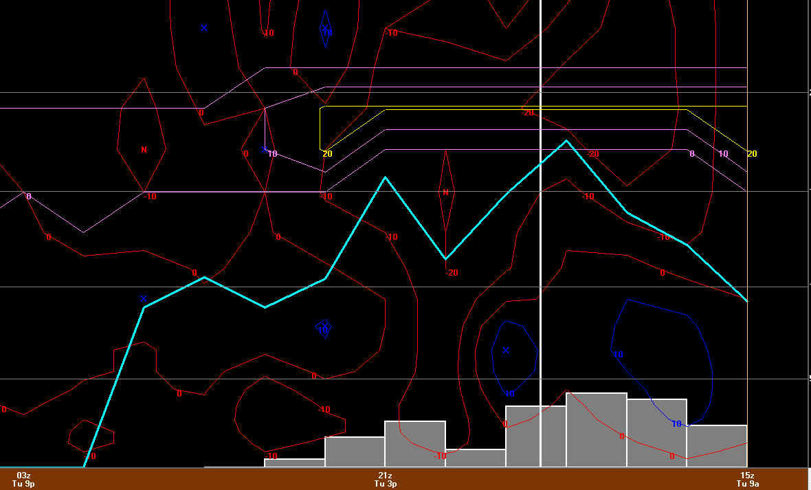
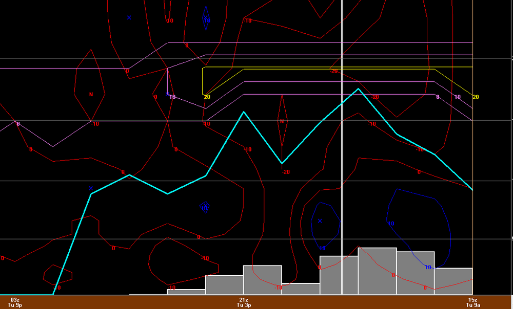
I almost spit out my coffee when I saw CEF was -10 lol. I really didn't pay attention to how low temperatures could get last night so I was totally off guard. I mean I knew it was going to be frigid but not -10 frigid. If someone had asked me what the temp was outside I maybe would have said single digits...but it makes total sense now based on how quickly the cold ate me.
-
Man what was going on in 1899? looks like a super strong EL Nino. so I guess super strong EL Nino's back then weren't country blow torches.
-
I actually had no clue it was as cold as it was. I was outside clearing off my gf car because she had to go out and I'm a frozen popsicle...the kind that's been in the freezer for a year and is freezer burned, that is me. I can't feel my feet. I didn't even have gloves on at one point but when I went back out I put some on. If I knew it was around -10 I would have worn boots and two layers of socks...UGHHHHH
-
THIS IS BRUTAL...THIS IS AWFUL...NOT FUN. FAKE, REAL, WHO CARES. THIS NEEDS TO END
-
I wonder how many local mets down there had to brush up on winter weather forecasting
-
I bet they get a historic snowstorm next year too...except it gets into southern Florida. The NHL is oddly doing outdoor games in Florida next January. I was betting on them like a crazy heat event with temps in the 80's but watch them get a snowstorm instead
-
I am also pissed, I for sure thought we would see some potential this weekend...i said no shot of anything going OTS....FOOKING FAIL
-
That is pretty wild. You would have thought thundersnow down there would be associated with some extreme mlvl instability...nope, due to extreme lift and crosshair sigs
-
This was the 16z HRRR for MSY. This is sexy, much sexier than snow maps.
-
A 7" report in Johnson Bayou, LA...essentially right on the Gulf Coast
-
I'm surprised MSY is still open. Obviously nothing operating into/out of but shocked they didn't announce a closure.
-
I hope this bitterly cold doesn't screw up the Gulf of Mexico too much...I want 70's dewpoints in here by May. But hey...the deep south steals our snow, maybe we'll steal their severe
-
Already looks like 1-2+ in/around New Orleans
-
7" report from Hayes, LA!
-
I'm sure we'll some some whacky totals because people are measuring drifts