weatherwiz
-
Posts
81,151 -
Joined
-
Last visited
Content Type
Profiles
Blogs
Forums
American Weather
Media Demo
Store
Gallery
Everything posted by weatherwiz
-
 BDL. I hope this verifies. And I don't mind looking at what ratios look like this far out so don't weenie me
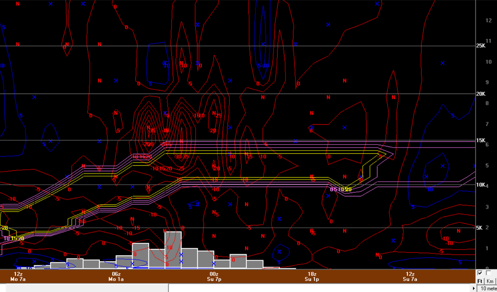
-
I wonder if the NAM is kind of chasing convection a bit there. But whatever...84 hr NAM.
-
I think it also depends on region...some areas it can be brutal in. Obviously it isn't going to handle anomalous patterns well but you're right...you have to know when to deviate from it.
-
Some notable differences aloft on NAM versus GFS/Euro (I know shocker, right).
-
Assuming this stays on course, the NAM should probably start becoming more beneficial 12z or 18z Saturday when really starting to diagnose banding potential and those specifics.
-
I just really hate MOS When I used to participate in the forecast challenge, if you basically ripped and read MOS for temps/wind you would get destroyed. Unfortunately, I still use MOS/NBM a ton because there is no other choice but it is cringeworthy how bad it really is and can be. I know feasibly forecasting specifics like temp/sky cover/wind takes an in-depth dive but if you don't have that capability to really do that...ugly ugly
-
wth...using MOS numbers for snowfall? I didn't realize anyone still did that. MOS is a piece of trash, unfortunately there is nothing else to use for quickly forecasting temperatures.
-
Oh boy...I hope they can incorporate that into bufkit
-
Even better than cobb?
-
Exactly. And with that, I think there is room to see this trend a bit stronger as we get closer and I would lean towards that happening. These trends I think are models catching up to the full potential. The 850/700/500 looks are very good here.
-
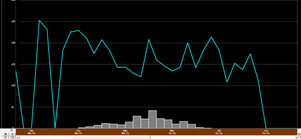
Have to see what bufkit shows around noon but ratios could be extremely good. I would have to think, at least under the banding, we could push anywhere from 15:1 to 20:1. Talking about highest ratios here...obviously will differ probably towards the coast.
-
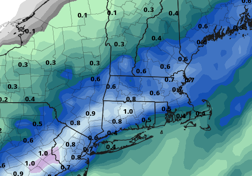
Very nice (this is in northeast CT ish). I'm looking at national map so not zoomed in.
-
yeah I was able to see that with Scott's suggestion of clicking radar (rain/frozen) versus MSLP + radar.
-
some pretty good llvl inflow with strengthening llj. Going to see a pretty solid band if that verifies.
-
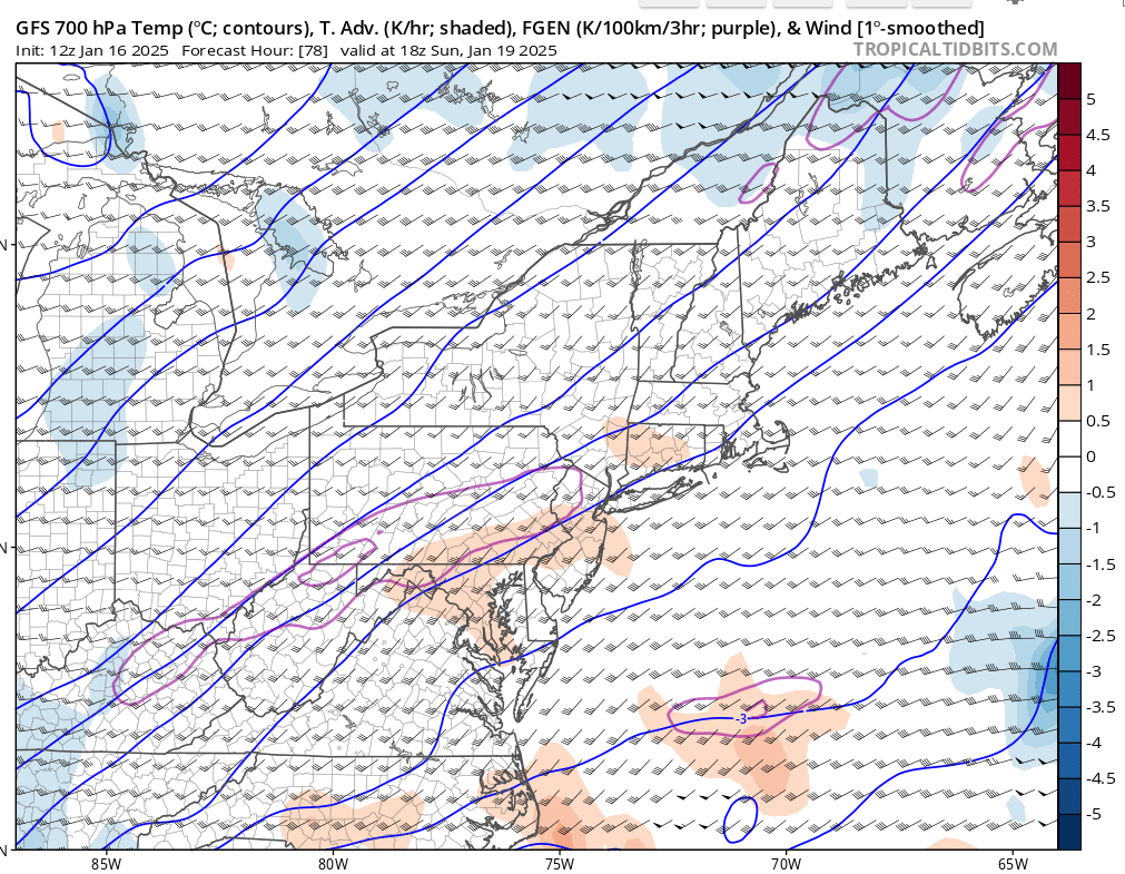
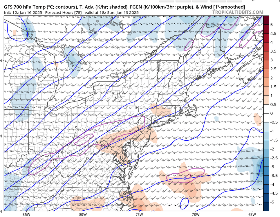
ahh makes sense. I would prefer to see more though than QPF but I would hope this is an encouraging signal for fronto potential at 78hr
-
Weird, hours 84-96 are grayed out for me on TT
-
I have a feeling Sunday night is going to surprise. You have some nice PVA feeding in and we're on the nose of a pretty strong 500mb jet streak. There should be some great frontogenesis over the region too. This would be one where I think the heaviest banding of snow would be farther northwest than models indicate and there is a nice inverted trough feature. I think this could evolve into a 3-6" type event for much of the region and maybe as much as 6-9" where heaviest banding traverses.
-
What's going to happen is we're going to get into the second half and February and first half of March and have all kinds of potential...but it will be interior/elevation that ends up cashing in. It will be the period where we're all hooting and hollering, "If only we got this setup x number of weeks ago".
-
euro still has Sunday night. Could see a nice heavy band evolve well northwest of the center, albeit narrow.
-
Very intriguing period for sure.
-
I do miss the times when discussions were more serious and the banter and emotional contributions would be at a minimum. I get everyone is fed up and all but like I said above, alot of the serious discussions get diluted and quickly because emotions start flying around. Maybe there should be some threads that are just designated to serious discussion - I know that's what the storm threads are for but a thread where you can bounce around ideas and principles. If you have anyone reading that is in college or maybe high school with a strong interest in meteorology - this place is second to none with knowledge and information. I know for myself, there is no way in hell I would be where I am today without what I have acquired and gained from the board over the years.
-
I get that but sometimes it bleeds into great discussion. There are probably lots of people who read (but don't post or post much) who are really trying to learn and understand more. This is a phenomenal source for learning and understanding the weather but it gets diluted at times.
-
How do you think I feel in the Summer I make a thread for convection...just general thunderstorms with maybe a rogue severe storm or two and everyone is screaming bust because there are no EF3s or widespread destructive winds or widespread hail...NO SHIT....never said there was going to be.
-
Just saw the 12z euro...that makes more sense to me then what the GFS was doing. Long ways out but this reminds me of (2 winters ago...maybe 3) when they had the series of winter storms across the deep South and we got one to come up the coast. Sure the look is suppressed well into the Gulf Coast but I love how the baroclinic zone is setup off the coast. Count me as intrigued around the 23rd.