weatherwiz
-
Posts
81,150 -
Joined
-
Last visited
Content Type
Profiles
Blogs
Forums
American Weather
Media Demo
Store
Gallery
Everything posted by weatherwiz
-
Back patio FINALLY ice free! Dog is very happy. Still has trouble walking within the yard though because of the snow but hopefully this will help get him comfortable with going to the bathroom outside more and not inside.
-
Outside with the dog before bed and it’s pretty nice out still…wow
-
That is quite the difference between Euro OP/GFS OP for March 5-6 lol. Euro with a 984 primary into Michigan and sliding across southeast Canada. Kevin would have his wind fetish satisfied
-
Keep in mind too, the better part of the last decade has been some wild transitions between ENSO events and this includes multiple super strong EL Nino's. When you account for lags which typically exist between the oceanic-atmospheric coupling and then throw in some rapid ENSO transitions and you're dealing with extreme chaos. Lots of gradients, both temperature and pressure, and combined with external forcings, what is the response of the atmosphere going to be with these gradients...very fast flows during the NH winter. We get ourselves into some more dormant ENSO years and we will see things relax.
-
That was one incredible stretch for sure
-
I’m still not over last winter. I felt really good going into the winter. The straw in the bag was the early Feb storm (well almost mid Feb) where north/central CT ended up getting hammered. I for sure thought I would see a foot minimum and got like 3.5”. I’m just ready to reset and try again next winter. If we get something in the next 3-4 weeks I’m game but I’m not getting investing in anything outside of 3-4 days (except of what I would have to do for work).
-
Getting a bit icy out there with todays melt refreezing
-
Sweeney/Neely screwed up and Montgomery was the scapegoat. Montgomery is a west coast offense guy…that’s why they brought him in, they wanted to become a more explosive offensively team. But what do you need for that system…speed and guys who can play make and quickly transition zone to zone. After the first Florida loss…Sweeney/Neely asked multiple bruins and Montgomery what they needed…they said speed. Same thing after last season. So what did they do, go out and bring in just the opposite. They have to re-tool on some players and the whole coaching staff.
-
Bank this… Bruins get the second wild card spot, match against the Caps, and knock them out in 5. but yeah I’m down for a little retool.
-
Tip’s sun angle definitely felt today. Was sweating actually driving…didn’t even need heat on
-
Eh we can get lucky with a few of those days. Hopefully anyways
-
I am really hoping we can sneak in some upper 70’s and 80’s in late April and May on a weekend with a Bruins playoff game and watch outside…that would be heaven. If we can muster out final snow storm let’s do it.
-
I was thinking of that, is that stuff safe for dogs though? I thought it wasn’t good for their pads
-
And WTF is going on in here? Some folks may want to get checked for carbon monoxide poisoning
-
This is nuts. Made a little bit of progress on back patio. Just sucks it only gets a few hours of sun.

-
68 days!!!
-
Actually kind of pleasant out today, could almost chop ice naked but not a good idea with ice flying around from the chopping.
-
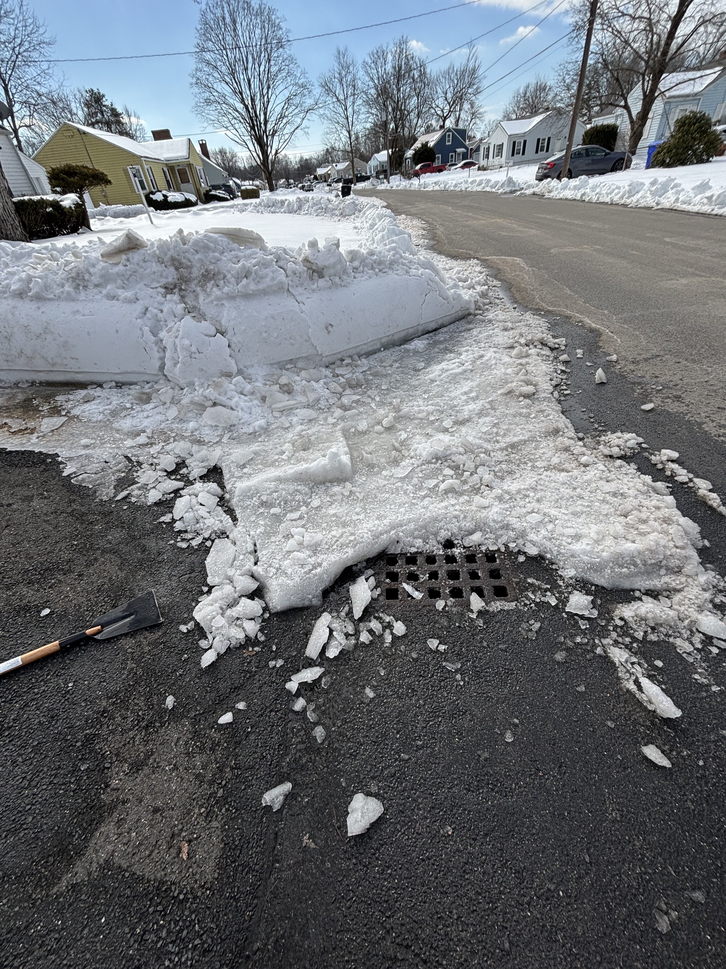
I had started to clean but then elected not too b/c I figured the snow would some ice on it would be easier to deal with then any freezing rain clinging to the concrete…oops bad mistake.
-
I took the ice chopper and chopped at it and the ice pieces that broke off I took the shovel and heaved them into the snow.
-
Our road has gotten a bit better but it’s not great. Thankfully, a good portion of the ice at the end of the driveway and into the road is gone. I did alot of work on it Monday evening. Need the ice on the patio to melt though so dog can’t get out there. Sucks because that area doesn’t get good direct sunlight yet. It’s too much to chop and deal with
-

New England Winter 2024-25 Bantering, Whining, and Sobbing Thread
weatherwiz replied to klw's topic in New England
Could be a samsquanch -
This was yesterday but still a great sight. Maybe I posted this…who knows
-
It's more so towards the end of it I am tired of it and ready to move on. It's not like November comes and I get all bent out of shape...I can typically deal with it but about this point I am done.
-
I don't mind the cold but months on end of it gets tiresome...thankfully we got some wintry events this month...that always helps. Upper 20's and 30's aren't a big deal but single digits, teens, lower 20's, especially wind...not fun at all.
-
2 weeks until we set the clocks ahead! Always love that but hate that forecast models come out an hour later