powderfreak
-
Posts
83,664 -
Joined
-
Last visited
Content Type
Profiles
Blogs
Forums
American Weather
Media Demo
Store
Gallery
Everything posted by powderfreak
-
72/46 Great day. Refreshing breeze, sunshine, puffy Cu, low dews and 70s.
-
The webbed hands of Stein slowly kill you like a boa constrictor… it’s so slow, you don’t know it’s happening until it’s too late. Can see the appeal of staying ahead of it.
-
All that looking forward to a dry 10-14 day stretch lasted about 24-48 hours without rainfall before you want more of it?
-
Still been holding 70-72F during the 3am hour for a proper overnight torch, ha. Warmest in New England in the north central mountain valleys of the Greens.
-
Still 72F at 9:30pm.
-
How much snow though?
-
81/54 is about perfect.
-
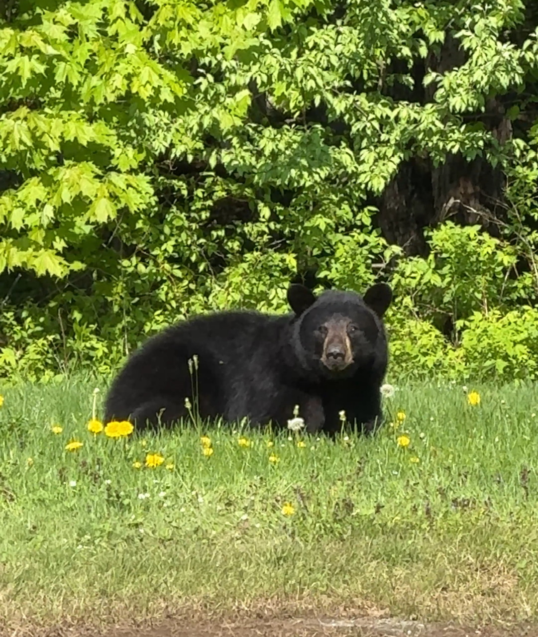
Found this guy just resting in the sun this morning…

-
You’re right, that depiction would be summer sun in CT. Beach weather on the Sound. Not variably cloudy at 55-60 degrees.
-
Shut ‘em down. The fresh green has exploded on the hill with the rain this weekend. Today saw heavy sheet drizzle up in the cloud, but 2,000ft lower where this pic is from, it was just a few sprinkles. Upper half of the mountain (3-4K feet) was a soaking wet environment. It felt like those days when there’s 6-8” of orographic fluff up top and only an inch or two at the base.

-
Congrats on day 100!
-
Feels like the hand wringing gets worse now with rain compared to snow. We are all getting old haha.
-
NNE going to steal the rain tonight?
-
This is just leftover snow. You can hike all around and go wherever you want. The Toll Road was open but that’s it. There are no services at a closed ski area on leased state land. You can go wander around but if something happens you need to call 911, not the ski area. It’s considered backcountry. These are just folks who saw snow and were drawn to it.
-
Saw a couple families sledding today. Lugged the light plastic sleds up and were taking turns going sledding down the terrain park piles. Others just sliding around on their shoes. The remaining snow was an attraction for the holiday weekend.
-
That’ll do it for the natural snow season on Mansfield. The stake is now clear of snow for 360 degrees around the immediate tree it’s on. It’s still patchy up there in the E/NE facing high ground but getting fewer and further between them.
-
High clouds moved in, but nice shorts a T-shirt weather to the summit.
-
I know, quite the flip possible. Its pretty nice here now. 66/37
-
Low of 34F. Already 61F and nice out.
-
42F at 10pm… its just an overnight and early morning chill, then moderates rapidly in the AM… but it does impact heating/cooling usage. 67F high, 42F now. The temperature is always moving around here.
-
You think 1,000ft where his point and click is probably from sees 10 days of 75-85? I’m guessing 1,000ft is 67-79F starting Monday like that forecast. Doesn't seem unreasonable.
-
Yeah I hear ya, and we post about it because it’s the min temp… but it’s also such a small part of the day its impact is very minimal except for sleeping and maybe to the vegetation.
-
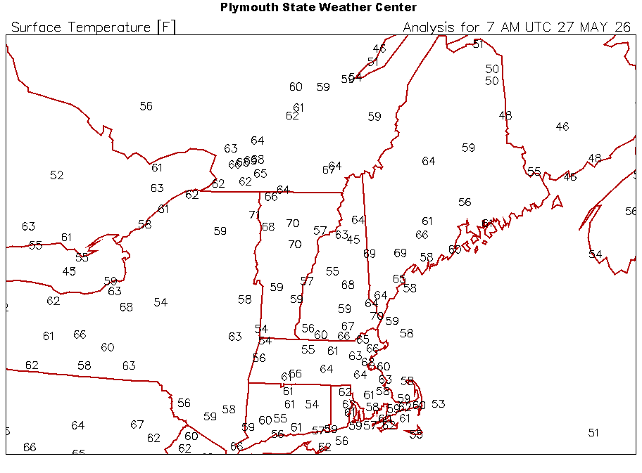
Ha I don’t think so, it’s just a different climate. We recover like 8-10F per hour rapidly… so comparing here vs OXC/Waterbury, CT 6am… 29F vs 48F By 9:15am… 54F vs 54F Very quickly normalizing after sun-up.
-
Ha, you guys make it sound like it’s 30s up north while it’s 70s down south. We had a hard freeze and are now the same temp as Waterbury, CT. We go up and down fast.
-
We are getting there. Ebb and flow.