powderfreak
-
Posts
83,678 -
Joined
-
Last visited
Content Type
Profiles
Blogs
Forums
American Weather
Media Demo
Store
Gallery
Everything posted by powderfreak
-
No, 69F is today’s 1,100ft average based on MPV norms. BTV is 74F. In another few days it ticks up to 70-75F.
-
Need some summer to go along with this long daylight. I’d take consistent 70s at this point.
-
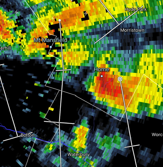
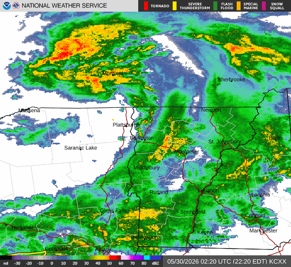
Yeah good call, it was downwind of the storm. I figured the dry low levels to start must’ve been eating up the liquid drops while the hail could make it to the surface. Still, not something I can remember seeing before. Just scattered hail stones falling as the leading edge… usually hail only comes in the core around these parts.
-
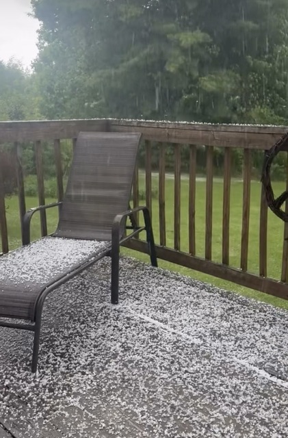
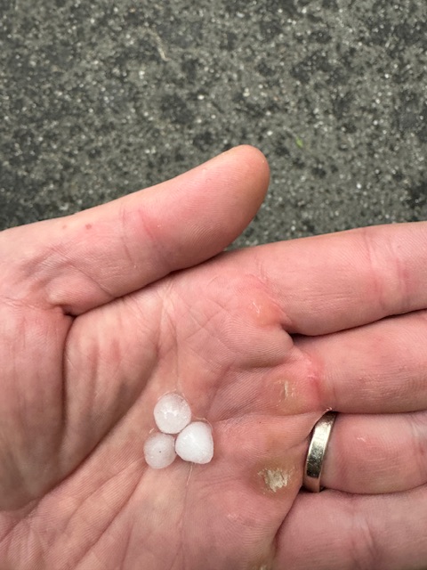
Decent pea-sized hailer around these parts.
-
Heavy hail now.
-
Not sure I’ve ever seen a shower start off with hail. Ground not even wet, just started as ice (peas).
-
Those storms north of the border are prolific lightning producers, damn. Hope that drifts south before we lose daytime heating.
-
Not going to lie, I just clicked on him and the first three posts are about drought relief (not hyping), a break in the Florida humidity with dry air, and cold New England temps.
-
Today’s going to be a lot worse than yesterday up here, ha. Raining and chilly.
-
That’s probably around 3sm -SN.
-
You look stoked, ha. Nice, those are big flakes to capture in a still frame like that.
-
That’s impressive. Tip of the cap.
-
Can see MWN and Lafayette ridgeline glowing from over here. Love how fast it cleared up.
-
It’s crazy how rapidly it left up here too. Turning into a sunny day and already 50s at 1,500ft after mangled flakes four hours earlier. 1.56” past 24 hours.
-
Nice Dave! That’s legit.
-
65-72F…
-
Cleared out pretty quick after precip ended.
- 306 replies
-
- 12
-

-

-

-
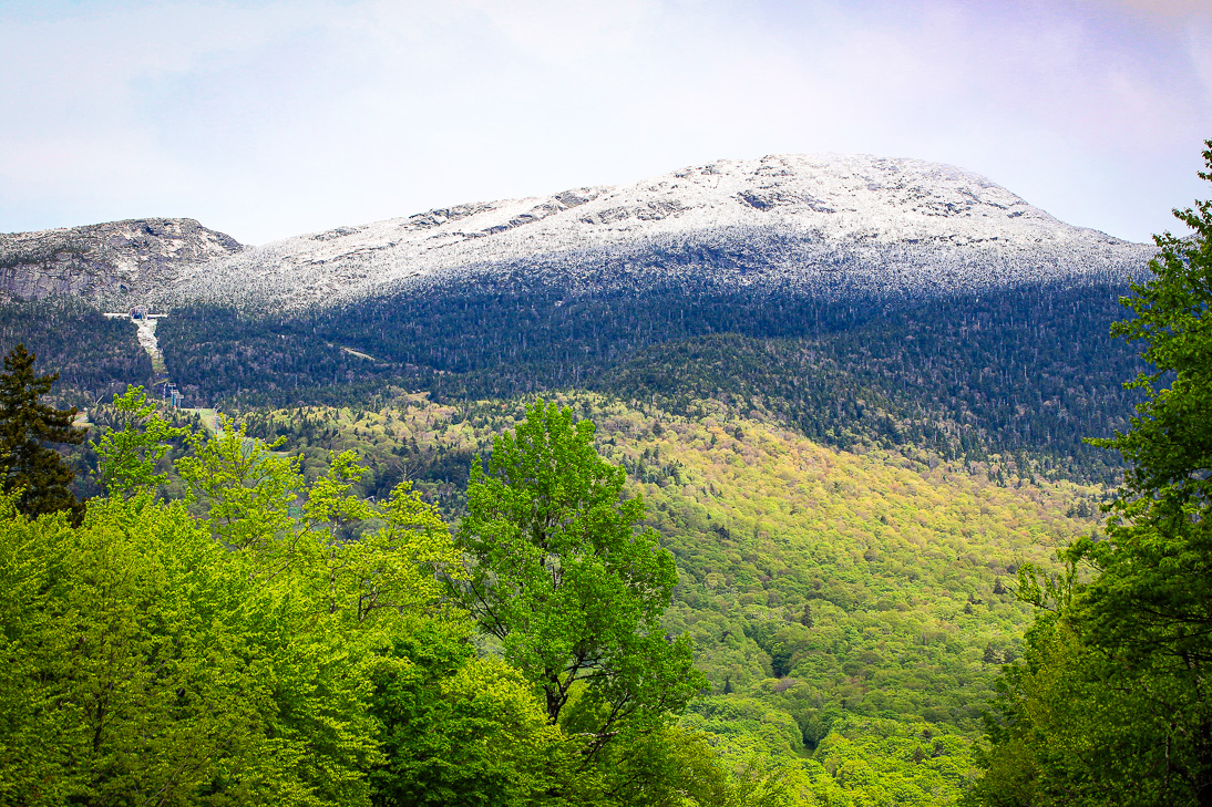
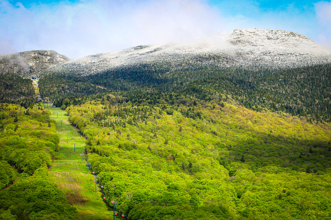
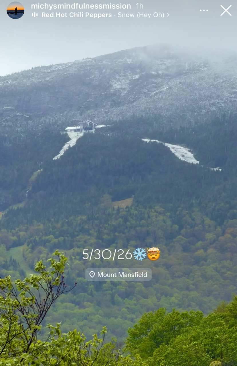
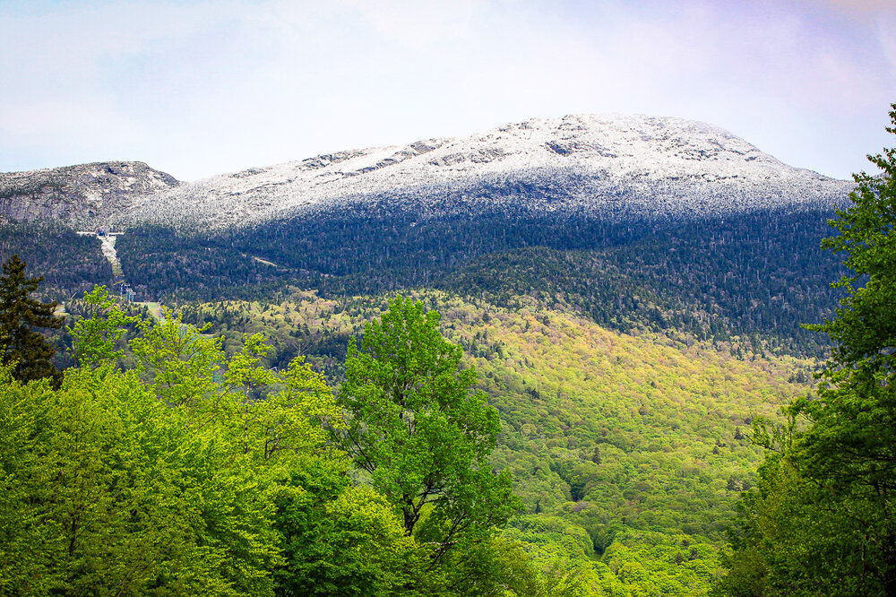
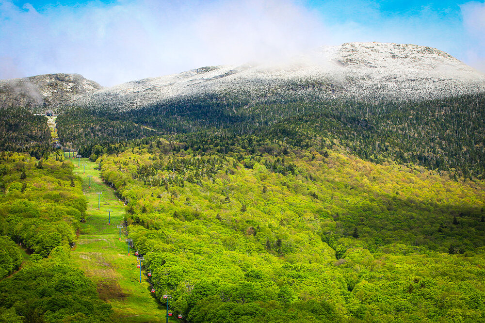
Very top of Mansfield got some. From social media:

-
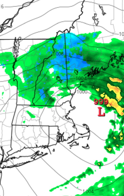
Thunder and lightning earlier, now just raining hard. Has a dynamic feel. Potent shortwave.
-
We had some good thunder and lightning roll through here over the past hour or so. Must be some good dynamics because 52/48 at the surface doesn’t scream thunderstorms.
-
Wonder how Phin fares. The northeastern side of the Presidentials should be ripe for snow if the upper level low continues to dive like that. The deep layer flow will be crushing those large scale eastern slopes.
-
50F and breezy this evening. Sort of an early October vibe but with twilight until 9:30pm.
-
Looks like a nice day.
-
Can’t wait for another round of 1-2” rainfall for most by middle of next week and then hearing about the Stein concerns that will develop after that. Always lurking after each rain event.
-
Went XC Skiing May 18, 2002... had 2-4" in the Albany area. Think the airport officially was 2.2". The hilltowns above 1,000ft had 4-6".