powderfreak
-
Posts
83,678 -
Joined
-
Last visited
Content Type
Profiles
Blogs
Forums
American Weather
Media Demo
Store
Gallery
Everything posted by powderfreak
-
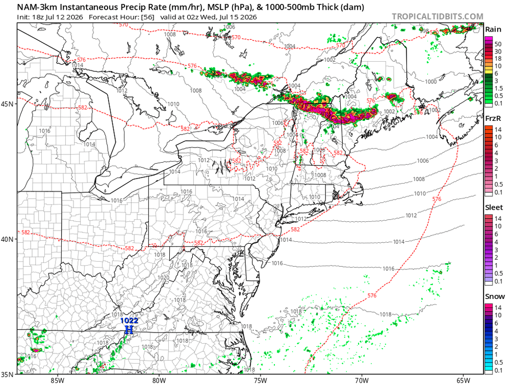
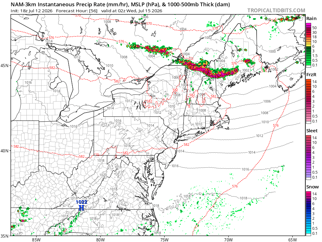
 The good news with that set up is you pump humid air out ahead of it with good pwats and it won’t take much to tally up some quick appreciable rainfall in New England as the front lifts NEward. Though I haven’t looked close enough to see if it’s occluded by that point.
 -
Stick with the 6z Euro in the paper bag.
-
Yeah looks like another good soaker on the way down there.
-
Maybe it’ll be like usual where the weather does the opposite of your worries?
-
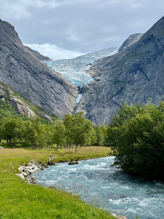
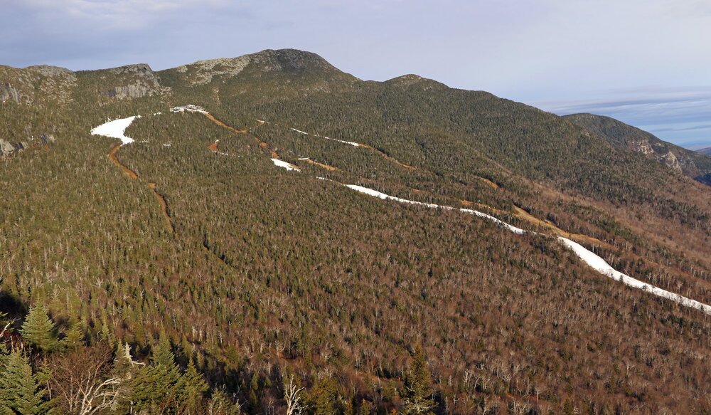
Another nice day in Vermont, under that Mount Mansfield glacier… the fabled Picnic Table Icesheet.

-
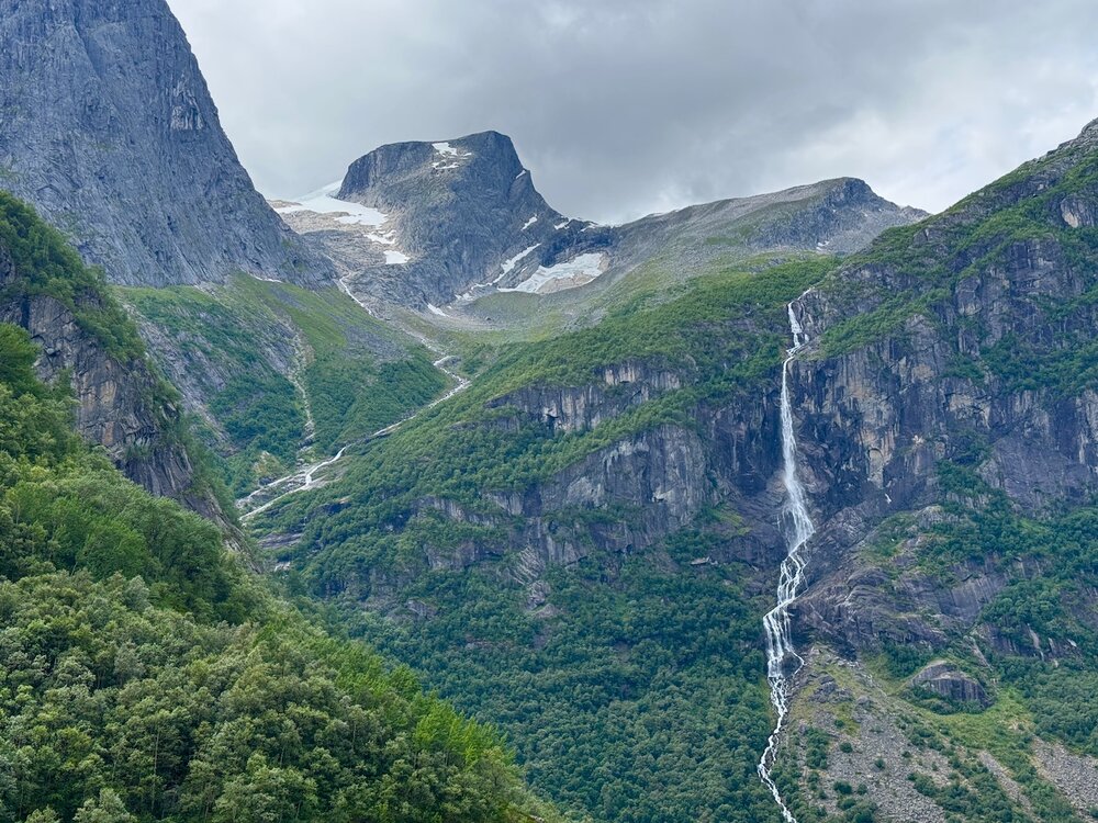
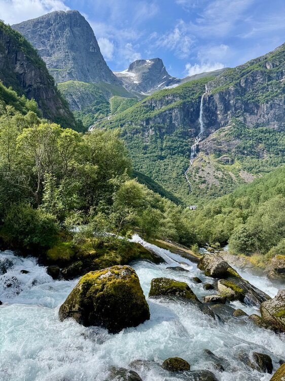
It’s nice now, sunset at 11pm last night and sunrise 4am. Winter must be a toaster bath of darkness though. Everything goes straight up from the ocean… and it’s wild the hanging snowfields above treeline (low treeline, like 2,000ft) up at 4-6,000ft still hang on through summer in areas. One local was joking that the natural snow up high that isn’t glaciated usually melts by mid-August and then two weeks later it starts snowing up there again to build the new snowpack.
-
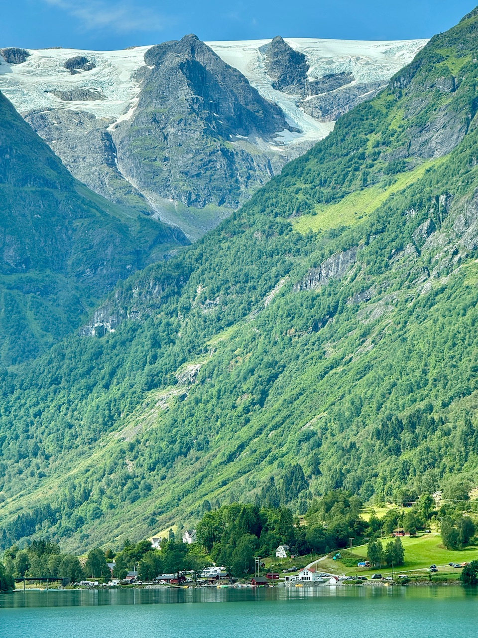
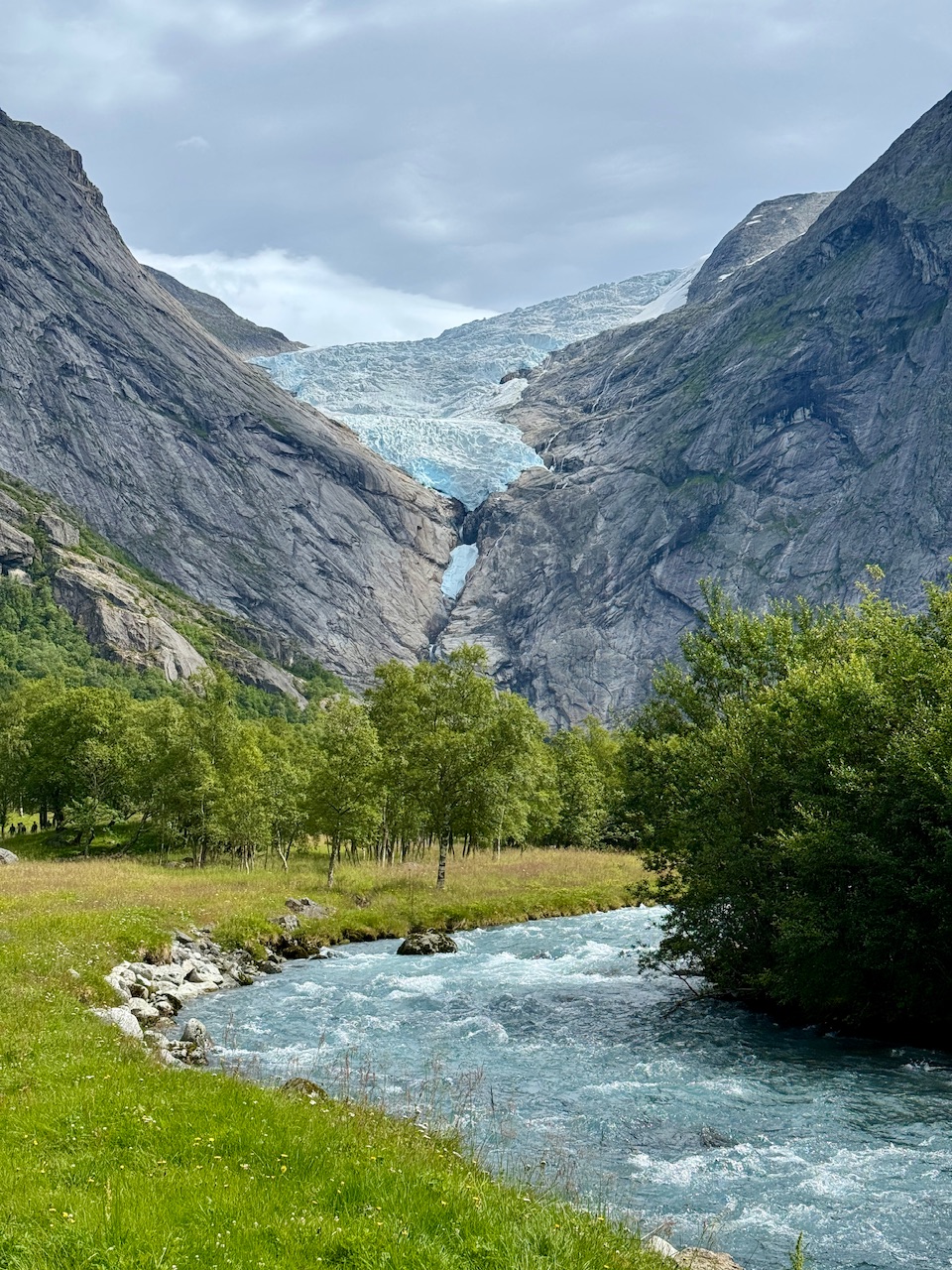
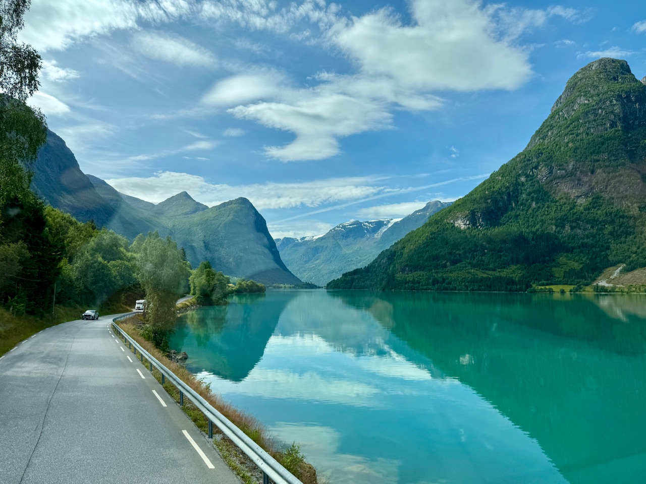
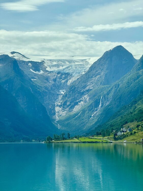
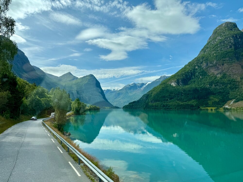
Made it to my grandparents’ homeland… Norwegian family here. Second time over in Norway, but man, this place is absolute sensory overload. Fun watching the Red Sox win 14 from various airports too, ha. Hard to drive with this going on around you..
-
You should hear our chairlift chats, ha. Guy is a ton of fun to be around on the mountain, but we do get into it on some of that stuff. A lot of it is just not wanting to “the good ol’ days” to be done… but we get that vibe on here sometimes. That by admitting it’s warming means you think it’ll never get cold or snowy again. It’s a “holding out hope” type vibe I get.
-
True, I just don’t like Fenway in HHH. You are sitting very tight with a bunch of equally sweaty fans ha. But it’s also nostalgic to be there when it’s hot. Childhood memories of humid evenings. Wrong weather for summer and the beach, but the ballpark is nice with a hoodie.
-
So if the streak ends, we know who to blame … perfect weather for the tight Fenway experience. Though if they win, you can’t miss another game this season.
-
Oh no, it definitely isn’t pedantic. I know “pedantic” posters but you certainly aren’t one… always respectful with measured views. Always appreciate the nuances and your expert opinion. Sometimes I just lean towards devils advocate comments, ha.
-
I was on a Lufthansa regional flight once from London to Munich… There had been a body-building competition and there were like a dozen absolutely massive human beings on the flight (all eating their Tupperware's of chicken and rice). They actually had to walk up and down the plane and redistribute the body builders throughout the plane before we could leave the gate. My buddy was like, dude, if we are so close to a limit that this airline official is walking the rows with a calculator and getting 300+ pound dudes to swap seats with petite women to even out the plane’s weight… like if that dude sits in 3A, this plane won’t get off the ground but if he’s in 36D we take flight… WTF, lol.
-
What about Blue Hill and PVD? It seems to lend credence to one ob when there are others supporting it to some extent, no?
-
Turned beautiful crisp blue with low dews and great visibility up here. From like a raging bonfire to Chamber of Commerce in an hour or two.
-
Heavy rain now but oddly no lightning or thunder that I can see/hear.
-
Yeah he’s the dude up here for on camera Mets.
-
Didn’t all the CAMs show more activity in Maine than has happened? It’s ok if it “busts”, no one saw the smoke coming. This has been a pretty hyped day, to the point that people who don’t follow weather have been talking about it up here. We were supposed to be like 90F today and instead low-80s. That has to matter. Our time in VT has always been like 9p-1a though… but like Tyler in the post, I thought Maine would’ve been lit up already.
-
It was interesting to see the sky go blue suddenly, temp skyrocketed, but now back in the smoke and temp down again.
-
End of times yellow glow around here from the smoke.
-
Nothing ever like that winter in recorded history up here. It was an experience for sure to try and operate a ski area through that. We even started up our summer activities that holiday period, like high ropes course, climbing walls, zip lines and stuff, to give all the hotel guests at least some activities.
-
I’d have to look it up… but nothing is sticking out in a memorable way. Looking at the snow depth there was a decent gain in the first half of December that plateaued for a while before a Xmas thaw hit. Snow depth looks pretty normal in Dec 2014.
-
Christmas Day 2015 baby. Only time in 70 years without a trace of snow at the CO-OP stake. Not even ice on the cliffs. Had a couple nights cold enough to blow a white ribbon, ha.
-
Feels like we do that anyway these days, Nino or not.
-
That October 2011 event makes you remember when "snow maps" were still a new thing, and Met offices didn't know how to use them exactly, especially in the shoulder seasons. "Dumb guy snow output" ended up being too low. HWO THERE IS A CHANCE OF A MODERATE TO HEAVY ACCUMULATING SNOWFALL ON SATURDAY. IF CONFIDENCE INCREASES...THEN A WINTER STORM WATCH. WILL BE ISSUED LATER TODAY From AFD THE GFS DUMB GUY SNOW OUTPUT IS 1-4 INCHES NORTH...10-15 IN HIGHER TRRN OF VT/MA/NY AND 6-8 ON VLY FLOORS. YES THESE ARE WINTER EQ AND THURSDAYS EVENT IT WAS ADVERTISING 4-8 INCHES AND MOST AREAS SAW 1-3. ITS NAM COUNTER PART IS MUCH FURTHER SOUTH...WITH 1-2 IN CATSKILLS AND 8 IN LITCHFIELD
-
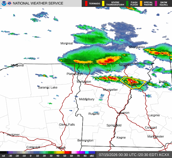
That’s a solid line sagging south.