powderfreak
-
Posts
83,674 -
Joined
-
Last visited
Content Type
Profiles
Blogs
Forums
American Weather
Media Demo
Store
Gallery
Everything posted by powderfreak
-
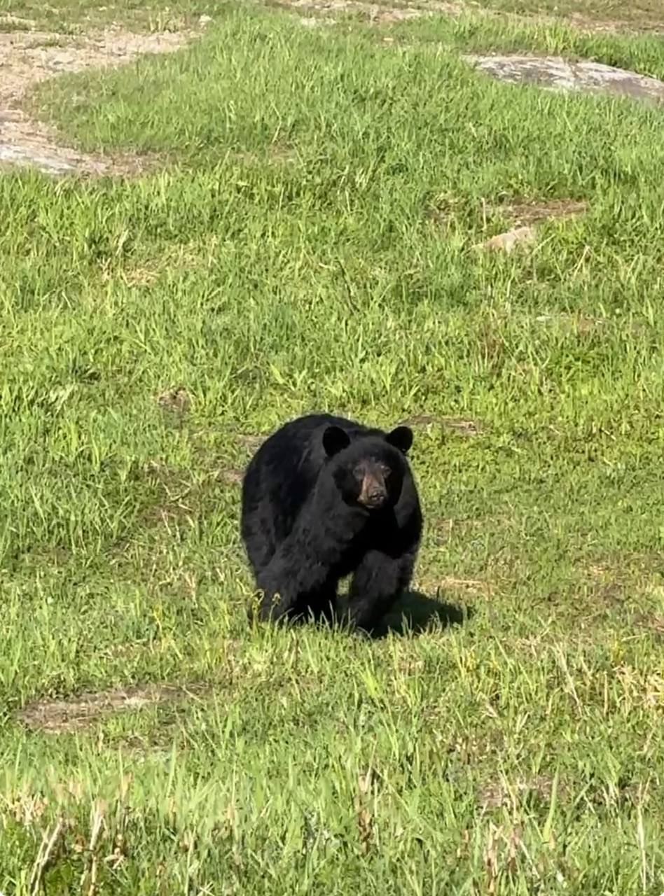
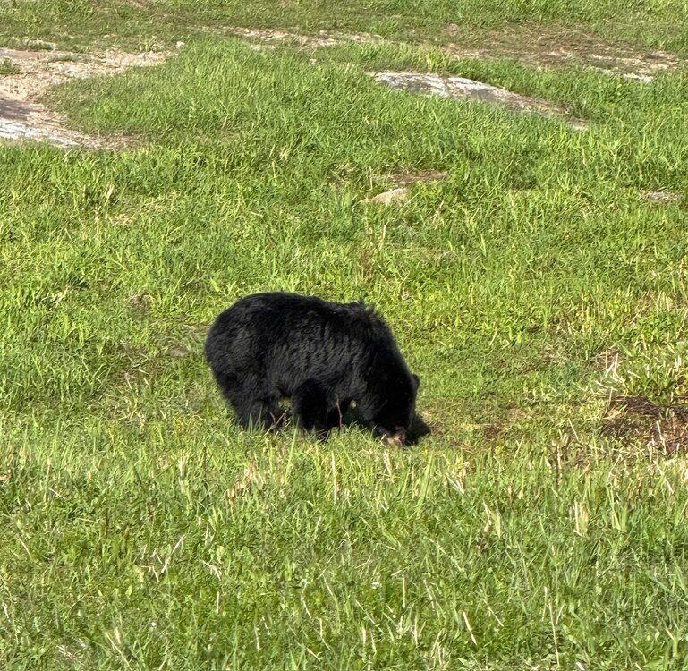
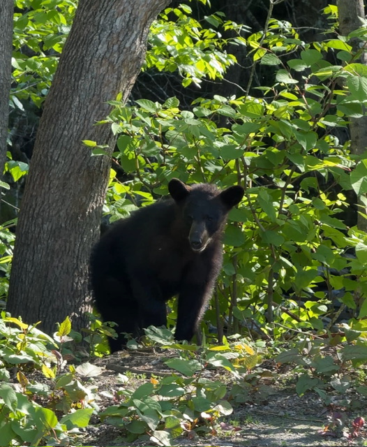
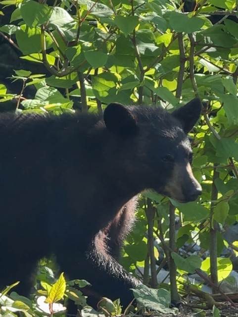
They are smart, strong and very determined. Yesterday I was wandering around and ran into a big one up near 3,500ft. I came over a knoll and she was right there. I just chilled and watched her for a while. She looked at me, assessed and gave me the nod of approval and went back to grazing the grass. She is a frequent flyer at the ski area, has had a very noticeable limp for years which is how we recognize her. Last year she had two cubs with her, but a year later they are off on their own now and she’s back to grazing around alone.
-
Same here, but by 10am… 43F to 73F.
-
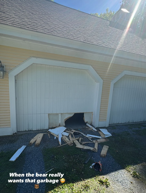
We’ve seen them climb the 5-foot retaining wall to get into the Gondola barn and then remove the storage door, hinges and all, just to get to a bucket of compost.
-
Haha, your entire house is masked up with those window ventilators. All jokes aside, you do live in a heavily wooded areas. I know it’s the same up in the woods at the family lakehouse in Woodstock… trees overhang everything and cover it in pollen.
-
Mask up.
-
79/42 A 40-degree diurnal rise day off 39F.
-
Sickest I’ve seen my lab was multi-day vomiting and needing an IV to replenish fluid and get her to stop puking… all because she had to go roll and drink a bunch of multi-week stagnant water that had turned orangish green with algae and other bacteria. She couldn’t have been prouder. Then couldn’t have been sicker. Like within an hour of doing that, and coming out covered in orangish algae, she was done for.
-
Haha yeah my dog just cost $400 past two weeks in ear infections because she’s a lab and that’s what they do. I will say, I would probably just monitor the hives unless the following below are present … but my wife would absolutely take the dog to the vet, haha. If the dog wasn’t feeling discomfort, sick, or raspy breathing, I’d wait but my wife would want to rush to the Vet to be sure. To each their own. While mild hives and raised hackles will typically resolve on their own within 24 to 72 hours, you should contact your veterinarian if you notice any of the following symptoms: [1] Swelling on the face, muzzle, or eyes Lethargy, vomiting, or difficulty breathing The raised spots are spreading, blistering, or causing your dog intense itching The bumps do not go away after 2-3 days.
-
Quick search would lead me to believe hives. Raised fur but smooth skin. First pup cup could be cause, might be something in that she’s sensitive to. As long as her breathing and other functions seem fine, I’d just monitor it. Could give Benadryl if concerned, but I would call Vet before hand as dosage is weight dependent. Hives (Allergic Reaction): This is the most common reason for bumps that feel like raised fur but have smooth skin underneath. It usually occurs as a reaction to an insect bite, or a new environmental trigger (e.g., pollen).
-
So the skin is smooth under that?
-
Yeah or did she roll or lay in something that irritated the skin on that side. I wouldn’t be too worried. But sometimes a quick trip to the vet is the best for your own mental well-being.
-
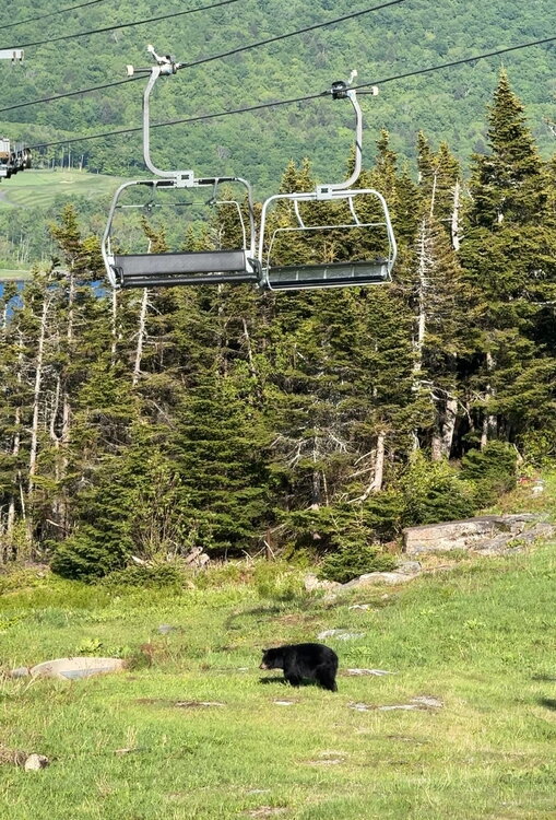
Bear break-in. These guys are tenacious.
-
39F to 67F by 9:40am. Fast recovery.
-
Those plumes from the rivers can go a long way… like when we have a good flooding event you’ll have folks out motoring around in boats thinking it’s nice, clear open water and run into a plume filled with debris and whole trees floating around in the lake. Nothing like hitting a tree trunk at 40mph in a boat out in the middle of no where.
-
Ha, not sure that's what that is. Lake Champlain isn't the cleanest at all, but that looks like sediment. Had 1-2" of rain over the weekend and sharply elevated rivers, probably a sediment plume flushed out from one of the larger rivers? Winnoski or Lamoille rivers need to be emptying around there somewhere depending on how he took off.
-
Yeah nothing remotely close to haze up here. Crystal clear low dew blue.
-
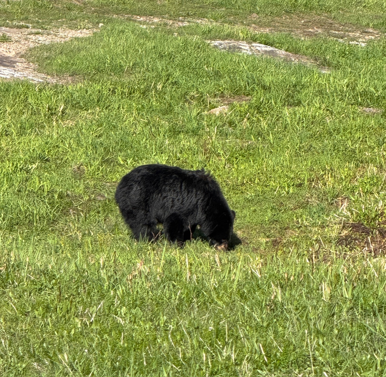
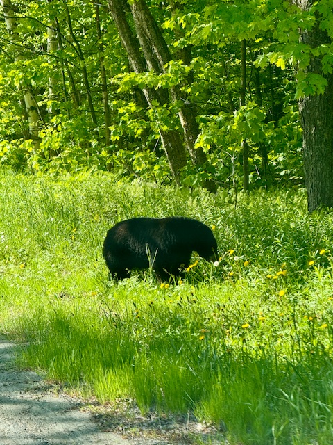
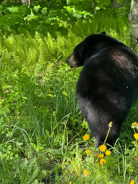
It’s like a bear safari around here. This guy was just chilling on the shoulder grazing away this morning. Much bigger than the one last night.
-
I always wondered if the large scale effort to eradicate it here led to it spreading even faster. It probably did. There used to be a group of landowners with like machetes walking along the river through Stowe hacking the stuff down and collecting it. Probably just led to it being washed downstream even faster or moved somewhere else.
-
Ha, I get 2 minutes of peas yesterday and I’m super excited. Denver is like, hold my beer. Clearing 8-10” of hail. https://www.instagram.com/reel/DZD5k9YCv2F/?igsh=bTRxaW93OHF1d3Jp
-
We used to have people cutting it and ripping it out of the ground each summer along the river but it was a losing battle. Now it’s just taken over all across the banks for like 5 miles.
-
Dude it’s out of control along the river banks here.
-
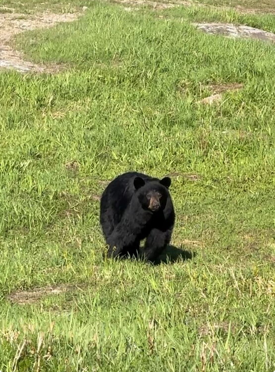
Another day, another weird looking dog wandering around. Four times in two weeks I’ve run into them. I think it’s two different bears, twice. This one is younger, probably first year or two without mom.
-
Ground level.
-
66F and sunny. Sun helps this time of year.
-
We rained overnight in the 40s, then cleared out as it moved south. Feels sort of like Saturday. Nasty when everyone was asleep, then by 8am it was breaking blue.