Blizzard-on-GFS
-
Posts
710 -
Joined
-
Last visited
Content Type
Profiles
Blogs
Forums
American Weather
Media Demo
Store
Gallery
Everything posted by Blizzard-on-GFS
-
E PA/NJ/ DE Winter 2021-22 OBS Thread
Blizzard-on-GFS replied to JTA66's topic in Philadelphia Region
Man Cape May has been getting rocked all day. They have to end up over a foot of snow -
january 3rd potential coastal grazer
Blizzard-on-GFS replied to forkyfork's topic in New York City Metro
Agreed -
Can someone please post the 18z Euro snow map for the NJ area please?
-
january 3rd potential coastal grazer
Blizzard-on-GFS replied to forkyfork's topic in New York City Metro
Can you post the snow map? -
E PA/NJ/ DE Winter 2021-22 OBS Thread
Blizzard-on-GFS replied to JTA66's topic in Philadelphia Region
Do it! Join the coastal crew!! -
E PA/NJ/ DE Winter 2021-22 OBS Thread
Blizzard-on-GFS replied to JTA66's topic in Philadelphia Region
Lol im a daily lurker! I’ve been unloyal and dabbling my feet in the mid-Atlantic forum a lot lately haha. But yeah I’ll be here for obs! I think south Jersey gets rocked this time around. A lot of models yesterday were showing the precip dying as it moved up the coast but i’m starting to see some high-res models jackpotting the Jersey Shore. I know there’s usually some great forcing along the coast with these storms so I’m not surprised -
E PA/NJ/ DE Winter 2021-22 OBS Thread
Blizzard-on-GFS replied to JTA66's topic in Philadelphia Region
I’m riding this one out at my parents shore house in Manahawkin. I really like my location for this. Most of the models show some really strong forcing along the cost for this one. I think I have a great shot at double digits. Its been like 4 years since I’ve seen over 10” so I’m overdue -
Really high winds and racing clouds picking up in Manahawkin, NJ. I am getting concerned as my area is still juiced as we didn't see much rain and clouds earlier and the upper level winds are racing...
- 487 replies
-
- 1
-

-
- hurricane
- flooding potential
- (and 2 more)
-
This appears to be real. Likely an F3 or even F4 went though this town based off the video footage I’ve seen
- 487 replies
-
- 3
-
-
- hurricane
- flooding potential
- (and 2 more)
-
FAKE I reverse image searched it. Its from OK
- 487 replies
-
- 1
-

-
- hurricane
- flooding potential
- (and 2 more)
-
Dang someone is spicy today, Same things we always talk about with weather… model output parameters, timing, forecasts etc. Not sure why everyone is freaking out over 1-2” of rain when we could have a banner tornado outbreak today. I think from I-95 south east the rain is going to be a major fail today. NW of there is fair game for the heavy rain totals
- 487 replies
-
- 1
-

-
- hurricane
- flooding potential
- (and 2 more)
-
How is no one talking about the tornado threat? Parameters are through the roof
- 487 replies
-
- 2
-
-
-
- hurricane
- flooding potential
- (and 2 more)
-
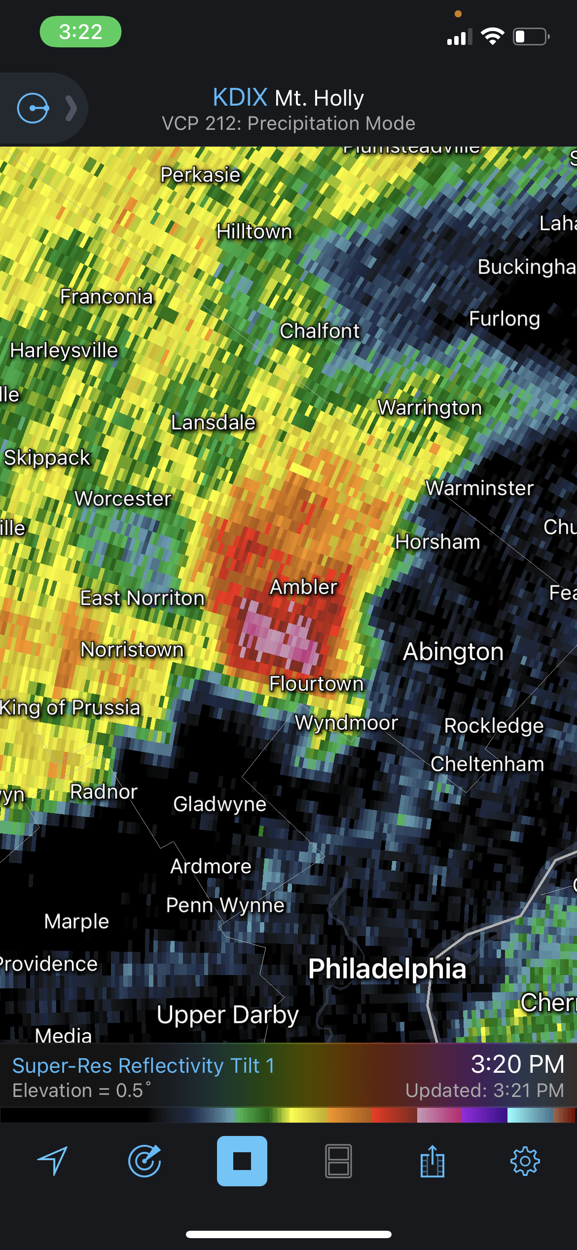
That’s such a nasty hail signature!
-
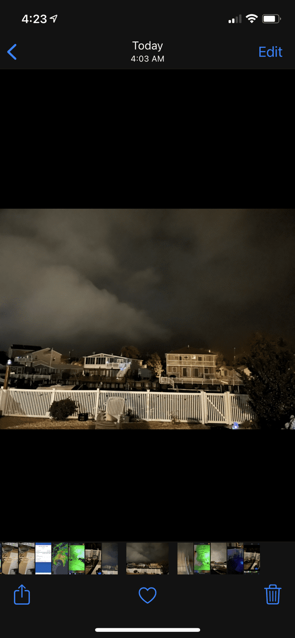
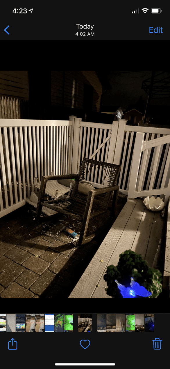
Yes I am in beach haven west and believe a weak tornado passed over my house. I watched day burst of windo launch my lawn furniture into my fence.
-
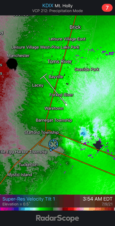
Thing is massive on radar. I’d be legit concerned in those areas. Who knows if it will hold together by landfall though.
-
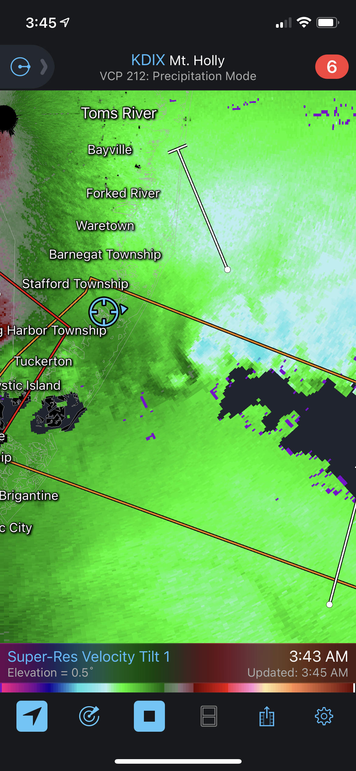
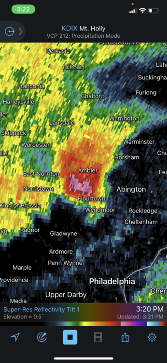
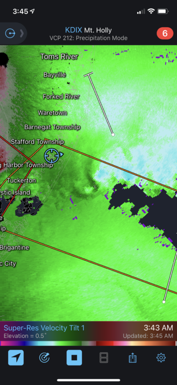
Is this a massive waterspout off of Brick? Velocity radar seems to indicate so… IMG_2499.mov
-
I believe a funnel cloud just passed over my yard in Beach Haven West. It was calm and the sudden woosh of air came in and launched my table and chairs off my porch and into the fence. I was watching this cell on radar and it appeared to have a couplet to my untrained eye. Could a Met chime and and see if they agree?
-
Appears to be lots of rotation in these cells east of Stafford Township. I expect to see the Tornado Warning to be issued further north again as it has been moving up the coast all night. There should have been a watch issued.
-
I'm surprised more people aren't talking about the TOR threat for NJ and NYC tomorrow night. I'm almost certain a TOR watch will be hoisted tomorrow night.
-
I like my location in Manahawkin NJ to do well here. Expecting 3-6" of fluff. I feel like wherever the banding sets up in these types of events tends to overperform. NWS in agreement. I'm just happy to have an all snow event for the first time all year.
-
For the first time all day Bordentown is in a good band. Its an weird random band but its back building and I’m happy lol. Whatever it takes!
-
WSW just issued for an additional 3-6”. I’ll take it. That would put my total in the 8-12” range.