jaxjagman
-
Posts
9,156 -
Joined
-
Last visited
Content Type
Profiles
Blogs
Forums
American Weather
Media Demo
Store
Gallery
Everything posted by jaxjagman
-
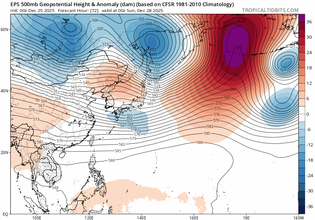
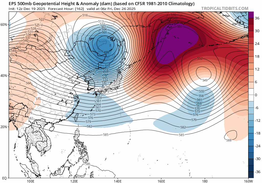
Buyt this should be more or less from the East Asia winter monsoon trough sorta speaking this shifts H from the Bering Sea into Siberia,Mongolia

-
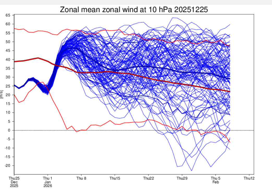
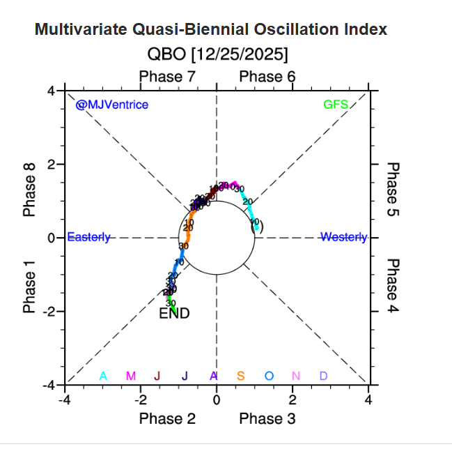
I mean,Dec should even break Dec records for EQBO
-
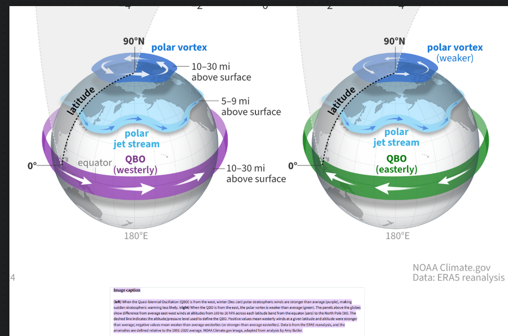
This might be one of the most negative EQBO since we've seen into the early 40's into Jan,tho its still up in the air right now https://psl.noaa.gov/data/correlation/qbo.data
-
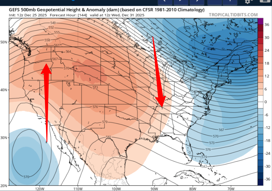
This should be the real deal as we get into Jan,should see a change after that trough moves east,this cold spell is nothing but transient right now,you could possibly be fixing to see a more substantial one afterwards
-
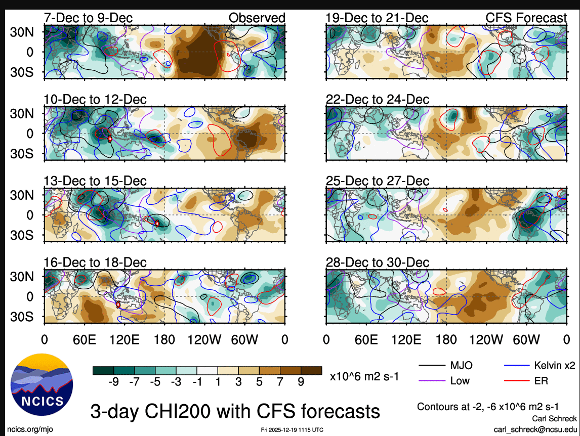
You should see some teleconection sorta speaking of where of MJO will be for the next several days even tho its into the COD upcoming

-

December 2025 Short/Medium Range Forecast Thread
jaxjagman replied to John1122's topic in Tennessee Valley
And it should be a pattern change upcoming unlike we are seeing now,look at East Asia after D3
-
December 2025 Short/Medium Range Forecast Thread
jaxjagman replied to John1122's topic in Tennessee Valley
Merry Christmas to all by the way!! I left one out the more important one,while yes it's a -NAO,its still a more based -ENAO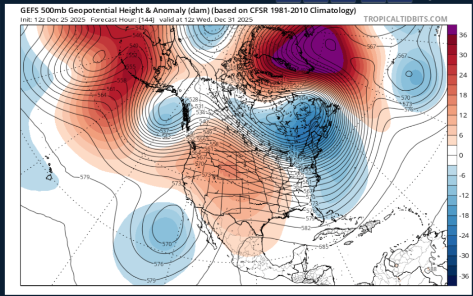
-
December 2025 Short/Medium Range Forecast Thread
jaxjagman replied to John1122's topic in Tennessee Valley
Basically in winter time when you see rising heights into Mongolia and troughs into East China trough Japan, it should look like this days after or around 8 days give or take When you see the opposite it should in general be the opposite. While the NAO also plays a big part in winter time for us,you'd still want to see a -WNAO and not a -ENAO, a -ENAO the trough axis moves further east more towards the east coast,you'd prefer a -WNAO,especially for us west of the Cunberland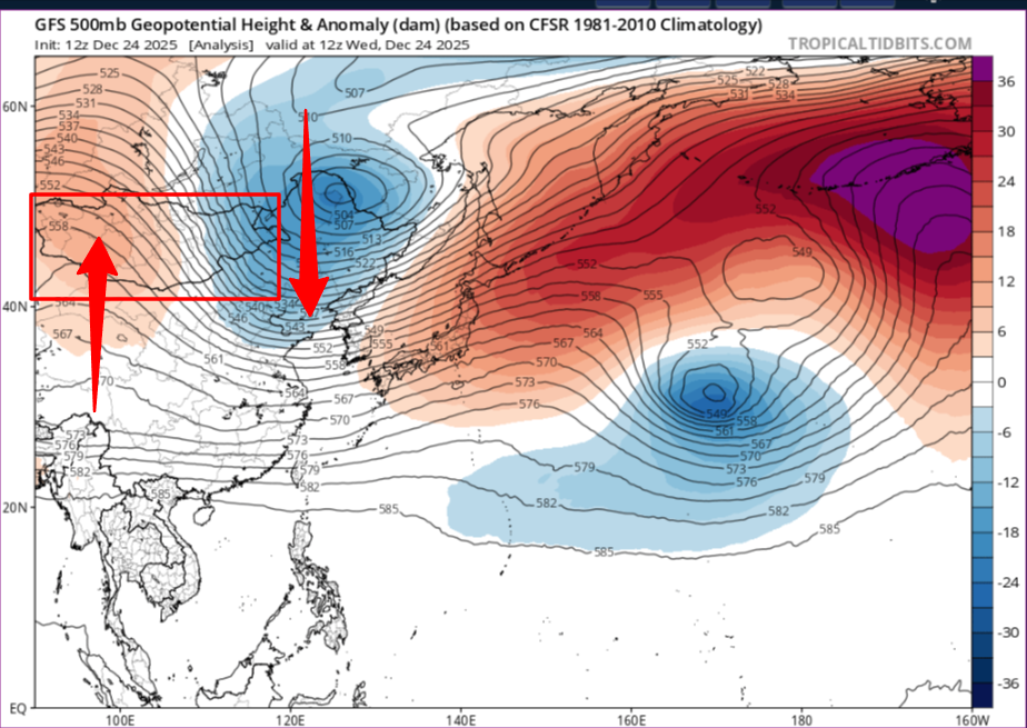
-
December 2025 Short/Medium Range Forecast Thread
jaxjagman replied to John1122's topic in Tennessee Valley
More like a NINO the AR out west -
December 2025 Short/Medium Range Forecast Thread
jaxjagman replied to John1122's topic in Tennessee Valley
Me too,i talked about the EAMT last night but if its a strong one you should in general show strong HP into Siberia/Mongolia,weak one its still warm in the SE,dont see that right now.Its flipped in a NIno compared to a Nina,weak EAMT is BN temps in the SE,looking at todays run of the EPS,but it still slightly better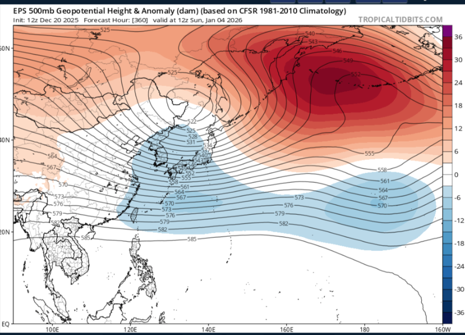
-
December 2025 Short/Medium Range Forecast Thread
jaxjagman replied to John1122's topic in Tennessee Valley
All good,most of those years were in a more NINA compared to this one,but i havent seen you post much so welcome to the board -
December 2025 Short/Medium Range Forecast Thread
jaxjagman replied to John1122's topic in Tennessee Valley
Yeah but comparing 2000 to 2025 is nonsense

-
December 2025 Short/Medium Range Forecast Thread
jaxjagman replied to John1122's topic in Tennessee Valley
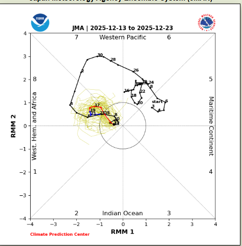
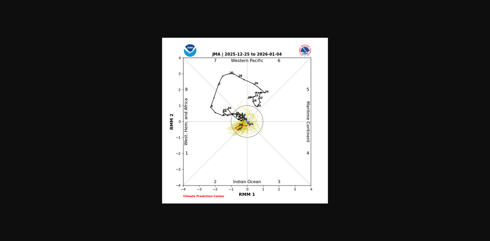
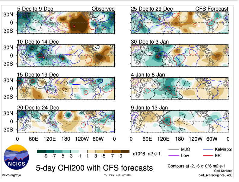
The oceans the last few weeks has been pretty much Chaotic from Kelvin Waves and the Rossby Wave Train,no end in site,why you see the RMMS do all this flip flopping sorta speaking
-
December 2025 Short/Medium Range Forecast Thread
jaxjagman replied to John1122's topic in Tennessee Valley
Like most people that own pay sites,they just are click baits so you subscribe -
December 2025 Short/Medium Range Forecast Thread
jaxjagman replied to John1122's topic in Tennessee Valley
Do you know off hand what years those were with a EQBO,i know last Jan was a WQBO? -
December 2025 Short/Medium Range Forecast Thread
jaxjagman replied to John1122's topic in Tennessee Valley
I dunno,but the (EAWM,East Asian Winter Monsoon should be coming up which could possibly shift the HP into Siberia,with troughs extending into East Asia into the Pac,im just gonna use the EPS I.E,this could seemingly change the pattern as we get into the New Year,for how long,really have no clue
-
December 2025 Short/Medium Range Forecast Thread
jaxjagman replied to John1122's topic in Tennessee Valley
Yeah but you can use Cyclonic for free,that sight is more or less click bait,open my wallet https://cyclonicwx.com/sst/ -
December 2025 Short/Medium Range Forecast Thread
jaxjagman replied to John1122's topic in Tennessee Valley
Probably better off just to reshuffle the patten and see what happens and put the MJO back into the Maritime once again. I always wondered myself the past several days of what lag effects the extreme -PDO has to do with the atmospheric patterns, back into the July and August,you havent seen these values ever since the early 1850's,just because you see these daily values each day rise and fall I.E., WPO,that's like saying the ENSO went positive today so the pattern is going to flip the next day from Nina to Nino it dont work that way,plus we are talking about the largest body of water on earth,the Pacific https://www.ncei.noaa.gov/pub/data/cmb/ersst/v5/index/ersst.v5.pdo.dat
-
December 2025 Short/Medium Range Forecast Thread
jaxjagman replied to John1122's topic in Tennessee Valley
That's what i'm gonna call it now "The Pig"...lol -
December 2025 Short/Medium Range Forecast Thread
jaxjagman replied to John1122's topic in Tennessee Valley
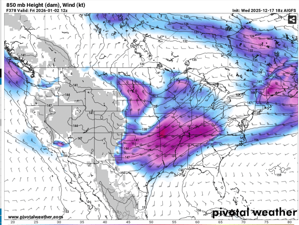
Sure its still a work in progress,post this just to see around New Years if its close to a severe look,cant get cold bring on severe
-
December 2025 Short/Medium Range Forecast Thread
jaxjagman replied to John1122's topic in Tennessee Valley
Looks like more like the GFS in the long range,anoms are like 30F-AN on NYD -
December 2025 Short/Medium Range Forecast Thread
jaxjagman replied to John1122's topic in Tennessee Valley
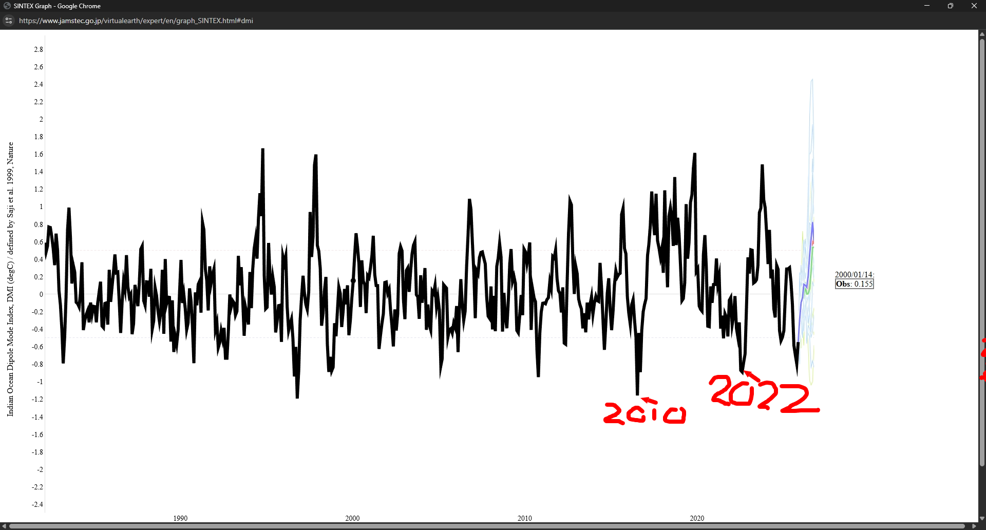
Excellent,i did some research of the DMI earlier today and gave up because of the ENSO,but these years into 2010 and 2022 like you mentioned in the modern day era more or less had like the same pattern to some extent with whats going on in the WP,even tho you had a more strong Nina in 2010 and even less so in 2022 and even more less so this year,the ENSO still plays a part into the IO
-
December 2025 Short/Medium Range Forecast Thread
jaxjagman replied to John1122's topic in Tennessee Valley
Yeah but its still more like NINO than NINA,you generally see the Atmospheric River out west in a NINO not NINA -
December 2025 Short/Medium Range Forecast Thread
jaxjagman replied to John1122's topic in Tennessee Valley
Maybe we are starting to see a pattern change as the Pac Jet get retracted into East Asia after Chistmas,dunno,ill beieve it when i see it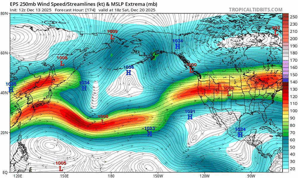
-
December 2025 Short/Medium Range Forecast Thread
jaxjagman replied to John1122's topic in Tennessee Valley
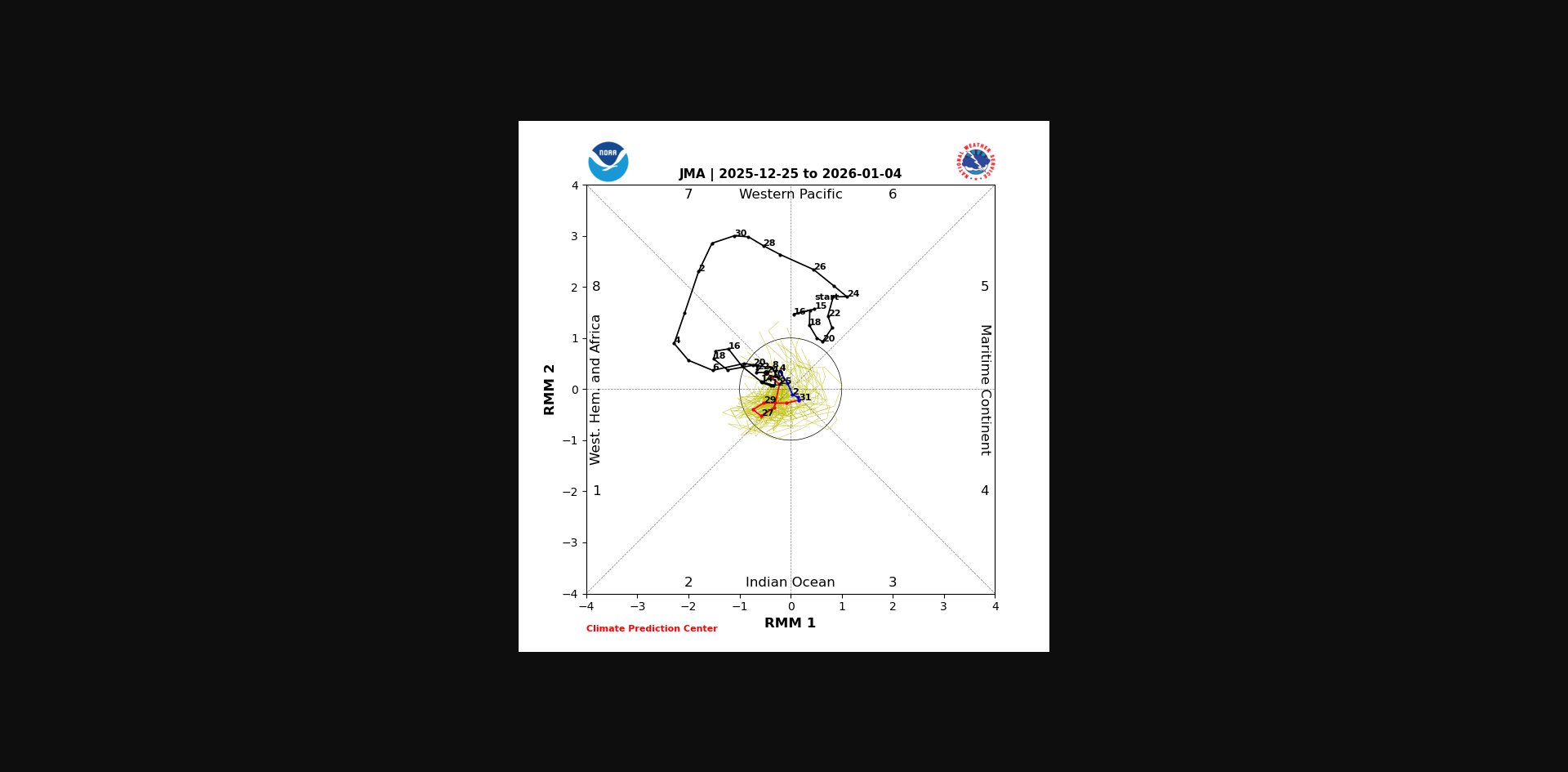
Why i prefer to use the JMA when looking at the RMMS,screw that 14 day crap,you can even see Kelvin is going to disrpupt the signal once again around the mid month into the NH