jaxjagman
-
Posts
9,156 -
Joined
-
Last visited
Content Type
Profiles
Blogs
Forums
American Weather
Media Demo
Store
Gallery
Everything posted by jaxjagman
-
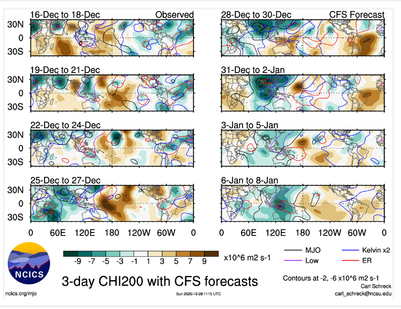
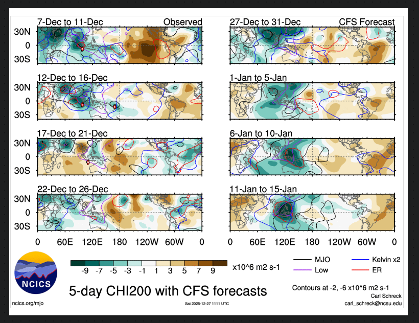
Better get something fast,it looks rather bleak right now down the road with that strong ERW thats fixing to pass along the IDL the next few days,Maybe it will weaken some but this could cause the tropical forcing to shit towards the WP into the MC,probably end up seeing RMM madness continue,you're seemingly starting to see the NINA background getting taken out now even tho it's still NINA.
-
To an extent this is true,but besides a NAO the first step is a good PNA in our parts , really some deception to East Tn to the West.TN,mountains im sure causes part of this,while the east wants to see a more stronger -NAO,it dont work like that from the close to the Cumberland to West it just leads with us with cold dry with cutters,compared to the east,we really live in a weird climo in Tn in winter,its really unusual to see the state wide snowfall at the sane time
-
I dunno,its just what i see now but planetary waves can disrupt the pattern,its nothing like equatorial waves
-
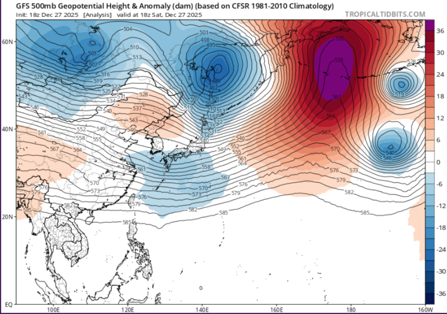
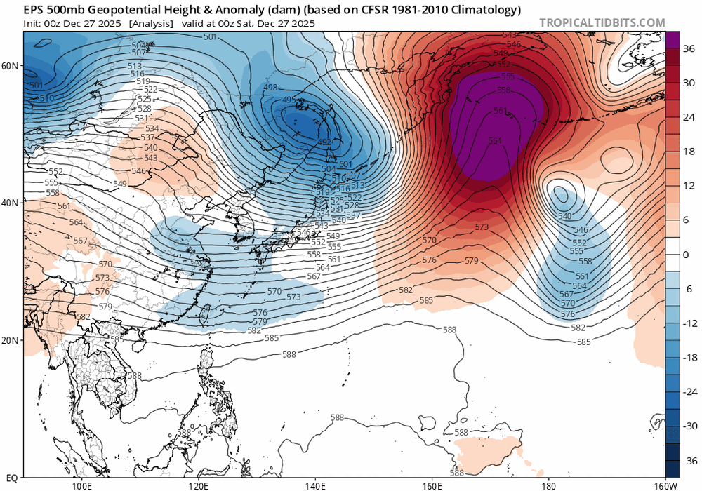
Yes,they didnt put there link at the bottom for nothing more than click bait,But in general you can look at East Asia to show you what the pattern might look like in several days,you see a trough going through Mongolia/Russia,with ridging building up into the Koreas with a ULL passing by NE Japan,it should look like this a ridge in the middle of the counrty,a crappie PNA and a ULL IN the NE,still the same the cold in winter relies on other teleconnections
-
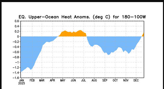
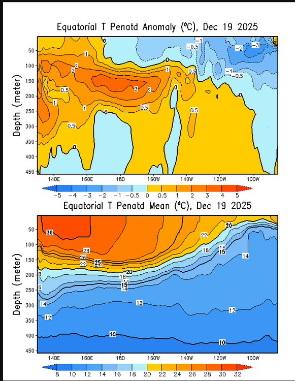
Its happened before with the AR out west during a NINA,buts its still more common with a NINO not NINA,it happened before in the winter of 2022-23
-
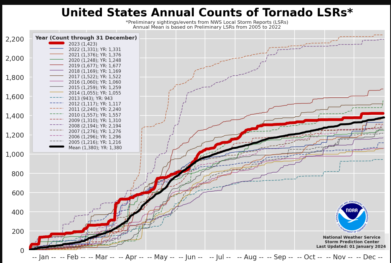
I know,i posted this in our severe thread earlier,its kinda like 2023
-
Right,the MJO right now you should look at whats driving the pattern,even the ensembles havent been very good in the long range this winter,its been a weird winter sorta speaking
-
There is so much crap going on this winter,its really hard to trust any model,we've been pushing back cold since Nov and seems to be maybe doing this again,you throw off one piece of the puzzle it throws off everything
-
Not that its not already chaos,just more..lol
-
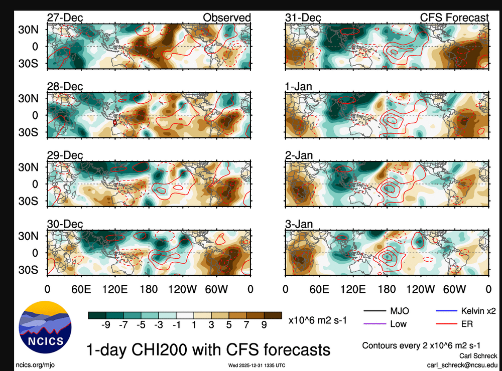
Chaos again with the MJO signal,alot of stuff going on as we get into the New Year with the Rossby Wave train and Kelvin Waves
-
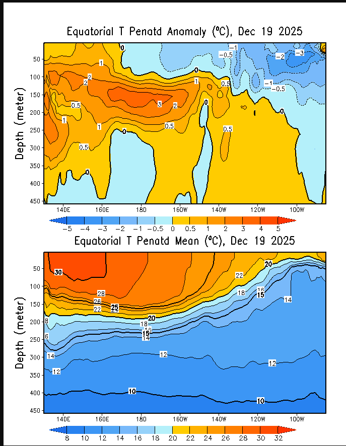
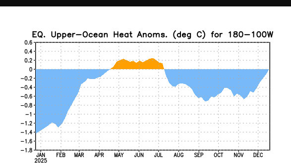
Wonder what this severe season will look like? The pattern oddly enough resembles 2023.During the winter of 2022-23,there was also a AR during that winter.Yes,AR'S can be had in NINAS,but are still more common in NINO'S. The latest charts today show NINO is peeping around the corner,while the subsurface in the east still have some cold pockets -2-3C mainly in the east,so it's not going away yet Not saying 2023 will happen again but it still is sorta a good analog year.Of course,there is also a chance of a SSWE later in the winter season
-
Has NINA actually not peaked,i mean the East is warning and the west gets cooler each day
-
Kinda like wash rinse and repeat,with Rossby and Kelvin Waves along with the standing wave in this regions for months it seems close to the MC
-
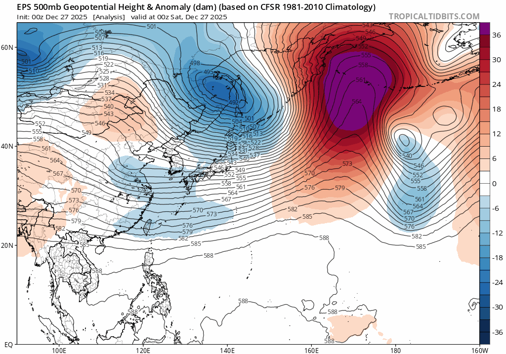
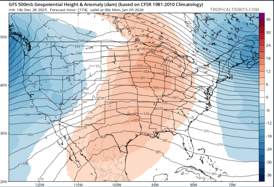
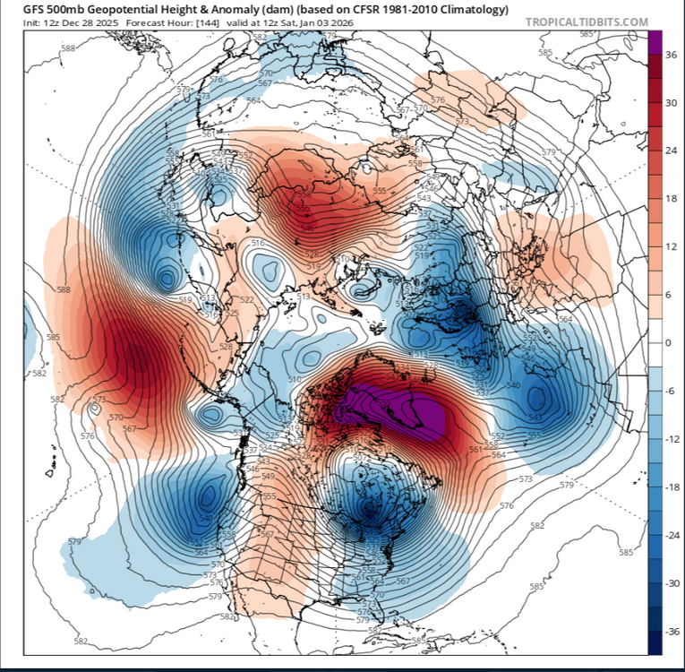
Decent look after the next couple days,you should be looking at a pattern change the next couple days.As this trough passes through Russia/Mongolia,models continue to show rising heights in this region for several days,just get ready for some moderation into the first week of Jan,throughs into Mongolia/Russia mean ridge building into the Koreas,so you should/could be seeing a -PNA for a brief time
-
I took my shit down this morning while it was warm..lol SHORT TERM... (Rest of today through Sunday) Issued at 1100 AM CST Sat Dec 27 2025 After an intensely foggy morning, it`s cloudy and very muggy out there. Temperatures have warmed into the low 60s so far and will make at run at 70 by this afternoon. The remainder of today will be cloudy and dry as the ridge responsible for our spell of above- normal warmth finally shifts to our east. Behind the exiting ridge will come a fairly strong upper low that will push a strong cold front through Middle TN Sunday night. Ahead of the frontal passage, flow aloft will transition out of the southwest, drawing anomalously high moisture into the area. Looking at soundings, instability overall is very limited with less than 100 J/kg and profiles are totally saturated. With that being said, a 60 kt low- level jet will be in place as this line moves through, and if any of that wind can mix down, there will be a chance for a gusts up to 40-50 mph with the line. With regards to any tornado potential, the threat is very, very low. Low-level helicities and shear are more than sufficient, but limited instability and weak lapse rates will make tor development very difficult. The most likely scenario is that a narrow band of heavy rain and gusty winds will move through tomorrow night between 7pm-1am. Non-thunderstorm gradient winds will be gusty tomorrow as the surface low moves across our north. There will be a steady breeze with gusts up to 35 mph at times. Here`s your notice now to get those outdoor Christmas decorations down!
-
Thx,you dont piss anyone off here,glad you post here
-
Wait a minute,i remember this storm now.The LP came from Middle MS and rode trough Cen Alabama into Ga,this caused a deformation band into North Alabama,we just moved from Jacksonville to Lawrecrmburg.Tn,we got 8" from that storm
-
TBH,thats not a clipper by reanalysis
-
Thats crazy,you sure this wasnt from LP?I i mean clippers are weak until they hit the Plateau,in general if you get 2 inches here thats a nice clipper.I remember tho when i lived in Lawrenceburg we got the lake effect snow from the Great Lakes that lasted about three days,didnt add up to much,i got tired of it snowing,didnt even hardly put a dusting down,just light snow or flakes
-
I wouldnt be to concerned with a ice storm,maybe next winter,We in Mid Tn and W/TN get ice storms from a NINO not NINA,plus this a more East based LaNina,the east gets all that and more than likely more snow
-
Yeah it not easy for you guys,its all with the trough axis and this has alot to do with the NAO,we never do good here in Mid Tn with clippers,we get very little and watch them explode as it gets into the Cumberland
-
Better than whats its been,we are getting rid of "The Pig" like @Flashcalled the Bering Sea ridge,just getting rid of that is a still a plus,we are fixing to have an active STJ,which could produce,just dont want to bury it or its hoping for clippers,we just live in precarious part of the lower 48 generally in winter there is a cutoff 1-40N-S,we just have to have the perfect setup,its not easy as many people think in Tn,alot can go wrong
-
I'm kinda like you,screw the cold if its not gonna snow.Kinda of like a cross hair tho,if you dont have cold you dont have snow.Our predicted high in Nashville is 74 Sunday,the record here is 75 back all the way into 1874,that's nuts
-
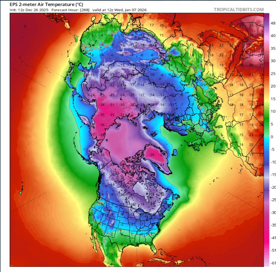
There is plenty of blocking into Mongolia/Russia,the problem to me is with the blocking into the Barents Sea.But the EPS looks better to me than yesterday,its much colder into Canada.It would even be better that the blocking into Barents goes into the Greenland Sea.But i guess it's baby steps maybe,we got rid of the Bering Sea ridge and now have a active STJ as @Houston mentioned

-
Thats not a warm look as we get into the the end of the first week of Jan