jaxjagman
-
Posts
9,145 -
Joined
-
Last visited
Content Type
Profiles
Blogs
Forums
American Weather
Media Demo
Store
Gallery
Everything posted by jaxjagman
-
Oh i agree,the GFS has been trash
-
Putting the skill of the GFS is gonna make it any better?
-
I'd be very careful if you are using the GFS into next weekend of what might happen,this is its last 8 runs,just saying
-
Ahhhh..the year NashSevereWX came up with the snow dome after the WSW and we got nothing but rain,and it took off with the public.Bobby Boyd use to use it in his disco but he explained the reason was Nashville is in a basin so things like this will happen.But it lasted for almost a decade it seems
-
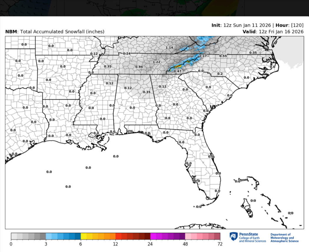
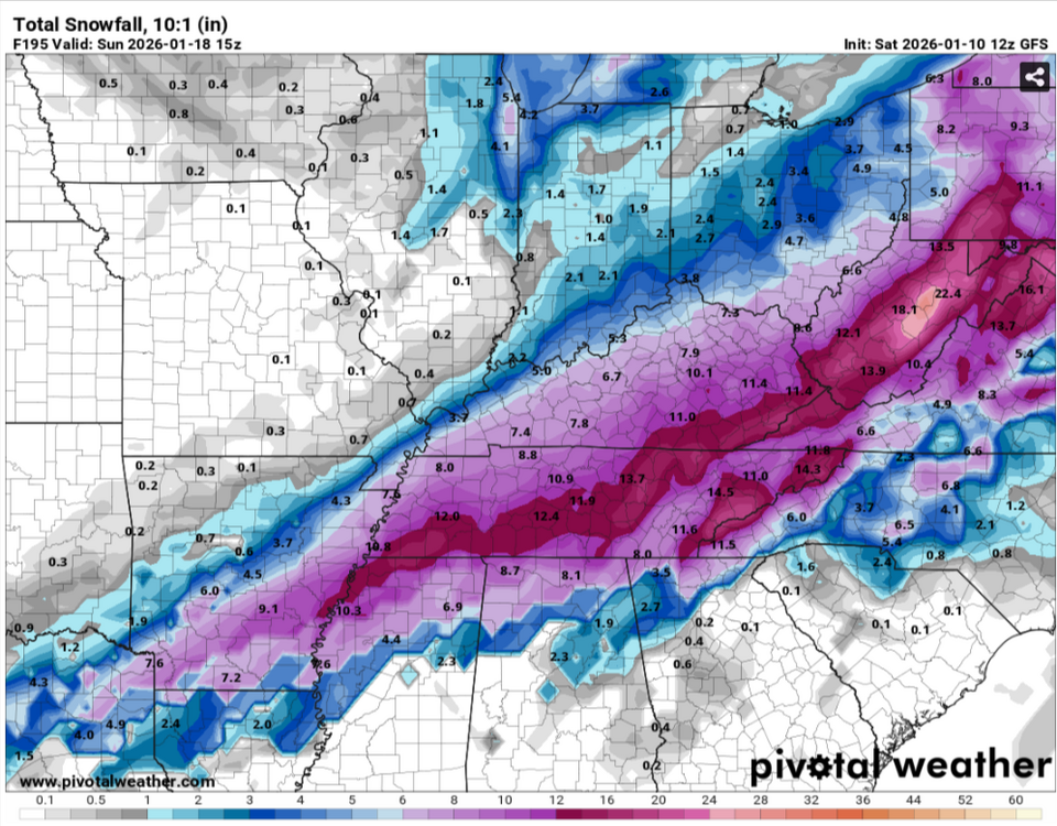
I thought the HRRR did pretty good actually to an extent even before i went to bed last night but it still whiffed,it was one of the few models that actually showed all snow but it missed the lower levels.Nashville even talked about it to a sort earlier .UPDATE... Issued at 654 PM CST Fri Jan 16 2026 An upper level trough and surface low are over the Great Lakes region pushing a cold front into Middle TN. We are seeing areas of rain ahead of this cold. The front will continue to push to the east into the overnight with rain ending in the Nashville area by midnight and after 3 AM for the Plateau. We are seeing some bright banding on the radar at times with the line and CC shows the freezing level at 1-3 feet off of the surface. Temperatures aloft are cold enough to support snow but our surface temps currently in the in the low to mid 40s are too warm for snow. Cold air will be settling in during the evening but we should remain warm enough for all rain through at least 9 PM. After 9 PM temps will start to be cold enough for some snow to mix in across the Plateau with all snow expected after 11PM/midnight. The Plateau could pick up a quick dusting to 0.50" between 11 PM and 3 AM. Overnight lows will be chilly falling into the upper 20s to lower 30s.
-
Guess my severe thinking next weekend is getting crushed..lol
-
Yeah towards or into next weekend
-
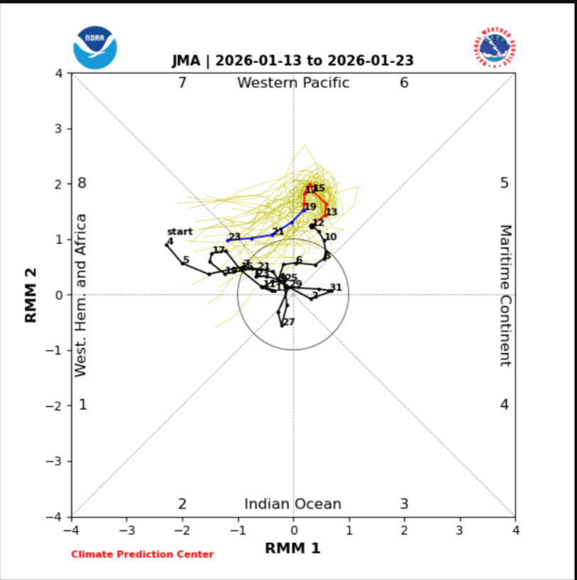
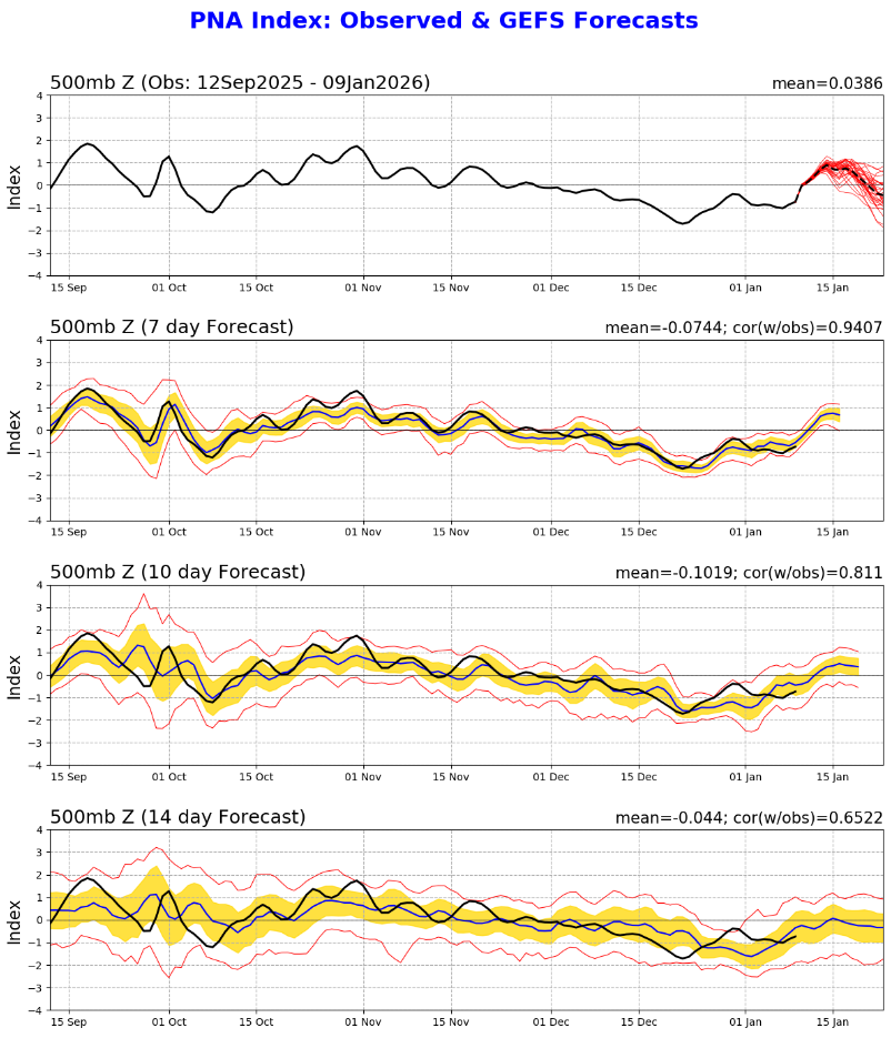
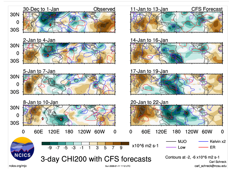
Models are in better agreement now with the MJO without the signal getting destroyed. Long range at least right now with the MJO into the WP is ongoing and should have a decent signal into the WH into the 3rd wk of Jan Next weekend right now looks severe,but this could be your typical strong CF before it turns cold again in winter.Thats the way it looks to me right now where the signs are headed
.thumb.png.079ff9cdfa52fdf08c6f62faaecfe3ab.png)

-
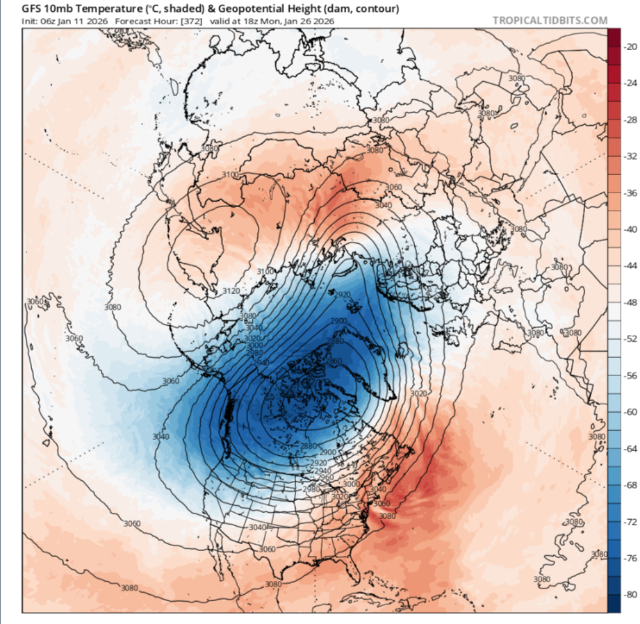
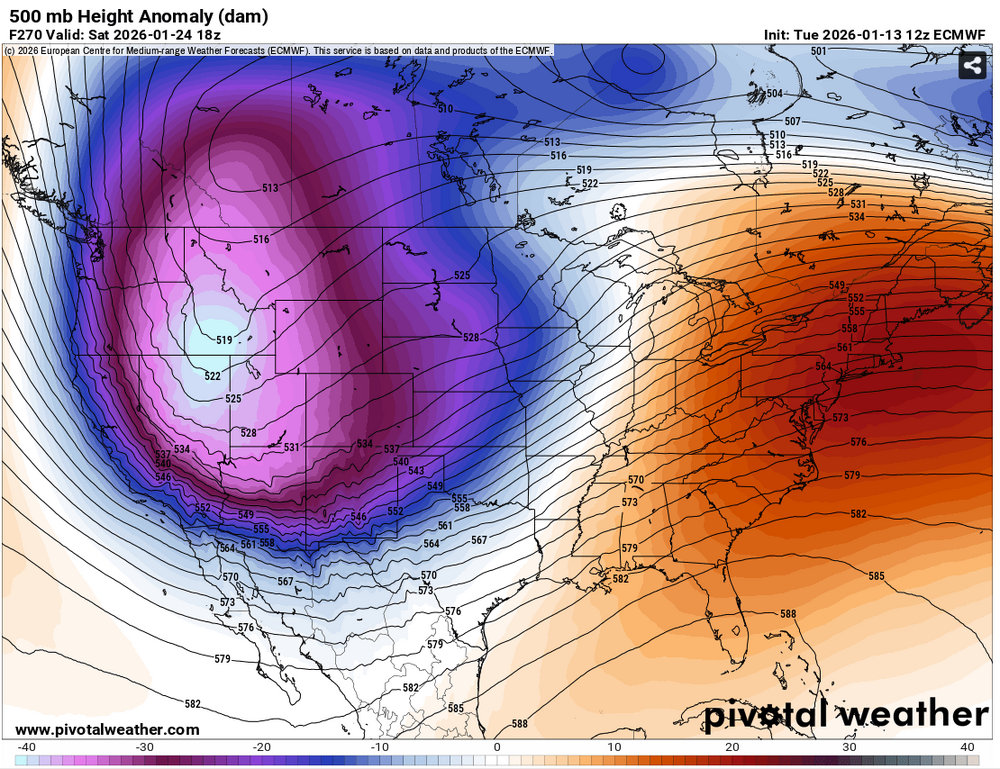
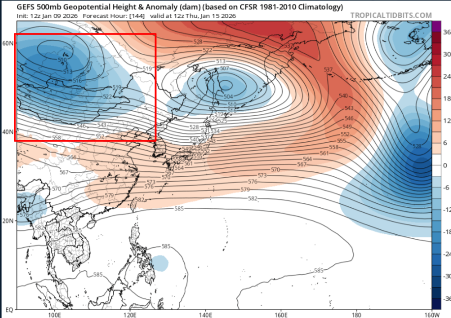
Just shows the PV getting dispaced into the Baffin Sea and Northwesten Passages,its still just fantasy,not sure why i even posted it here,but that could get quite cold into parts of NA depending on what ever teleconnection connect with
-
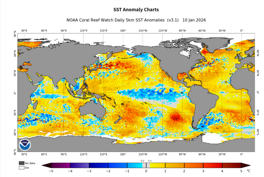
The warm SST'S into the GOM are a breeding ground for strong storms right now,really would hate to see cold get penetrated into the region,of course for people into that region time to time you see winter modeled into that region even tho its fantasy range
-
True,thats a uptick even since the 12z,not much but something is better than nothing..lol
-
Purty active pattern upcoming,someone should get something out of this mess

-
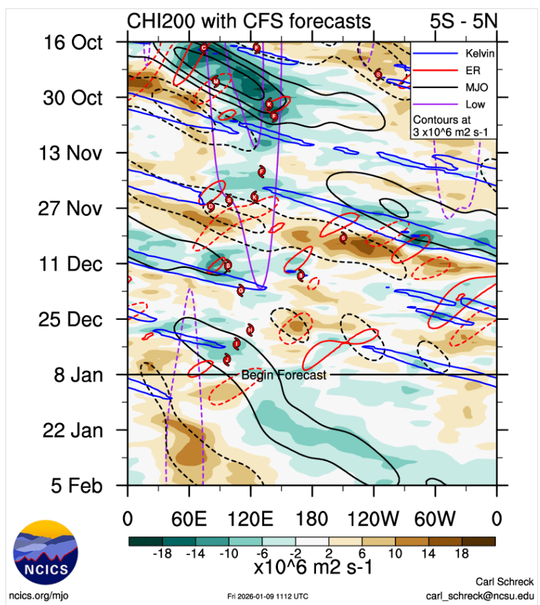
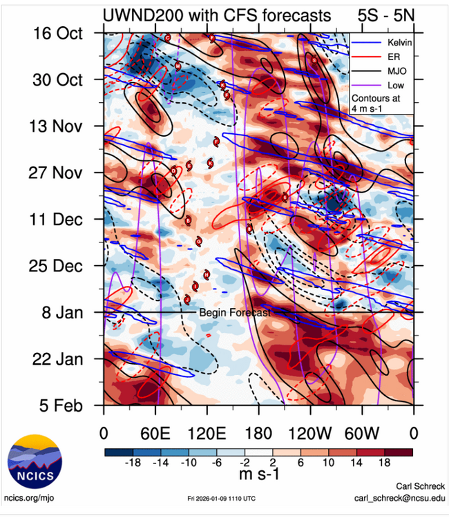
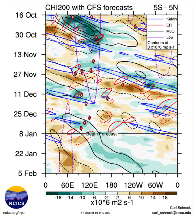
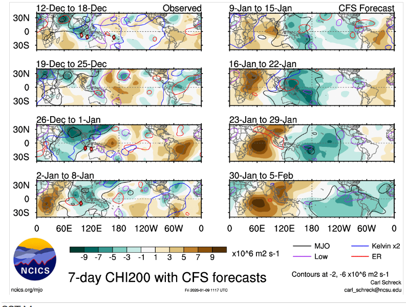
In general when you see all that mess into WP,you'd think its gonna warm up in our parts with the MJO signal relative strong and you also see where the MJO RMM'S do funky stuff into P6,past the mid month.MJO is still moving even tho the RMM'S says it isnt,my thinking is after that mess clears,the RMMS will correct itself and show a fast moving signal until they catch up,just destructive interference from Rossby and Kelvin
-
It dont look as brutal as it has been this time.The ensembles all of them seem to struggle to even get into the 40's,so maybe it wont be that bad.
-
Can you imagine that with this,of course its fantasy right now

-
Just for fantasy purposes,its still fun to look at if you are a cold lover,i'm not that person but you can also see a big artic high nosing down towards the Upper Plains the end of the run on the GFS,if you look at the other charts

-
Probably the best look we've seen all season other than what you guys got in the east got earlier.hopefully something transpires for someone
-
Hopefully the Euro is wrong,its still showing the MJO in the WP and with some strong blocking into Siberia but its shows a Asian winter time monsoonal flow,rhis would be a waste with the blocking into Siberia it shows in our parts
.png.d8b785a36a14e09b2925943305947b48.png)
-
I'll take a shot of the GFS

-
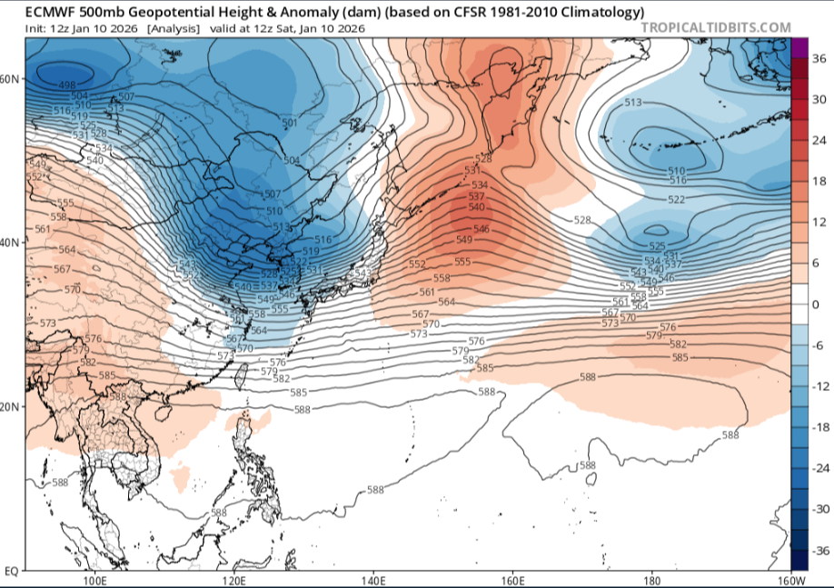
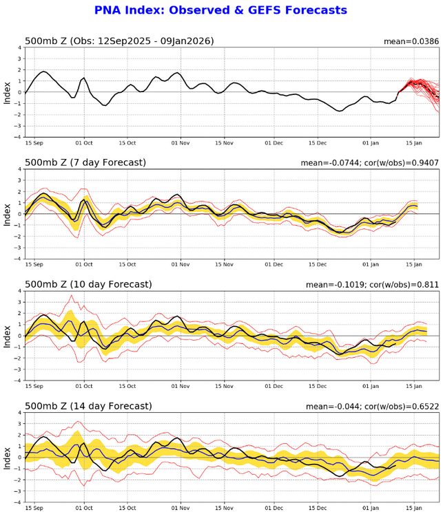
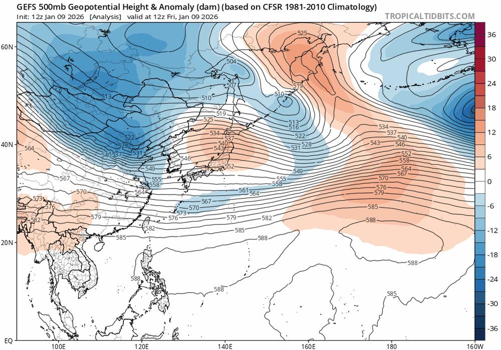
You can teleconnect with what the GEFS shows into East Asia,while you have some possible winter in the long range,this should just be transient cold and a warm up afterwards.But this is also with the MJO related sorta speaking So this is gonna crash the good PNA as heights lower into Russia/Mongolia
-
You're definite seeing a pattern change since we've seen this since fall in the upcoming days
-
But anyways what it seems to me is the MJO is headed towards the WH.AFRICA and possibly strenghten,patterns like this in a declining Nina even tho its still Nina probably means possibly into Feb you guys in the east could get a good storm depending on other teleconnections,especially into our subforum
-
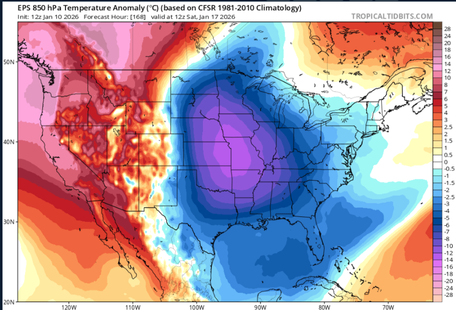
Its definite a cold look as we get into next weekend just looking at whats going through East Asia the next few days, for a few days,maybe we can score during this time
-
Seemingly we are starting to see a pattern change upcoming,the tropical forcing is getting taken out of the WP/MC which is what we've been seeing literally since fall I'm using the GEFS and CFS I.E,take out the tropcial forcing you dont see these troughs going trough East Asia,
-
Sorry to hear this about your mom also,prayers for you and your fam


.png.295c885683ee5ae57eb90b40979dad9a.png)