tstate21
-
Posts
84 -
Joined
-
Last visited
Content Type
Profiles
Blogs
Forums
American Weather
Media Demo
Store
Gallery
Everything posted by tstate21
-
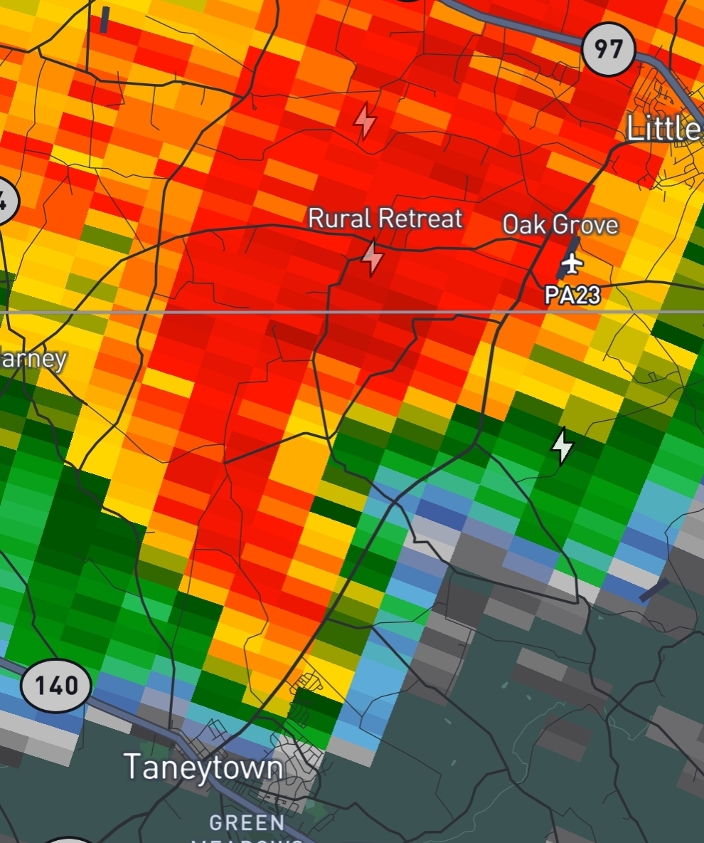
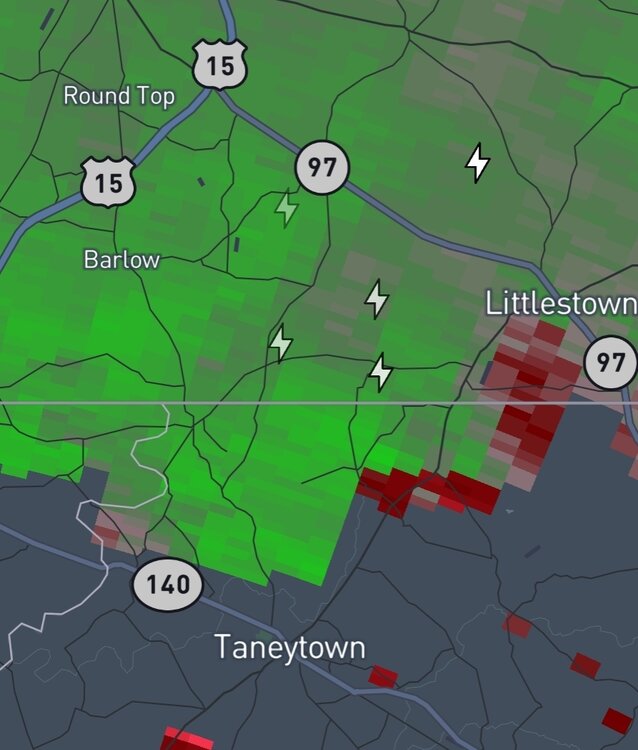
Would not be surprised if there was a small spin up tornado NE of Taneytown about 15-20 minutes ago. Certainly a velocity couplet there for a few frames.

-
https://x.com/i/status/2024564778669395990 Think this answers your question and to be fair the majority of us thought the GFS op runs from those timeframes were BS too.
-
So wait, has no one mentioned the wright weather boards yet? I joined those the 2002-2003 winter leading up to PD2. Maybe its an omen for this winter? Fun times.
-
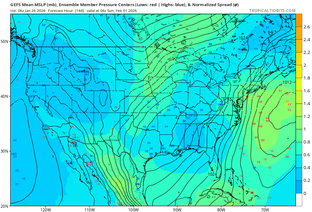
00z GEFS has some large changes from the prior runs, even showing some inland members and the majority of the members are inside the ensemble mean.

-
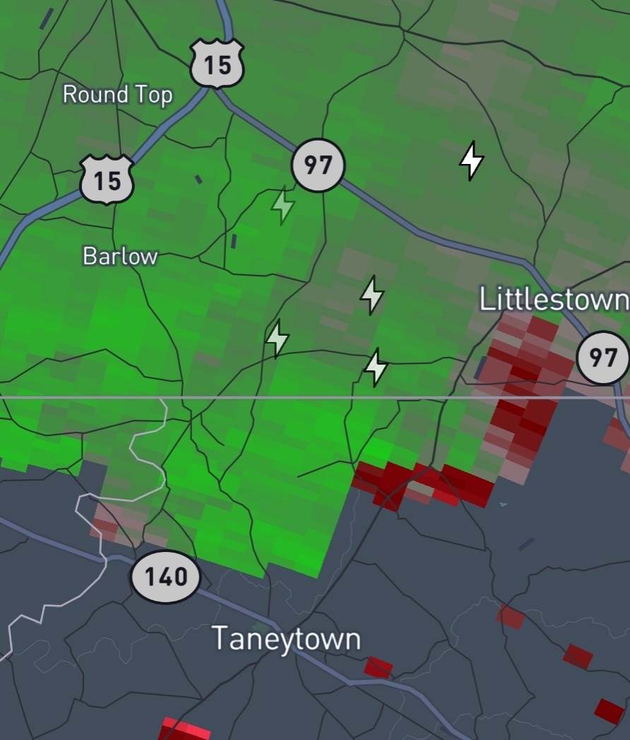
Even looks to be a little bit of weak rotation just NW of Owings Mills. Doubt it produces but provides something to watch at least.

-
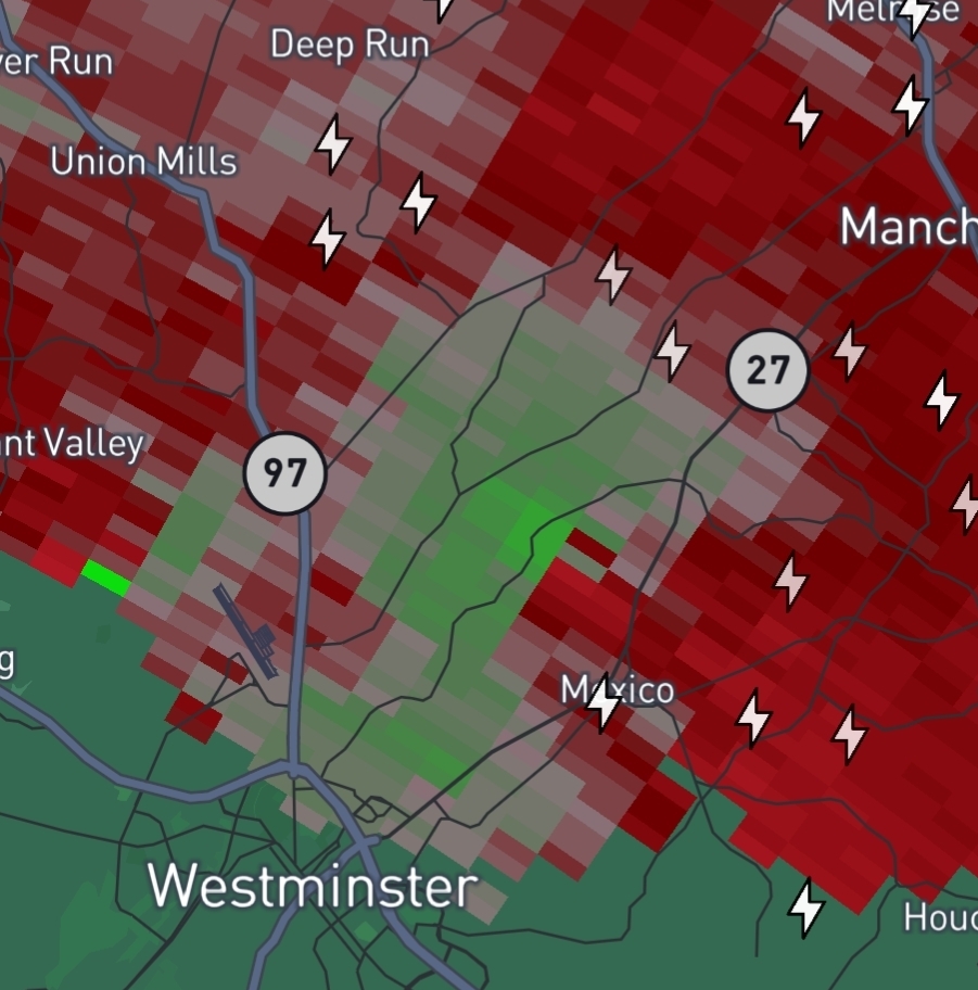
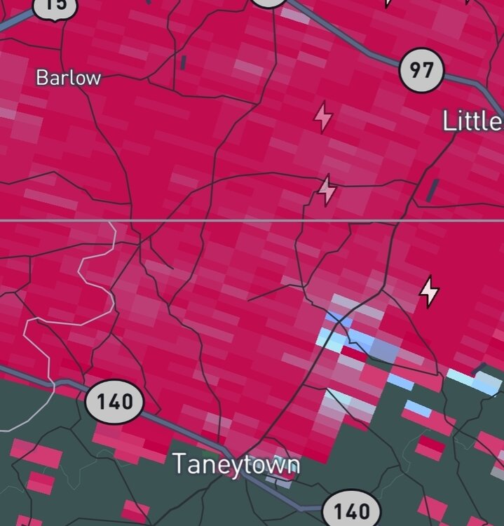
298 WFUS51 KLWX 170026 TORLWX MDC005-013-170100- /O.NEW.KLWX.TO.W.0033.250717T0026Z-250717T0100Z/ BULLETIN - EAS ACTIVATION REQUESTED Tornado Warning National Weather Service Baltimore MD/Washington DC 826 PM EDT Wed Jul 16 2025 The National Weather Service in Sterling Virginia has issued a * Tornado Warning for... Northeastern Carroll County in north central Maryland... Northwestern Baltimore County in northern Maryland... * Until 900 PM EDT. * At 826 PM EDT, a severe thunderstorm capable of producing a tornado was located near Hampstead, or near Westminster, moving east at 10 mph. HAZARD...Tornado and golf ball size hail. SOURCE...Radar indicated rotation. IMPACT...For those in the direct path of a tornado touchdown, flying debris will be dangerous to those caught without shelter. Damage to roofs, siding, and windows may occur. Mobile homes may be damaged or destroyed. Tree damage is likely. * Locations impacted include... Hampstead, Manchester, Millers, Greenmount, and Upperco. PRECAUTIONARY/PREPAREDNESS ACTIONS... Tornadoes are extremely difficult to see and confirm at night. Do not wait to see or hear the tornado. TAKE COVER NOW! Torrential rainfall is occurring with this storm, and may lead to flash flooding. Do not drive your vehicle through flooded roadways. && LAT...LON 3958 7697 3965 7698 3970 7676 3955 7674 TIME...MOT...LOC 0026Z 269DEG 10KT 3961 7691 TORNADO...RADAR INDICATED MAX HAIL SIZE...1.75 IN
-
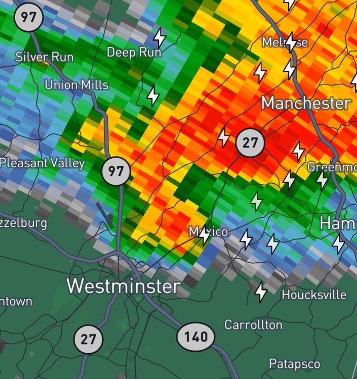
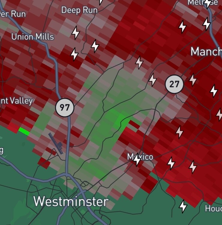
Big time rotation on the storm just northeast of Westminster. Surprised there's no tornado warning on it yet.
-
Now tornado warned. Figured it would be.
-
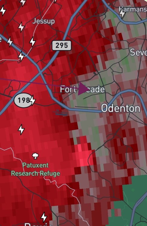
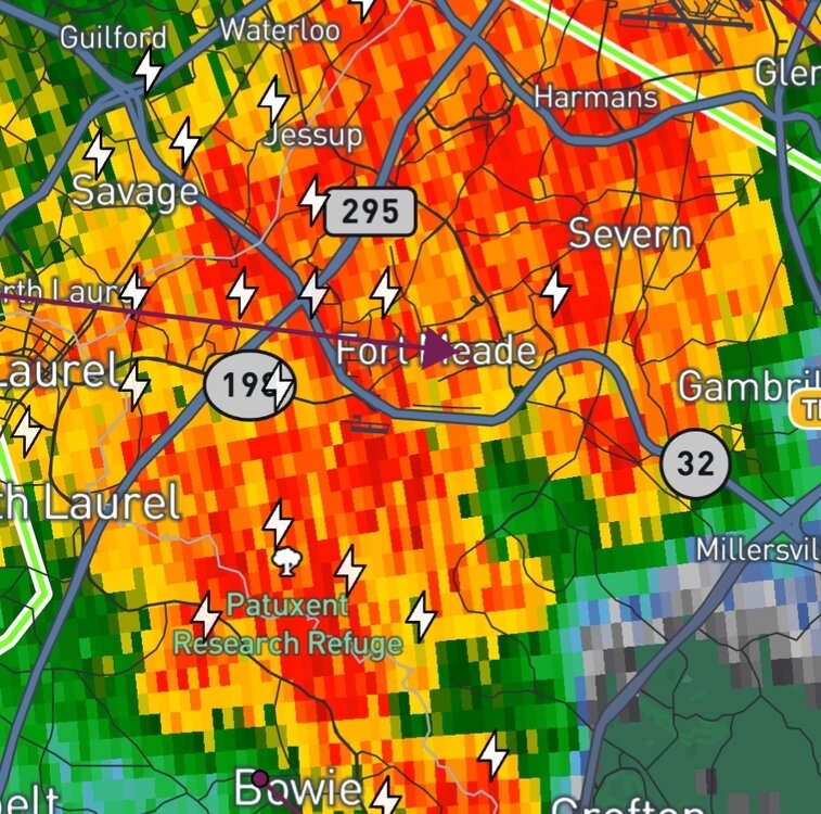
May have been a brief touchdown just south of Ft Meade. Anyone there confirm?
-
Even if Milton simply maintains intensity, I would expect this to be the case given we are approaching diurnal max. Now if he strengthens further tonight... get ready for some even more impressive colors to show themselves soon.
-
There was a definitive hook as that complex crossed into Maryland. I would not be surprised if we see a report of a brief touchdown in Southern PA tomorrow morning. Seems to have developed into a more of a squall line at this juncture.
-
Debris being lofted over 1500 feet in the MoCo cell apparently.
-
Appears to be. Warning reflects radar confirmed as well. A bit of a couplet near Perry Hall now as well.
-
Many of these warnings seem to be precautionary with broad areas of rotation, with the exception being the Leesburg cell for a time.
-
Wow. Leesburg TW now radar confirmed.
-
The Weekend Rule? Saturday 2/17 - The Icon Storm
tstate21 replied to DDweatherman's topic in Mid Atlantic
I'm counting this as a "winter weather advisory watch". -
2024 Valentines Day Who the Hell Knows - Comeback Thread
tstate21 replied to DDweatherman's topic in Mid Atlantic
First signs of snow mixing in here in Owings Mills. -
2024 Valentines Day Who the Hell Knows - Comeback Thread
tstate21 replied to DDweatherman's topic in Mid Atlantic
I know its only the 18z NAM (and at range), but at 78 hours it is substantially further south from it's 12z run. Seems that there is quite a bit more confluence from the northern stream. Maybe a nice start going into happy hour? -
And there's the TW but radar isn't looking as impressive the last few scans.
-
Certainly some broad rotation just E of White Marsh but nothing of immediate concern at the moment. If there is going to be a brief spin-up soon, it would likely be in that area.
-
Tornado possible tag in the STW for the cell near Beltsville.
-
14-21 named storms is such a large range IMO. Since 2010, 77% (10/13) years had between 14-21 named storms. Easy to be "correct" when you have such a large target. It tells me that they are unsure of what is actually going to happen.
-
On a related note, what radar apps/websites are you all using? I used to use marylandwx but their radar site has been down for months now.
-
March Medium/Long Range Thread: The Empire Strikes Back
tstate21 replied to stormtracker's topic in Mid Atlantic
Either everyone has given up or everyone is asleep to miss the bomb at 204h on the 00z Euro... -
January/February Mid/Long Range Disco IV: A New Hope
tstate21 replied to stormtracker's topic in Mid Atlantic
Just a beautiful setup on the 00z Euro with a slow moving juicy low running into a stout 1040mb+ high up top and then redeveloping off the coast. Surely shows the potential of the pattern coming up. Can the Euro finally be picking up on the start of something here or is it another mirage?