

mahk_webstah
-
Posts
11,844 -
Joined
-
Last visited
Content Type
Profiles
Blogs
Forums
American Weather
Media Demo
Store
Gallery
Everything posted by mahk_webstah
-

December 2021 Obs/Disco...Dreaming of a White-Weenie Xmas
mahk_webstah replied to 40/70 Benchmark's topic in New England
is it still true that the GFS is better than the Euro with NS lows? -
December 2021 Obs/Disco...Dreaming of a White-Weenie Xmas
mahk_webstah replied to 40/70 Benchmark's topic in New England
lets just hope it does this in a way that has it be snow -
December 2021 Obs/Disco...Dreaming of a White-Weenie Xmas
mahk_webstah replied to 40/70 Benchmark's topic in New England
probably not enough further back, but this can still develop a bit I'd think. If the trend to an earlier phase continues for another run or 2 then maybe it is cold enough for heavy wet snow in the interior. -
December 2021 Obs/Disco...Dreaming of a White-Weenie Xmas
mahk_webstah replied to 40/70 Benchmark's topic in New England
does the snow cover help with the BL or is it more about the bigger process/evolution? -
December 2021 Obs/Disco...Dreaming of a White-Weenie Xmas
mahk_webstah replied to 40/70 Benchmark's topic in New England
exactly. the either-or statements aren't fact-based. A good pacific is better sometimes, and a good Atlantic at others. Also depends on where you live, as I look out my window. -
December 2021 Obs/Disco...Dreaming of a White-Weenie Xmas
mahk_webstah replied to 40/70 Benchmark's topic in New England
let's get the ponds frozen and traversable. 10 here. -
don't need the fluff unless its on top of 2 ft pack.
-
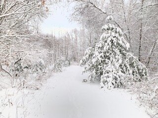
What a gorgeous morning. A very thick dense snow, sticking to everything and should be a good base to start the snow pack. One stick had about 5 inches the other six in the other somewhere around 6 1/2. I’m going to call at 5.75 inches, a little less than Brian has as is usually the case.
-
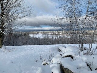
At least the pack will have some density
-
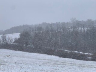
Some mixing here. Snow growth is not good though radar returns are fairly healthy. Maybe ice crystals are granules mixed in with very small snowflakes and sleet
-
Post your radar pretty please?
-
Looks like some somewhat heavier snow building back in up here from the west, unless I’m having radar hallucinations. Yellows showing up not too far north of Brian and I
-
December 2021 Obs/Disco...Dreaming of a White-Weenie Xmas
mahk_webstah replied to 40/70 Benchmark's topic in New England
how should I interpret that at 850mb my temp at 7am is 2 or 3 degrees celsius above normal? maybe a cloudy night with snow falling keeping the temp above normal? Looks like it might be pretty warm midwest? -
I think you are overstating what was expected and warm surfaces had no impact because they weren’t that warm anyhow
-
Thanks for that Chris. I figured it was likely to develop further but the radar does look shitty
-
That radar makes me decidedly an optimistic about going anywhere more than about three or 4 inchesThat radar makes me decidedly an optimistic about going anywhere more than about three or 4 inches
-
We tend to do a little better than you I think. And Bryan does a little better than me. My gut is similar but the models seem to be pretty consistent on wanting us to get six or seven or even 8 inches though, we’ll see
-
This is about 45 minutes ago. Looks to be getting slightly heavier now.
-
The weather underground app though has gotten a bit more aggressive suggesting something that would total closer to seven or 8 inches. I guess we’re going to get into it. Of heavier snow here in a bit. Either way it’s a nice start to the snow season because this will probably be the start of a pack given the long range forecast and some nice cold nights this week.
-
This is about half inch per hour
-
Maybe 2” light to mod. Low visibility due to fog. Hopefully we get heavier. This evening
-
Well the Verga was overcome decisively and the snow after 15 minutes is moderate and the mulch is dusted. That was fast, hopefully it maintains
-
Not yet. I think I have shitty radar neck rad and Weather Underground. According to them at its snowing here for a few hours but they’re returns due look meatier
-
Just a little snow storm PTSD. The dew points were already high enough so I thought we were pretty well moistened but looking at the radar there’s still a lot of low level dry air that needs to be overcome. But the returns are beefing up just to my west so I think it’s probably going to start in the next hour in earnest
-
I thank you for that permission. It’s the weather underground radar hallucinations that are doing me in. But on the other hand I’m getting a bunch of pre-storm prep done and covering burn piles and such
