

Terpeast
-
Posts
6,687 -
Joined
-
Last visited
Content Type
Profiles
Blogs
Forums
American Weather
Media Demo
Store
Gallery
Everything posted by Terpeast
-
Just checked the calendar for something work related… and couldn’t help but notice that Feb 23-25 falls on a weekend.
- 2,509 replies
-
- 6
-

-
- weenie fest or weenie roast?
- weenies got roasted
- (and 2 more)
-
Don’t be surprised folks if the next euro control run shows nothing or rain 20 days out. As long as we have the pattern and it moves closer in time, we should be fine
- 2,509 replies
-
- 4
-
-
- weenie fest or weenie roast?
- weenies got roasted
- (and 2 more)
-
Not really, no. Not with support from a background pattern like the plots we're seeing for mid-late month
- 2,509 replies
-
- 5
-
-
- weenie fest or weenie roast?
- weenies got roasted
- (and 2 more)
-
It does also mean we have a legit shot at a MECS/HECS, which is something that couldn't be said for the last 8 years.
- 2,509 replies
-
- 7
-
-
- weenie fest or weenie roast?
- weenies got roasted
- (and 2 more)
-
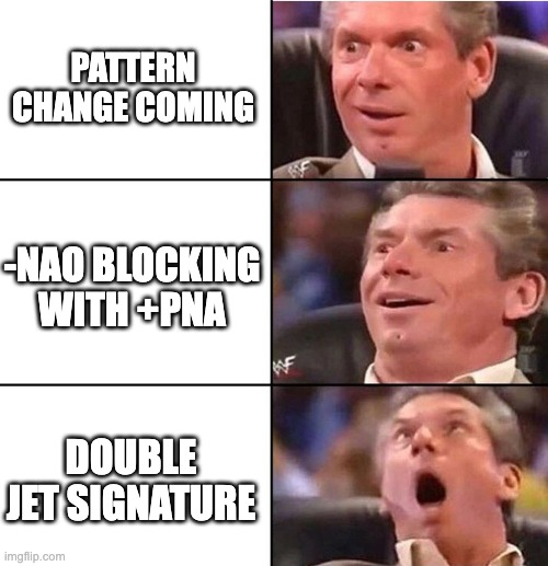
Right rear entrance of northern jet + Front left exit of southern jet = double jet signature!
- 2,509 replies
-
- 23
-

-
-
- weenie fest or weenie roast?
- weenies got roasted
- (and 2 more)
-
Look at that 50/50 with an incoming STJ wave. Canada no longer torched, should be cold enough to snow from NC north
- 2,509 replies
-
- 3
-
-
- weenie fest or weenie roast?
- weenies got roasted
- (and 2 more)
-
I think it has gotten a lot more competitive now than in my generation overall, but there was still decent competition in my age group. My 50m free was in the low-mid 24s and 50m breast was 32 something. I don't recall my 100m free time because it was a long-course pool and I wasn't used to that, so I had a bad race. But the 100y short course was low 49
- 2,509 replies
-
- 1
-
-
- weenie fest or weenie roast?
- weenies got roasted
- (and 2 more)
-
Nice, you're doing great! Mine was free and breast, and like you I was a sprinter. 50/100m events were in my wheelhouse. Made it to state in my junior and senior years Now all this discussion about swimming is starting to get me motivated about it again! Not gonna dive into Masters or anything, but just to get things going a little bit more. I sit too much for work!
-
Swimming is great. Used to do it competitively. It just takes more time to drive to a pool, change into my suit, and do enough laps to get enough cardio benefit, and then change and drive back. But I’m definitely keeping that option open
- 2,509 replies
-
- 1
-
-
- weenie fest or weenie roast?
- weenies got roasted
- (and 2 more)
-
I wouldn’t go that far. I have folks on my ignore list and EJ isn’t one of them. Pessimistic, maybe. But he’s provided a lot of value with the mesonet stuff.
-
Good day to go out for a nice long run. I love cold, but I hate exercising out in it, and the rowing machine is getting a little boring
- 2,509 replies
-
- 3
-
-
- weenie fest or weenie roast?
- weenies got roasted
- (and 2 more)
-
Not at all. Get the cold here first, then bring on the STJ parade
- 2,509 replies
-
- 6
-
-

-
- weenie fest or weenie roast?
- weenies got roasted
- (and 2 more)
-
Yep, 850 starts to flip BN on the 14th - remarkably consistent over the past week’s worth of runs. Then by the 16th they get pretty cold.
- 2,509 replies
-
- 7
-
-
- weenie fest or weenie roast?
- weenies got roasted
- (and 2 more)
-
No change to pattern timing, but the “wait” just keeps getting warmer. Hopefully it’s just a product of sharpening the wave features leading up to the pattern change
-
Yeah I was half expecting to see it fall apart and get replaced by a SE ridge. Was anything but.
- 2,509 replies
-
- 1
-
-
- weenie fest or weenie roast?
- weenies got roasted
- (and 2 more)
-
Checked the models… no change. I guess we’re either enjoying the trip down memory lane while we wait
-
Yeah, I don’t think the prime time starts until after 2/15 anyway. The week before that appears to more of a transition period
-
How so? It looks decent to me. Cold air boundary moving south with reinforcements over time
-
Yeah, I'm less worried about the clock running out on us than I was a week ago, or even a few days ago. That 540 line is pretty close to us on the D12-15 ensembles... and that's geopotential height, not thicknesses!
- 2,509 replies
-
- 3
-
-
- weenie fest or weenie roast?
- weenies got roasted
- (and 2 more)
-
Looking at analog matches centered on Feb 11 seems a tad too early. I'd want to see what the matches look like centered around Feb 18th or so.
- 2,509 replies
-
- 6
-
-
- weenie fest or weenie roast?
- weenies got roasted
- (and 2 more)
-
Low of 26. Thick frost
-
Don’t look now but 0z gfs trended even further west with the TPV lobe and phases into a closed h5 low over delmarva. Clips cape cod. Very close to a coastal MA hit. Razor thin close. Continue this trend, it’s back alive for eastern folks. Unfortunately it’s on its own with only the icon for support. Other models way OTS
- 2,509 replies
-
- 3
-
-
- weenie fest or weenie roast?
- weenies got roasted
- (and 2 more)
-
Looks awful
-
Final January average for mby: Jan 2024: 44/28 (~3 deg AN), 6.54” (wet!) Dec 2023: 51/33 (~5 deg AN), 6.55” (wet!) Noting these against my outlook. I was pretty confident that we’d have a wetter than normal winter and so far that is panning out. Not surprised by the warm december, but would have thought Jan would be closer to normal. That 78 degree day skewed us at least full degree upward. Take that day away, we'd be at only 2 degrees AN at roughly 44/26 Now let’s see what Feb brings!