-
Posts
6,596 -
Joined
-
Last visited
Content Type
Profiles
Blogs
Forums
American Weather
Media Demo
Store
Gallery
Everything posted by Terpeast
-
Got down to 42. Seems the Euro got it right for mby
-
-
I’m with bluewave here. I’ve been using SQL for 12+ years, including window functions. It makes more sense to non-technical audiences to portray data like this (I made these values up): Year | Avg Temp | Rank 2022 53.6 1st 2003 53.4 2nd 2016 53.0 3rd Tie 1977 53.0 3rd Tie 2005 52.9 4th Than this: 2022 53.6 1st 2003 53.4 2nd 2016 53.0 3rd Tie 1977 53.0 3rd Tie 2005 52.9 5th (note there is no 4th place)
-
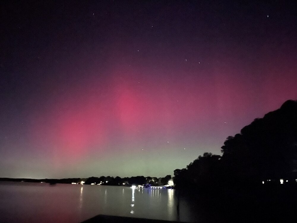
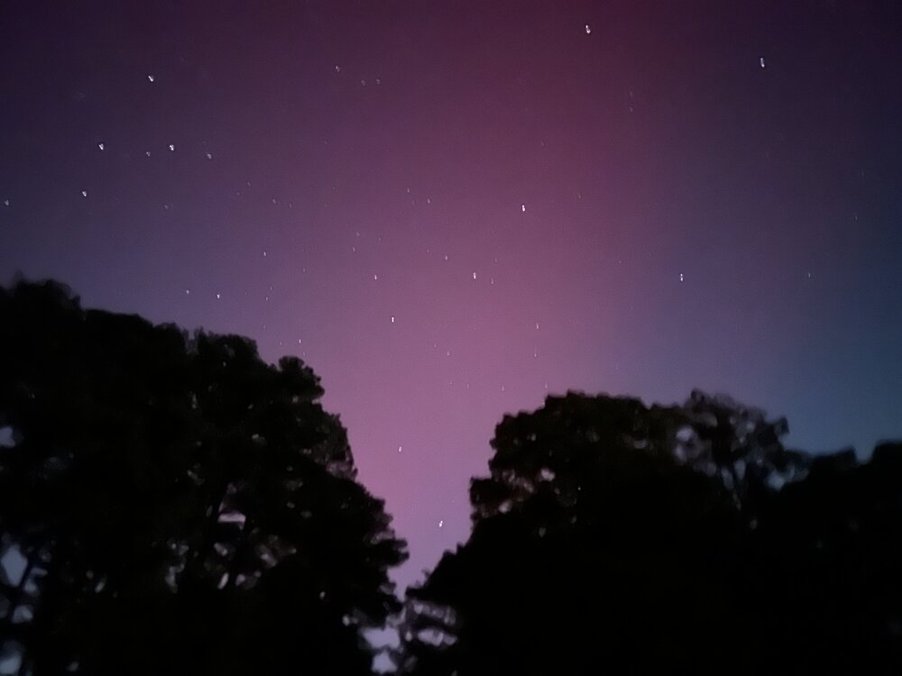
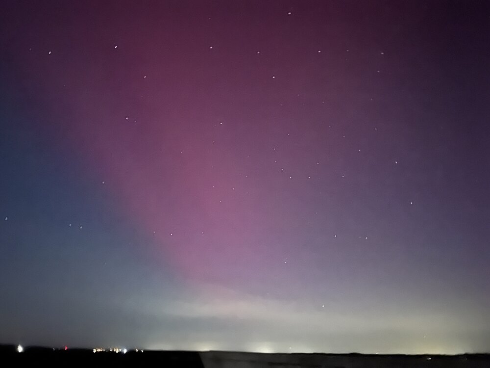
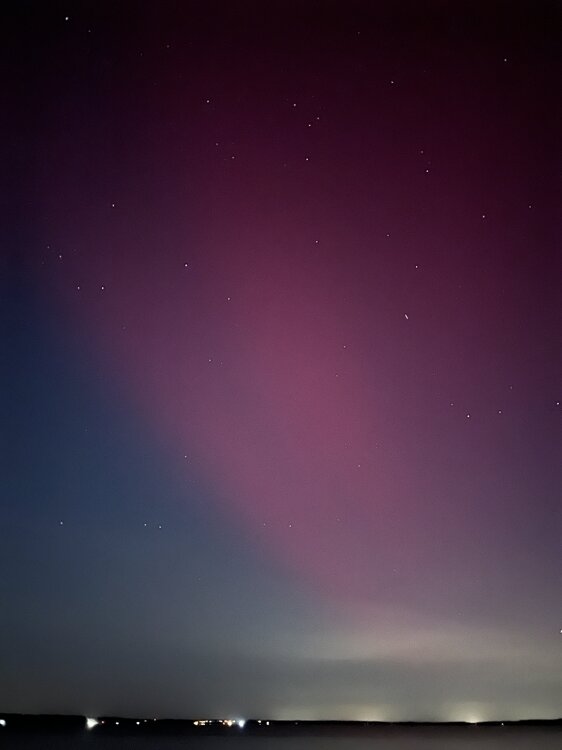
From Jamestown VA on a camping trip with the family. Always wanted to chase north for aurorae and even go to Iceland or Norway for that. But I never thought I’d see it in SE VA of all places.
-
Looking forward to seeing more details of your analysis. I’m curious about the distribution of snowfall when you say the mean prediction is 10.2”. Whether the median is also close to that, or whether one season is skewing the mean. In my case, my analog set was fairly balanced where the median was close to the mean, with one outlier on the high side and one on low side.
-
42.8 for the low
-
Yeah it checks out with my +2 to +3 call for much of the east, but when warm anomalies happen, they are often more extreme than forecast. My hope is that we can get cold air outbreaks to offset some of the warmth.
-
Sarasota obs gust to 93 before the eye
-
Thanks, appreciate it. Wish me luck, it's rough out there. As for 2020-21, it might be a fit for sure, but I think I left it out because of the QBO. Anyhow, the QBO-sensible wx relation is pretty weak in my opinion, so I think it makes sense to use it as an analog as well. I don't think it would change much if I tossed that in.
-
Those are much better than IAD numbers. I made a mistake and included 16-17 instead of 17-18, so the average is actually 11.8" not 10". But still... it's a sign that the NE areas like Balt-DE may do better with coastals if we get them this year.
-
My outlook for the mid atlantic. Thoughts are welcome!
-
My outlook for the mid atlantic. Thoughts welcome.
-
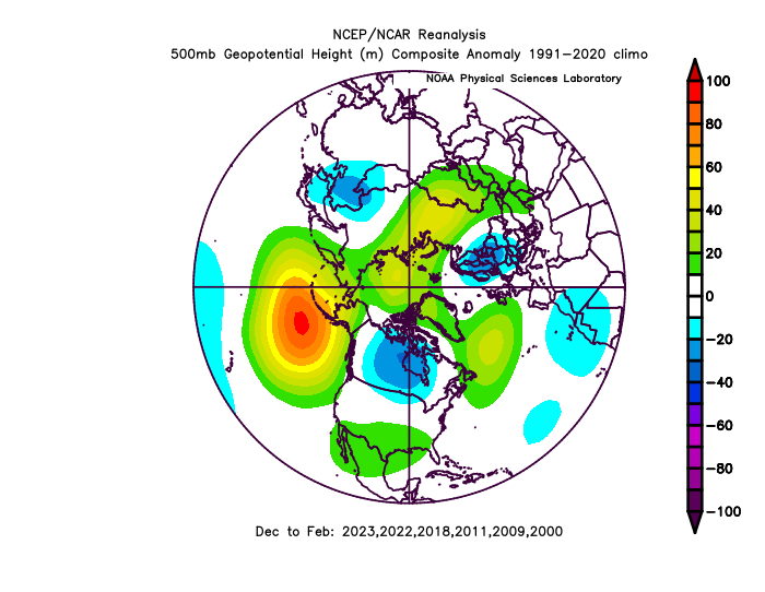
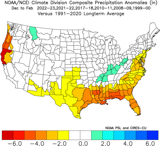
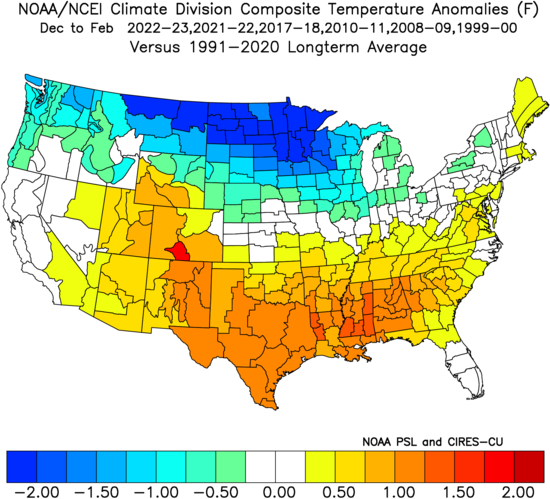
Not gonna go as in depth as last year because I'm in the middle of a job search. Gotta stay focused on applying and interviewing. But wanted to share my thoughts about what might be in store for winter. Not gonna wait for further data since that might be delayed due to Helene and now possibly Milton. Based on the PDO, ENSO, QBO/solar, I came up with analogs going back only to the year 2000 (including Dec 1999): 1999-00 2008-09 2010-11 2017-18 2021-22 2022-23 Those are all nina winters with negative PDO, and the 500mb map shows as such, which not surprisingly matches up with the base state aleutian ridge. But it also matches up with the latest CFS and other seasonals, with hints of poleward ridging into Alaska and a polar vortex down into central Canada. AO somewhat negative, but NAO more neutral. Temperature and precipitation anomalies: Doesn't seem like the blazing warmth that I expected not too long ago, but I would probably adjust the whole map up by a couple degrees F. So overall, we may see a +2 to +3 DJF this year, with somewhat below normal precipitation. IOW, it'll be mild overall like the past 7-8 winters, but I'm banking on at least 2 severe cold outbreaks in the east either preceded or succeeded by large storms. We may actually barely touch zero/subzero F temperatures this time around, especially west of I-95 towards the hills/mtns. The snowfall average at KIAD from these analogs comes out to 10". But 1999-00 was the best of the bunch, with 24". If we take that out, the average goes down to 8". I think the best case scenario this winter is something like 2021-22 plus a storm that takes us by surprise. Worst case is another 2022-23. My probabilistic snowfall outlook is thus as follows: 0 to 10 inches: 60% 10 to 20 inches: 30% 20 to 40 inches: 10% 40 inches or more: 0% Biggest thing is we don't know whether the tier with the highest probability will be closer to a shutout or closer to 10". I cannot predict that months ahead of time. That's beyond me. A lot will come down to luck and timing.
-
47.5 crispy
-
My aunt lives in Winter Haven, but is now out of town and planning to fly back on Wednesday. I’ve been telling her that I recommend cancelling her trip for now.
-
The GEFS backed off a bit on mjo 5-6 strength, but most models are converging on a healthy mjo run of decent strength through those phases through the end of this month.
-
49.5 low, then beautiful day to take my daughter biking to the playground. Twice.
-
Only looking at January, I could also make the case that 2021-22 is a recent case of a very warm december followed by a colder and snowier than normal January. Going by KIAD numbers, Dec 2021 was +7.5 and Jan 2022 was -2.5, a swing of -10 in departures. KIAD also got 11” during Jan 2022, with places further south getting even more.
-
I’m not as bullish as you, but maybe thats just because of our locations. I’m about 70 miles south of you, which could be the difference between a serviceable winter and a dud. I’m just looking for signs of a temporary break from the 22-23/23-24 pattern that resulted in +5-8 degree temp anomalies here. For example, can we get a Jan 2022 or a mid-Jan 2024 “break” that gives us cold and snow as far south as here? I want to say yes, there will be 1-2 periods of this, but all signs point to another very mild winter overall.
-
FWIW ensembles show a warmer west canada with a near normal to cooler east in the 5-15 day time frame.
-
Have you noticed our hurricane seasons getting extended and lasting longer into the fall?
-
Looks pretty neutral. Wasn’t it strongly positive last month?
-
The euro definitely has a la nina signature in its mid latitude atmospheric pattern. Just because the equatorial pacific ssts aren’t as cold as you want them to be, it doesn’t mean there won’t be an aleutian ridge as the euro is showing.
-
If you’re correct, that would be good news for the MA. Based on 850mb DJF climo, it gets down to around -3 along i-95. The past two winters were so warm that the 850s averaged 0 or above, which is a death sentence for snow prospects here. If it’s not going to be as warm, we could maybe have opportunities in borderline situations with west of 95 doing better.


