psuhoffman
-
Posts
26,419 -
Joined
-
Last visited
Content Type
Profiles
Blogs
Forums
American Weather
Media Demo
Store
Gallery
Everything posted by psuhoffman
-
Yea I should hit the “doesn’t bother me” harder. Just saying that one run was “extra” as my students would say.
-
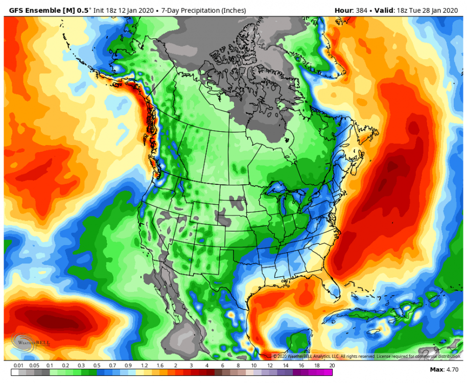
18z Gefs goes suppression in the long range. Bone dry after the weekend storm through the end of the run. That is the most likely way we fail if we don’t snow. One run doesn’t worry me but we don’t want too much of a good thing. Day 8–6
-
Nice axis of precip Ninja’d

-
I’m taking the wife to a B&B in Gettysburg this weekend. A little snow could be a nice touch.
-
The euro isn’t superior by enough to just ride with it no matter what. Especially in specific situations when adjusting for its typical error bias is rational. It’s been over amplifying systems lately.
-
This is a lot more fun than day 15 pattern chasing
-
I agree. If you get some luck...this kind of pattern can actually be better from an "excitement" POV. Obviously 2010 was the exception but that was a once in a lifetime thing... most big blocking patterns don't go down that way. The double edged sword, and I know you know this... with a big arse NAO block is that we need the pattern to start to break down to hit a big storm...and then usually that means soon after we warm up and have to wait for a reshuffle. Often a big block will recycle and give another shot later but its often not right away. This pattern could throw opportunities at us rapid fire if we get the stj going and the trough axis aligns right. So while the chances of a hit with any one storm aren't as high...this could offer more sustained entertainment in here. See 2014/2015...
-
If in a month we are having a debate whether the pattern was more like the Bengals or the Browns...do you really think it matters?
-
@Bob Chill EPS REALLY likes the day 10-15 period....
-
I’m a little more optimistic maybe but not over any one threat. I agree this isn’t the look where we have one storm with a high probability. But we seem to be facing the potential for a prolonged pattern that includes a favorable east based epo ridge/block, an arctic dump into the EASTERN US, and an active southern stream. If that has any legs at all we will have multiple opportunities and the odds of abject failure would take Cleveland Browns level ineptitude.
-
Im going to go ahead and call BS on the lack of surface reflection to this! I suppose that would be a new way to fail, the “everything went right and WTF” scenario. But it doesn’t matter. Odds it’s 100% with h5 at that range is small but either way don’t sleep on early next week. It’s not showing on the current op runs but the potential is there.
-
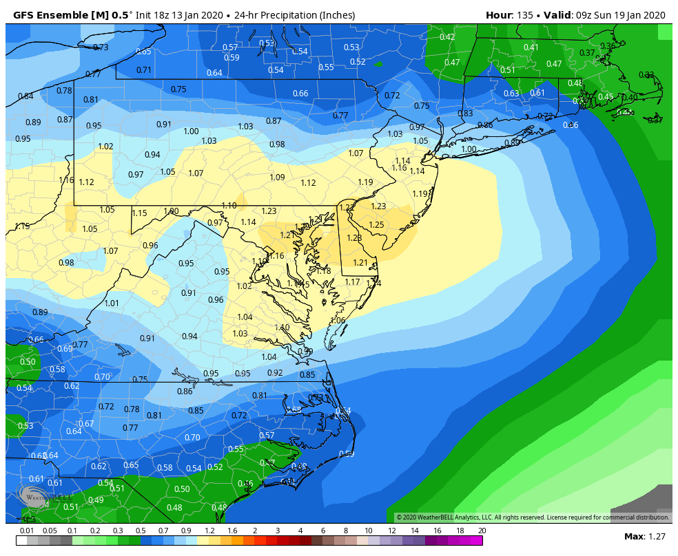
You want to feel warm and fuzzy...look at the slug of moisture coming out of the gulf at the end of the 12z gefs run right into entrenched cold air. Before that there were discreet threats around next Tuesday and Friday/Saturday
-
@Bob Chill we can see both options for the potential stj system next week on the gefs. The GFS op dives the majority of the canadien ridge into the northeast. The ridge rebuilding west of Hudson Bay isn’t strong enough yet so the trough amplifies in the weakness to our west. But on the GEFS both options show. There is clearly two ridges there. If the one west of Hudson is stronger than whatever dives across to our north we likely get the coastal solution. If the ridge in the northeast is more dominant the system likely amplifies to our west. Gefs leans coastal. Eps was split. Too soon. Won’t be out last shot in this pattern it looks like.
-
It's there on all guidance yes. They all agree that a piece of the block in Canada will split and dive southeast and create some ridging a bit too far south than we would want for a short time. But how that plays out isnt' all hostile like the GFS op. The GFS really went crazy with that ridge and allowed the next wave to dig in and cut off to our west. That said...even with everything going wrong it still ended up only 100 miles from a big coastal storm. An inland runner at day 11 is not that big a deal. There are lots of options how that plays out...the EPS has quite a few where that ridge actually acts to suppress a system to our south...and a few big hits in that range. It's undecided how that ridge interacts with the other players. It depends on how strong a piece dives into the northeast vs remains up in Canada. More ridging "behind" that wave instead of in front and suddenly we have a 980 low off Ocean City instead of over Annapolis.
-
Last 3 GGEM runs
-
GEM significantly south of 0z.
-
op GFS gonna be too warm it looks like for the day 10/11 gulf low threat. Breaks part of the block over Canada off and dives it into the northeast which allows a bit too much ridging in front and causes the trough to dig in slightly too far to our west. But its damn close to a big storm for that range. Just need a slight adjustment.
-
It would be nice to put down a snowpack at the start of the pattern change because whatever happens it is likely to stay cold a while after with a 1040 high dropping into the midwest behind the system and the epo ridge going ape in the longer range. We could have a rare situation with extended snowcover "IF" this threat works out. Especially if we can get some appreciable ice on top of a few inches of snow.
-
GFS has a dryslot, probably due to down-sloping, across VA but I would have to look at the exact wind flow to see. But that kind of dryslot, while possible, is dependent on the exact wind trajectory to be correct. The lighter precip rates also negatively impact the thermal profile as less mixing out of the warm layer. The result is ugly there...but that is not the kind of meso scale feature the GFS is going to get right at this range so don't worry, the larger more important factors all broke our way this run.
-
That is a snow sounding with any decent rates. Although the best lift is below the DGZ and in the warm layer...so it likely would be an icy rimed messy low ratio 5-1 type snow....but still.
-
Wait the icon doesn’t start as rain all the way to Burlington VT anymore?
-
@showmethesnow great write up. How many times has a ns vort pinwheeling around a 50/50 screwed us by squashing a threat...or a blocking ridge trended weaker allowing a cutter. Nice if both those features could work to our advantage for once.
-
Despite some pretty good blocking across Canada the AO looks to remain positive, although much less so. And while everyone is focused on the epo which is the best way to get consistent cold despite a +AO, the look of ridging near Hudson Bay with an active STJ cutting under it on the EPS has my attention. That feature is one of the best ways to get a big snow during a +AO regime.
-
Agree with this. I’m not totally sure what happens up top though. It’s a sudden flip to blocking then a sudden flip back although with a perfect epo ridge. But that’s two sudden high latitude reversals in a week. Volatile to say the least.
-
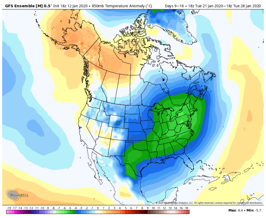
I can live with this profile day 9-16 850 temp anomaly mean precip