SnoSki14
-
Posts
16,212 -
Joined
-
Last visited
Content Type
Profiles
Blogs
Forums
American Weather
Media Demo
Store
Gallery
Everything posted by SnoSki14
-
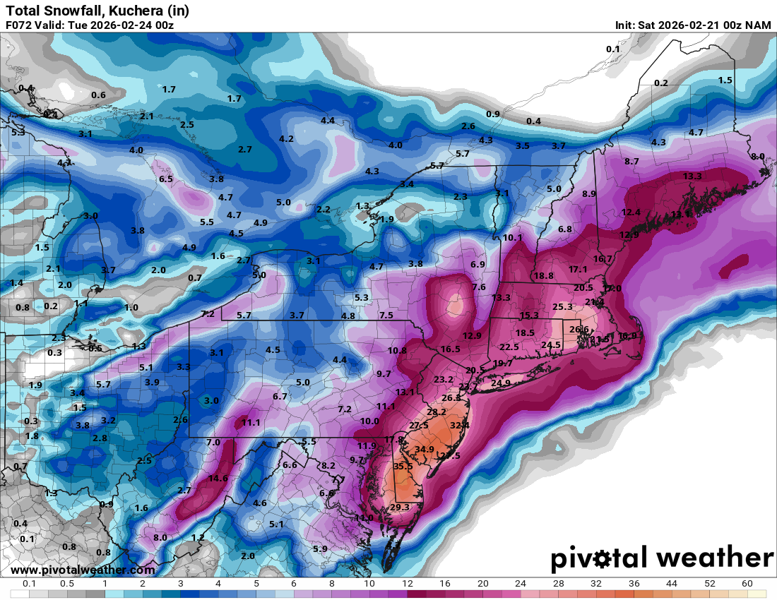
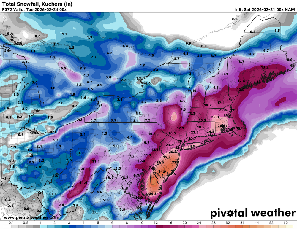
Parts of Southern NJ pushing 3 feet. That's nuts
-
If it's correct then people are not ready for what's coming
-
That wouldn't surprise me. Often it starts faster than expected and ends earlier than forecast.
-
As long as it's a strong, dynamic system then I prefer a very tucked in track maybe 50-75 miles SE of ACY
-
Yes it was.
-
I still can't believe the GFS OP pulled this off.
-
Let's keep our expectations in check though. Remember NAM struggles mightily beyond 36-48hrs, we're just entering its more accurate range.
-
Correct. Whatever hundredths of QPF we lose to a mix won't matter once the storm gets going.
-
Um no lol
-
Well when you keep weening out over every storm eventually you'll be right.
-
Good point. Imagine the panic tomorrow if warnings go up for 12-18"+
-
Is the public really aware of this. I know they generally expect snow just from talking to people but I feel the hype has been far less than the Jan storm.
-
If it follows that playback then amounts will keep going up until start time
-
I saw that and was in awe. I don't recall seeing a 60-72 hour ensemble prog that strong. The true scope of what's unfolding may not even be apparent yet if that's correct.
-
Because it's not done trending yet.
-
It tends to be more suppressed in general. Odd outputs sometimes. I remember with the Jan storm it kept spewing 3-4" totals over NYC and into my region too vs the 10"+ amounts we got.
-
Having a 3 day ensemble mean have a 976 low is crazy.
-
GEFS look really good
-
If only it started tomorrow afternoon. Another harrowing day of model runs before the whole picture comes together
-
I know we always worry about could go wrong but what if the storm is still trending towards a bullseye.
-
The NAM would be a verified blizzard. It has sustained winds of 30-40 mph with gusts of 60+ pretty far inland.
-
Plus there's ensemble support. It's a bit early but the GFS has done really well with this, shockingly so. Very consistent too. Broken clock type scenario
-
Very possible although ensembles suggest a westward lean which could hint at more west trends tonight and tomorrow
-
Agree, Mt. Holly are the watch happy ones
-
Got more maps for the EPS