Ephesians2
-
Posts
559 -
Joined
Content Type
Profiles
Blogs
Forums
American Weather
Media Demo
Store
Gallery
Everything posted by Ephesians2
-
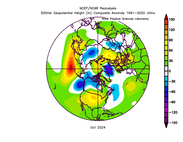
Oct 2024 had positive EPO: Oct 2023 was negative: Oct 2022 was neutral... Oct 2021 was positive. Oct 2020 looks neutral maybe slightly negative. Oct 2019 had a slightly negative EPO and 2019-20 was very positive. So looking back at the last few years, there isn't a single year where this correlation has actually existed. Maybe 2017-18 but it's weak. I think we can look at these correlations, but even in what you showed the significance seems to be pretty minor. I'm not sure this is a causal relationship at all, and if it is, it's a very, very minor factor.
-
Well, to be fair, he's right that a warm October doesn't necessarily mean a warm winter in the east. October 2011 was cold, while October 2010, 2013, 2014 were above average. November is more correlated in my understanding.
-
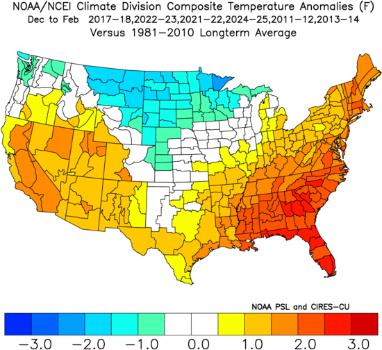
 DCA +4.3 NYC +3.8 BOS +3.5 ORD: +5.4 ATL: +4.0 IAH: +3.6 DEN: +1.0 PHX: +1.3 SEA: -0.5
 -
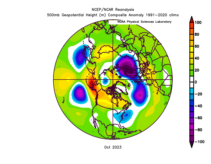
I could see it being a -EPO / -PNA / southeast ridge kind of winter with a few brief but relatively intense cold shots but overall warmer than last year. I've heard that the North Atlantic anomalies signal a +NAO, but if we get some transient blocking in January or even March, we could luck into something. 2021-22 was mostly like that except for Jan and we had chances. I don't even think there was much blocking that year. If we had had Dec 2022 later on, it also could have produced. Something like 2017-2018 or last year is probably the best case scenario. (I'm using 1981-2010 anomalies in this image on purpose. It's just so hard to get a legitimately cold winter now. Even this September is likely going to end up above normal here.)
-
First 80 degree day of the year.
-
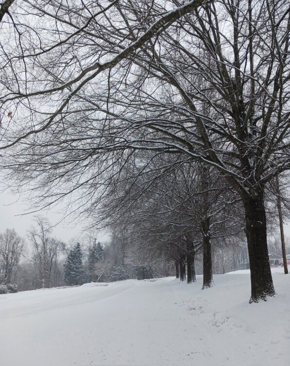
B. Ended up with about average snowfall but more than any winter since 2018-2019. Never got a direct hit from any storm - either slightly too far north (Jan 6, Feb 13, two warning level ice events) or too far south (Jan 11, Feb 19-20) but in return, there were 4 or 5 notable snow events and snow cover for most of January.
-
A lot of Nino years in the analogs... interesting. https://x.com/MikeTFox5/status/1894541347563913353/photo/1
-
Richmond Metro/Hampton Roads Area Discussion
Ephesians2 replied to RIC Airport's topic in Mid Atlantic
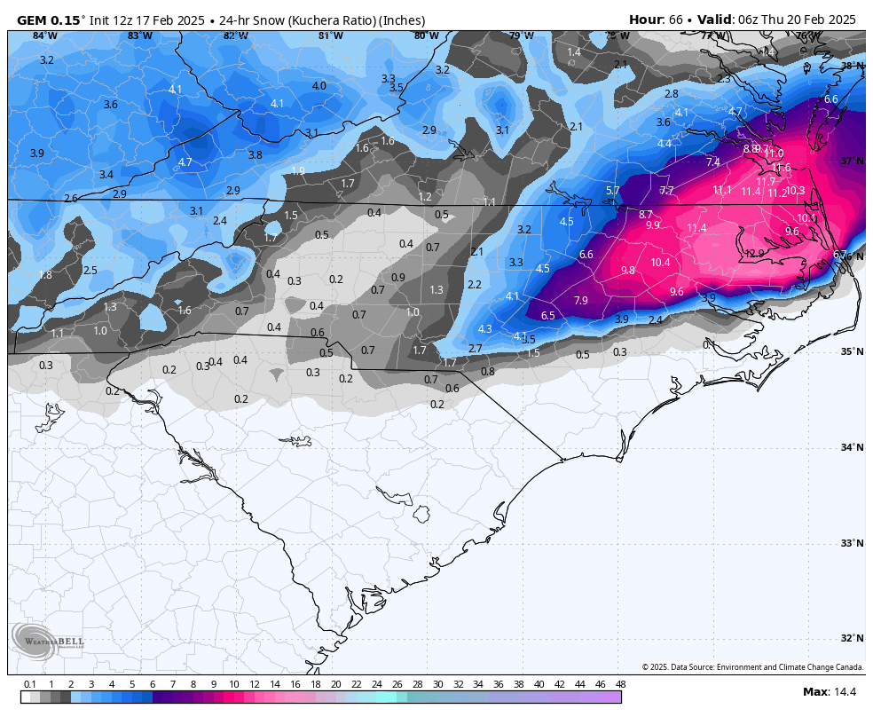
19:1 ratios
-
2/20/2025 - 1.0" Total: 11.4"
-
Picked up an extra inch of so of high ratio powder this morning
-
If we lived in a colder climate we'd just be complaining about April.
-
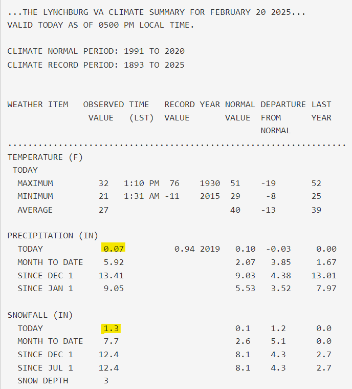
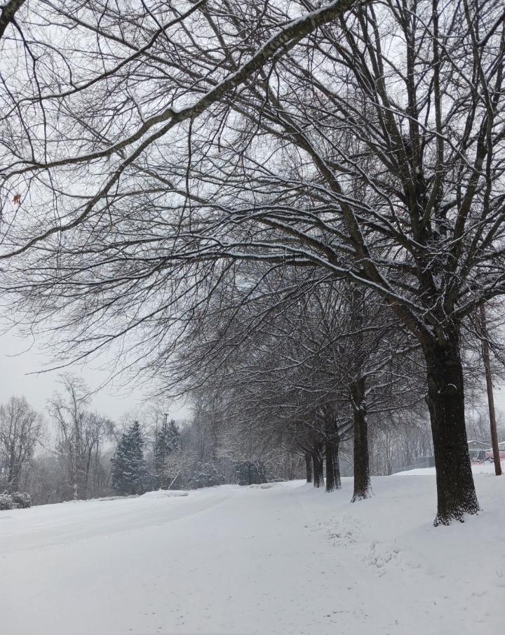
2/19/2025 - 1.4" Total: 10.4"
-
Richmond Metro/Hampton Roads Area Discussion
Ephesians2 replied to RIC Airport's topic in Mid Atlantic
Light snow since around 7... total of 1.4" with the back edge approaching. -
Richmond Metro/Hampton Roads Area Discussion
Ephesians2 replied to RIC Airport's topic in Mid Atlantic
Might be wishful thinking, but this was posted in the SE forum:
-
Richmond Metro/Hampton Roads Area Discussion
Ephesians2 replied to RIC Airport's topic in Mid Atlantic
-
Richmond Metro/Hampton Roads Area Discussion
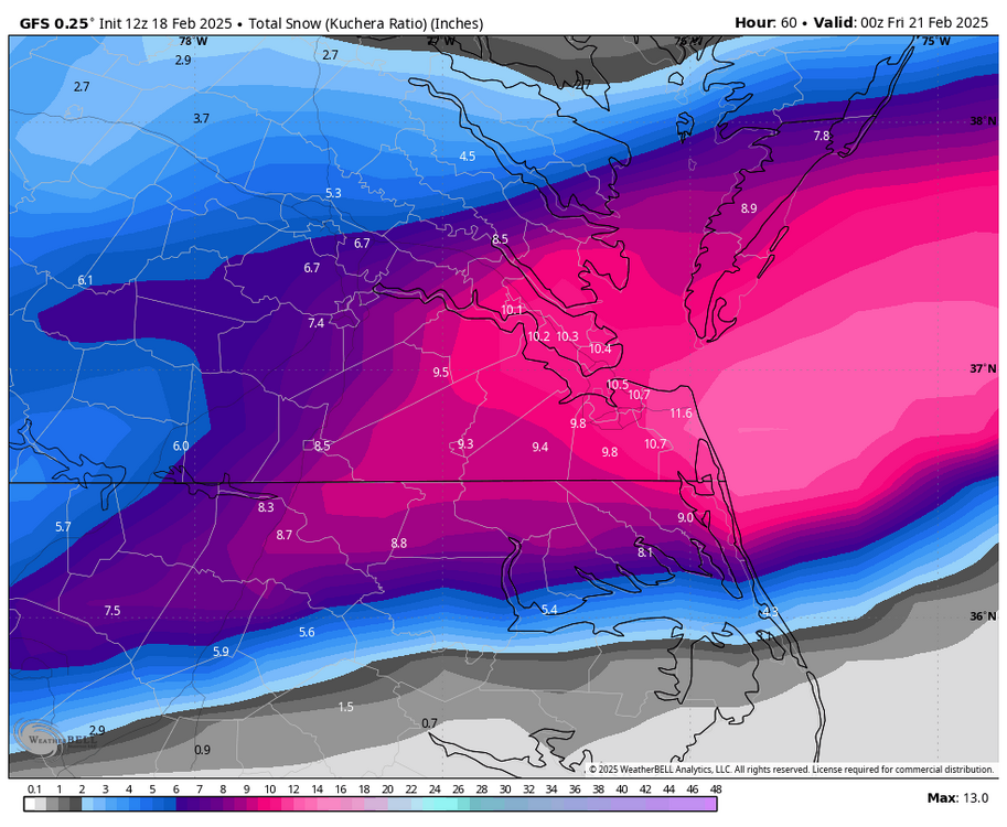
Ephesians2 replied to RIC Airport's topic in Mid Atlantic
GFS out to 27... still early but looks like a SLIGHTLY healthier storm Update: out to 39 - tiny tick north and looks a bit more consolidated, wetter, otherwise very similar to 06z -
Richmond Metro/Hampton Roads Area Discussion
Ephesians2 replied to RIC Airport's topic in Mid Atlantic
Still some to come at this point.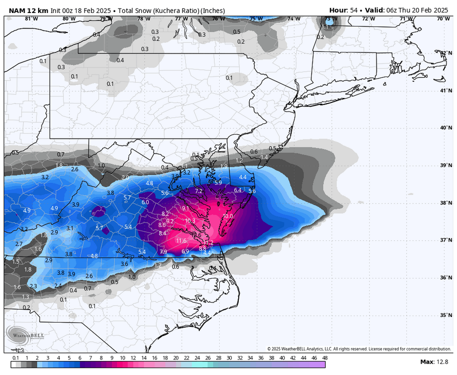
-
Richmond Metro/Hampton Roads Area Discussion
Ephesians2 replied to RIC Airport's topic in Mid Atlantic
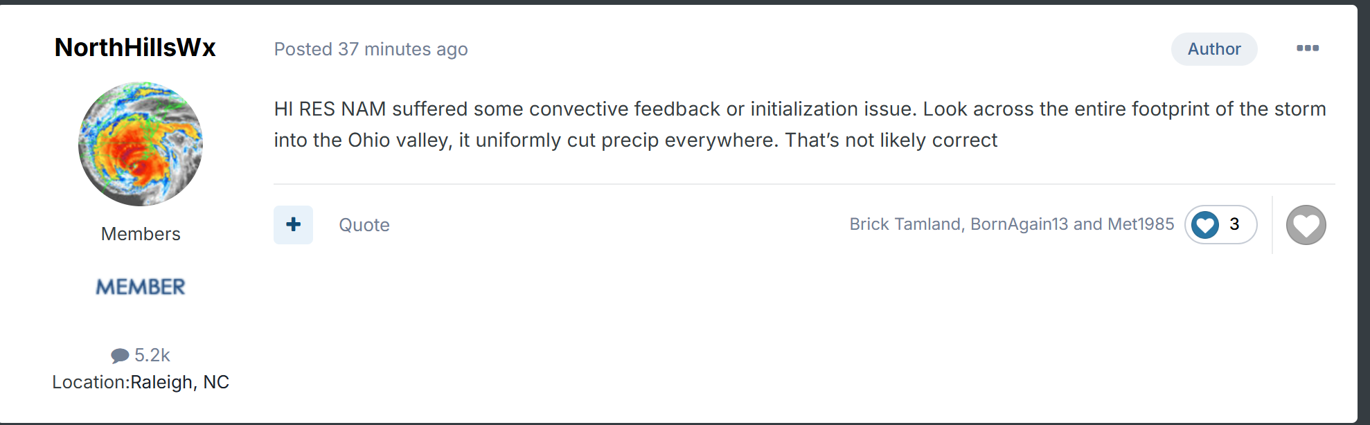
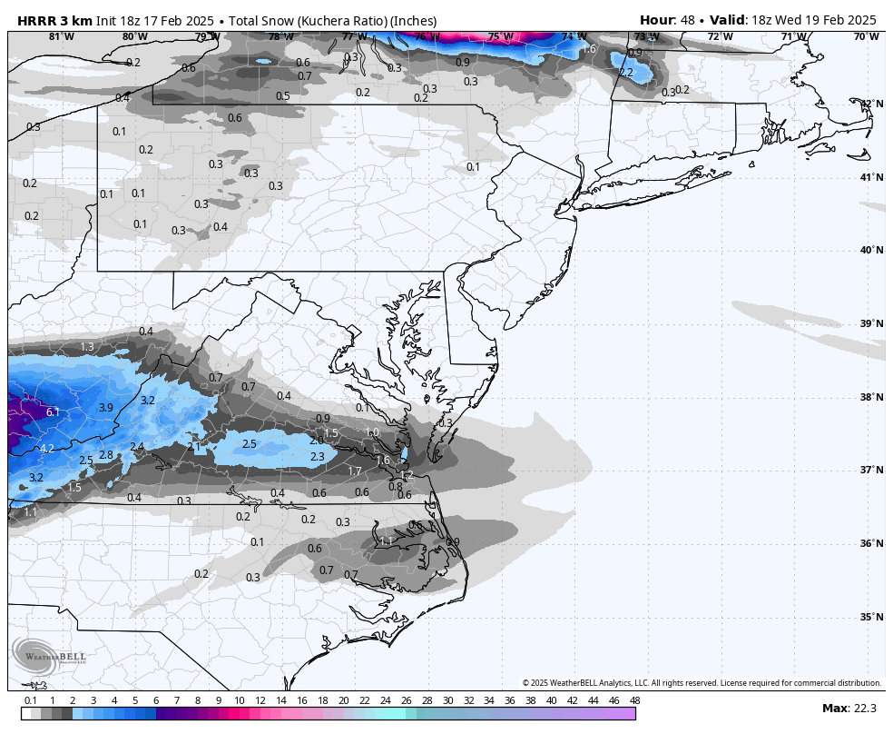
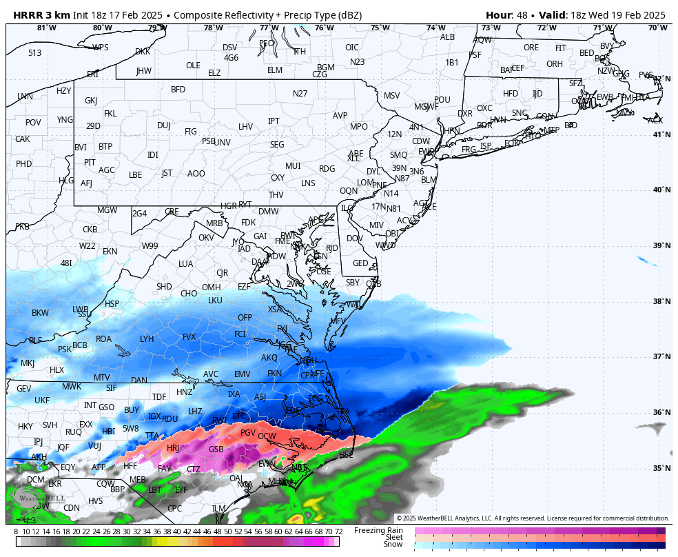
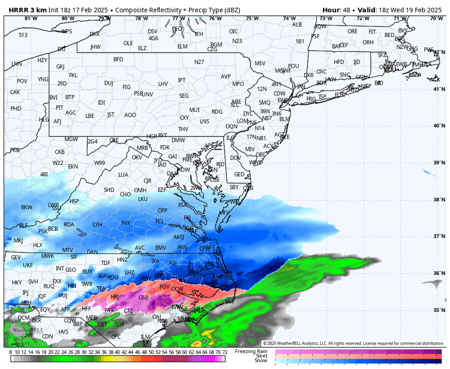
It's way out of range, but the HRRR seems dry and south.
-
Richmond Metro/Hampton Roads Area Discussion
Ephesians2 replied to RIC Airport's topic in Mid Atlantic
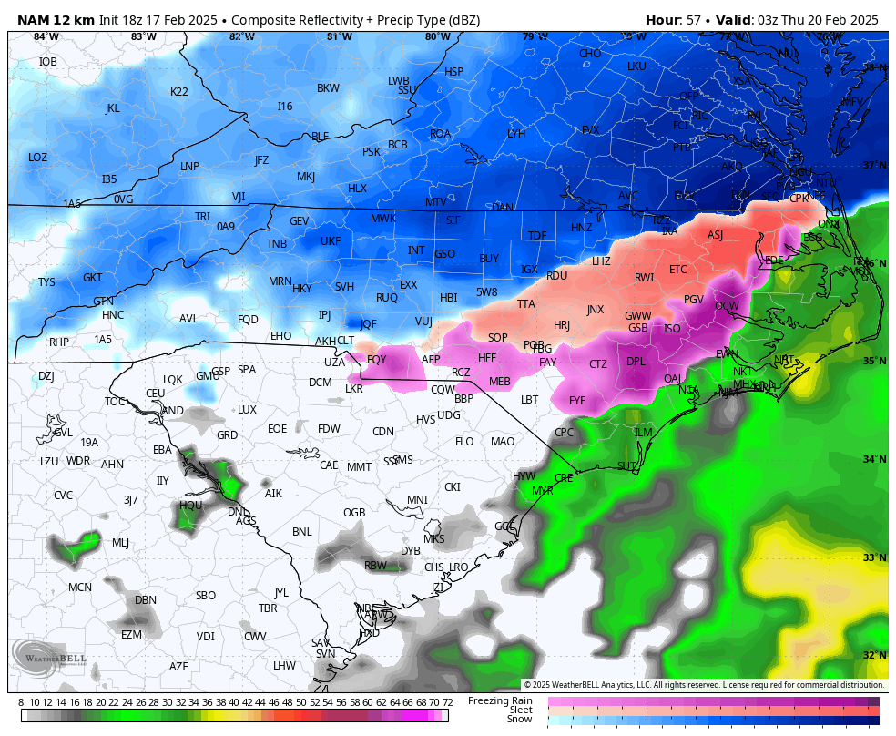
3k NAM is also very amped. -
Richmond Metro/Hampton Roads Area Discussion
Ephesians2 replied to RIC Airport's topic in Mid Atlantic
NAM holding the line.
-
Richmond Metro/Hampton Roads Area Discussion
Ephesians2 replied to RIC Airport's topic in Mid Atlantic

-
Richmond Metro/Hampton Roads Area Discussion
Ephesians2 replied to RIC Airport's topic in Mid Atlantic
The Canadian seems basically unchanged at 54 -
Richmond Metro/Hampton Roads Area Discussion
Ephesians2 replied to RIC Airport's topic in Mid Atlantic
ICON is wetter and slightly north. Not a huge change, but it looks like the bleeding has hopefully stopped -
Richmond Metro/Hampton Roads Area Discussion
Ephesians2 replied to RIC Airport's topic in Mid Atlantic
**Storm isn't over at this point -
Richmond Metro/Hampton Roads Area Discussion
Ephesians2 replied to RIC Airport's topic in Mid Atlantic
Well... the ICON is definitely a tick north and a healthier precip field at 54