MN Transplant
-
Posts
17,816 -
Joined
-
Last visited
Content Type
Profiles
Blogs
Forums
American Weather
Media Demo
Store
Gallery
Everything posted by MN Transplant
-
0.17”. Take that, Frederick.
-
Got saved by the final batch. 1.82” in May so far.
-
Disappointing so far.
-
That is a wild severe warning box
-
Frederick again. Amazing.
-
0.71” total. Helpful, but drought not busted.
-
0.00”. Hopefully that stuff by Richmond pops.
-
Large hail simply doesn’t happen much in this region at all
-
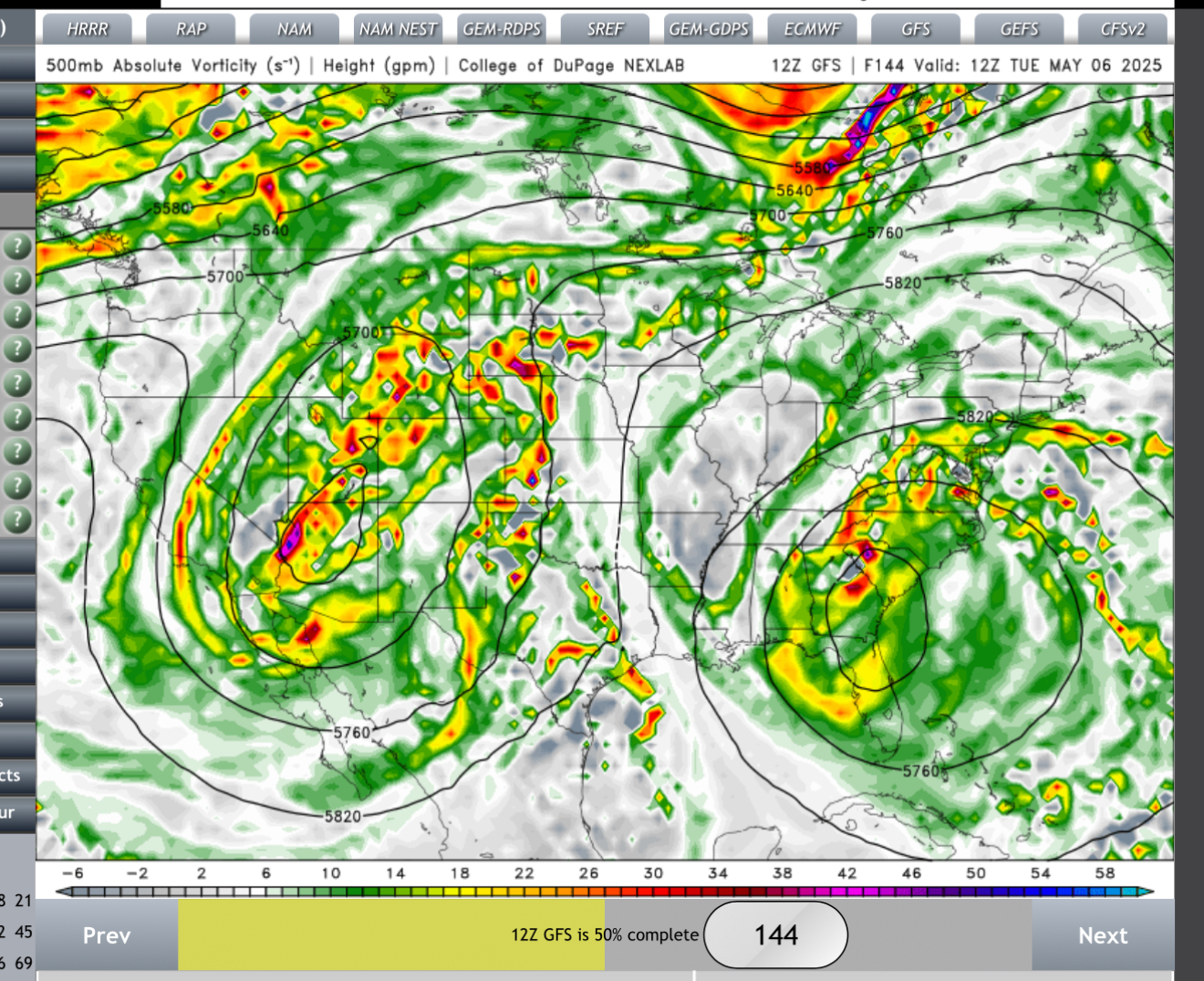
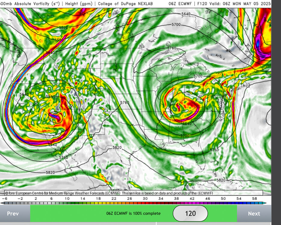
The 12z GFS is moving towards the Euro with the cutoff situation. It is wild to see two lows side by side like this.

-
I stretched and put down a trace
-
On that run we barely see the sun for 10 days.
-
Finished with 0.66”. If we could do that every 3-4 days through summer that would be great.
-
Getting some good showers. Nice to have the multiple rounds of rains to at least keep the surface wet.
-
I’ll complete the trio with 0.44”
-
Laz Diaz
-
At least the clouds are saving us from drying out even further.
-
Nice I68 storm
-
Feels nice today, though
-
The HRRR is extremely aggressive with winds in any convection that develops this afternoon.
-
Spectacular, except this is the first day I've noticed bugs.
-
They got rain the day prior from the broader trough but not the low itself.
-
Mostly unimpressive except for two locations and two individual events. The early-season SE Colorado event and then the absurd Gulf Cost event.
-
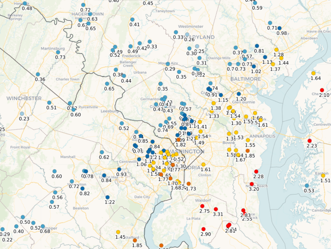
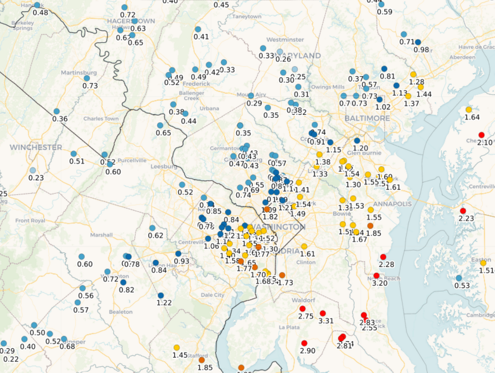
Quite the gradient (2 day totals)
-
Yeah, I’m dancing on the edge right now. 0.38”
-
12z HRRR looks great. Even throws 0.5” back to Winchester.