MN Transplant
-
Posts
17,625 -
Joined
-
Last visited
Content Type
Profiles
Blogs
Forums
American Weather
Media Demo
Store
Gallery
Everything posted by MN Transplant
-
Rank: Newbie Posts: 14.4k Those are some high standards.
-
I blame the new forum software. In no way could there be user error.
-
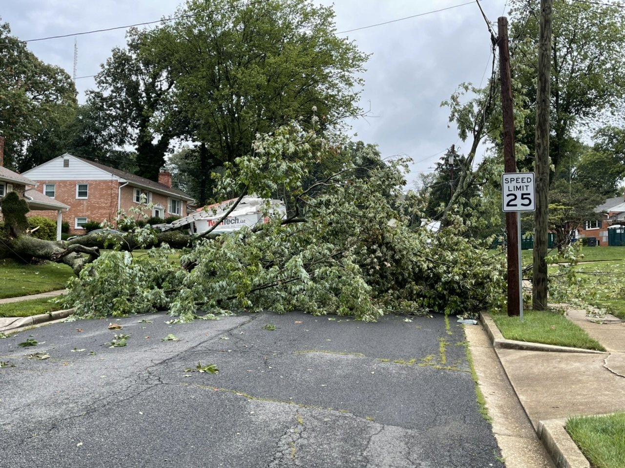
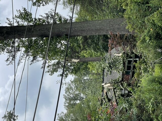
Very true. I don’t remember 06 having the wind, but the multiple rounds of thunderstorms was impressive. A couple more damage shots from my area.
-
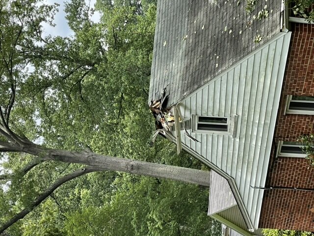
This one a couple of blocks over from me. Hit the front of the truck. Didn’t see anything particularly wrong with the tree, so this is just straight storm damage.

-
2008 and 2006 are the gold standard for multiple rounds.
-
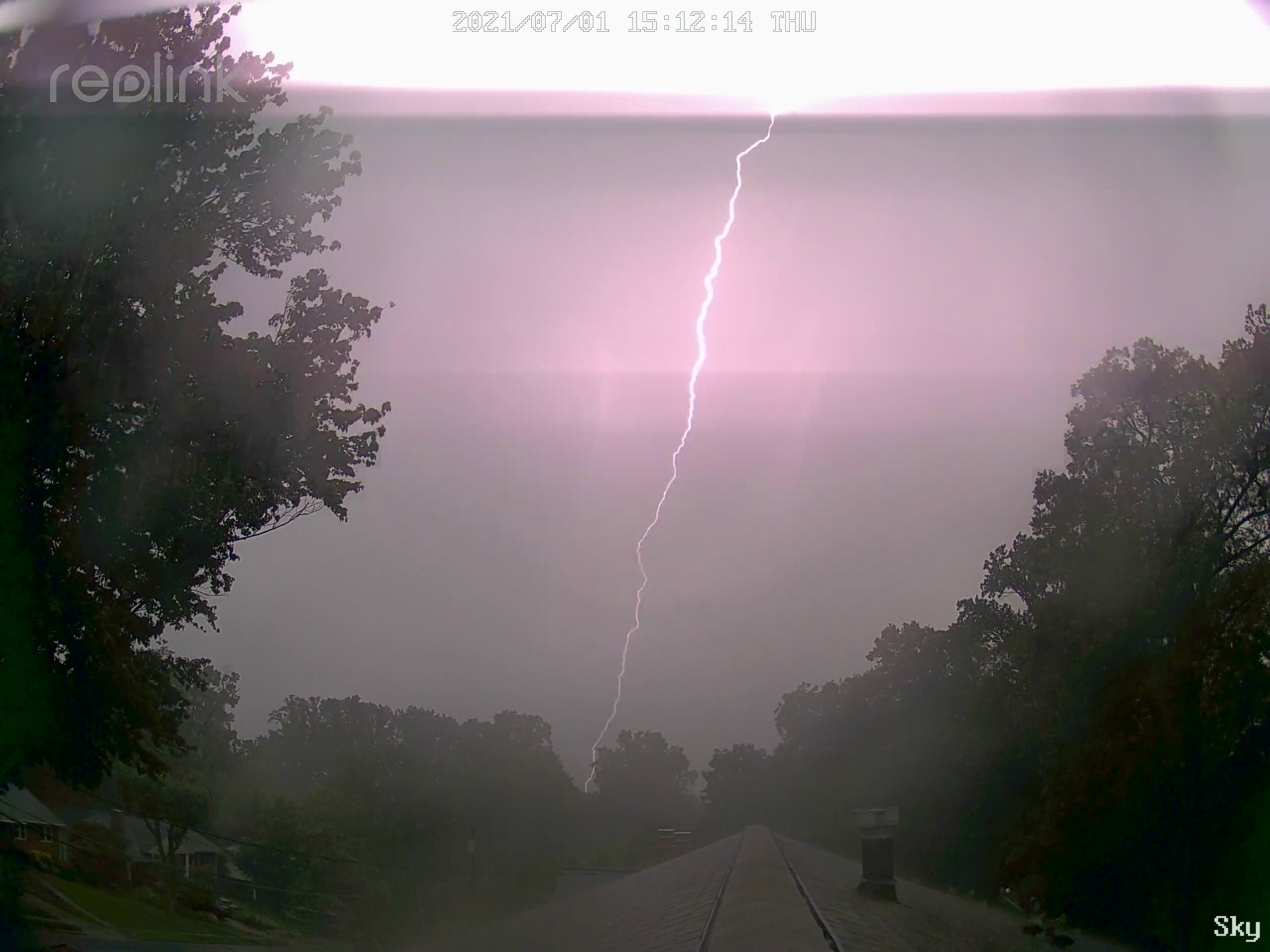
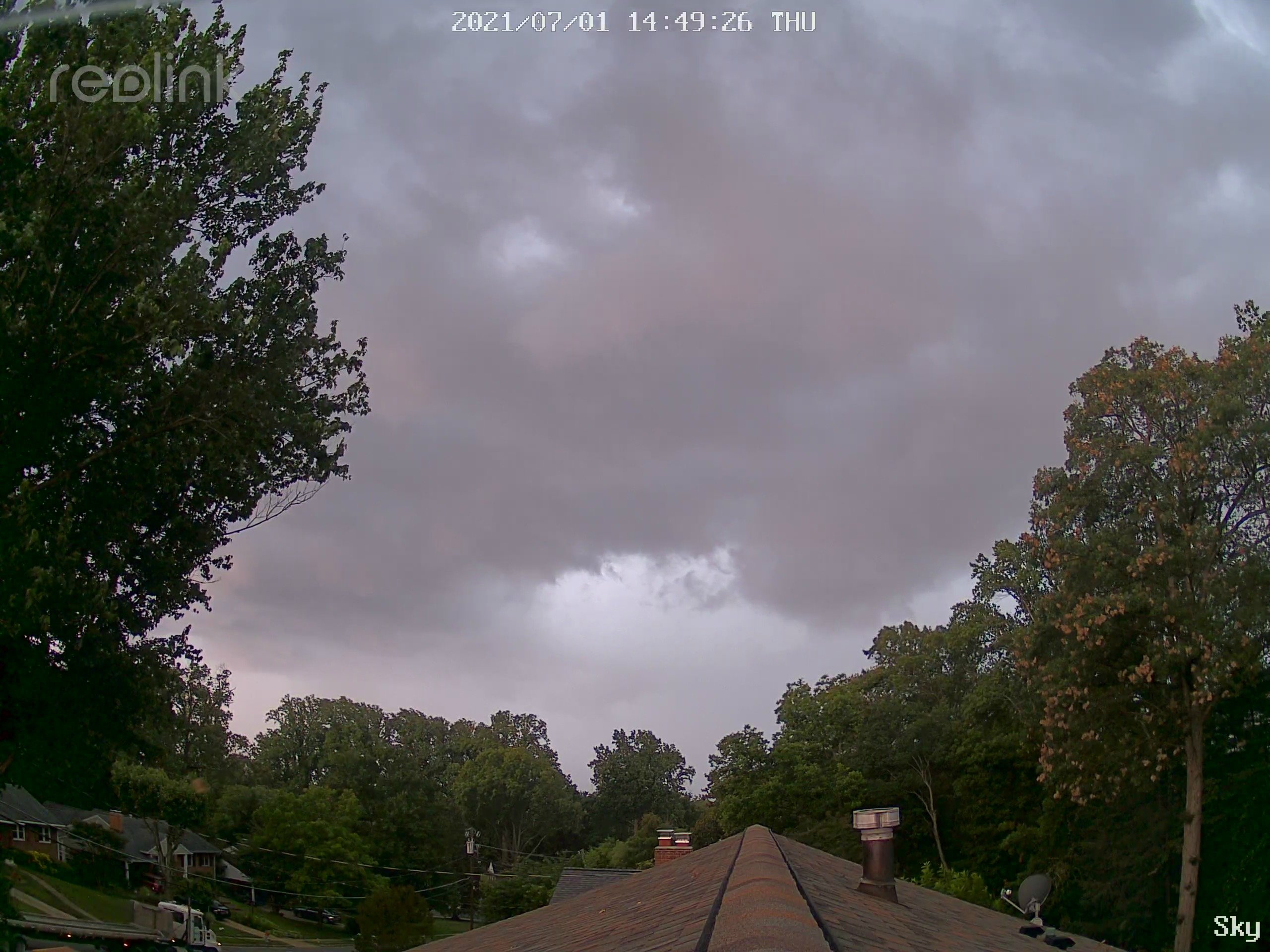
At least you have power. Starting to get sticky in here. 2.28” per the tipping bucket including a 13” rate which I can’t recall seeing before. Took a quick drive around, lots of branches down, but I didn’t see any whole trees. Streets are littered with: 1) leaves from cicada damage, and 2) actual litter because it is trash day tomorrow.
-
Clearly, this was after the power went out
-
Unequivocally the best storm in years. Watch out DC!
-
Can’t recall the last time I was in two severe warnings in the same day, but separated by a significant amount of time.
-
0.93”, which is about double the total of the last two weeks. Run something like that through every week and I’d be happy.
-
I absolutely did not get an entire home surveillance system just for weather. That’s my story.
- 856 replies
-
- 17
-

-

-
The T&L is definitely further back, like the trailing region of an MCS.
-
Stormy

-
2021 Atlantic Hurricane Season Tracking Thread
MN Transplant replied to WxWatcher007's topic in Mid Atlantic
The mythical Tampa track. -
I can still smell them by our big maple.
-
Historic Pacific Northwest Heatwave of 2021
MN Transplant replied to donsutherland1's topic in Climate Change
The Kamloops, BC temp from today (115) would have set the all-time Canadian record if Lytton (and others) hadn’t gone thermonuclear the past few days. And Ft. Smith in the Northwest Territories has apparently set that province’s all-time record at 103. -
Yeah, that’s an exaggerated version of what a couple of mine look like. Little leaf clumps are falling every time there is any wind.
-
18z NAM 3k is largely similar tomorrow. 18z HRRR extended has rain in the morning, mostly in MD, but it mutes the instability. Interestingly, both are a bit more aggressive for later today in at least sending some storms through.
-
Peaked at 97.5 here. DCA’s river wind is comical.
-
0.36” for the second half of June. Hope the next few days deliver.
-
Historic Pacific Northwest Heatwave of 2021
MN Transplant replied to donsutherland1's topic in Climate Change
6 hourlies Walla Walla, WA: 116 Ephrata, WA: 116 Omak, WA: 117 Richland, WA: 117 Hermiston, OR: 118 Pendelton, OR: 117 Lewiston, ID: 115 -
Historic Pacific Northwest Heatwave of 2021
MN Transplant replied to donsutherland1's topic in Climate Change
Hermiston to 118. -
Historic Pacific Northwest Heatwave of 2021
MN Transplant replied to donsutherland1's topic in Climate Change
This is an extension of the table that I referred to yesterday. The right column is the 5 minute ob possibilities. You can see that the way they do the rounding, some numbers aren't possible except for on the hourly obs. So, given this, here are some of today's leaders: Pendelton, OR: 116/117 Hermiston, OR: 117 on the ob Lewiston, ID: 114/115 Ephrata, WA: 116/117 (likely 116 given it was one ob) Walla Walla, WA: 116/117 Richland, WA: 116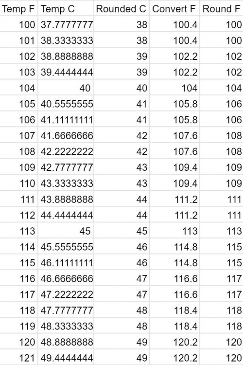
-
Historic Pacific Northwest Heatwave of 2021
MN Transplant replied to donsutherland1's topic in Climate Change
Winds are awful light in eastern WA/OR. Hard to get to state record territory without a good downslope component. 113/114 right now for the hot spots. -
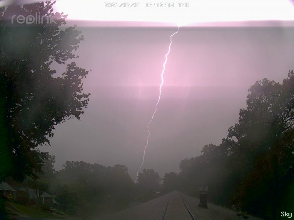
Little optical streak out there. Must be the right cloud alignment.