MN Transplant
-
Posts
17,845 -
Joined
-
Last visited
Content Type
Profiles
Blogs
Forums
American Weather
Media Demo
Store
Gallery
Everything posted by MN Transplant
-
Along with the lack of rain has been a lack of wind recently. True doldrums. The clumps of cicada leaves falling off the trees today gave me that thought.
-
Pretty much a region-wide thing over the last 3 weeks.
-
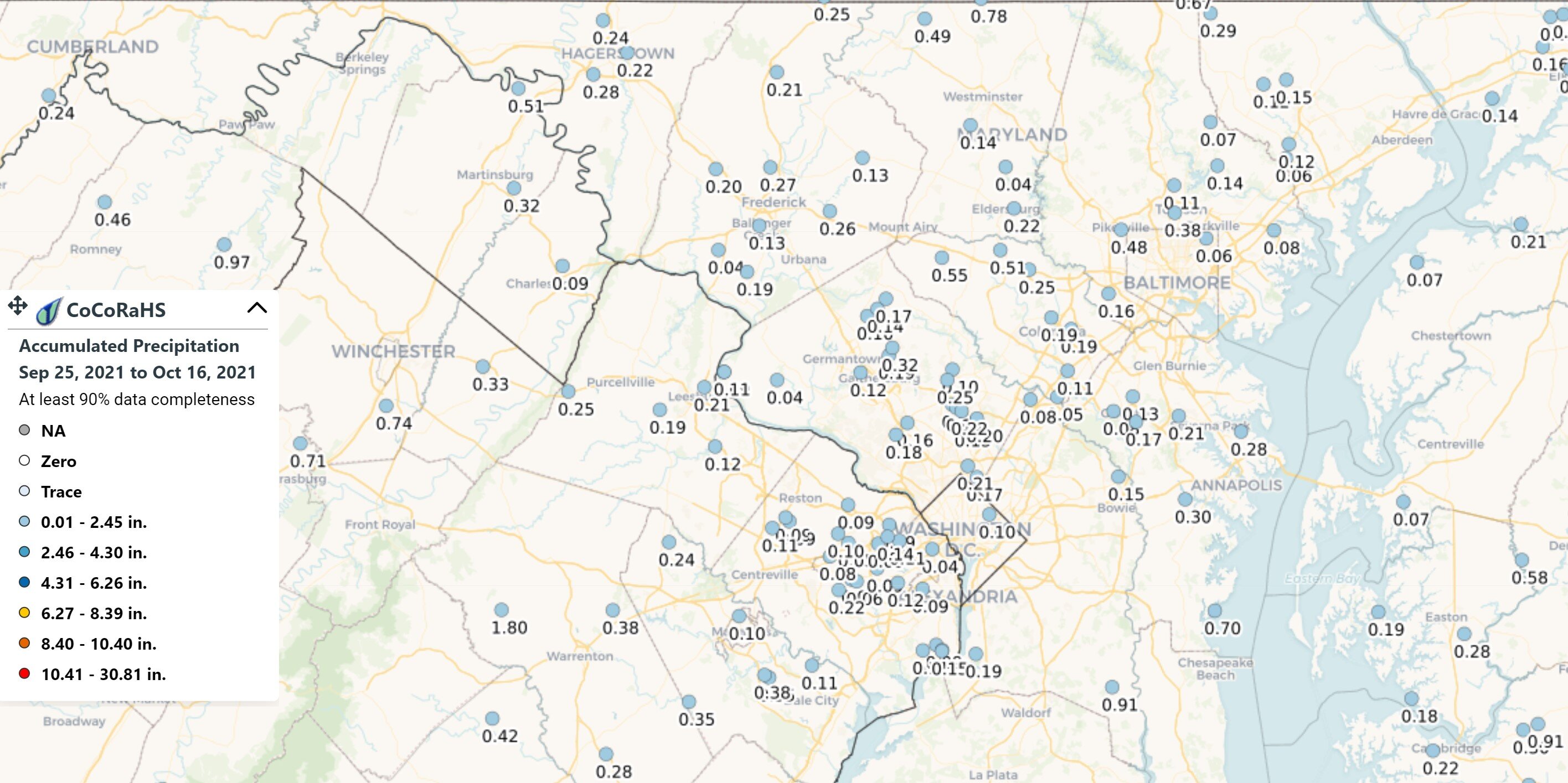
I’m actually hoping for a bit of rain today. Despite the overall humid murk, it has been really dry over the last 3+ weeks. I’m at 0.08” so far for October.
-
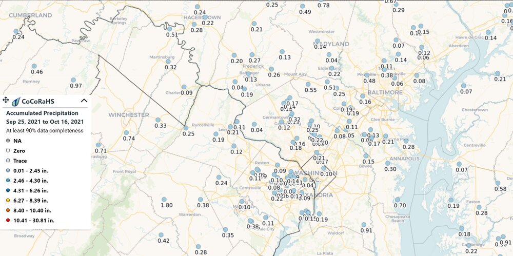
That map has adjacent zones with over a month differential. Not sure it is the best way to display it.
-
The month started ok, but pretty dreary over the last week. Even when there are spikes of more solar, they are short-lived.

-
Euro and GFS now pumping out near-record mid-80s Fri/Sat before the front gets here.
-
Everybody seems to be having a lot of fun. Nice weather for it. Glad the sun isn’t out.
-
First time at Cox Farms. Apparently with most of the rest of Northern VA.
-
DCA: 11/14 IAD: 10/27 BWI: 11/14 RIC: 11/14 Tiebreaker: 0.89”
-
2021 Atlantic Hurricane Season Tracking Thread
MN Transplant replied to WxWatcher007's topic in Mid Atlantic
Sam is now the #1 ACE system in the 2021 Atlantic season -
I figured that the ridge out west would hold and we wouldn't go super-high this year, but the final numbers are shockingly low, especially RIC.
-
It feels right for the GOAT kicker to have the record.
-
The big problem with the GFS forecast now is that we barely see the sun for a week starting 5-6 days out.
-
The last winter that fell in that temperature range at DCA was 13-14.
-
Actually had to close the windows up again since it popped to 74 and it is still kind of humid out with everything so wet. Looks like there is a second surge of drier air coming this evening.
-
2.25”. looks like the big spots were E and W of Frederick this time.
-
Big severe warning box south of DC. Guess it makes sense with how quickly these are moving.
-
The UHI problem is well-known and accounted for in larger-scale analyses. This summer wasn't super hot, but it shouldn't have been based on where the ridge set up in the west. It is actually kind of sad that we didn't end up below normal. I think the late season humidity also skewed perception of the summer.
-
Brief downpours in these tiny cells.
-
It is fun to crap on Kirk, but he led game-winning type drives in both games this season, only to see his star RB “fumble” (air quotes because the booth f-d up the review) and his kicker miss.
-
Those dew points.
-
2021 Atlantic Hurricane Season Tracking Thread
MN Transplant replied to WxWatcher007's topic in Mid Atlantic
Got it. "Peak season" was throwing me off. -
2021 Atlantic Hurricane Season Tracking Thread
MN Transplant replied to WxWatcher007's topic in Mid Atlantic
Ok, there are too many pages. What are these numbers? Is that a full-year forecast, or a forecast-to-date? What does the () refer to? -
Euro has the frontal passage on Thursday. GFS Wednesday. Go USA!