MN Transplant
-
Posts
17,859 -
Joined
-
Last visited
Content Type
Profiles
Blogs
Forums
American Weather
Media Demo
Store
Gallery
Everything posted by MN Transplant
-
2021 Atlantic Hurricane Season Tracking Thread
MN Transplant replied to WxWatcher007's topic in Mid Atlantic
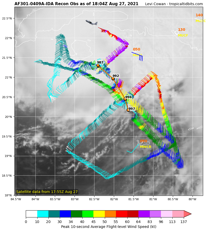
From 997mb to 987mb during the AF flight. Definite bend to the NW.
-
HRRR continues to favor north of the Potomac today. NAM is more widespread. Storms are starting to bubble.
-
2021 Atlantic Hurricane Season Tracking Thread
MN Transplant replied to WxWatcher007's topic in Mid Atlantic
992mb. Down 5mb while in recon. -
2021 Atlantic Hurricane Season Tracking Thread
MN Transplant replied to WxWatcher007's topic in Mid Atlantic
Western Cuba offers little resistance for most storms that have themselves together. It is so narrow and most storms (like Ida) move roughly perpendicular to the island. -
2021 Atlantic Hurricane Season Tracking Thread
MN Transplant replied to WxWatcher007's topic in Mid Atlantic
Next center fix from recon is going to be interesting. -
2021 Atlantic Hurricane Season Tracking Thread
MN Transplant replied to WxWatcher007's topic in Mid Atlantic
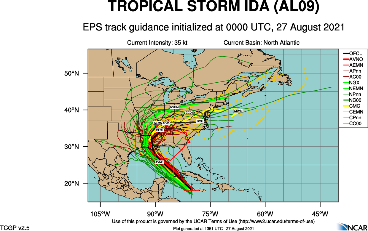
For EJ, the ensemble guidance from last night has the GFS with weaker steering, keeping it away. CMC and Navy are more interesting. That said, we don’t usually do that well with a looping track like this from the gulf. For impacts here we generally want a FL panhandle hit (Ivan).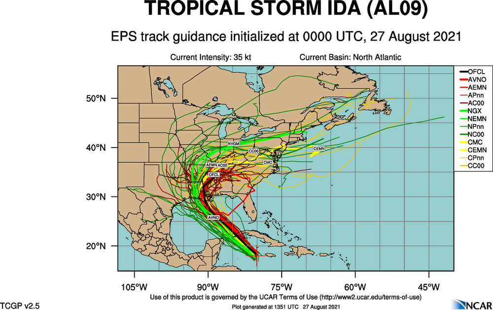
-
Looks like 5 more days of truly disgusting weather, then we get a break. After that we are into September and while it’ll get gross again, it’ll probably be in shorter spurts.
-
That’s wild. I never had more than one on me.
-
Amazing to see a storm almost completely within the borders of Arlington.
-
91 over humid. Sufficiently disgusting again.
-
Good that the Dulles area is getting in on some rain. Don’t really care if it makes it here or not.
-
Maybe even 5. River wind isn’t hurting much anymore.
-
Have avoided the really big heat, but creeping up there on the 90 list
-
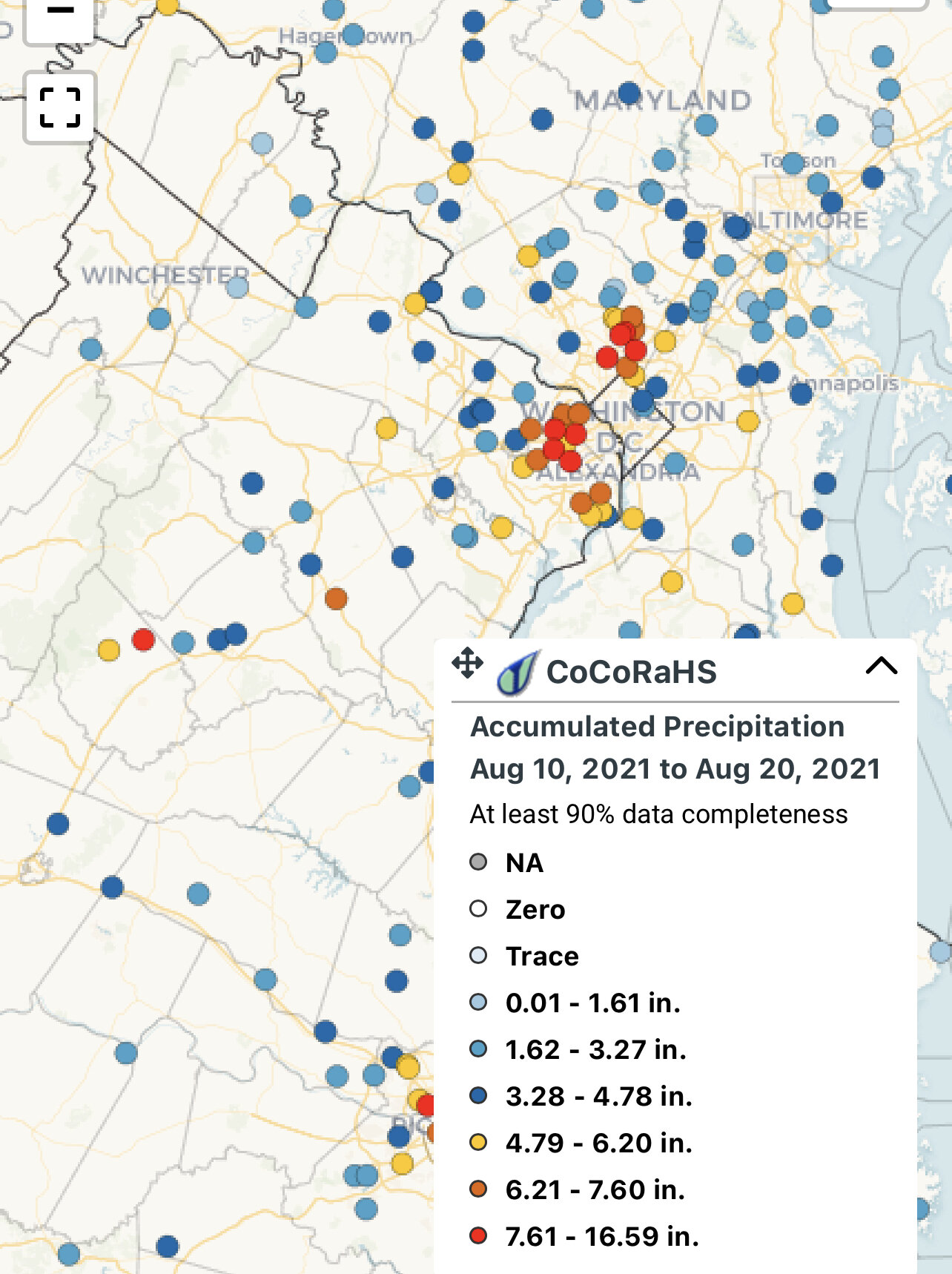
CoCoRaHS. If you go to View Data and then the total precip summary link, you can get the data. Have to be careful about who is submitting every day and who only occasionally does it.
-
The low spots are along I81, exactly where you’d expect them to be. Except the Dulles area which is a relative min. The high spots are in the SE part of VA, again, expected.
-
DCA at 34” on the year, IAD at 23”. I’m at 35”. Annandale pushing 40” in Fairfax Co.
-
Two weeks later and the music of my neighborhood is still the gentle hum of chainsaws.
-
I lived in the central valley in California for several years when I was a kid. We had one moderate (6-ish) earthquake when I was 5 or 6 years old. The water sloshing out of our pool is one of my earliest vivid memories. I probably conveyed it earlier in this thread, but my memory of the 2011 quake is that I was on the 6th floor of an office building and the ceiling tiles started rattling with the initial waves. Then the S wave hit and the floor moved up and down, which was the very clear indicator of an earthquake and I got out real quick.
-
Summer 2010 had the record number of 90 degree days, 2011 had the insane humidity/heat, and 2012 had a bunch of 100+ days. It really was an amazing period.
-
-
@EastCoast NPZknew where he was moving.
-
Can’t do 3 months on CoCoRaHS, but the last 10 days paint the picture.

-
Over 3” now. Everything is just soaked.
-
>9” in the past 10 days. It can pause now.
-
Nope, that’s me. 2” and pouring.