MN Transplant
-
Posts
17,858 -
Joined
-
Last visited
Content Type
Profiles
Blogs
Forums
American Weather
Media Demo
Store
Gallery
Everything posted by MN Transplant
-
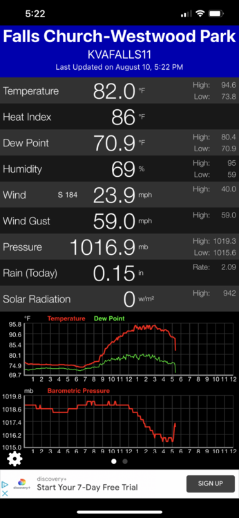
DCA 94 so far today. IAD 98 BWI 96 95.7 at home
-
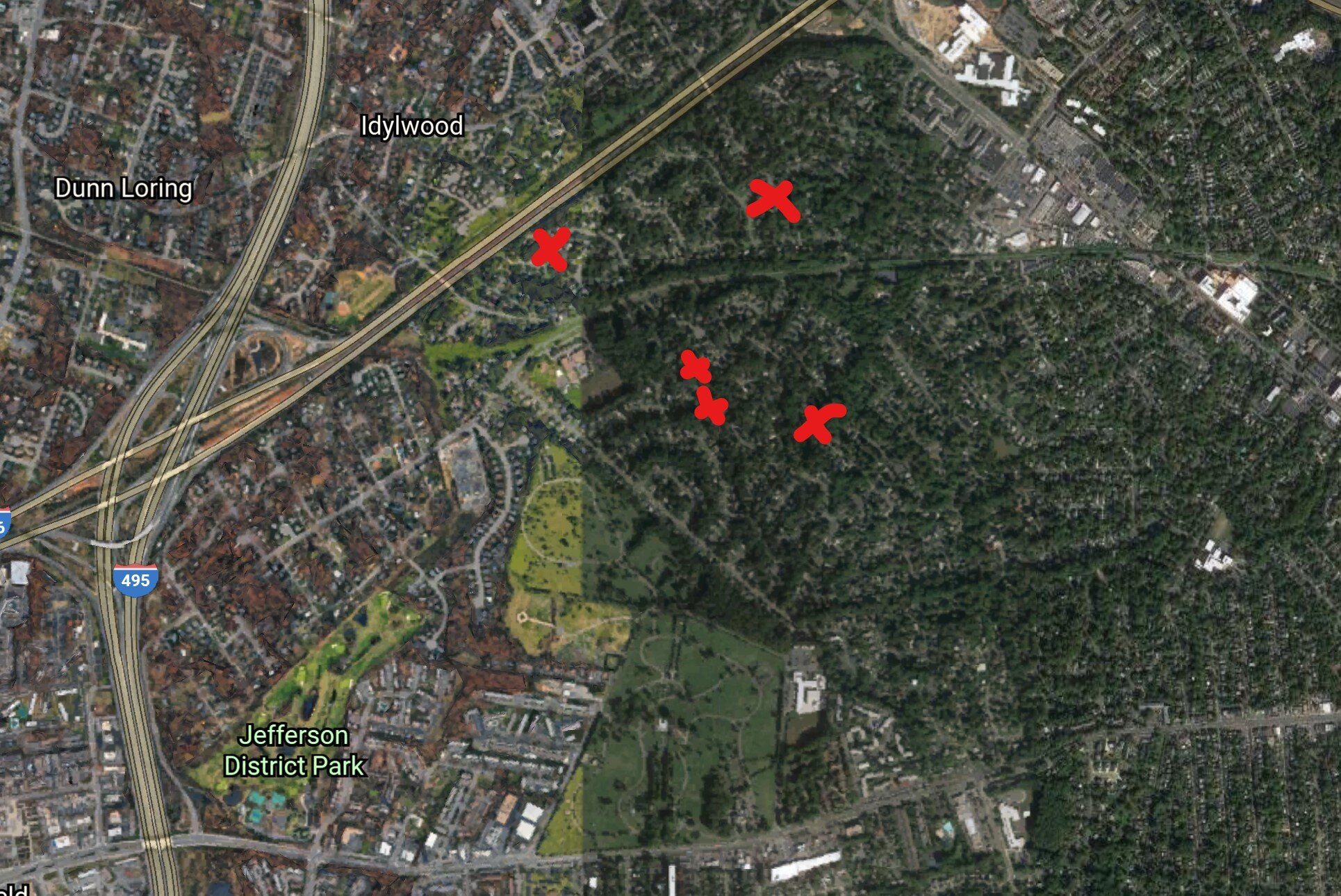
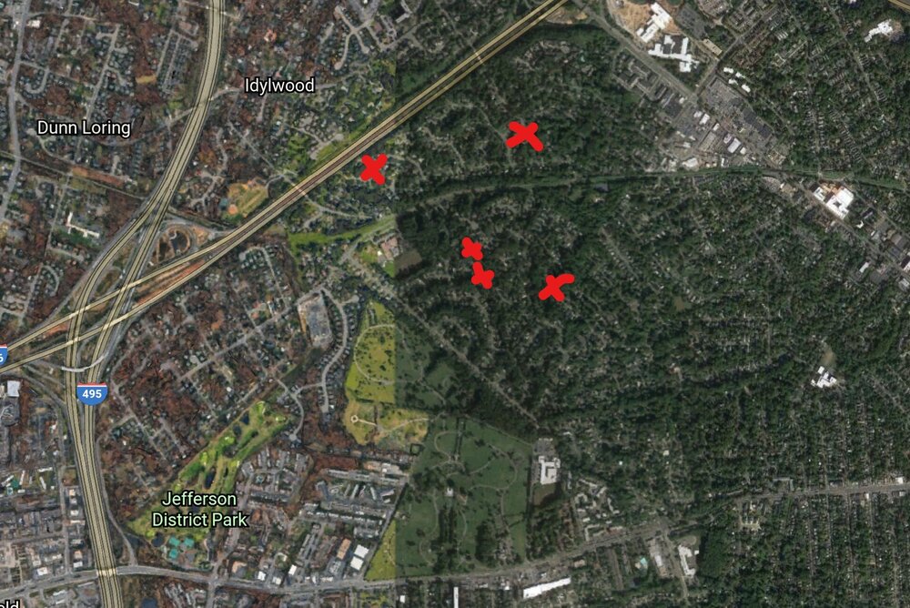
Here's the general location of the significant tree vs house hits that I'm aware of. I put an X on Salem (the NW one), but I didn't go over there to check. The Falls Hill one that we've been talking about was on Barbour.
-
IAD sets a record with 99. Records tomorrow are attainable (99 DCA/BWI, 98 IAD).
-
2021 Mid-Atlantic Severe Weather - General Discussion
MN Transplant replied to Kmlwx's topic in Mid Atlantic
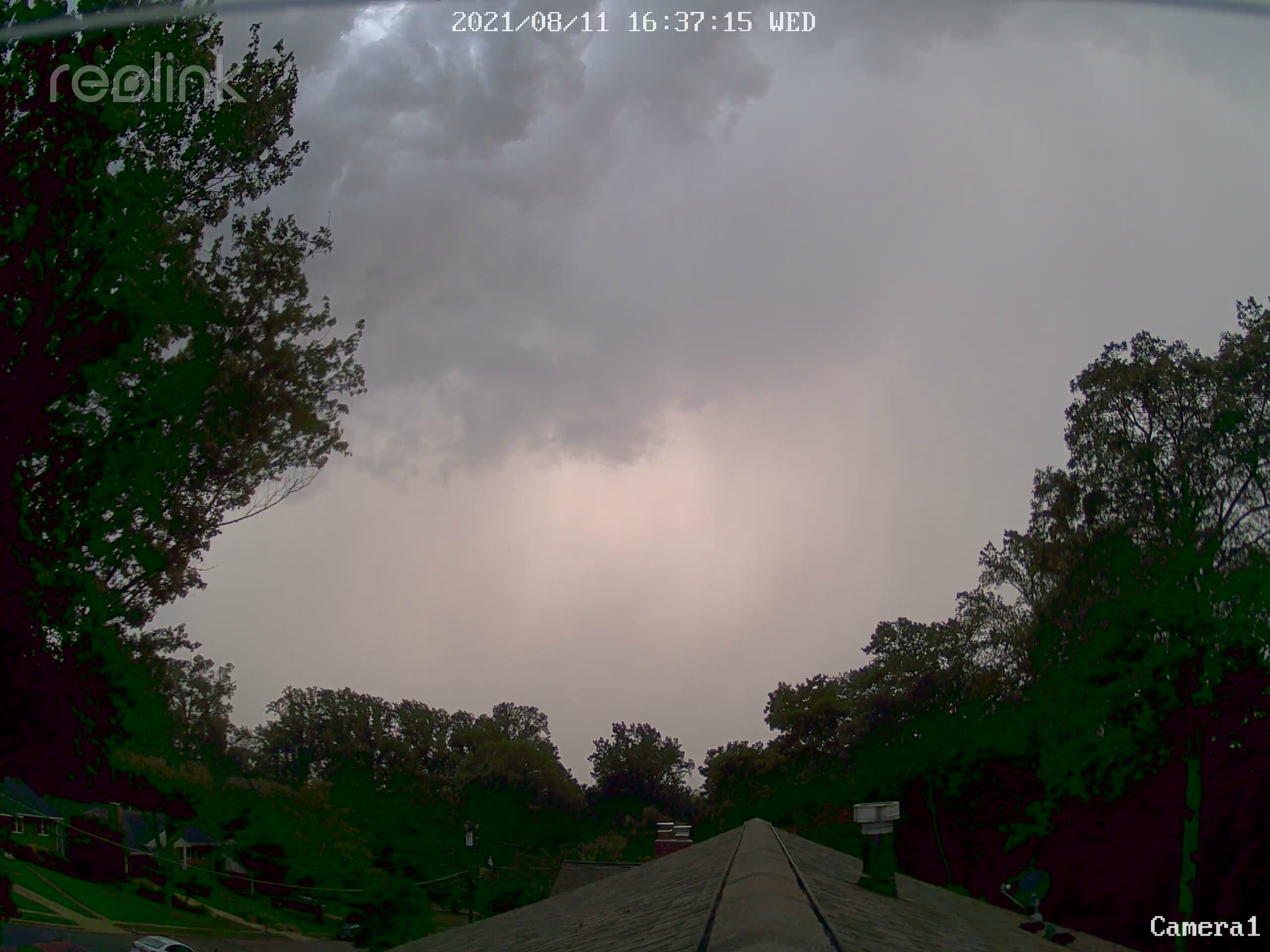
Projectiles! Thankfully this one was just rain here. -
2021 Mid-Atlantic Severe Weather - General Discussion
MN Transplant replied to Kmlwx's topic in Mid Atlantic
Incoming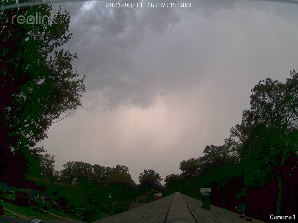
-
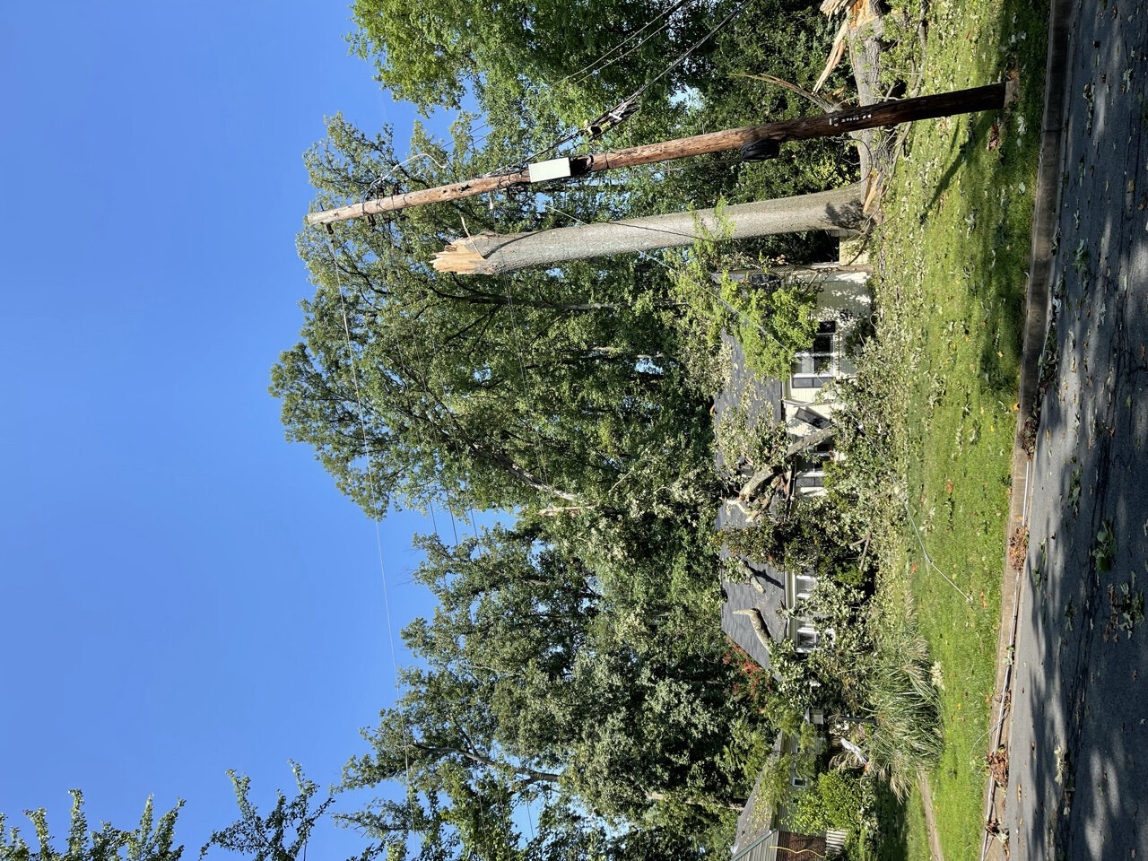
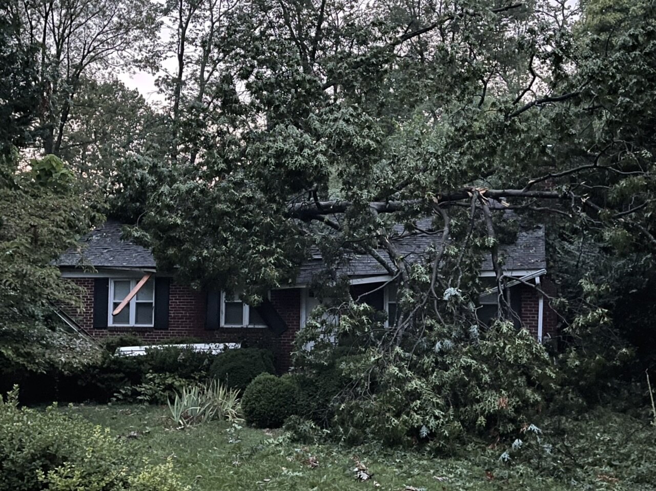
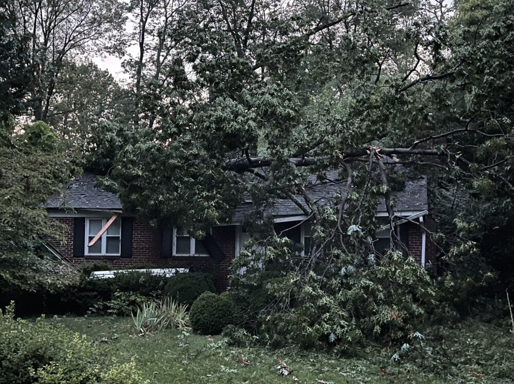
Sadly those are different houses. The one through the window is particularly scary. Temperatures are interesting today. It has been really dry in west central VA, and sure enough it is 97 at CHO and Culpeper. 95 BWI, 94 IAD, and 91 in the new icebox at DCA.
-
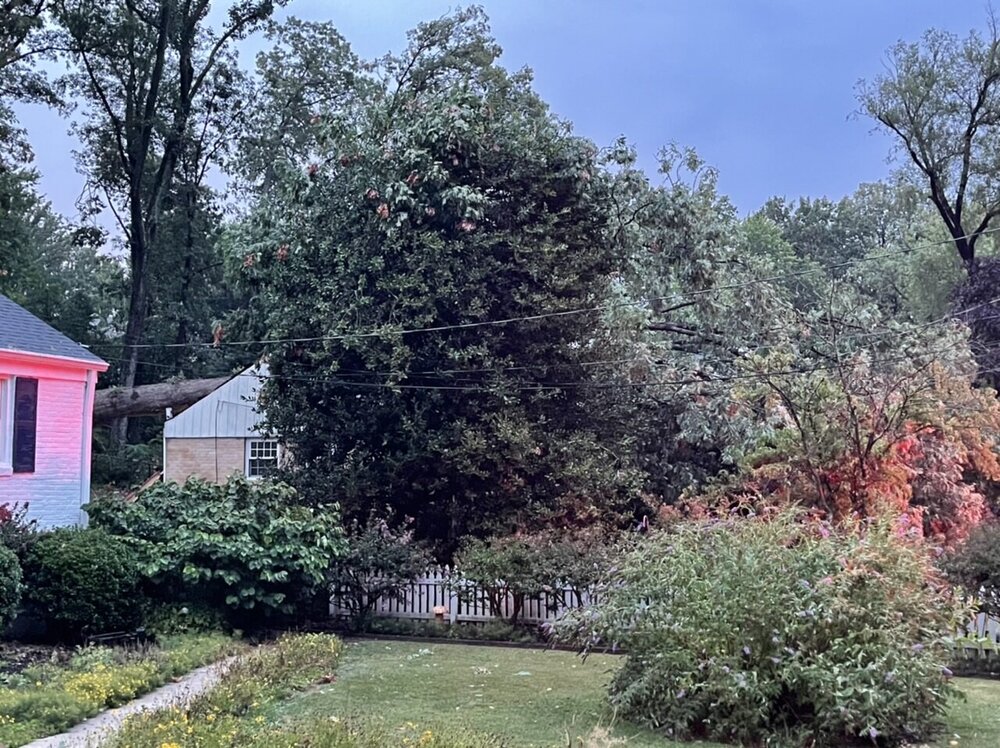
I’m just across Shreve from Falls Hill. Here is another one two blocks away.

-
Two things that really strike me other than the obvious. Leaf parts pasted to cars/garage doors/etc. And even low things in my garden are blown over. The good part is that this was localized enough that cleanup is already going quick. Power was only out for 4 hours here and the tree companies are blanketing the neighborhood. I do feel for my neighbors about 5 houses away who had their AC unit smashed. The upcoming 105-110 HI is going to be rough. They may just bail out of town, though.
-
The guy wasn’t home at the time, thankfully.
-
I think I’ve seen enough to say that this was the biggest storm to hit my immediate neighborhood in decades (better than the derecho). Two houses with direct hits, one down the street from me and one a block over. Branches down and leaf parts sticking to everything. I bet we went 70+.
-
2021 Mid-Atlantic Severe Weather - General Discussion
MN Transplant replied to Kmlwx's topic in Mid Atlantic
It is always hard to compare, but I think this was the best storm in my yard in the 12 years I’ve lived here (caveat - I missed the derecho). Big branches down next door and across the street. Highest wind gust on my anemometer (probably was higher in the March wind event, but no power). This one combined with the July 1st tornadic storm is a solid one-two punch this year. -
Rocked. Big branch down across the street and my in-process playhouse has a lean to it.
-
New weather station record gust!
-
It’s decent
-
HRRR seems to be slowly beefing up the coverage this afternoon. It is favoring MD at the moment.
-
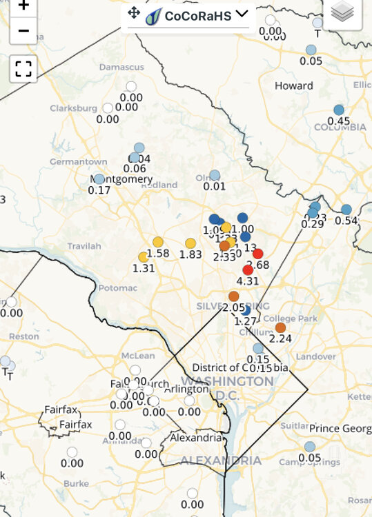
Hopefully a little more widespread today. That 0.01” in Olney. Ouch.
-
https://www.washingtonpost.com/dc-md-va/2021/07/30/oak-mites-bite-cicadas-dc/ If you don’t get the Post, you can Google and there are tons of stories out there now.
-
I hate summer.
-
The oak mites that are feeding on the cicada eggs are kicking my ass. Worse than mosquito bites.
-
The carve-out for NPZ's yard.
-
I got 0.05”. But still, lol.
-
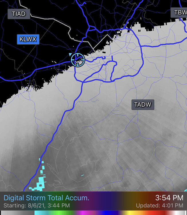
So, at the moment we have a dousing from the Euro and temps in the low 70s, the NAM and GFS have a glancing blow with minimal rain, but clouds that keep it to 80 or less, and the HRRR is a whiff and we are upper 80s.
-
The GFS can just be terrible at times.
-
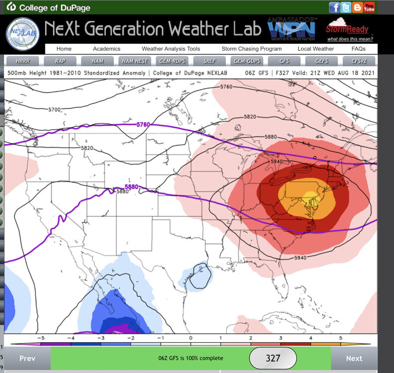
GFS/Euro both throwing triple digits out there for next week. Even if that is overdone, it looks hot.
-
I’m not sure who @mattie g sold his soul to in order to get every storm over the last few weeks, but I need a contact number.