Kmlwx
-
Posts
13,681 -
Joined
-
Last visited
Content Type
Profiles
Blogs
Forums
American Weather
Media Demo
Store
Gallery
Everything posted by Kmlwx
-
Yeah all that junk to the north and west is killer. It's a huge blob of sub-severe rain
-
Kind of impressive that the SE OH cells are showing a bit on the LWX radar (in GR2AE3)
-
This sort of thing has happened before. But also somebody noted a little further up that Convective Temps are like 95 today. So without the better forcing from the front we might not have much going on until later. Also @yoda - I'd think so - but quite of bit of seemingly stratiform junk in front of that stuff as well. A messy radar picture as a whole other than the organized stuff down south.
- 2,562 replies
-
- 1
-

-
- severe
- thunderstorms
- (and 7 more)
-
A little shower popping near Brunswick now.
-
It's beyond the echo tops product range for LWX too! Impressive that it's showing so strongly. Must have a heck of an updraft...
-
Hopefully the VA storms don't rob energy - I think they have enough separation. That severe cell back in WV may be awfully far away to be our threat...will have to see if anything can trigger along the ridges and such.
- 2,562 replies
-
- 1
-

-
- severe
- thunderstorms
- (and 7 more)
-
That's one thing that during our heat stretches this year...the dewpoints haven't been mixing down as low as they have in prior heatwaves. That makes a ton of difference for sensible weather...sure we hit 100 sometimes but often the dews would drop back into the 60s. Being up near the century mark and having dews stay well into the 70s is nasty. Radar looks meh for the DC region for now - but that activity down deep in VA looks decent. Will have to see if anything more substantial pops up closer in. Some of the CAMs yesterday had a sort of gap in the activity between SEPA and Central VA/Southern Maryland leaving some of us high and dry (relatively speaking).
-
MCDs seem to be surrounding us lol Also 86/78 here. Thought my dewpoint was suspect but @MN Transplant gives me some confidence in it.
-
Would think a mesoscale discussion would be coming in the next 1-2 hours. But only guessing.
- 2,562 replies
-
- 1
-
-
- severe
- thunderstorms
- (and 7 more)
-
Uptick in lightning near Jerryville, WV
-
It's Yoda accidentally refreshing this page instead of the SPC site.
- 2,562 replies
-
- 6
-

-

-
- severe
- thunderstorms
- (and 7 more)
-

Intermittent (but frequent) Bad Gateway 502 Errors
Kmlwx replied to Kmlwx's topic in Forum Information & Help
@dendrite - @Wow - just bumping here as it seems like the same symptom(s) are back today. Lots of intermittent CloudFlare issues. Getting hit be foreign IPs again? -
The board is having issues again it looks like
- 2,562 replies
-
- 1
-
-
- severe
- thunderstorms
- (and 7 more)
-
14z HRRR continues to be fairly bullish. I'm relatively "in" so far.
- 2,562 replies
-
- 3
-
-
-
- severe
- thunderstorms
- (and 7 more)
-
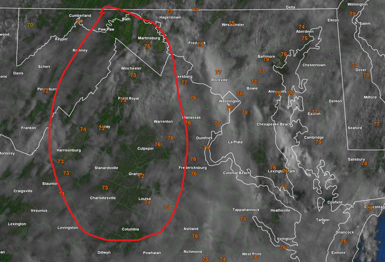
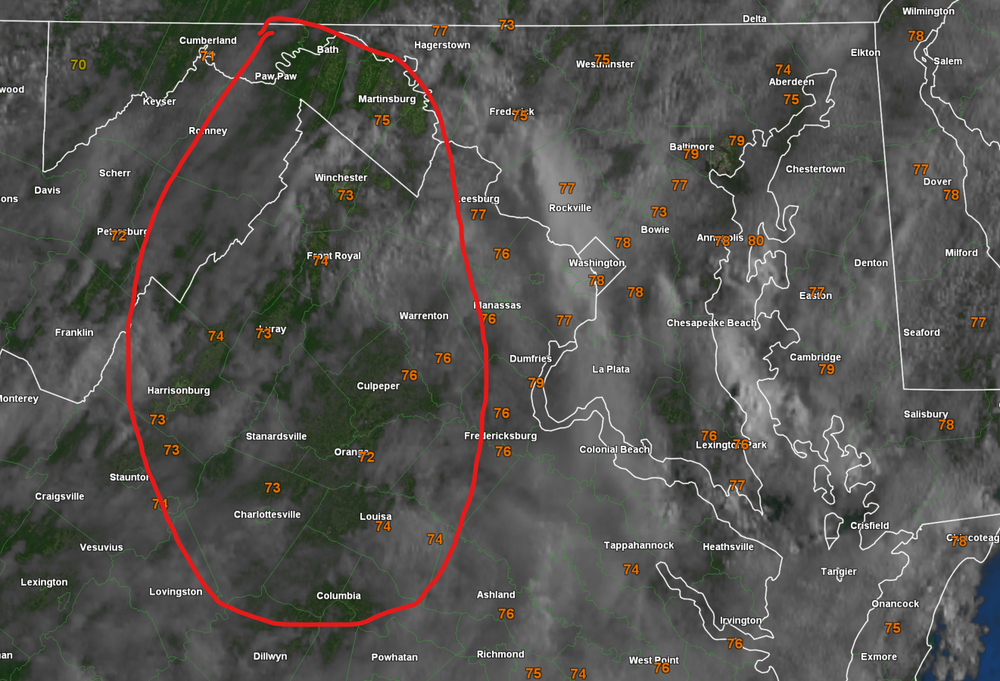
Red circled area looks decent...
- 2,562 replies
-
- 4
-
-
-
- severe
- thunderstorms
- (and 7 more)
-
Severe wx is fickle....impossible for any of us to say. 5 miles makes a huge difference on days like today for sensible weather. If nothing else - 80 miles isn't terrible in the grand scope of things...and I guess there are worse places to be than Columbia
- 2,562 replies
-
- 2
-
-
- severe
- thunderstorms
- (and 7 more)
-
I've always been vocal in my opinion that I love our summer severe crew. With a few notable exceptions over the years we all just seem to mostly get along and not stir up the drama like the larger crowds in winter. Sure....every now and then we get the ethics debate about "rooting for" severe weather. But all in all, we are just fellow weather weenies trudging through the hot, humid, disgusting days of spring through early fall until we can start tracking first frost/freeze. This is banter, and I am being a little overly nostalgic - but I mean this wholeheartedly when I say it: Some of my most fond weather memories have been centered around Eastern/AmWx over the years. Sure...the actual weather events themselves are the "core" - but I've experienced them alongside all of you. I've had the pleasure of meeting some great characters from here in person at the conferences as well. Whether we bust today (or in general) or not...gotta say ya'll are awesome.
- 2,562 replies
-
- 7
-
-

-
- severe
- thunderstorms
- (and 7 more)
-
-
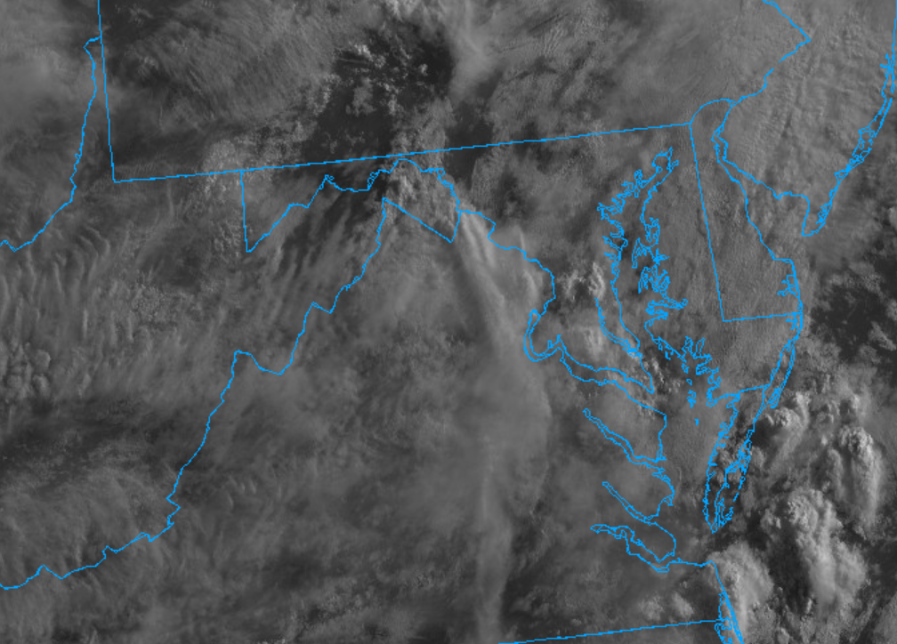
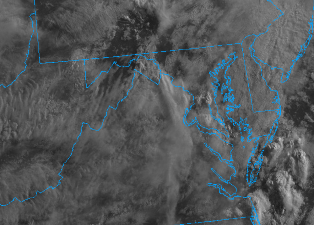
Our severe crew isn't always up super early (except @yoda who seems to never sleep lol). We don't do the wall-to-wall posting as well as the larger winter crowd. I'd expect by 9-10am you'll get some more of the folks posting in here. Pretty cloud in Colesville, MD right now. Haven't looked at visible sat yet though
- 2,562 replies
-
- 1
-
-
- severe
- thunderstorms
- (and 7 more)
-
Then again...clouds are one of our most common failure modes. I do think someone will get walloped tomorrow. But I might have been inclined to keep it at 30% with no CIG hatching. The CSU MLP guidance has not painted any 45% contour at all on today's runs. That said, the 30% on that guidance *is* centered over the DC region.
-
Afternoon LWX discussion mentions "significant severe weather episode" and "scattered significant wind damage reports"
- 2,562 replies
-
- 4
-
-
- severe
- thunderstorms
- (and 7 more)
-
Double post but deal with it We all need to just consider the outlook meanings as a whole. a severe report within 25 miles of a point can be VERY high confidence especially in highly populated areas where there are now an abundance of spotters and average joes sending reports in.
-
Well I also think exactly what we all thought would happen with the new outlooks this year, has happened. It truly is that with forecasting advances, 45%+ is just not going to be super uncommon anymore. Everything has probably shifted upwards a tier. So 60% may be the new 45%. I think we will continue to see a higher incidence of 45% wind days. It does *not* mean that there will be more outbreak days. We have to sort of re-train our brains at least on the wind side of the outlooks. We used to get super amped for a 45% wind day....that will be like a 30% in the past. Sure - it's better than 15% but it's not like a derecho is coming through. If 2012 evolved in this new outlook scheme - as SPC upgraded that night with the line approaching - we probably would have gotten a 90% prob...
- 2,562 replies
-
- 1
-
-
- severe
- thunderstorms
- (and 7 more)
-
Nothing new....we probably will really have no idea how it will play out locally until 10am tomorrow or later
-
CIPS is not super-honking (the threat is there - it's just more muted). If nothing else - I am hoping for an event where I am working from home for a change (or at least in the area...) That said - a confirmed TOR passed near me up in PA Saturday evening (the Houtzdale/Whiteside, PA one confirmed by CTP). Was a few miles away.
- 2,562 replies
-
- 2
-
-
- severe
- thunderstorms
- (and 7 more)