tiger_deF
-
Posts
615 -
Joined
-
Last visited
Content Type
Profiles
Blogs
Forums
American Weather
Media Demo
Store
Gallery
Everything posted by tiger_deF
-
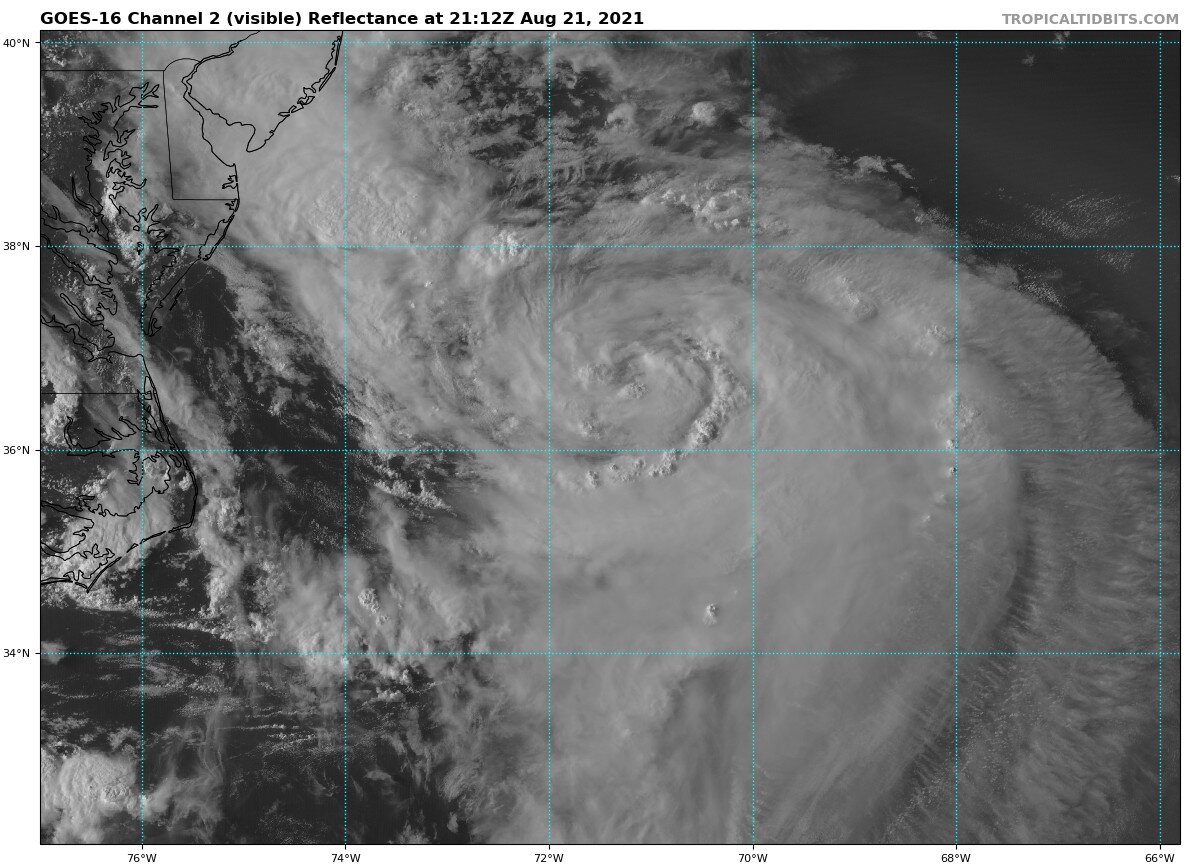
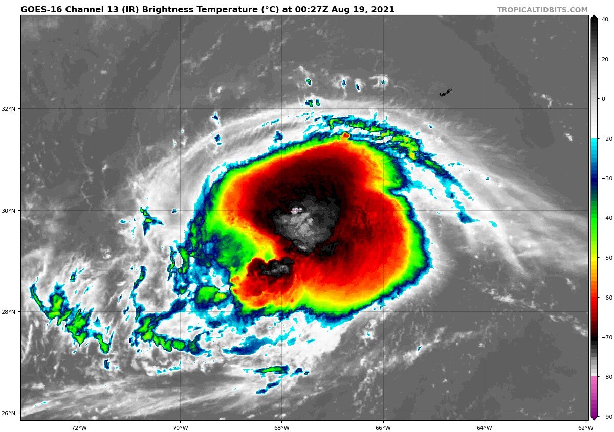
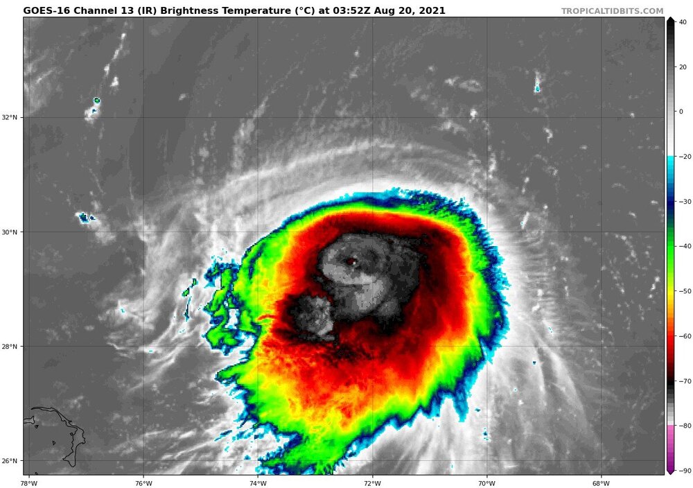
Appearances can be deceiving, but Henri looks the best he has ever looked
-
-
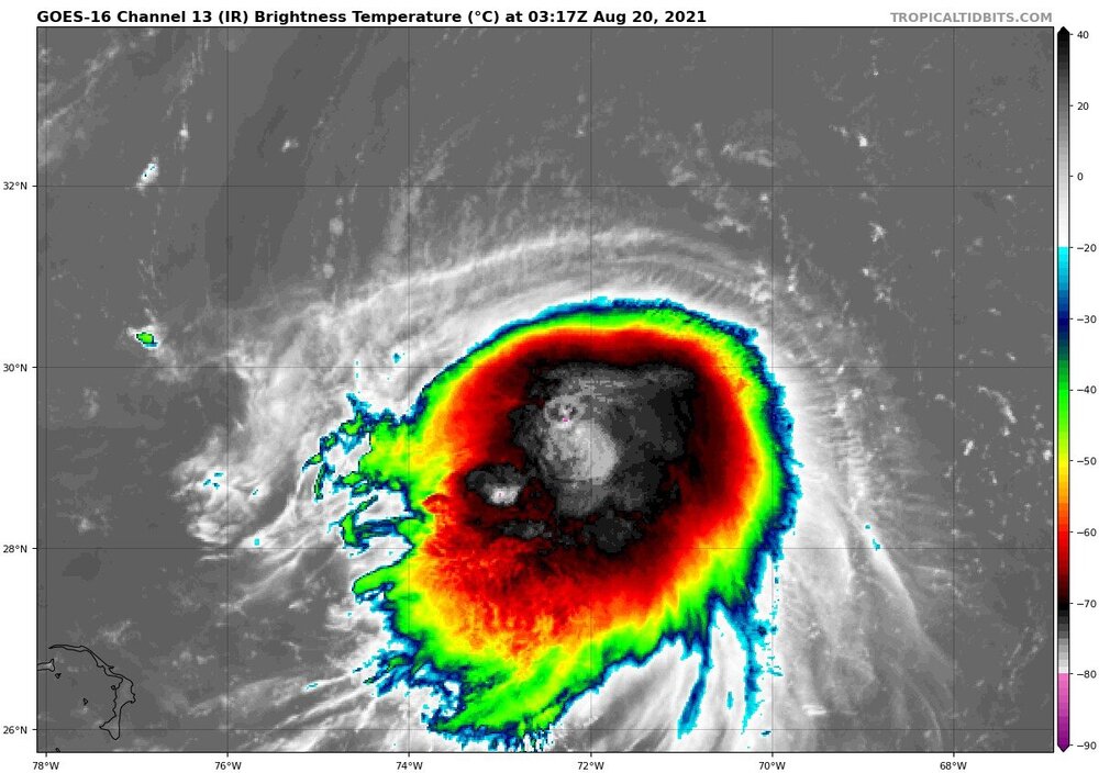
Sure looks like Henri is strengthening right now. I would imagine this will continue for the ~3 degrees latitude Henri has left of serviceably hot waters
-
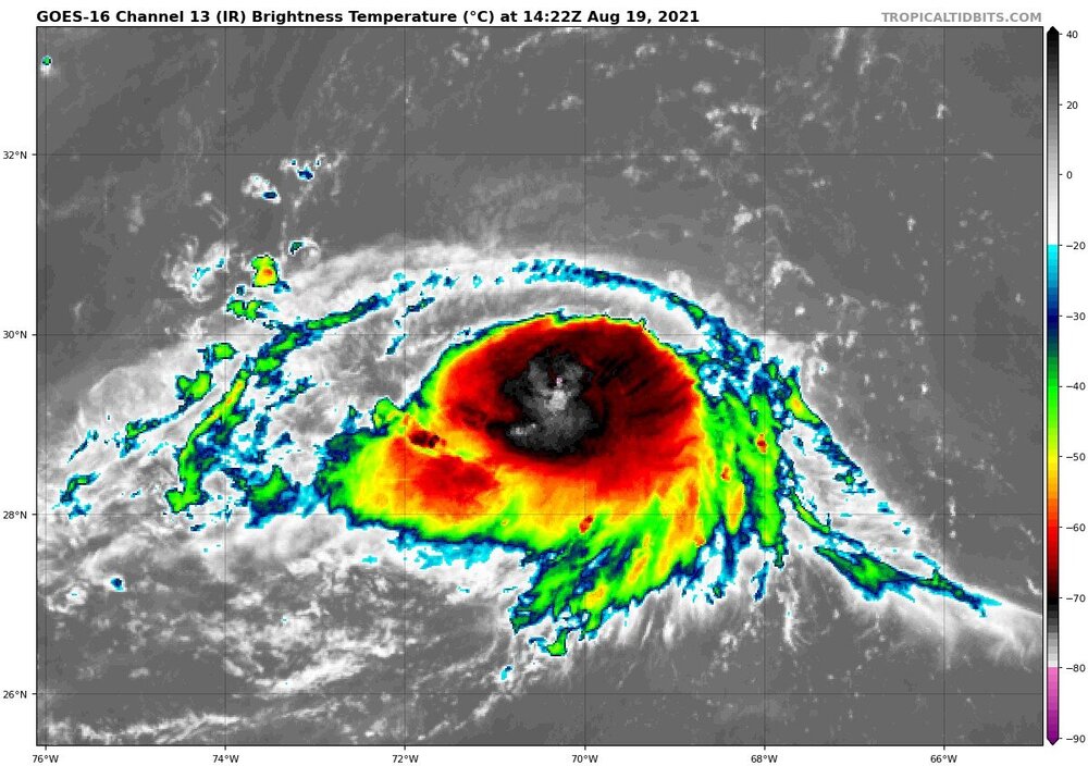
Reports of Henri's death have been greatly exaggerated
-
Now that everyone on this forum has been poo pooing this storm for days, I am fully expecting it to bust upwards.
-
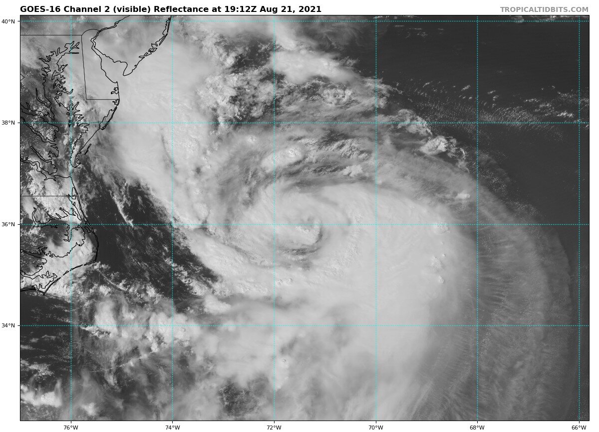
Henri is quickly building outflow to the west, though it is still restricted to the North. Impressive convection nonetheless though, I would bet that Henri is near, if not at, hurricane status.
-
Henri's quite the blobular lad tonight
-
I like to hold the 3k NAM as the theoretical maximum of a current system. Plenty of systems have verified with the NAM before, but usually when they are in ideal conditions, or for whatever reason seem to "pull it off" given the current environment and overperform.
-
We are talking about half a foot plus of precipitation, so there is some similarity!
-
Practically stalls right over SE MA
-
~20 mb weaker 24 hours out, and ultimately a few mb stronger at landfall. Much farther West as well
-
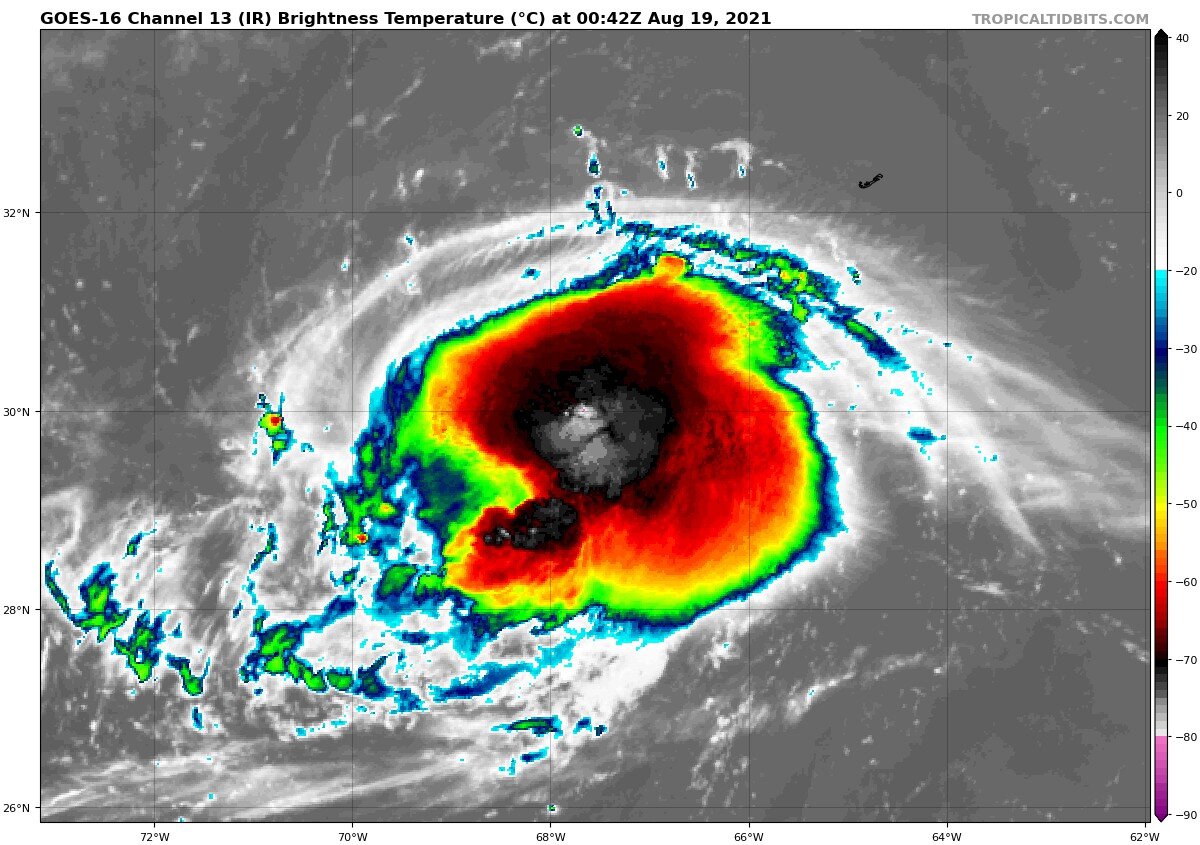
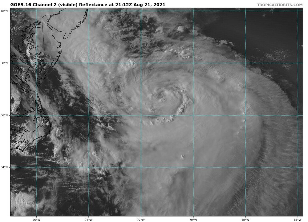
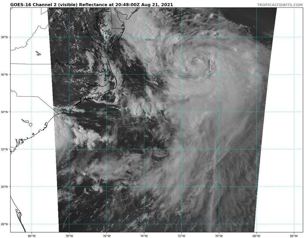
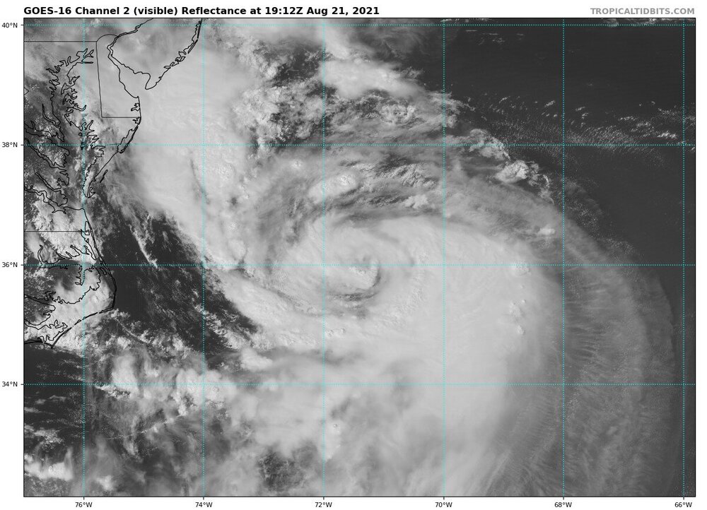
Live feed from GOES-16 streamed into the home of every weenie or bust
-
So instead of coming closer to agreement ~3 days out, the EPS and GFES basically switch places. Wonderful!
-
I still remember the days of "King Euro" How the mighty have fallen...
-
Pretty epic bust potential in either direction for this. I could buy a weak, sheared TS crossing hundreds of miles offshore, a cat 2 landfall in SE NE, or anything in between.
-
I'm interested in seeing if Henri has a symmetrical, concentrated wind profile, or one that is shallow with multiple wind maxima.
-
For NY/LI/Mid-Atlantic? Yeah Sandy will almost certainly be worse. I think the localized impacts may end up being worse for the Cape and some of SE new England.
-
Considering Henri is directly under 32kt of Northerly unfavorable shear, he isn't looking too bad this AM
-
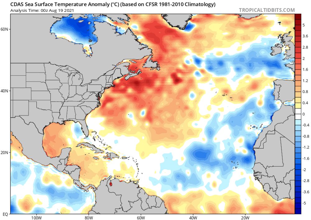
It's worth pointing out that the SST's off the coast are running 2-3+ degrees Celsius above normal, which could potentially be lifting the relative latitude where a cyclone is able to maintain tropical characteristics.
-
Looking forwards to what recon finds today. IMO Henri was a hurricane all of yesterday, slightly weakened to a tropical storm overnight, and is now maintaining intensity in face of shear
-
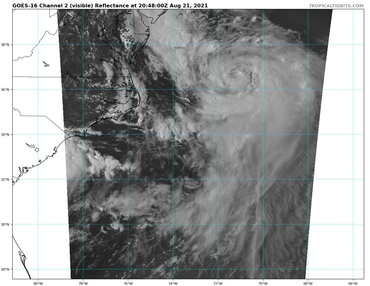
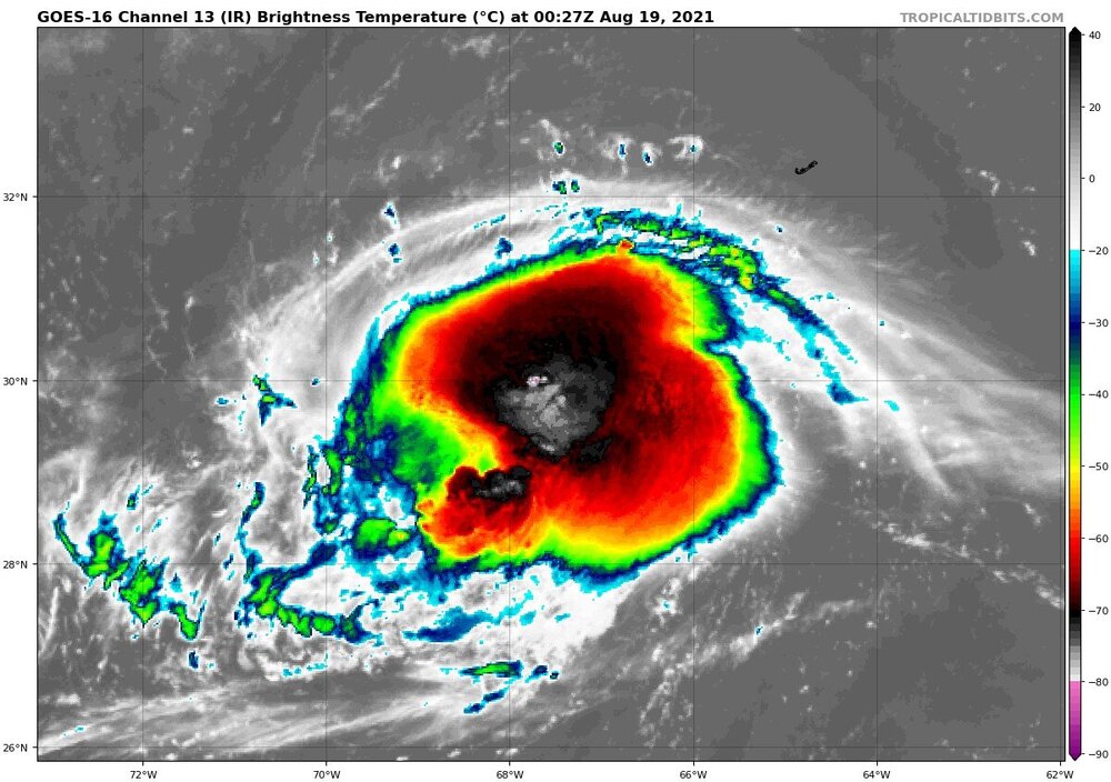
Looks to be trying to form a primative eyewall. Still not quite there, but whether it can hold off from shear and complete itself over the next 36 hours is crucial to it's eventual track.

-
Henri looks to be trying to close off an eye. Still not quite there, but certainly indicative of a low end hurricane.
-
The short-term strength of Henri will be crucial to the eventual track; will he continue to steadily intensify, or briefly weaken due to shear?
-
I wouldn't be suprised if Henri is closing in on 995 mb right now
-
I doubt we will have a clear idea of what Henri is going to do until we start getting regular recon data fed into the models, which should be the case by Friday