

tiger_deF
-
Posts
615 -
Joined
-
Last visited
Content Type
Profiles
Blogs
Forums
American Weather
Media Demo
Store
Gallery
Everything posted by tiger_deF
-
This is shaping to either be a complete bust for the models, of a complete bust for many snowfall maps
-
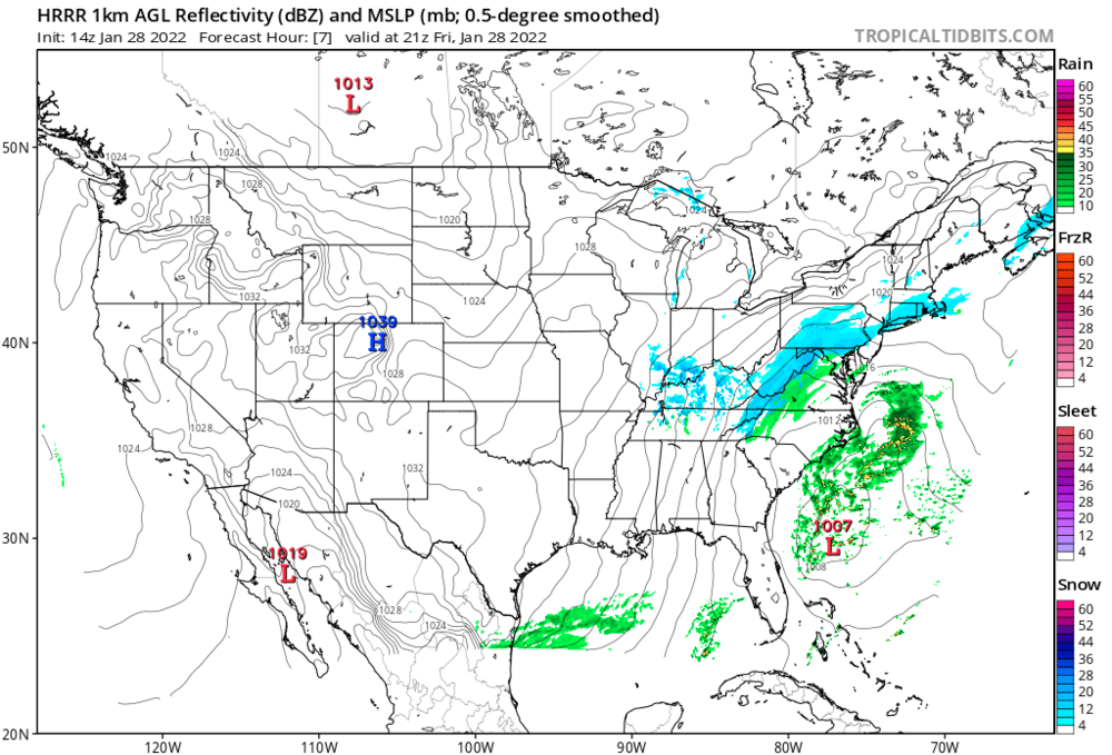
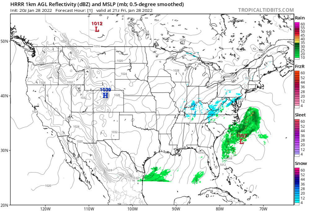
HRRR for +1 at 14z vs HRRR for +1 now at 20z
-
OBS/DISCO - The Historic James Blizzard of 2022
tiger_deF replied to TalcottWx's topic in New England
How's our low pressure system down South looking? -
GfS looks deeper, and doesn't really trend much through 18h
-
We should really have a nowcast thread so we can observe the development of the low and any possible signs of two lows developing
-
West shift on the medium range HRRR
-
If this starts trending East on the next GFS run we know why
-
I'm curious to see if the strength of the low will be trimmed up as we head closer to go time, or if it will maintain the low 970's-960's that most of the models strengthen it to. How many sub-970 Nor'easters have we had up here?
-
Do the actual computational models themselves work in 6 hour increments, or is that just how the data is presented? Sorry if this is a stupid question
-
These hours after the GFS and before the ECMWF are truly the dark times
-
From someone still relatively new to meteorology, what about this is so impressive?
-
There was far more consensus on Monday than there is today...
-
Are we writing off a tuck/capture or is it still a possibility?
-
Now watch the Euro do something completely unexpected at the 11th hour and ruin the consensus again
-
On one hand I can see the dual lows robbing eachother of energy and intensity, but I can also see a scenario where they significantly prolong the snowfall
-
My mind is telling me no but my body is telling me yes
-
All the models have massive differences in where they first generate that low off the coast of Fl/Carolinas, until we know just where that low generates there is going to be a degree of uncertainty.
-
I have a feeling we still have lots of suprises left, whether good or bad we'll find out
-
We've been really unlucky this year with last minute modeling shifts and storms escaping away to the East. I really think that deep down some people think this one is going to continue to follow the same pattern
-
He'll definitely have much more fun
-
Amazing how bad the GFS and ensembles look compared to the rest of the models. If I had to infer the state of all the models just off it's recent runs, I'd think it was a total whiff and the board was melting down
-
It was inevitable that the minute a weenie here canceled a flight back to stormchase, things would trend more positive
-
If the 0z models are as bad or worse than the 18z and 12z I'm seriously going to lose my shit. It's my fault for getting so invested, but I've convinced half the block we're in for a big one
-
If the Canadian is right and the max about is less than a foot, this winter gets an automatic F. It would be such an absolute waste of potential
-
The way I see it, while the general trend has been East the main player in this shift has been the S stream, which has repeatedly been buried farther and farther West. The North stream, in most models but especially the Euro, has actually looked more conductive as of late. If we can get a slight east shift in the southern stream, or even just halt the general regression, we still might have a HECS in the cards That being said, I fully expect the 18z suite to make me look like a complete fool


