tiger_deF
-
Posts
615 -
Joined
-
Last visited
Content Type
Profiles
Blogs
Forums
American Weather
Media Demo
Store
Gallery
Everything posted by tiger_deF
-
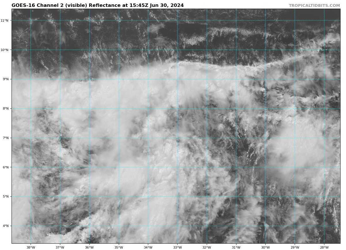
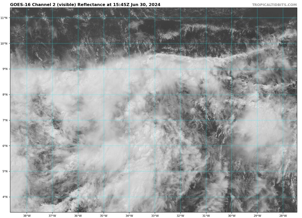
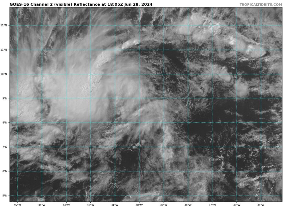
Interesting cloud formation, resembles a wall of clouds separating the SAL to the North and the vorticity to the south
-
I’m still skeptical that Beryl will achieve cat 5 intensity, certainly possible but one EWRC would torpedo those chances. Frankly I think that could actually be worse, since the storm would expand appreciably.
-
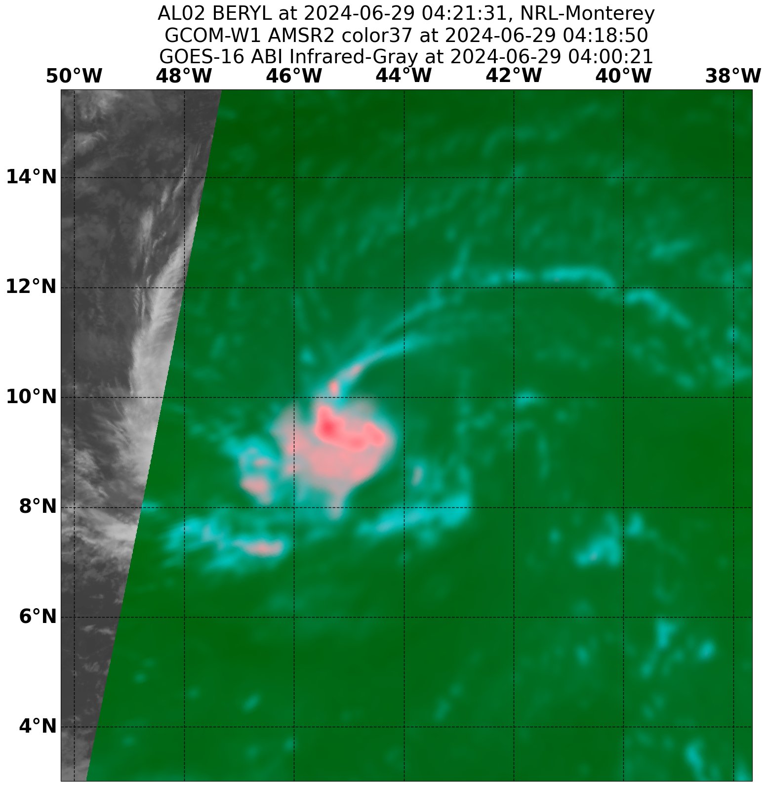
Beryl is looking fierce right now. I’d say a 45-50 mph tropical storm still intensifying at a fast clip. What’s most intimidating is the total lack of other clouds around the system. Once the system fully stacks we are going to see some beautiful outflow.
-
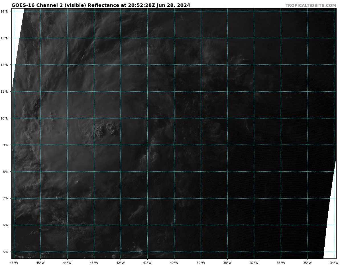
Incredible how much better the TD 2 looks now than 16 hours ago

-
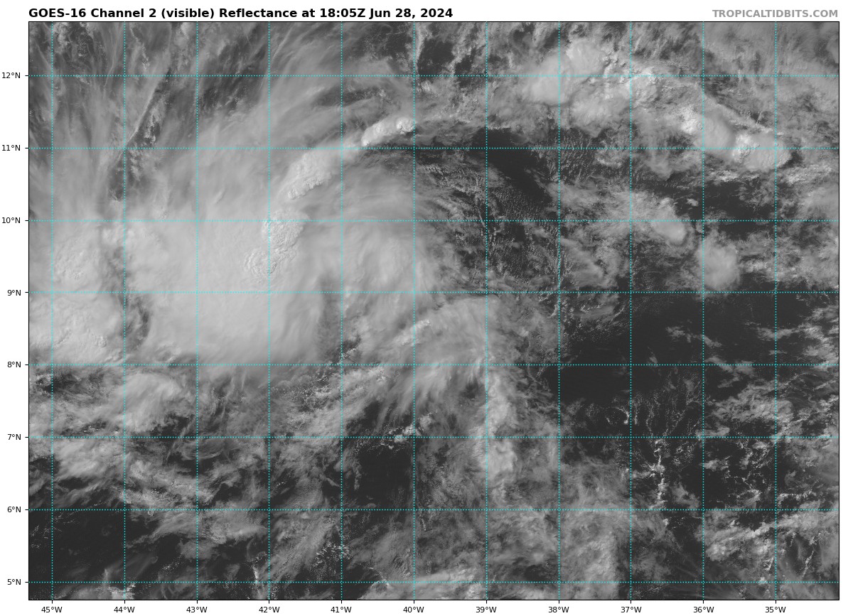
Looking better by the hour
-
Still a little displaced, but it’s go time
-
95L is well on its way to becoming a TC, intense burst over its true center and a potent feeder band is establishing itself to the SW.
-
Looks like the season is picking up - 95L may become the strongest MDR/Ecarib hurricane since 2005. Keeping a wary eye on it, ridging will likely push it due west but it it strengthens earlier than forecast it might find a weakness.
-
2024 Atlantic Hurricane Season
tiger_deF replied to Stormchaserchuck1's topic in Tropical Headquarters
The board would go nuts if this happened, two hurricanes in the Caribbean in early July -
2024 Atlantic Hurricane Season
tiger_deF replied to Stormchaserchuck1's topic in Tropical Headquarters
I’m still waiting until we can get a storm to Gaston-maxx. It’s been 8 years and I still haven’t let him go… -
2024 Atlantic Hurricane Season
tiger_deF replied to Stormchaserchuck1's topic in Tropical Headquarters
That’s tough. I personally think this year might have quality over quantity (unlike say 2020). I wouldn’t be surprised if we busted under in terms of ACE, but I think it’s likely we will be tracking some formidable systems. For being so concise your slang list is no cap, fr man -
2024 Atlantic Hurricane Season
tiger_deF replied to Stormchaserchuck1's topic in Tropical Headquarters
Sorry, one of two Gen Z Anyway it’s looking more and more likely that we will get some June/July MDR action. Major SAL outbreak is going to dampen activity some, but conditions will be quite favorable otherwise. -
Absolutely soupy in Middlesex county, feels like a swamp. Sun broke out an hour ago. If anything makes it down this far South it will have some serious fuel
-
2024 Atlantic Hurricane Season
tiger_deF replied to Stormchaserchuck1's topic in Tropical Headquarters
Would certainly be a harbinger of a hyperactive season if we beat the EPAC to the first storm of the NW hemisphere… Model signals are going to back on and off development over the next few days but in the long run we are entering a more favorable period for disturbances. -
2024 Atlantic Hurricane Season
tiger_deF replied to Stormchaserchuck1's topic in Tropical Headquarters
The wave in question has vigorous convection which has been sporadic but persistent. Upper level environment is quite hostile to the Northwest (where it will be moving eventually), but it’s immediate environment seems favorable, though a little far to the South. ASCAT pass 3 hours ago shows a defined wave axis and a broad swath of winds, but not much in the way of a closed circulation yet. Best chance for development IMO is the next couple of days or later when it exits into the SW Atlantic. -
2024 Atlantic Hurricane Season
tiger_deF replied to Stormchaserchuck1's topic in Tropical Headquarters
GFS has been hinting at potential development in the SW Caribbean for a little while. Might just be another phantom but interesting to watch over the next few days. -
It’s phantom season baby!
-
2024 Atlantic Hurricane Season
tiger_deF replied to Stormchaserchuck1's topic in Tropical Headquarters
For pre-season development I have my eyes on a tropical wave which for several runs has been shown for several runs to move off of South America into the Caribbean in around 7-10 days. It will potentially move NE to the open Atlantic, as shown by this 018z GFS run, where it might be able to align along the shear vector at some point and develop. Waters are certainly warm enough SAL and high wind shear from zonal continental flow is currently dominating the basin (typical in Mid-May), so the tropical Atlantic is going to be shut down asides from a potential sneaky system for some time. However, MJO is moving into the basin in late May, and as the ICTZ continues to tick northwards and pockets of lower shear start to pop up, things will start looking more favorable for some early-season development, and one of the most hyped seasons in years will truly begin. -
2024 Atlantic Hurricane Season
tiger_deF replied to Stormchaserchuck1's topic in Tropical Headquarters
MDR is absolutely toasty right now, hard to imagine a more favorable look. I can't remember ever seeing this level of warm anomalies across the tropical Atlantic, and as the SATL and El Nino regions are cooling off, it continues to warm. OHC anomalies in the MDR are a month ahead of 2023 and 3 months ahead of the 2013-2022 average. -
This goes against my preferred narrative, therefore the UKMET is as garbage as they come and can be completely ignored.
-
If we get both a Lee landfall/close brush and Nigel becomes a threat, would this be the most active tropical period for NE in recent history?
-
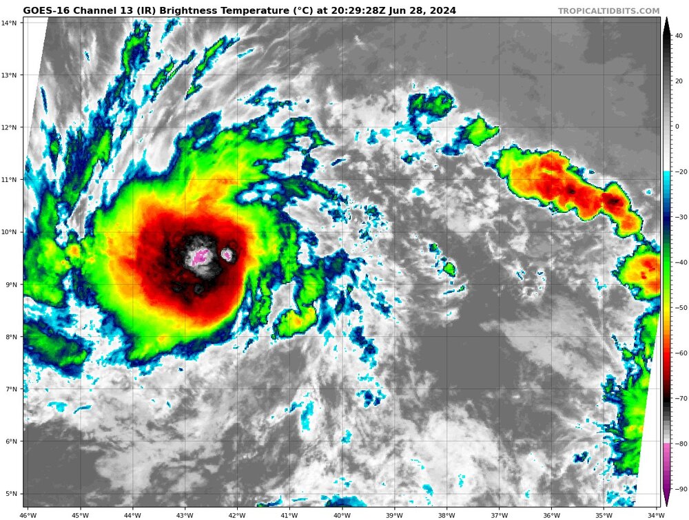
Now this is an overreaction if I've ever seen one. Lee is in the latter stages of an ERC, and though the inner eyewall is fighting back it will be toast in the long run. I expect that by tomorrow Lee will clear a big, beautiful eye.
-
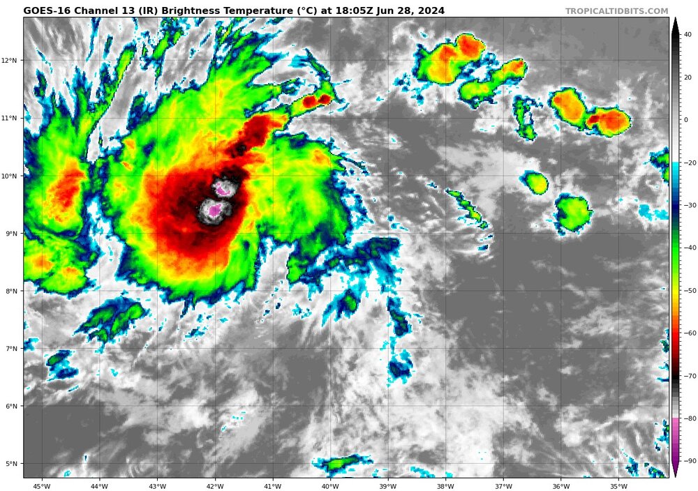
GOES trying to will a hit into existence
-
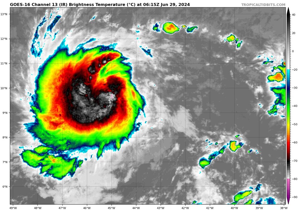
Lee is looking better by the frame; this is the clearest the eye has been in days, and intense convection has fully surrounded the center of the system. I think he might make a run for his earlier peak if trends continue.