tiger_deF
-
Posts
615 -
Joined
-
Last visited
Content Type
Profiles
Blogs
Forums
American Weather
Media Demo
Store
Gallery
Everything posted by tiger_deF
-
Ian's structure is improving, but it looks absolutely terrible on IR (considering it was forecasted to be near hurricane strength by now)
-
The Euro is showing another monster trough in the 18z run picking up Hermine (or Ian?). I certainly wouldn't bet on anything, but given the prevailing pattern this season, this might be one of our best chances at something tropical for the next few years.
-
Frankly I think we have as much of a shot with the next system slated to develop versus we did earlier on with Fiona (unlikely, but possible)
-
Is that an eye-like feature?
-
CDO continues to expand, this may be the deepest convection of any named system so far in the Atlantic
-
IR appearance has rapidly improved over the last several hours
-
This is a pretty beautiful half a storm
-
Normally I'd be bearish for a system becoming decoupled from its MLC, but the current one has been so persistent with such deep convection that I wouldn't be surprised if it becomes the dominant feature. Certainly the best looking tropical system deep in the MDR to date.
-
Frankly I think we already have tropical storm Fiona. Considering how dry the mid-level environment is around TD 7 and the effects of westerly shear, there's a robust core with intense hot towers, as well as signs of nascant banding.
-
The collapse of the convection to the left and dramatic blowup of convection tonight has made 96L look 10x better
-
2022 Atlantic Hurricane season
tiger_deF replied to StormchaserChuck!'s topic in Tropical Headquarters
Convection is sporadic, but this is by far the best 850 mb vorticity 91L has displayed so far. This system is absolutely consolidating, and it looks to have quite the fetch. This could work against it in the long run if dry air becomes entrained, but this system has the potential to be a formidable hurricane. -
2022 Atlantic Hurricane season
tiger_deF replied to StormchaserChuck!'s topic in Tropical Headquarters
It's organization is dramatically improving as well, here's 6 hours ago vs now -
2022 Atlantic Hurricane season
tiger_deF replied to StormchaserChuck!'s topic in Tropical Headquarters
That's just an ugly trend for the hyped wave coming off of Africa. At least our lemon in the MDR is looking marginally more robust -
2022 Atlantic Hurricane season
tiger_deF replied to StormchaserChuck!'s topic in Tropical Headquarters
Oh look, the operational GFS trended even weaker with both waves and pushed the timeframe of the actual TC back. What a surprise... Feels like mid-July -
2022 Atlantic Hurricane season
tiger_deF replied to StormchaserChuck!'s topic in Tropical Headquarters
This is not an incredibly scientific analysis, but it seems that over the past several weeks waves have come off Africa and languished between 20-30W, with no sustained forward motion cutting through the SAL. The monsoon trough has been fairly active but it almost seems as if vorticities have strung out in an area of disturbed weather rather than punching through as an AOI. -
2022 Atlantic Hurricane season
tiger_deF replied to StormchaserChuck!'s topic in Tropical Headquarters
I'm definitely concerned that every time the development time frame for a system has pushed below 100 hours, the models have dropped it. Happened to the wave before the one at 25W, happening to the current wave, and may happen to the one behind it. Still very dry out there, and every wave coming off of Africa has been stripped of convection by 35-40W. If this doesn't change soon we could see a season bust of epic proportions.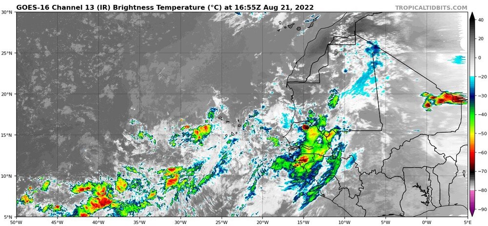
-
2022 Atlantic Hurricane season
tiger_deF replied to StormchaserChuck!'s topic in Tropical Headquarters
Curving to the left in the last few frames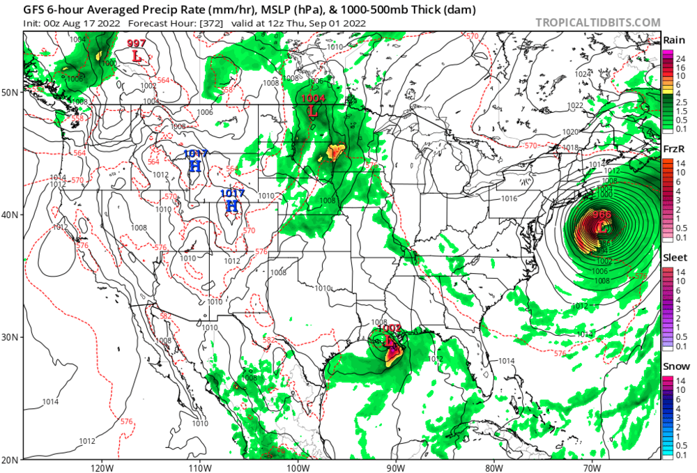
-
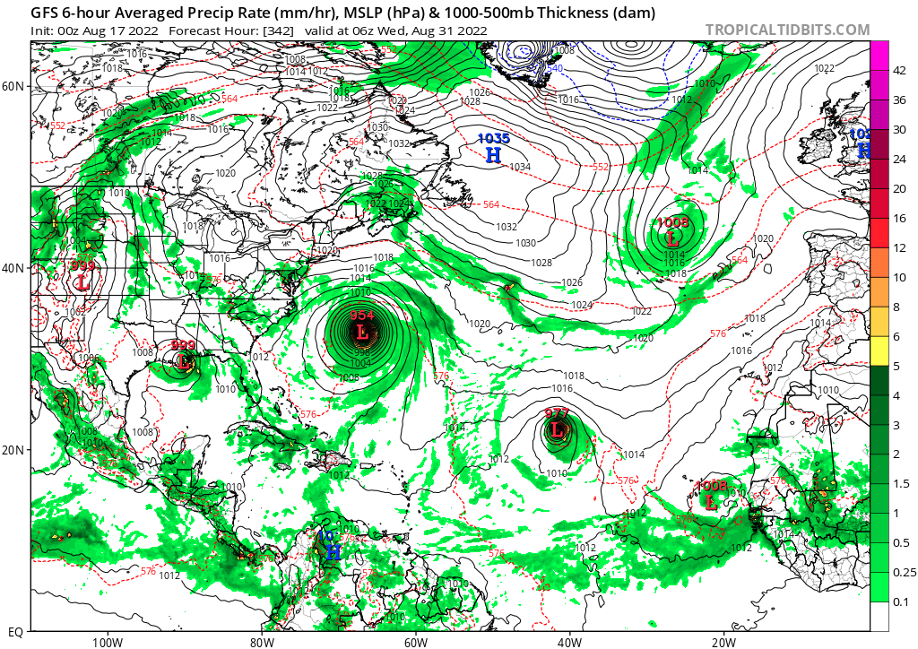
Looks like an active pattern ahead in the tropics
-
2022 Atlantic Hurricane season
tiger_deF replied to StormchaserChuck!'s topic in Tropical Headquarters
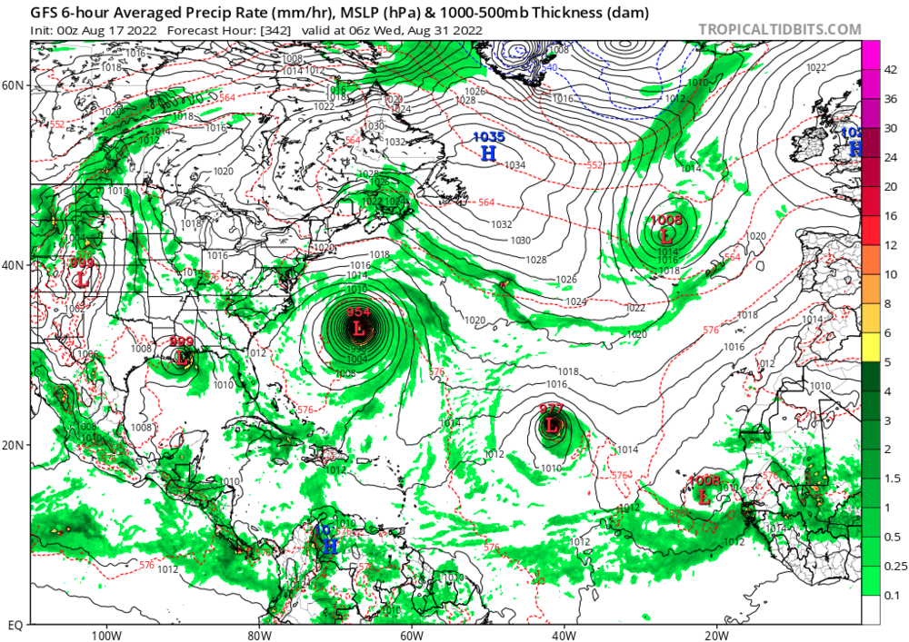
0z GFS going nuts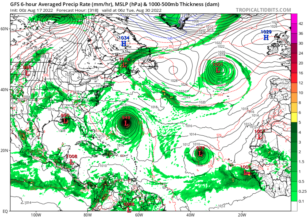
-
2022 Atlantic Hurricane season
tiger_deF replied to StormchaserChuck!'s topic in Tropical Headquarters
I can't tell if the board is stuck in early season or late season blues, that this middling circulation is the most exciting thing we've been able to track in over a month. -
2022 Atlantic Hurricane season
tiger_deF replied to StormchaserChuck!'s topic in Tropical Headquarters
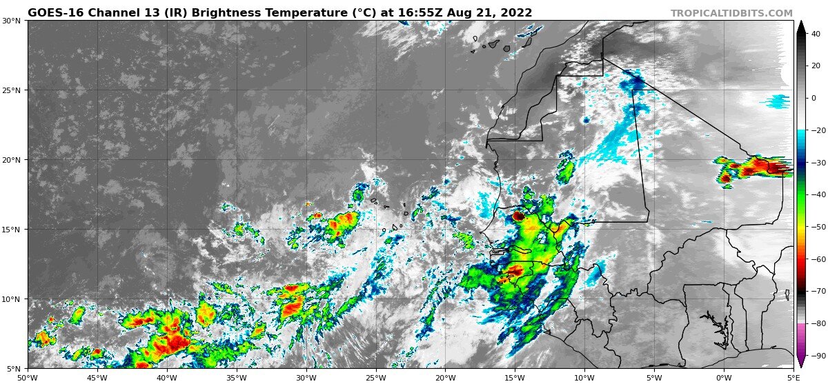
Given how bearish the board is I was suprised to see our AOI off of Africa looking pretty healthy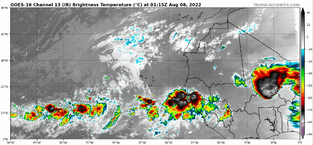
-
Impressive convective pattern

-
OBS/DISCO - The Historic James Blizzard of 2022
tiger_deF replied to TalcottWx's topic in New England
Heaviest snow of the day here in Arlington, been shoveling for an hour and there is easily 3 inches of snow on the stairs I shoveled first -
OBS/DISCO - The Historic James Blizzard of 2022
tiger_deF replied to TalcottWx's topic in New England
How many more hours of heavy snow are we in for in Boston? -
OBS/DISCO - The Historic James Blizzard of 2022
tiger_deF replied to TalcottWx's topic in New England
Even if the low is fairly displaced to the East, I'm really hoping we get at least some sort of capture, which would make this storm go from a monster SE snowstorm to a historic one