tiger_deF
-
Posts
615 -
Joined
-
Last visited
Content Type
Profiles
Blogs
Forums
American Weather
Media Demo
Store
Gallery
Everything posted by tiger_deF
-
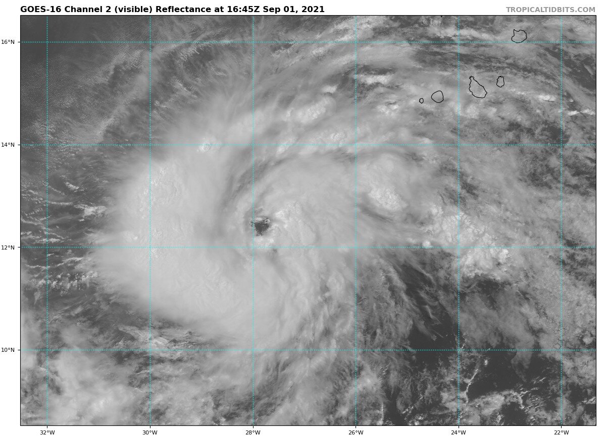
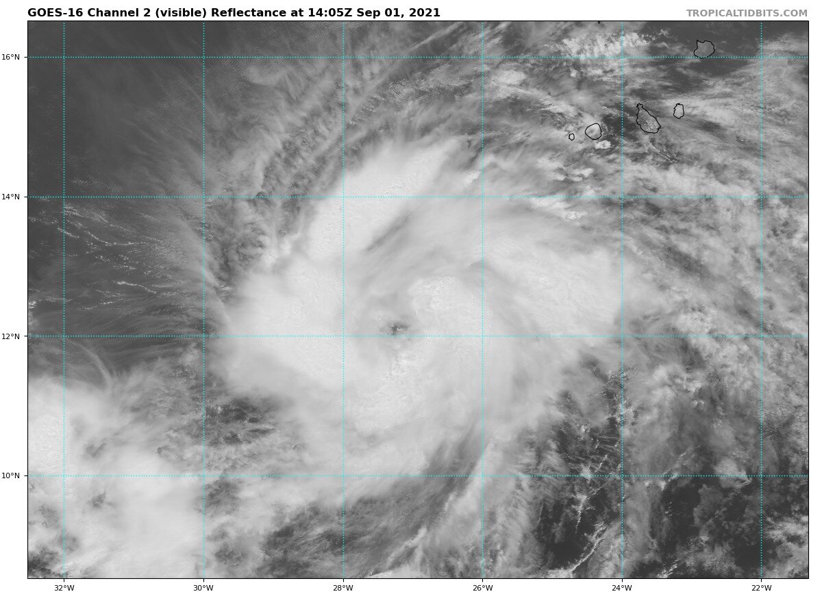
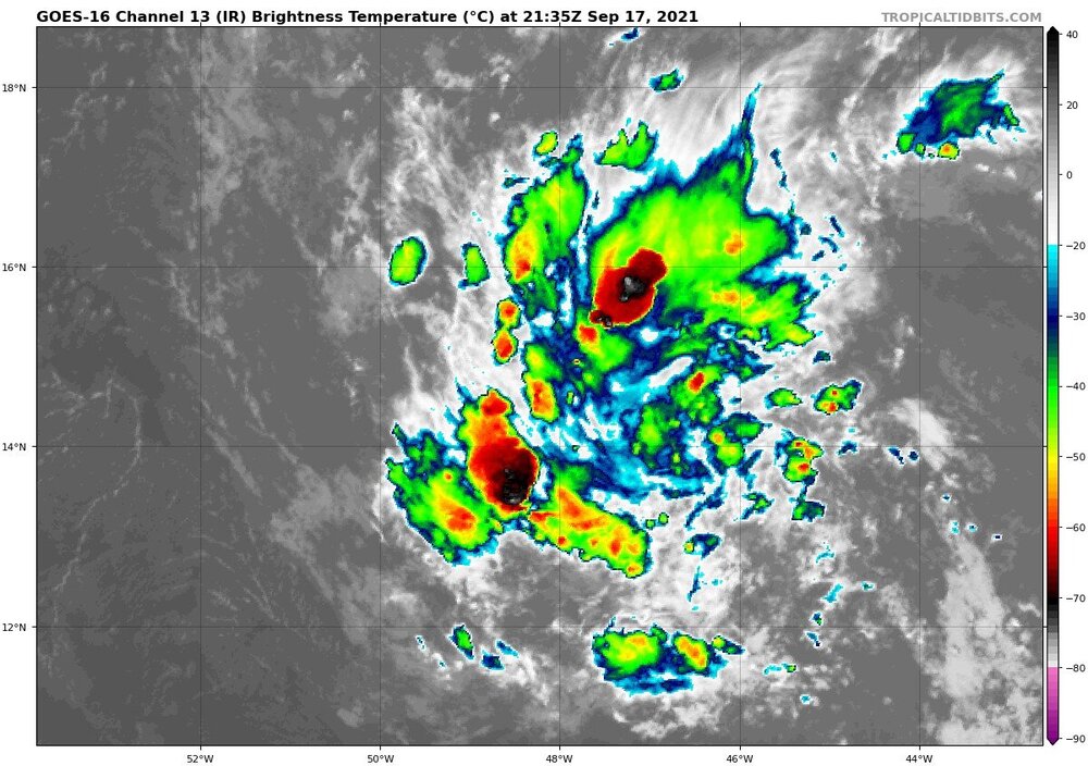
95L ~4 hours ago vs 95L now
-
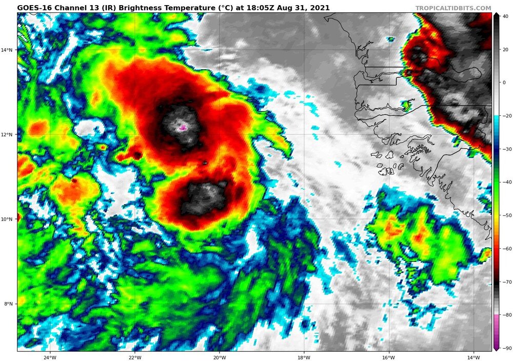
Frankly Larry right now in the EATL is already practically as strong as Henri was at it's peak. Conditions look conducive for further strengthening in the near future, despite potential dry air entrainment. In addition, Larry has a far larger circulation, and even if it was in the state Henri was in it would move much more water
-
As much as I am certain that this will not go anywhere near the eastern seaboard, we can't discount the journey of Henri from fish to (pathetically weak) threat. The pattern has been there this year, folks
-
Be careful what you wish for, we will get all of that as rain instead of snow
-
Scenes out of New York are straight out of Day after Tomorrow
-
Will all the flooding damage caused by remnant Ida get added to Ida's eventual total?
-
This is going to be a major disaster for NYC
-
Central PA - Summer 2021
tiger_deF replied to Itstrainingtime's topic in Upstate New York/Pennsylvania
Brownwater rafting is really in right now -
LSD (Colloquially known as acid) is typically in the form of a tab, which are ripped off from sheets of hydrophilic paper. These sheets tend to have wild and "trippy" patterns on them, like the ones above.
-
I've seen hurricanes with worse eyes than this dry spot
-
-
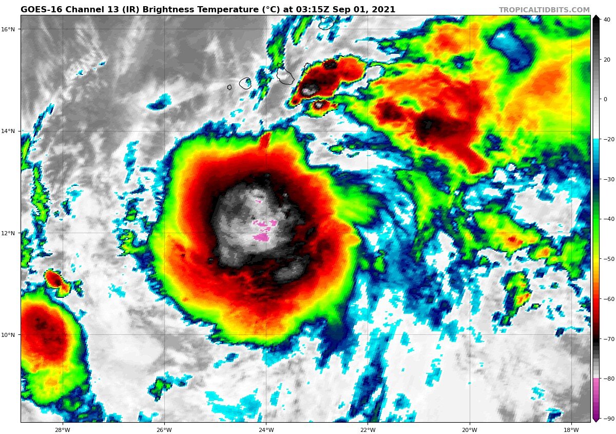
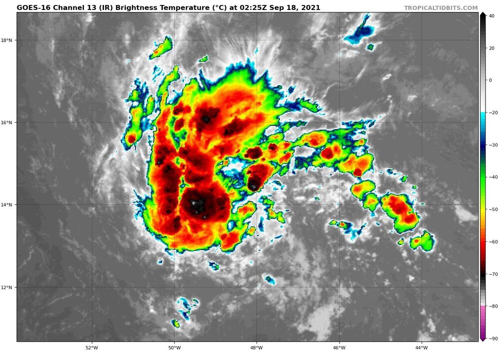
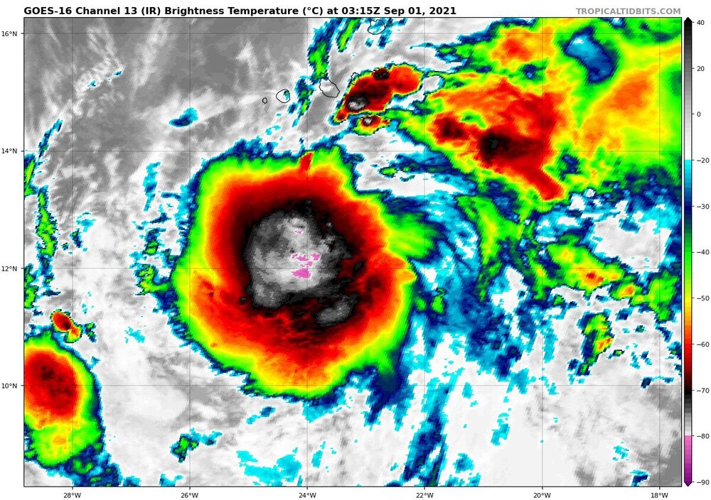
Looking pretty beastly for a system that just came off of Africa
-
90L is consistently pushing out deep convection on IR
-
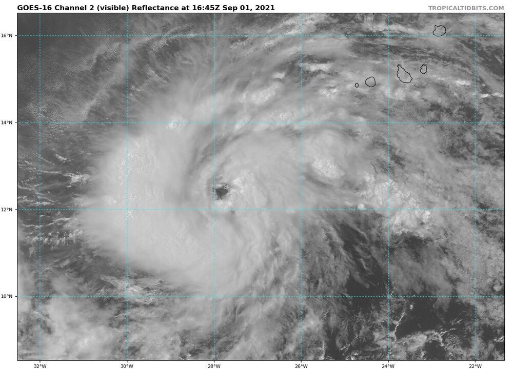
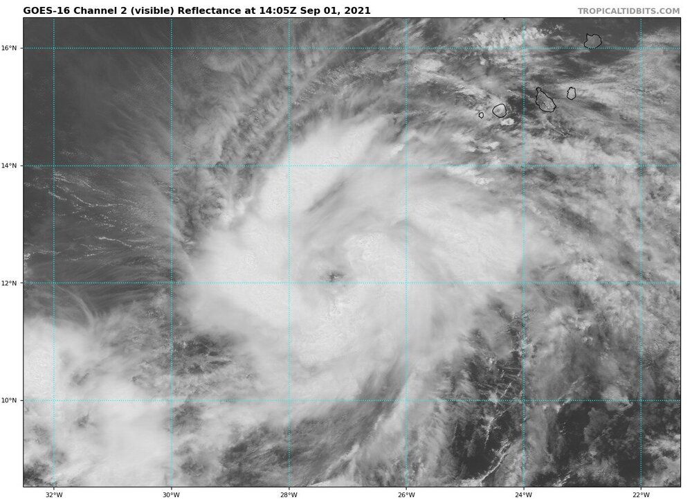
While the chance of impacts are extremely scant, I think it would be well worth it to keep an eye on soon-to-be Larry. Henri's earlier landfall (as pathetic as it was) is a sign that there very much is an atmospheric pattern to allow for such situations. In addition, Larry will have weeks of time over the atlantic to strengthen and grow larger. As of right now all guidance is well out to sea, but there have been consistent West shifts.
-
I'm curious to see the next phase of Ida's evolution as it moves North and eventually out to the East
-
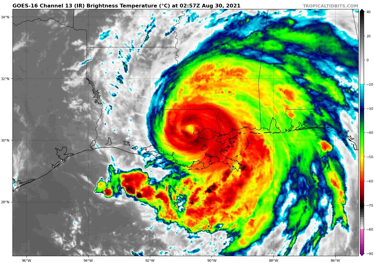
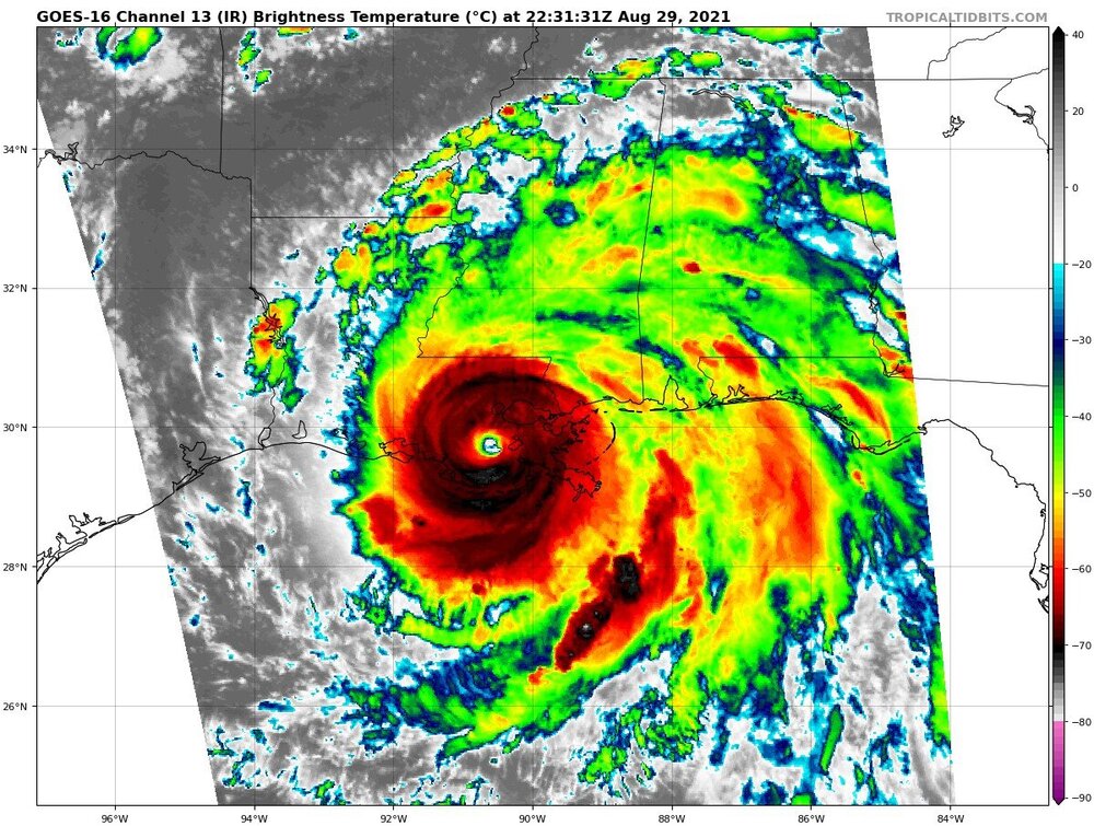
While I have no doubt Ida is quickly weakening, her eye has actually become better defined on IR over the past hour

-
On the anniversary of Katrina no less
-
Almost sure this dude is doing this for clicks.
-
Ida more than 6 hours after landfall... Eye has started clouding in but is still remarkably clear, and radar is still very potent
-
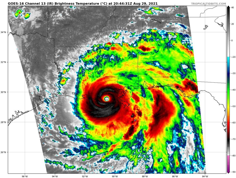
Ida, nearly 5 hours after landfall
-
August Disco 2021. Do record dews continue?
tiger_deF replied to Damage In Tolland's topic in New England
Why are any of you awake? Why am I awake? -
Presentation is rapidly improving on IR
-
IR appearance has degraded, but on radar the center is as clear as it's ever looked. I expect Cuba interaction will disturb it somewhat, but it should be fully recovered by tomorrow morning
-
Would this disrupt the core?
-
Absolutely dumping rain in greater Boston, came in without a warning