tiger_deF
-
Posts
615 -
Joined
-
Last visited
Content Type
Profiles
Blogs
Forums
American Weather
Media Demo
Store
Gallery
Everything posted by tiger_deF
-
When barely any precipitation falls the entire winter on a good chunk of NE, gradients mean jack
-
This will absolutely ruin the end of any hurricane season. Just because these storms happened, we will all be expecting similar late season activity, and be disappointed when it inevitablely isn't the same. That, or climate change really is leading to more active hurricane seasons.
-
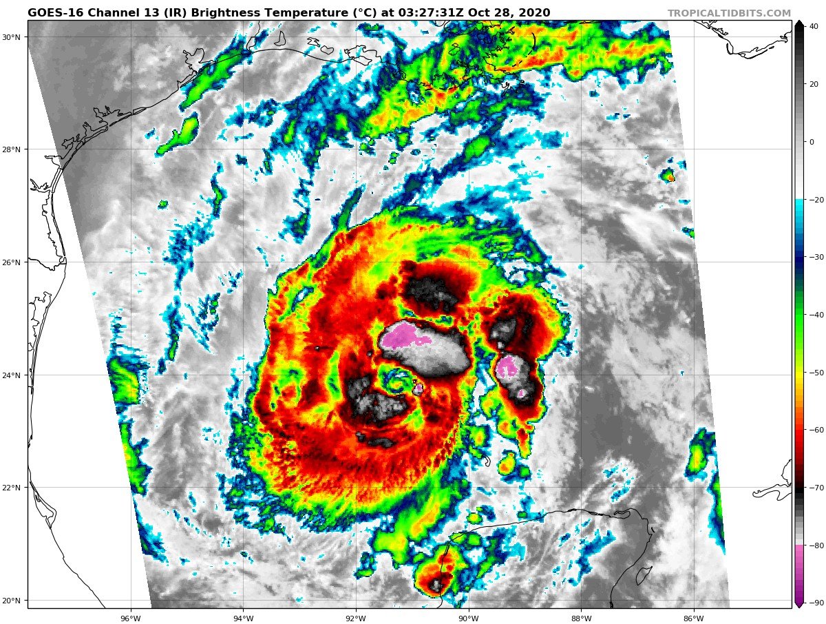
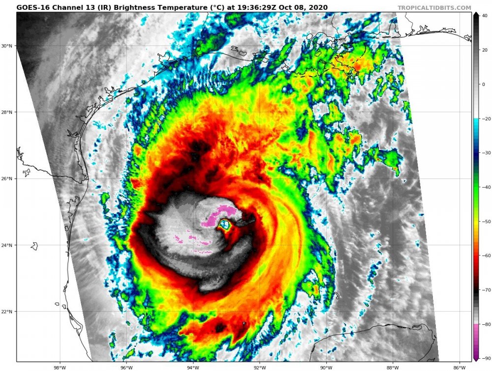
Cloud tops are colder than even some of the strongest WPAC storms
-
Raw ADT of 7.9!
-
I'll go 890 and 160kt. Someone's gotta do it
-
In Boston and it is accumulating somewhat on the streets and sidewalks and coming down at a heavy pace, pretty suprised as I was expecting to torch here
-
Is there a reason that the WPAC basin doesn't really have recon missions from any agency like we do in the Atlantic/Pacific? Lack of funding?
-
Unironically the most bullish I've been on any storm this season. Nearly perfect upper level anticyclonic pattern combined with excellent OHC and above average SDT's given the time of the year, as well as a vigorous circulation that appears to already be in the process of developing
-
Is it just me or is Zeta clearing out an eye over land?
-
Someone needs to remind Zeta that it isn't in the GoM anymore and can begin disintegrating instead of firing deep convection
-
I think this may take lots of folks in New Orleans by suprise unfortunately
-
NHC upgraded to 973 mb and 105 mph
-
119 kt FL winds in the SE!!
-
Lots of lightning in the eyewall, still think we could push a low end Cat 3 if the baroclinic forcing and trough interactions line up just right
-
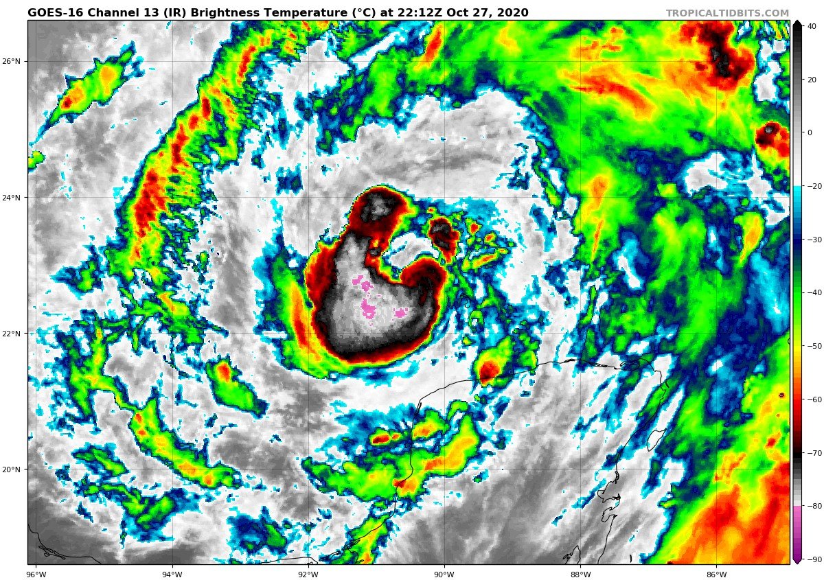
Recon will be enlightening, sure looks like Zeta is still strengthening
-
Looking at this right now I find it hard to believe Zeta isn't near or at Cat 2 status. Unbelievable presentation considering what it looked like just 6 hours ago

-
2.5 hours apart

-
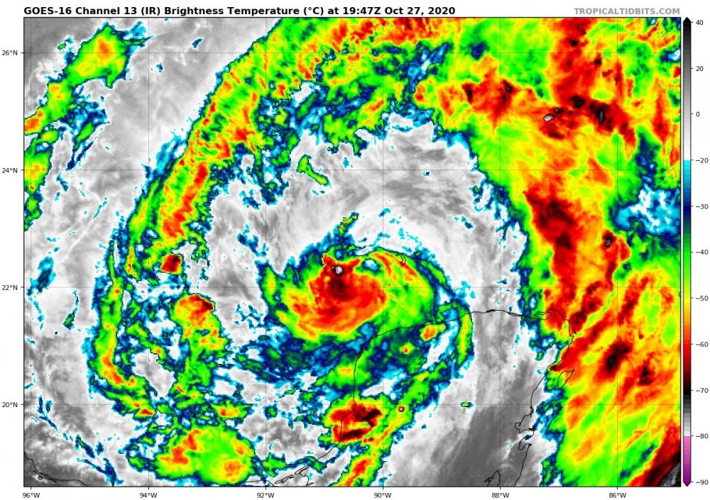
Within the span of a few hours Zeta has materialized 3/4 of an eyewall, once it closes it off I expect fairly steady to quick strengthening. This is a huge system, and once it fully develops I expect it will be larger than both Delta and Laura
-
Zeta looks to be strengthening right now, I am seeing signs of northerly banding from the main convective mass, the convection continues to cool over the center of the MLC, and overall banding features have developed considerably over the past hour (with the potential start of a curved band developing to the left)
-
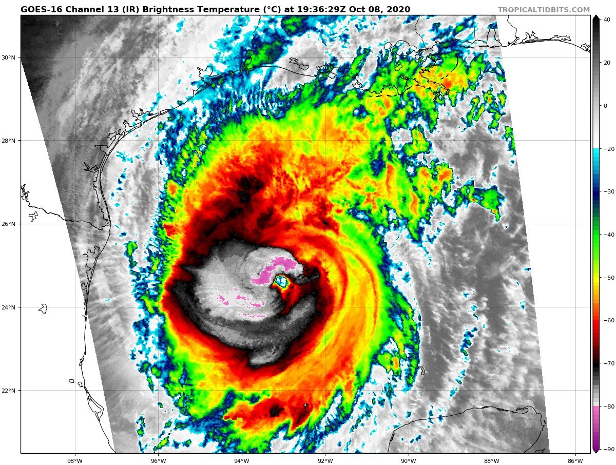
That makes it even more impressive, what a freak of nature. Usually ULL's are the destroyer of cyclones; this one has provided the perfect pocket for a major
-
Ugh this setup has the potential to produce such a powerful hybrid storm, so of course it will miss us 500 miles to the east
-
Unflagged 119kt FL winds in NE quadrant. I'd say 95kt would be a good estimate, maybe 100
-
Like fully cleared the eye
-
And just like that, the eye is clear
-
You guys may have jinxed it, Delta's eastern eyewall is the best I've seen it recently