

midatlanticweather
-
Posts
4,926 -
Joined
-
Last visited
Content Type
Profiles
Blogs
Forums
American Weather
Media Demo
Store
Gallery
Everything posted by midatlanticweather
-
The weather is broken! I am sick of the riding the fence crap and the DC area snow hole.. Bring on Spring at this rate.
-
About 0.5" from wave 1. But still great to take a walk as the ground remains white! And then this guy showed up!

-
So the snow that the GFS showed in northern Virginia yesterday appears to have gone north. @Ji I think we are cursed
-

Feb Long Range Discussion (Day 3 and beyond) - MERGED
midatlanticweather replied to WinterWxLuvr's topic in Mid Atlantic
The only thing I think could have helped was the +PNA - But I mean - I want Unicorns.. Agree that this year has been a tough one. We had most all the checklist covered except a few items.. but you should not have to get all right to get some good snows. This has been a suck winter in many ways. But, one storm could get many to Climo, but there are still many, especially easy of 95, totally starving from lack of snow. Crazy year! LA Nina and the ripping and shearing of systems was definitely an issue. And the set up now is not ideal.. but you would think we could get something to break the right way! -
.5" of slop.. bummer
-
Seems this is the line.
-
Still sleet/rain mix here in Purcellville.
-
And just like that.. flakes have slowed to almost a stop. Surprised by this burst, but that did not last too long! See more building slowly to the west.
-
Snowing well out here in Purcellville. Slushing up the pavement and a coating already! Temp is down to 34. Big flakes, but not quite what we say last Sunday.
-
February 10-12, 2021 Winter Event
midatlanticweather replied to MN Transplant's topic in Mid Atlantic
I say you pull a Leroy Jenkins and start the Obs.. if the Euro tries to throw us something, we can share it there.. but the writing is clear! And we will be seeing echoes soon!! -
February 10-12, 2021 Winter Event
midatlanticweather replied to MN Transplant's topic in Mid Atlantic
Even if not perfect, the output has been a harbinger of eventual outcome. I mean, the model is doing what it is supposed to do.. giving guidance that can be used to make educated forecasts. I am impressed. It is becoming clear that this year, the way things are set up, it is a model that needs respect for possibilities. No model is perfect, but they do let you know what to watch for... Much more respect. I feel @ers-wxman1 should chime in as he saw the merit to it in the first storm. -
You are good man! I appreciate the input! BTW - @Ji and I are in the dead zone! LOL! Amazing! You do a good job of posting strategically. But who posts is like a Machine Learning algorithm on whether something looks good or bad! What a crazy time!
-
How do you know a storm is likely a dud? All the red taggers disappear! Bob goes back into hibernation. PSU may post when someone's reasoning is way off, but he becomes a lurker. Every weenie becomes a wishcaster and thinks they can will a storm in the right direction. And the mood is so low as the chase has died. Depressing
-
February 10-12, 2021 Winter Event
midatlanticweather replied to MN Transplant's topic in Mid Atlantic
I was thinking the same thing -
Feb Long Range Discussion (Day 3 and beyond) - MERGED
midatlanticweather replied to WinterWxLuvr's topic in Mid Atlantic
GFS is lost with all the waves of energy and the sprawling Highs. -
February 10-12, 2021 Winter Event
midatlanticweather replied to MN Transplant's topic in Mid Atlantic
Come on GFS to make us feel a bit better.. then the EURO for the real better feel. NEED THAT NORTH TREND.. on Wave 2 -
February 10-12, 2021 Winter Event
midatlanticweather replied to MN Transplant's topic in Mid Atlantic
NAM almost has the nightmare scenario ! Too far south for wave 1 and too far north for wave 2! -
February 10-12, 2021 Winter Event
midatlanticweather replied to MN Transplant's topic in Mid Atlantic
I am no met, but I was mentioning yesterday that these waves, from what I remember, are 3 to 5 inch snows.. the difference here is there were two waves instead of one which was doing better! Jut my 2 cents... This wave still looks like an overperformer for those perfectly set up. Again, not a met.. just going from memory -
February 10-12, 2021 Winter Event
midatlanticweather replied to MN Transplant's topic in Mid Atlantic
Congrats @Ji east of the mountains! Lol..thumb.png.9a45653f23a6768e5a2df422c72a0818.png)
-
February 10-12, 2021 Winter Event
midatlanticweather replied to MN Transplant's topic in Mid Atlantic
Seems everything shifted north. Mix line is on the dooratep here in Loudoun -
February 10-12, 2021 Winter Event
midatlanticweather replied to MN Transplant's topic in Mid Atlantic
Most favorite quote from you in the 2013 - 2014 epic year was that if the atmosphere farted, we got snow! I still laugh at that!! Some similarities, in a way, to what we are seeing in this stretch. -
February 10-12, 2021 Winter Event
midatlanticweather replied to MN Transplant's topic in Mid Atlantic
HH GFS Ensembles? Anyone got maps? Yep.. I am in a meeting! LOL! Where is the Bingo card on this event? -
February 10-12, 2021 Winter Event
midatlanticweather replied to MN Transplant's topic in Mid Atlantic
If my memory serves me (and it may not) waves like this are usually 3 to 5 inch events (higher in the higher spots).. So we get two, which would net 6 to 10 inches (maybe?).. I would think. A long while ago in the early 90s (yep..) I remember tracking one of something like this and it was a 3 to 6 inch event .. I was an intern at the Climate Analysis Center at the time... but it quickly moved through. So two, seems like a double of the same thing. On to the model analysis! -
Feb Long Range Discussion (Day 3 and beyond) - MERGED
midatlanticweather replied to WinterWxLuvr's topic in Mid Atlantic
Remember it very well! Sleet bomb it was! Looked like sand when the salt and sand was on the sleet. Nasty stuff. -
February 10-12, 2021 Winter Event
midatlanticweather replied to MN Transplant's topic in Mid Atlantic
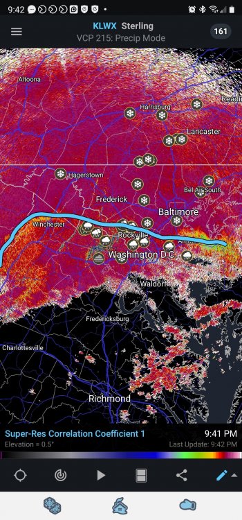
For one last look. Pivotal


.png.1134279c7a544d2720ba1883016195ac.png)
