midatlanticweather
-
Posts
4,928 -
Joined
-
Last visited
Content Type
Profiles
Blogs
Forums
American Weather
Media Demo
Store
Gallery
Everything posted by midatlanticweather
-
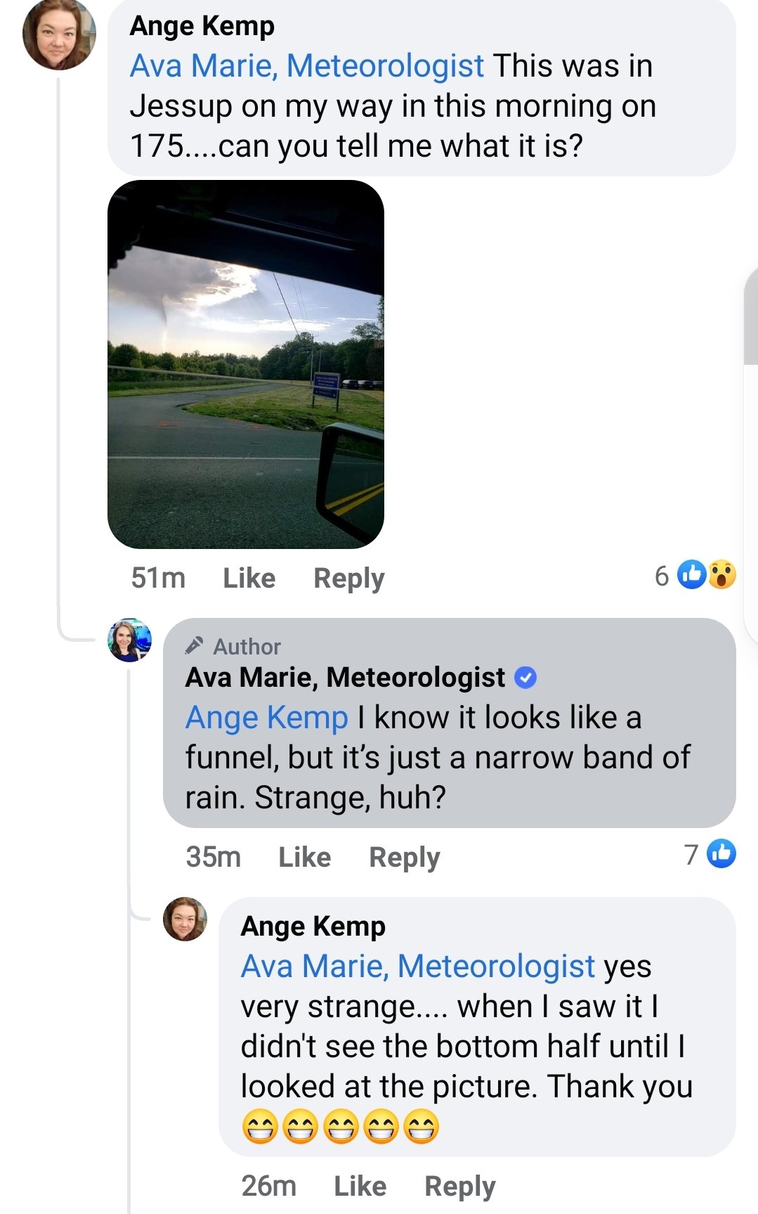
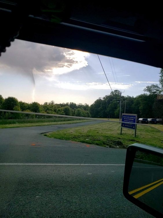
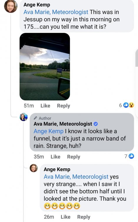
Saw this on an FB post response from Ava Marie.. It almost does look like a small funnel on there.
-
Looks like graupel falling pretty heavy briefly in Purcellville
-
Wow. 37 for a low is kind of impressive.
-
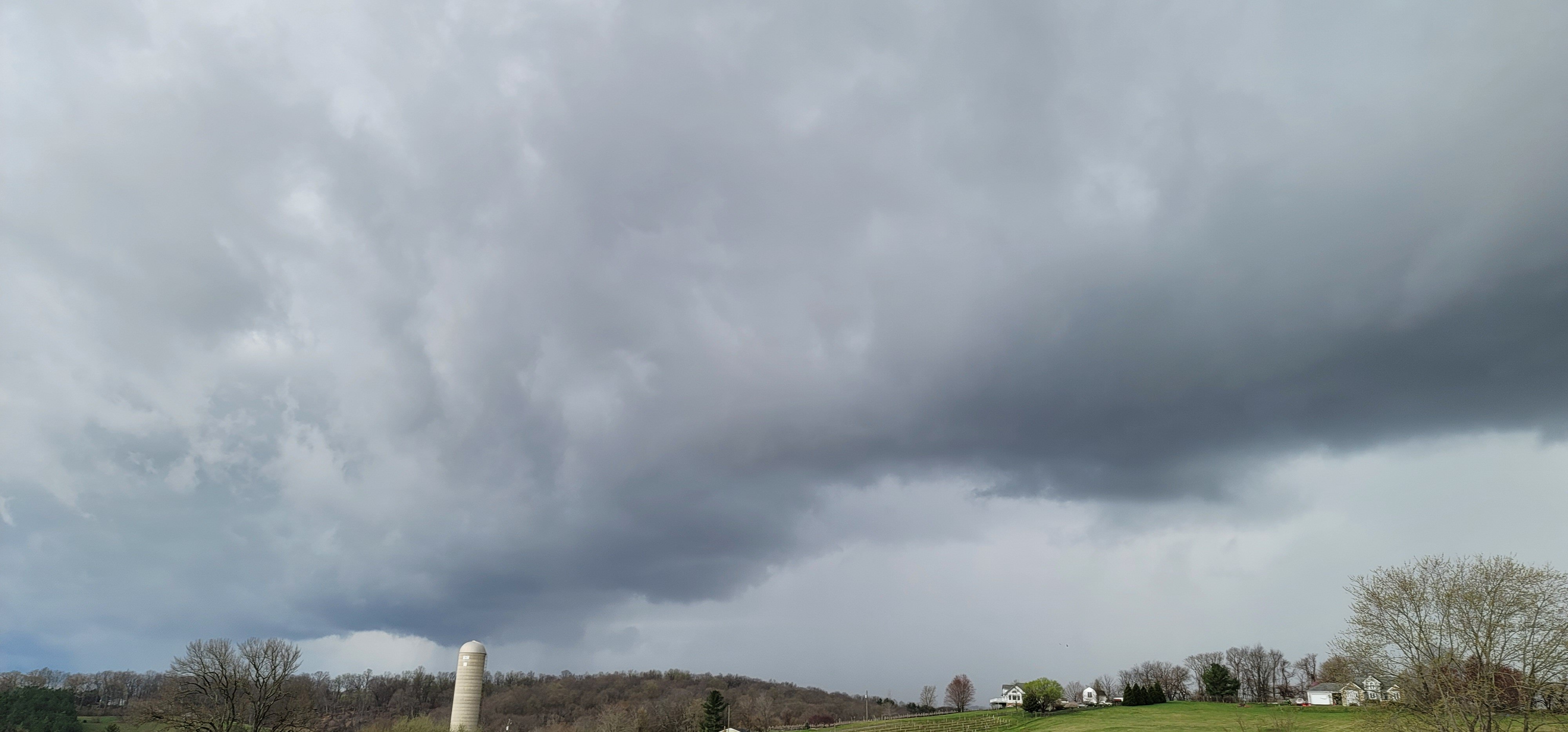
Those little heavier showers have some broad rotation in them even! LOL!
-
Just sprinkles out here in Purcellville today! So little that my rain gauge has not measured anything! I was in Leesburg earlier today and they seemed to have quite a bit more of rain, but this has not been a heavy rain producer in my area
-
41 degrees for a low! Chilly out there
-
How about that https://forecast.weather.gov/wwamap/wwatxtget.php?cwa=hfo&wwa=winter storm watch Hawaii winter storm watch
-

2021 Mid-Atlantic Severe Weather - General Discussion
midatlanticweather replied to Kmlwx's topic in Mid Atlantic
Seems that way when looking at it closer!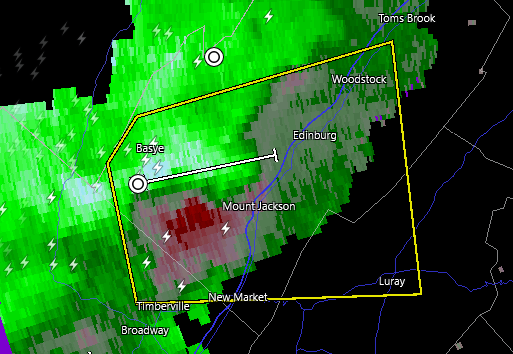
-
2021 Mid-Atlantic Severe Weather - General Discussion
midatlanticweather replied to Kmlwx's topic in Mid Atlantic
@mappy was active on twitter about an hour ago. I think she was aware and keeping safe -
Things remain calm compared to earlier! Winds sustained 10 to 20mph and even lower at times. Not much happening.
-
Yikes
-
I am in Purcellville, and right now, we are the least windy we have been in a long while.. Will let all know if the second line brings it all back.
-
That line of showers brought some of the best severe winds of the Spring! WOW!
-
That line of showers brings the gusts down! Had about 5 minutes of sustained winds bouncing up to 45 to 50mph but I had no way to measure the gusts! WOW! Watch out when the showers come through!
-
2021 Mid-Atlantic Severe Weather - General Discussion
midatlanticweather replied to Kmlwx's topic in Mid Atlantic
https://www.spc.noaa.gov/products/md/md0468.html -
27.5 for my low this morning. Brisk feel out there!
-
Graupel pretty heavy up here in Fredrick Maryland, where I happen to be today.
-
2021 Mid-Atlantic Severe Weather - General Discussion
midatlanticweather replied to Kmlwx's topic in Mid Atlantic
That next warning Polygon is yuuuge -
2021 Mid-Atlantic Severe Weather - General Discussion
midatlanticweather replied to Kmlwx's topic in Mid Atlantic
Before they hit Purcellville
-
2021 Mid-Atlantic Severe Weather - General Discussion
midatlanticweather replied to Kmlwx's topic in Mid Atlantic
Watch for areas that have not had the front yet. -
2021 Mid-Atlantic Severe Weather - General Discussion
midatlanticweather replied to Kmlwx's topic in Mid Atlantic
Those things are moving fast. Cold winds and heavy rain came through fast. -
2021 Mid-Atlantic Severe Weather - General Discussion
midatlanticweather replied to Kmlwx's topic in Mid Atlantic
Getting some minor rotation in one of the cells near Berryville -
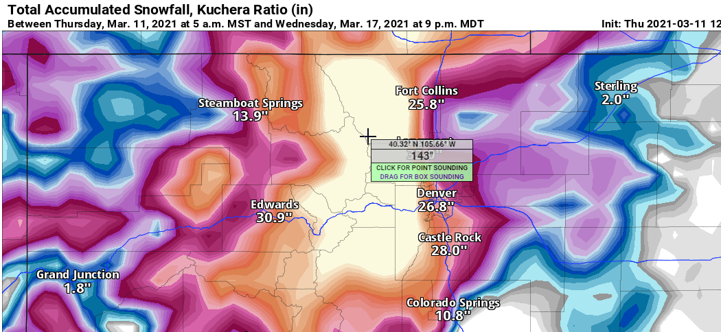
Hovering over areas west of Denver are now into the 100+ inches category between now and next Wednesday on the GFS! I saw up to 143 inches on Kuchera!
-
How about those amounts forecasted in Denver from the GFS! Insanity!