midatlanticweather
-
Posts
4,917 -
Joined
-
Last visited
Content Type
Profiles
Blogs
Forums
American Weather
Media Demo
Store
Gallery
Everything posted by midatlanticweather
-

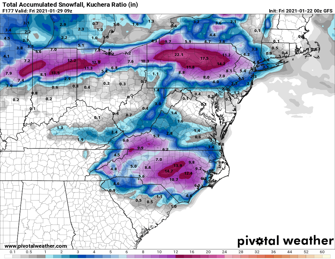
January Storm Term Threat Discussions (Day 3 - Day 7)
midatlanticweather replied to WxUSAF's topic in Mid Atlantic
Anyone looking at 18z Euro for trends on the strength of the low getting ejected from out west? Or was it bad so we did not see it? -
January Storm Term Threat Discussions (Day 3 - Day 7)
midatlanticweather replied to WxUSAF's topic in Mid Atlantic
Ouch. This looks familiar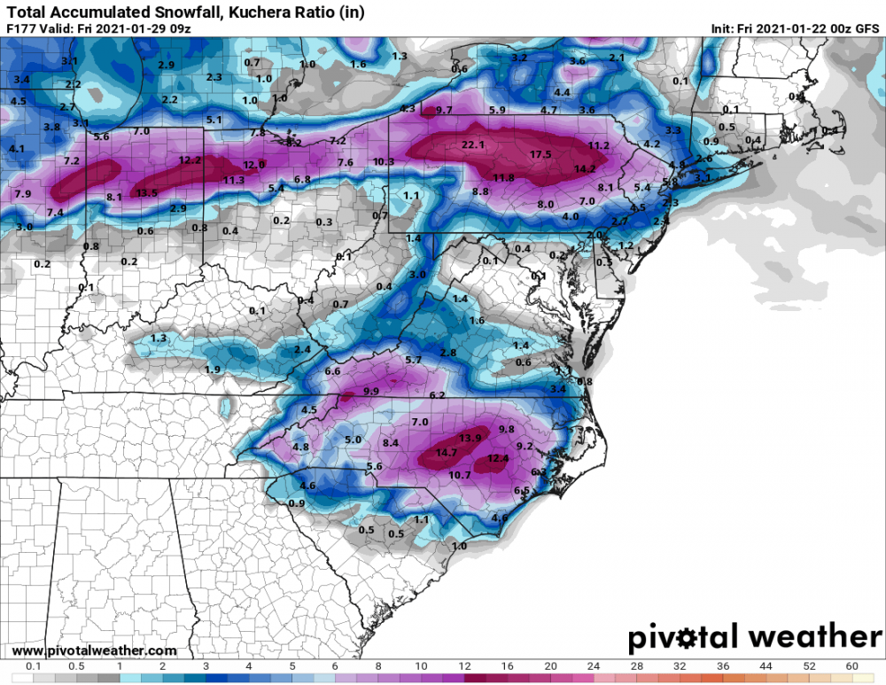
-
January Storm Term Threat Discussions (Day 3 - Day 7)
midatlanticweather replied to WxUSAF's topic in Mid Atlantic
Craptastic -
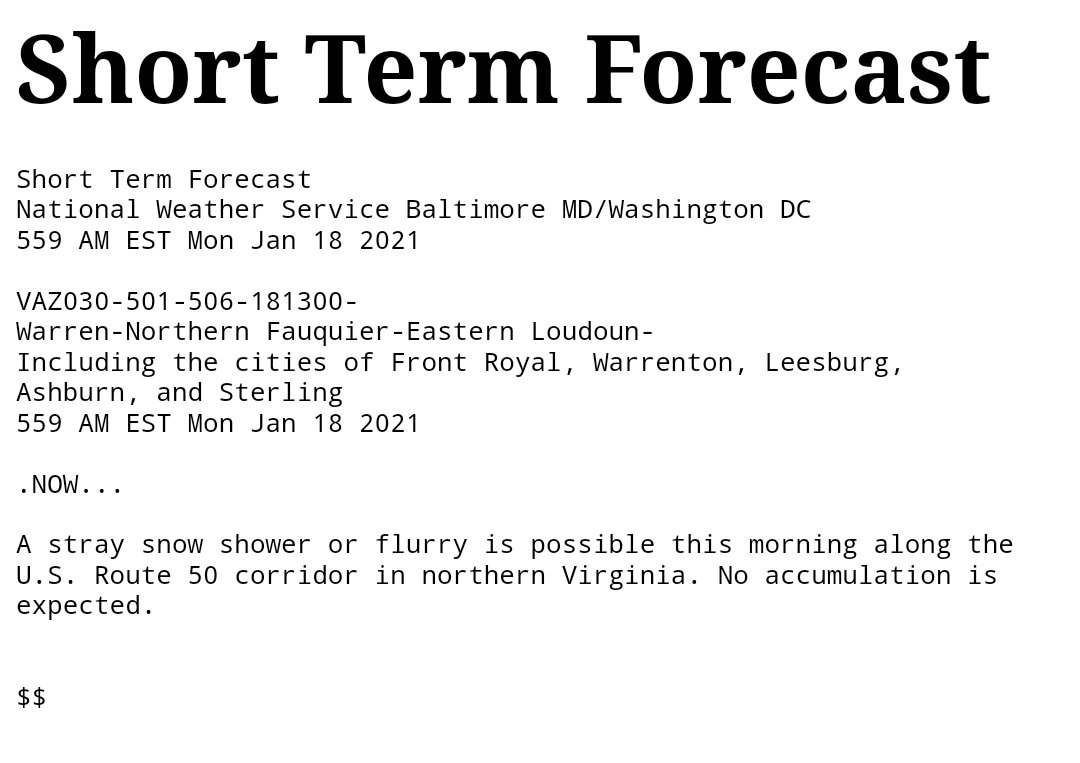
Jan 25th Wintry Mix Obs and Nowcasting
midatlanticweather replied to stormtracker's topic in Mid Atlantic
I find that generous! LOL! Probably too generous.. but I would take that. -
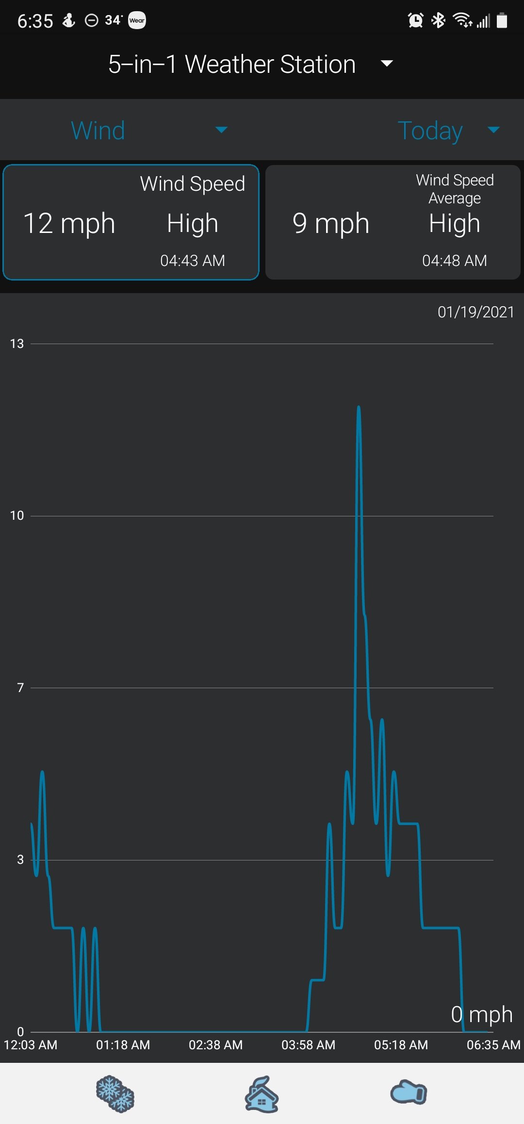
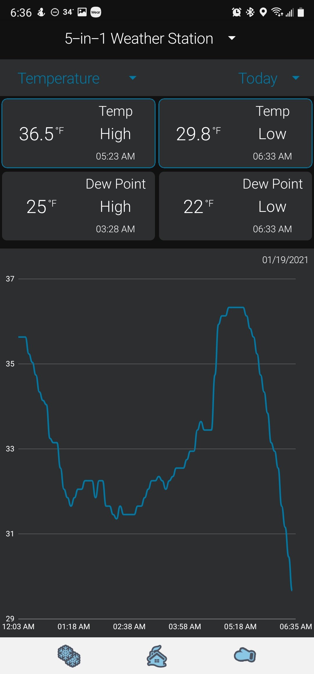
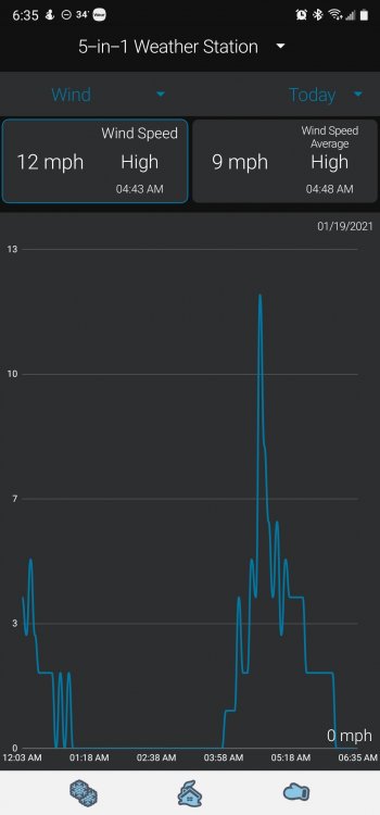
Hit 17 degrees at about 2:30am.. Some light breezes started and my temp quickly rose and now I am up to 28. Looks like a nice day ahead.
-
January Storm Term Threat Discussions (Day 3 - Day 7)
midatlanticweather replied to WxUSAF's topic in Mid Atlantic
I think that is when I found Eastern.. I remember a coworker calling me after the small stuff the day before that brought in the cold.. I said - "That was not it!" - he thought I busted. -
Little fun with the Temps and wind. Small gust caused Temps to rise earlier this morning, then we went back to calm and I am at the lowest temperature of the day.

-
Feb Long Range Discussion (Day 3 and beyond) - MERGED
midatlanticweather replied to WinterWxLuvr's topic in Mid Atlantic
Like we needed any depressing news -
Looks like a few snow showers far SE Loudoun moving into Fairfax.
-
Feb Long Range Discussion (Day 3 and beyond) - MERGED
midatlanticweather replied to WinterWxLuvr's topic in Mid Atlantic
Gfs -
So maybe the storm after the storm.. We play that card many times.
-
-
Little something/nothing on the gfs for the weekend. There.. somone had to say somethin'
-
And a bombing 1016 Low...
-
Meh...
-
Ya.. Me too...
-
We can hope... It seems that way, and I want to believe, but man it seems hard to get things right when the time approaches. I am hoping for better trends for next week..
-
Not exactly looking great beyond Tuesday's system either. The whole continent looks above Normal!
-
Yes and is running now
-
Gefs looks good for NC and Southern Virginia from what I have seen
-
Yes.. usually after they get snow in the south then it gets pulled NW and gets the folks up north! DC Snow Hole! I think we know this timeframe has potential - do we capitalize? Does anyone? We just have to wait and see how the actual outcome evolves! But waiting is the hardest part!
-
That looked like a great track for most of the run! But it did not go boom fast enough! We will see if this goes north and west with time.
-
That is a trend you do not want to see this early! It will be in PA by tomorrow at that rate of adjustment!
-
I do not think we are looking for perfect set up this early. We want the key players on the field - or Ducks on the pond.. or whatever.. a perfect set up will likely disappoint if modeled this early.
-
Hoping HH throws us some encouragement. Signals are not strong enough yet to get too invested through