KoalaBeer
-
Posts
636 -
Joined
-
Last visited
Content Type
Profiles
Blogs
Forums
American Weather
Media Demo
Store
Gallery
Everything posted by KoalaBeer
-
I take it back, that was pretty photogenic coming in over the back bay in Portland. You can really see the water start to get pushed across the bay. Nice storm with some good wind. Small branches down mostly.
-
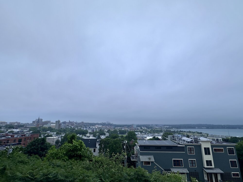
Certainly not photogenic storms. Looking out over Portland to the west.
-
Ya what a beast. These isolated supercells that attach themselves to the warm front tend to be memorable. Doesn’t look like it’s cycled at all and approaching 30 miles on the ground.

-
We allowed to talk severe wx in here for the heart of the country? Those regional forums are dead. That is an insane tornado in IL. The trajectory of that OKC cell is worrisome if it decides to touchdown something meaningful….
-

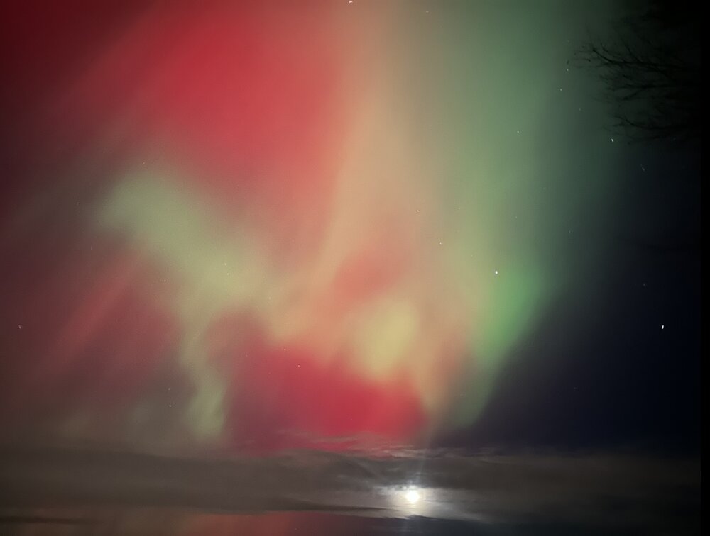
"Don’t do it" 2026 Blizzard obs, updates and pictures.
KoalaBeer replied to Ginx snewx's topic in New England
The mental image of TheSnowman going around the neighborhood measuring with his yardstick in a fit of rage until he finally has had enough, snaps the stick in half over his knee like a frustrated MLB players snaps a bat, all the while his neighbors sip hot cocoa watching from there windows pondering if they should intervene is humorous. Anyways, not a whole lot of snow up here in Portland ME but impressive blizzard conditions out there. Hopefully we can cash in later this week, especially the resorts. -
I use this. https://mesowest.utah.edu
-
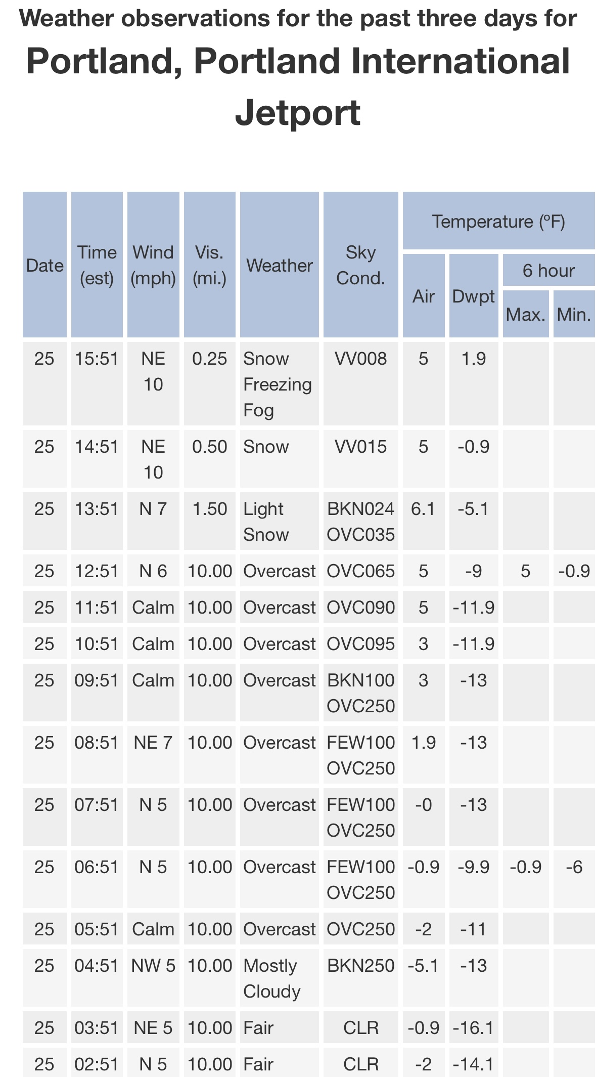
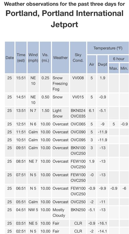
So much for a high of 16 today….really impressive storm with the rates combined with the arctic cold. Been a while since we’ve had one like this. Enjoy everyone.
-
January 2026 regional war/obs/disco thread
KoalaBeer replied to Baroclinic Zone's topic in New England
And this is why we can’t have nice things… When the actual Mets with a degree stop posting as much and we wonder why, the past few pages are the answer. I may not post much but the reason I lurk often is because of the insights you get here from actual meteorologists that they otherwise aren’t going to share on official NWS products etc. If you want a cookie cutter risk adverse discussion go read your local AFD twice a day dink. So a special thank you to posters such as Brooklyn, Coastal, Chris, Wiz, Seymour and Tip (even though I don’t know what you are saying 50% of the time, something about the flow being raging fast!) Your insights are much appreciated from me. -
Brick sidewalks are a literal death trap in Portland right now. Almost just died getting home from work, had to shuffle walk like a duck. 32 and light rain.
-
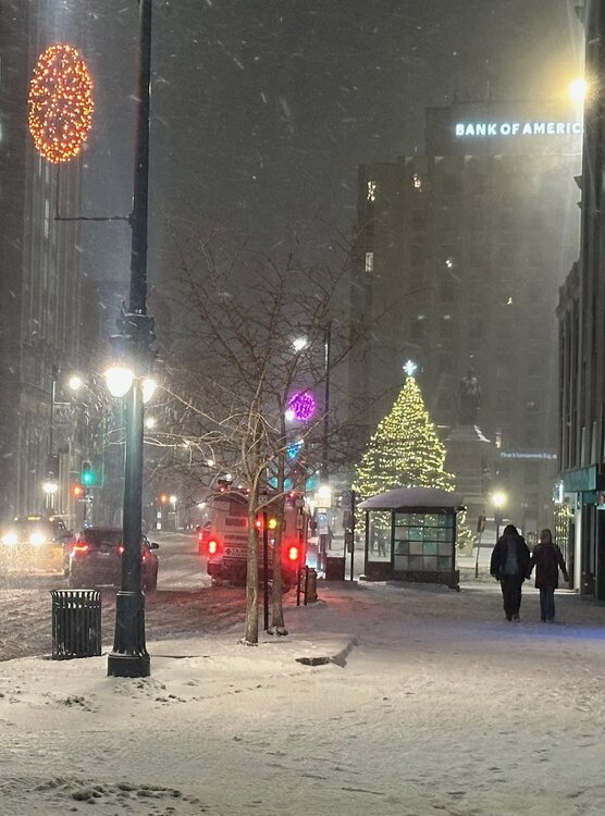
Festive in downtown Portland. Been snowing pretty much non stop since 9AM with not a ton to show for it but we’ll take it.
-
First Winter Storm to kickoff 2025-26 Winter season
KoalaBeer replied to Baroclinic Zone's topic in New England
Absolute white out on the Sunday River cams. Surprised to see no WWA up there from what people were telling me who travelled down from sugarloaf etc. today. Im liking my spot in Portland for Tuesdays deal. -
East end Portland ME about 15 minutes ago.

-
November 2025 general discussions and probable topic derailings ...
KoalaBeer replied to Typhoon Tip's topic in New England
I’ll come out of hibernation and bite against my better judgement. It’s funny (or not) how CC became such a bipartisan issue. I was watching the documentary The White House Effect on Netflix last night and didn’t realize how seriously the bush administration took global warming, at first accepting the scientific facts but eventually whitewashing it as up to debate. How much we have regressed since then is depressing. It should not be a D vs R issue. Anyways hope all of you are well. Just got a snowmaking gun delivered to work today so I’ll be making and frolicking in the white stuff before the rest of you weenies. -
Uhh just check the NHC website.. https://www.nhc.noaa.gov/refresh/graphics_at4+shtml/154002.shtml?cone#contents
-
Agreed. I guess that why I put capture in parentheses. I think the interaction will pull it more northward then some of the eastward solutions being thrown out there is all I’m saying. I like the St Marks call for landfall as a low end Cat 4. I certainly wouldn’t let my guard down in places like TLH.
-
Zooming out and looking at the big picture is mesmerizing. Strongly recommend going to watch the loop and switching over to water vapor as well which highlights the interaction with the trough. Already hints of it getting “captured” which I think limits how far east this goes. Despite what others are saying I’ll stick with the NHC. https://www.tropicaltidbits.com/sat/satlooper.php?region=us&product=wv_mid
-
Fair enough. It’s not super uncommon with these high end systems. Florence is another one that comes to mind that dropped a fairly widespread 20-30+ inches.
-
Tornado threat ramping up into the afternoon. CC drop on this one by Ehrhardt SC.
-
-
Straight from the mouth of the NHC. Just read the 5 pm forecast discussion. https://www.nhc.noaa.gov/text/refresh/MIATCDAT4+shtml/242058.shtml Of equal importance to the forecast intensity is Helene's forecast size. Helene's forecast radii are at the 90th percentile of major hurricane size at similar latitudes, and therefore storm surge, wind, and rainfall impacts will likely extend well away from the center and outside the forecast cone, particularly on the east side.
-
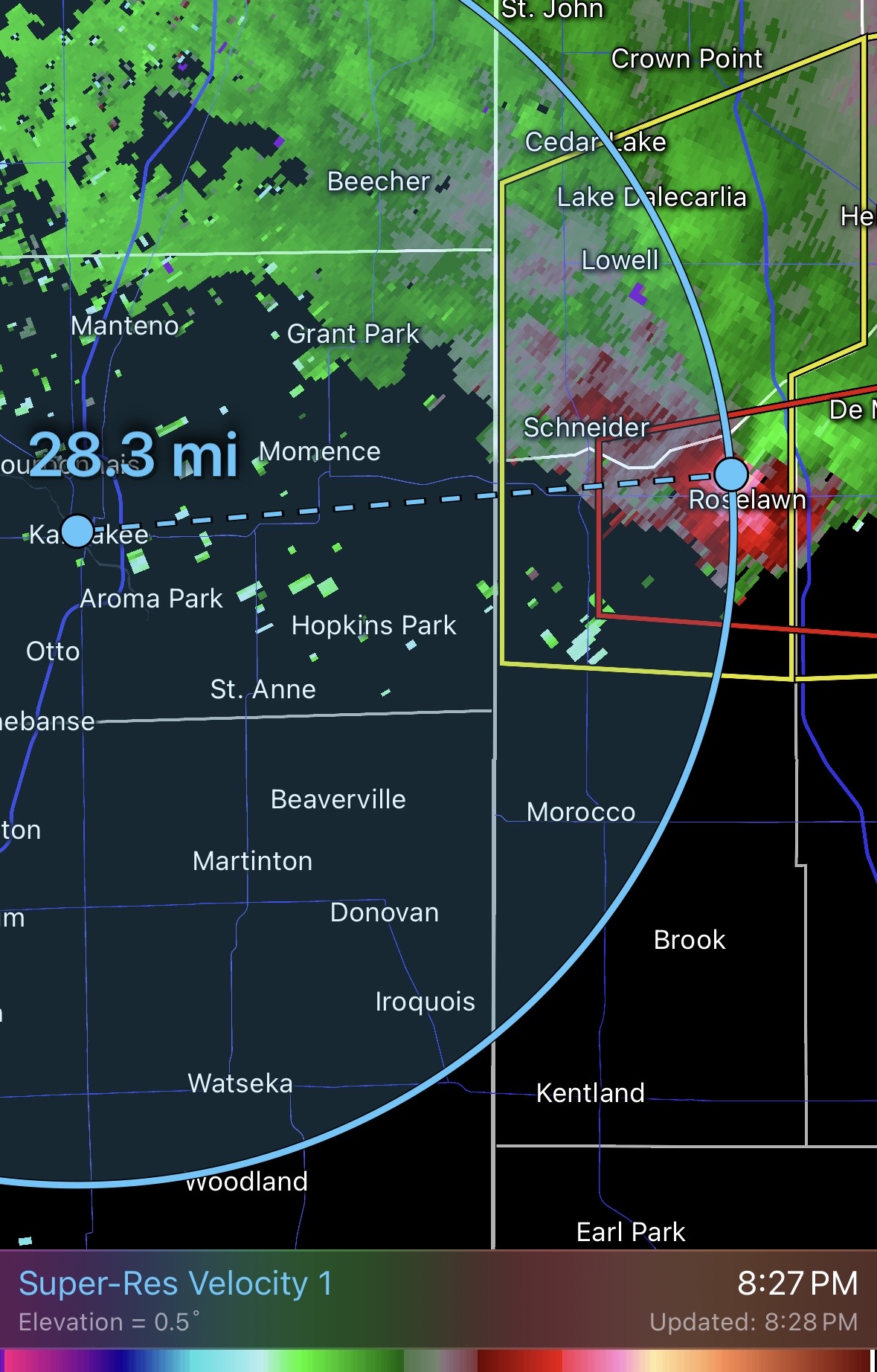
Wow, at work and did a quick radar check on my phone and that is quite the wall of TOR warnings across LA into TX. A few of them with a significant TDS on them.
-
Ya absolutely. Seen it time and time again. With enough time some systems can recapture it but that’s simply not the case here. Those broad cores can take quite a long time to reconsolidate into something that can RI. I like comparing it to some big severe weather days when people are drooling over those high STP maps. Sure there is a pristine environment for a violent TOR but the question is there a storm that is able to take advantage of it? I think your call is good even if it comes in a little weaker, it’s pretty hard to hit the nail on the head with a system like this.
-
Can’t argue with you there. Beryl kind of got the 1-2-3 whammy. Land interaction -> cool SSTs of the northern Yucatán -> dry air intrusion that was very apparent on WV loops.
-
Agreed. Despite pretty much all systems being go for intensification up until landfall it’s still to broad. Some systems just can’t get it back together after land interaction. Almost looks like it has subtropical characteristics to it. Still a dangerous storm for the TX coast and should intensify right up until landfall but I don’t think Beryl will be pulling a Harvey on us.
-
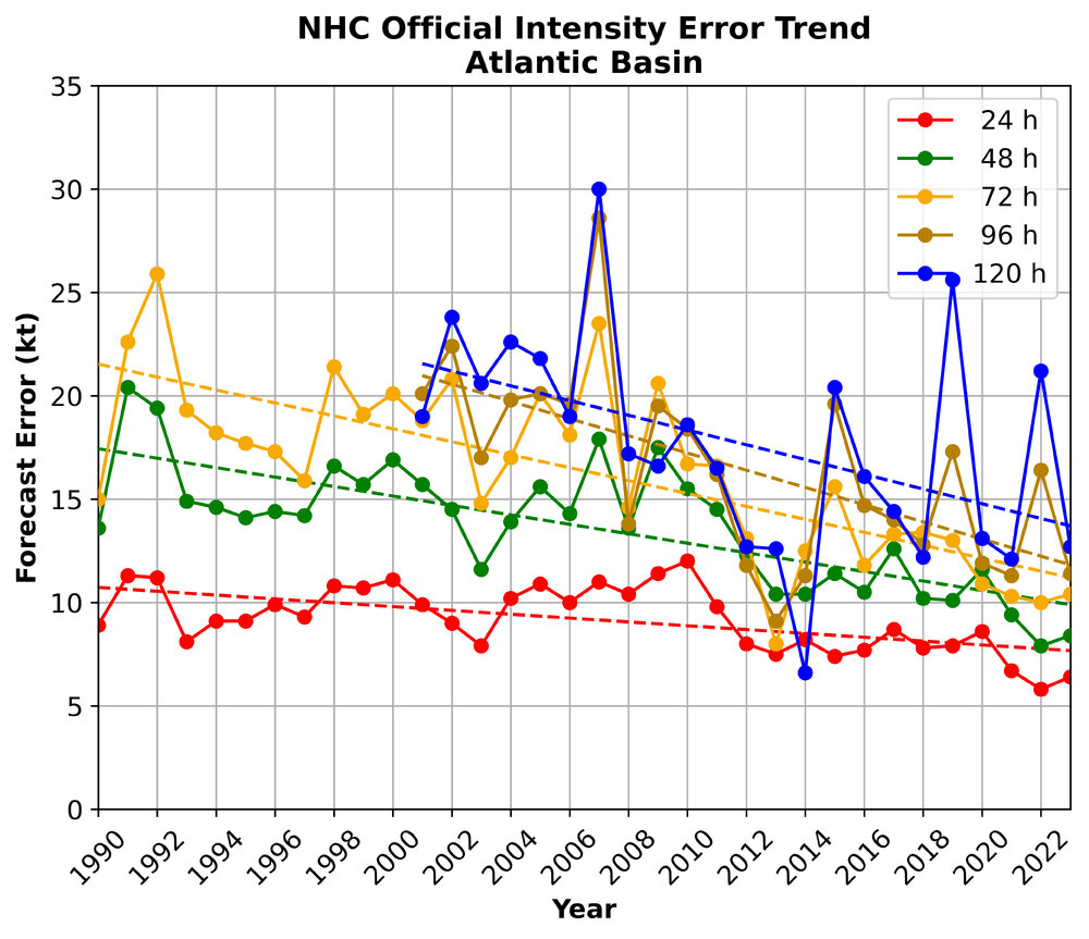
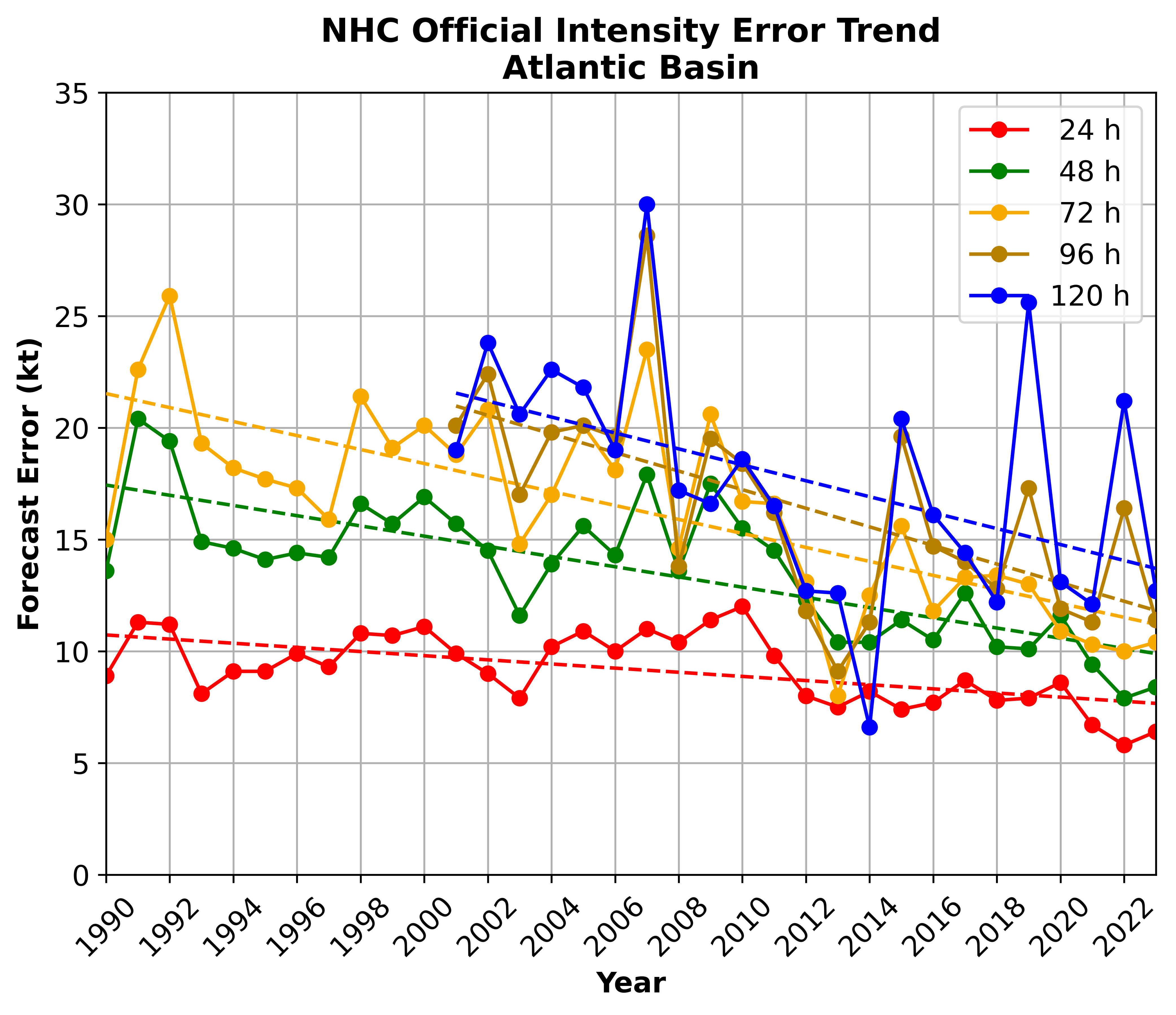
I feel like people are saying stuff like this all the time without any data to back it up…. I think it’s easy for humans to remember the storms that over performed on intensity, and not so much the forecasts that were accurate or the storms that underperformed. https://www.nhc.noaa.gov/verification/verify8.shtml https://yaleclimateconnections.org/2023/06/which-hurricane-models-should-you-trust-in-2023/