-
Posts
3,332 -
Joined
-
Last visited
Content Type
Profiles
Blogs
Forums
American Weather
Media Demo
Store
Gallery
Everything posted by CheeselandSkies
-
DVN has added the video still I offered them (same as my avatar) to their 3/31 event page. https://www.weather.gov/dvn/summary_03312023
-
Yeah, we got lucky in that the active storm pattern pretty much shut down after the 4/4-4/5 event. In 2008 we had a big melt followed by relentless thunderstorm (including training MCS) activity for about three weeks straight from late May into June.
-
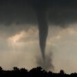
Mayflower-Vilonia tornado of 2014
CheeselandSkies replied to Chinook's topic in Central/Western States
This is getting into a whole OT can of worms but IMO this is bogus because it was said when the EF-scale was adopted that it would be a 1:1 changeover from the original Fujita scale, I.E. an F0 then would be an EF0 now, and so on all the way on up. Obviously in practice that's not true because the definitive descriptor of F5 damage was "strong frame houses lifted off foundations and carried considerable distances to disintegrate...". Now of course, not all frame houses are created equal and "strong" is subjective so applying some engineering standards and scientific rigor isn't a bad idea, but the pendulum has swung too far, in some cases very much too far in that direction. Now, I agree with @andyhb that Vilonia 2014 is the most egregious case of this (just ahead of Chickasha and Goldsby, OK 5/24/2011), and set a bad precedent to the point where it's gone way beyond the understandable challenges with determining the difference between EF4 and EF5 based on the engineering quality of a structure that no longer exists, and resulted in suspiciously lowballed ratings much further down the scale (to the point where in some cases we've seen the sweeping away of frame homes initially rated as low as EF2, which is outside the bounds of the scale, before being "corrected" to low-end EF3). -
July 1995 is one of those rare weather months that stands out in my memory. At the time we lived in a house with two window A/C units, one in the living room and one in my parents' bedroom which they didn't like to use because they didn't trust the wiring up there (1920's house with one two-prong outlet per bedroom, except the master which had two, my dad upgraded all the wiring on the first floor but never got around to the second before we moved out). I don't think nine-year-old me wore a shirt outside of school all month. Fans going full blast in every room and almost nightly thunderstorms. Good times.
-

Mayflower-Vilonia tornado of 2014
CheeselandSkies replied to Chinook's topic in Central/Western States
This is something I just learned recently from watching Trey Greenwood's videos but this is a good, stark example here. The hodograph shape will resemble the radar structure of supercells that form in the shear environment it represents. We can see how the hodograph folds back on itself in the upper levels, and thus how the storm's forward-flank core curls out ahead of the tornado's path. This can make for not-great viewing conditions even though the rear flank is fairly well separated from the core and not "rain-wrapped" in the stereotypical HP fashion. Something similar was observed at Louisville, MS the following day. OTOH the storm I chased in Iowa on March 31 formed in an environment with much less clockwise curvature in the upper levels, the hodograph went straight out to the northeast and very little rain fell in the eventual path of the tornado as the storm's core skirted by to the north. -
They've finally corrected/updated the survey to reflect the fact that a cycle occurred just southwest of Keota. So it's now properly two tornadoes, one EF3, one EF4. https://www.weather.gov/dvn/summary_03312023
-

Spring 2023 Medium/Long Range Discussion
CheeselandSkies replied to Chicago Storm's topic in Lakes/Ohio Valley
Gotta love spring in the Midwest. -
Reedited my footage to cut out most of the low-contrast approach of the original Ottumwa/Farson tornado, refined my contrast adjustments on some of the shots and actually added a couple seconds to the shot crossing 92 which I had cut when I didn't really need to.
-

April 2023 General Discussion
CheeselandSkies replied to PositiveEPOEnjoyer's topic in Lakes/Ohio Valley
We palmin' now.- 512 replies
-
Kinda interesting that they haven't seen fit to use it since, even with the extreme conditions of 4/27/11 or that infamous HRRR simulation on 5/20/19.
-
Do they still have the Ottumwa-Keota-Kalona family as a single EF4 path?
-

Spring 2023 Medium/Long Range Discussion
CheeselandSkies replied to Chicago Storm's topic in Lakes/Ohio Valley
Western Plains especially Kansas desperately need rain. That said it's relatively not too bad further SW in the more traditional EML source region, so kind of a mixed signal for the rest of chase season. -
Well, I couldn't catch lightning (or a tornado) in a bottle twice in a row. Spent the afternoon moseying on down from Dubuque to Mt. Pleasant. Didn't want to commit to the stuff further west in Iowa because I thought the mixing problems would kill tornado potential with it. Finally decided to start making my way east on 34 into IL while the seemingly disorganized convective cluster was coming out of MO just to my south. My main goal at this point was just to stay out of any heavy rain/hail from it and start making my way home. Of course this is when it finally got its act together and went tornado warned, but there was no way I could get a view of the base without driving directly through the core, so I just continued heading home. Elevated hailers kept firing all around making for a decent lightning show, but I managed to avoid nearly all precip on the drive up US-67 to the Quad Cities, then north on 61 back to Dubuque and 151 home. Didn't sting nearly as bad as it would have without Friday, though.
-
HRRR is consistentlly firing a supercell in SE IA between 23 and 00Z, but soundings around it are still either super mixed or have a weird low-level inversion. The favorable environment might exist only right on the warm front, where it's impossible to get an uncontaminated sounding. Low-level shear is monstrous in any case, though. It is also showing some mid-morning convection in the area which you'd think might alleviate the mixing issue, but so far it doesn't seem to be according to the model.
-
Found the PDS on the NAM despite that hellacious inversion.
-
NAM cool bias at play again? Just a real headscratcher how we have some models with hot temps/mixing issues and some with capping issues due to cool temps. It is quite dry at 700mb, though. Although I remember people saying dryness at 700mb was gonna be a problem on the Gilmore City day last April.
-
I wonder if the HRRR is still having those overmixing issues @andyhb mentioned and if so, at what point it will catch on.
-
Interesting the HRRR still blows up that monster simulated supercell in IL tomorrow but the environment ahead of it is not really impressive...super mixed and with ho-hum low-level shear. I can't get a good sounding in proximity to it that both has impressive parameters and isn't contaminated. Also interesting that the globals (namely EURO) are more bullish on convection than the CAMs.
-
@andyhb What do you make of some of these RAP soundings? Parameters are absolutely off the chains but there's that pesky low-level inversion. Just the other day we were talking about temps in the 80s and mixing issues, but a lot of these seem too cool (uppers 60s/low 70s) almost like we're more used to seeing from the NAM?
-
Yeah, I agree on that.
-
That was initial thinking but now looking like the trough is ejecting more slowly.
-
With the Day 3 update I'm wondering now if Tuesday's initiation (if any) will be too far west for me to chase, even though it should be quite a bit later than last Friday's. Not really keen on a west of I-35 target after working 3AM-noon. Was one of the things that made Friday a no-brainer go for me.
-
I think the main things that's' not always conveyed is that oftentimes the sparser the storm coverage, the more dangerous the hazards can be from any one storm. Meteorologists & chasers know it, but EMs and the general public usually do not.
-
Yeah, I only found out about that when I was looking through the Wikipedia tornado list last night (still waiting on DVN to officially confirm the handoff near Keota instead of having one EF4 path all the way from Wapello County up to Johnson County, been spamming them on Facebook with me and @hlcater's video). Sounds horrible, but they actually got lucky it wasn't a stronger tornado.
-
Out now...very interesting and rather ominous wording for both ends of the setup (southern one also upgraded to tornado-driven MDT).


