Hank Scorpio
-
Posts
395 -
Joined
-
Last visited
Content Type
Profiles
Blogs
Forums
American Weather
Media Demo
Store
Gallery
Everything posted by Hank Scorpio
-
That neighborhood must have had the most robust obs reports in the region. Easiest way to spot fellow weather weenies in the neighborhood is to find the good weather stations, I've found.
-
Never knew I was the closest in proximity to @Ji out of anyone on the board...neat.
-
This accumulation distribution matches the January 22/23 1940 storm pretty closely. Richmond received 21" and DC got 15". I believe that is still the biggest storm on record for Richmond. No idea if any part of the pattern or storm evolution is also a match, but there is at least historical precedence for accumulations like this.
-
Add snowshoes to our hospital bag... Got it! A few days after the snow stopped in the January 96 storm, they did send a humvee down our street to pick up my neighbor. She was a nurse at the local hospital and I guess it was way past time for shift change.
-
I mentioned in a different thread last week that my wife and I are on baby watch. We're still on baby watch, and now I have a bunch of logistical questions about snow I hadn't previously considered. For example, what if everything goes great for us and for snow lovers, the hospital discharges us, but our streets aren't plowed?
-
Really does feel like cold wind is our weather most days in the winter, spring, and fall. I at least finally figured out how to keep my very heavy deck furniture from going sliding across the deck. Bummer about the bronchitis. Is that something that just needs time to resolve? We have the flu in my house and as you might guess, it's quite unpleasant. Sooooo fatigued.
-
Thank you, and congrats to you as well! I hope your wife and your son (and you!) are doing well and starting to settle into a routine now. It was slippery out that day and the next morning. Always interesting to see which roads get attention and which don't.
-
I can almost guarantee we jackpot, simply because my wife and I are on baby watch and that's how these things go. A blizzard baby would make for cool memories, even if it did create some logistical issues for us haha
-
28/23 I'm supposed to be driving down to Richmond early tomorrow morning for work. Gonna see how things look at 6 and then perhaps issue a two hour delay for myself.
-
Vivid lightning and loud thunder with that cell that just moved through Loudoun. Sounded like a good old summertime thunderstorm
-
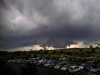
I don't have great visuals to share, but in person it looked mighty interesting too. Lots and lots of motion all over the place
.gif.e18ec7b35ed88921ee144b9367100da0.gif)
- 1,378 replies
-
- 9
-

-
- severe
- thunderstorms
- (and 2 more)
-
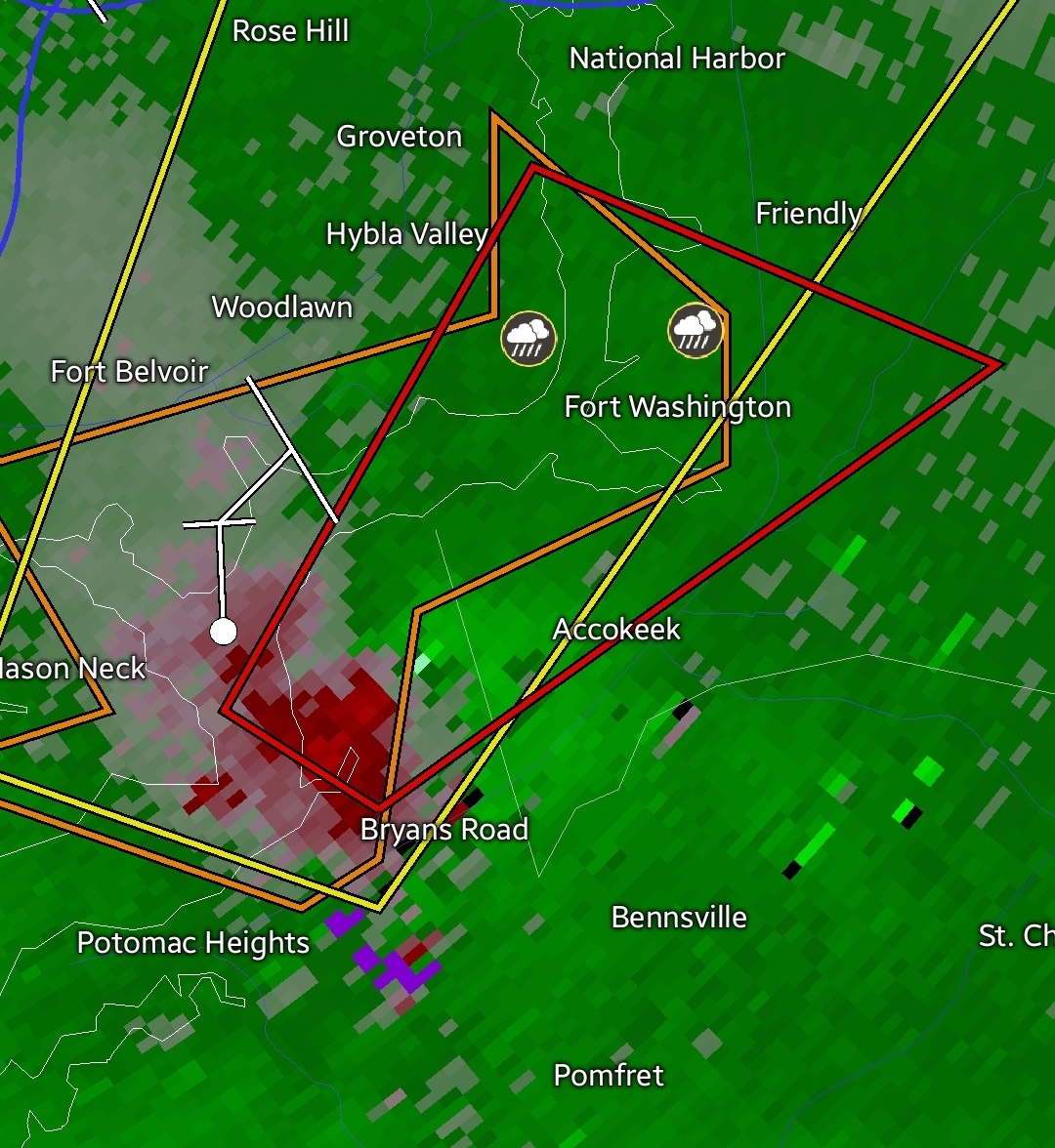
The storm moving across northern Loudoun right now looks awesome. Lots of lightning though, so I got outta my viewing spot pretty quickly
-
Very similar story a handful of miles to your south in Leesburg. 9.42" in May 3.17" in June 1.34" so far in July I know it'll turn around at some point, but it's been wild watching almost every storm blow up to our south and east over the past month. Even stuff that's looked good on approach from the west has died just before arriving and then ramped back up to my east.
-
Can't seem to buy a drop in Leesburg. We've seen 0.03" today. That makes for a total of 0.44" over the past two weeks. I'm sure it'll balance out eventually though.
-
That cell in WV is looking really explosive...bubbling up like crazy
-
Yep, good call

- 1,378 replies
-
- 1
-
-
- severe
- thunderstorms
- (and 2 more)
-
Yep, exactly. Last month they kicked my son's team off the field in the middle of a game. Apparently the decision to close the park happened late. Instead of just letting the little kids finish their soccer game, they insisted everyone leave the field immediately.
-
Oooof, 89 with a heat index of 95 according to my tempest. Feels every bit that hot if you sit outside for a few minutes, too.
-
Little mini train setting up for those of us in Leesburg. Nothing compared to what's hitting the western part of the state, but padding stats for sure. Up to 1.4" today and closing in on 5" for the month.
-
Picked up .33 in about 10 minutes from the edge of that cell that worked it's way through the middle of Loudoun. Also looks like a house a couple of streets over got struck by lightning
-
1.5 yesterday and 1.03 today. Guessing that was my heaviest rain of the year that fell yesterday, since the 1.5 inches fell over a combined 162 minutes. Also kinda crazy that I received about 25% of my yearly rain total over a span of 18 hours these past two days.
-
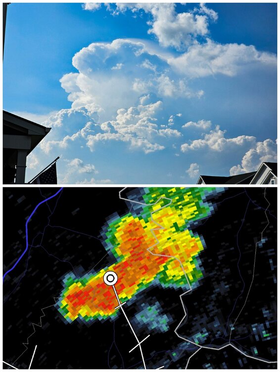
Wow, yeah, I think that spike coming off the cell at the 4 o clock position is a classic indicator of very large hail.
-
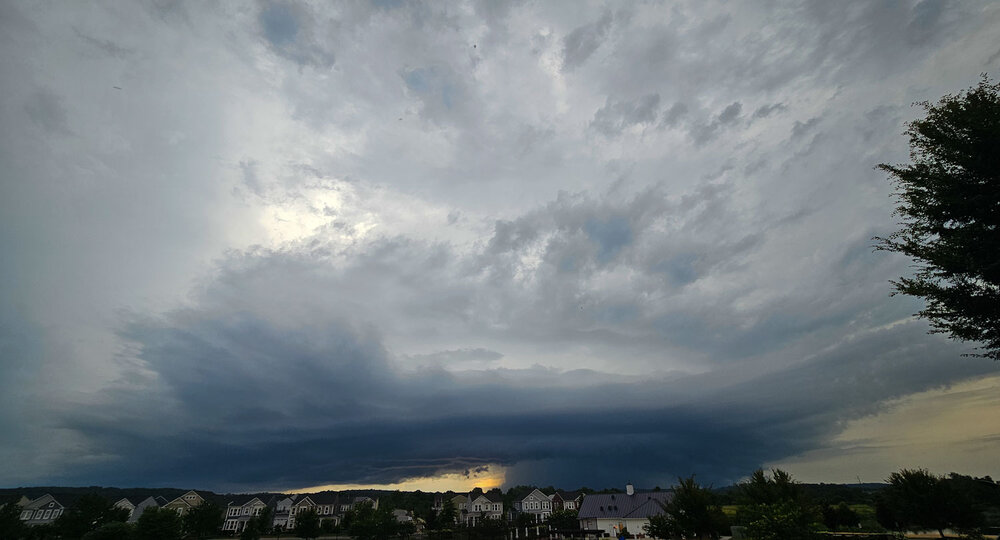
Nice little storm moving through Loudoun. Bit of wind, some pea sized hail, heavy rain, and a few claps of thunder. Hopefully just the start of a stormy stretch for the area.
-
Yep, same for us with the soccer season. This will be week 5 and they've played 1 game. Maybe the whole thing will keep slowing down and it'll stay dry until the evening. After that, bring on the deluge.
-
Beautiful out there this evening. The winds have died down and it feels perfect if you're out in the sun. 62° under clear skies currently.