NJwx85
-
Posts
19,676 -
Joined
-
Last visited
Content Type
Profiles
Blogs
Forums
American Weather
Media Demo
Store
Gallery
Everything posted by NJwx85
-
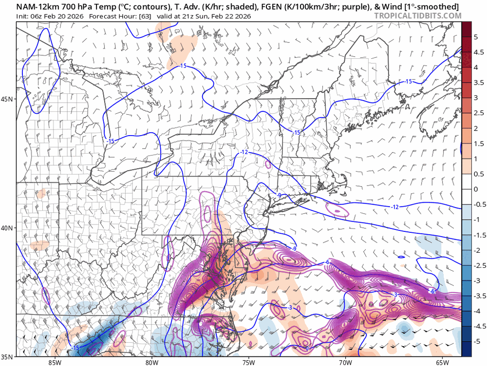
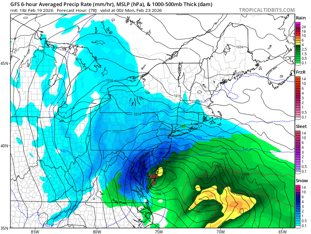
This is a classic deformation band system. If you're under the banding, you will get dumped on. If you're not under the banding, you won't get much. This is similar to, "holds my nose" Juno and the Boxing day 2010 system. The one we had in January was a completely different setup even though both are Miller B's.
-
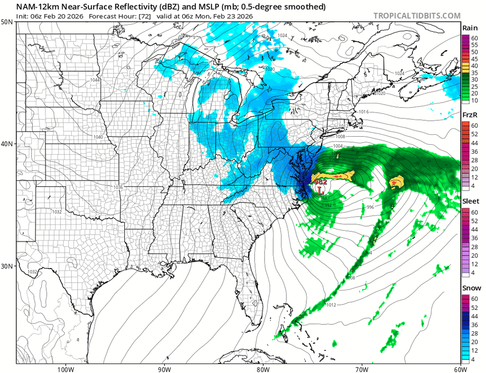
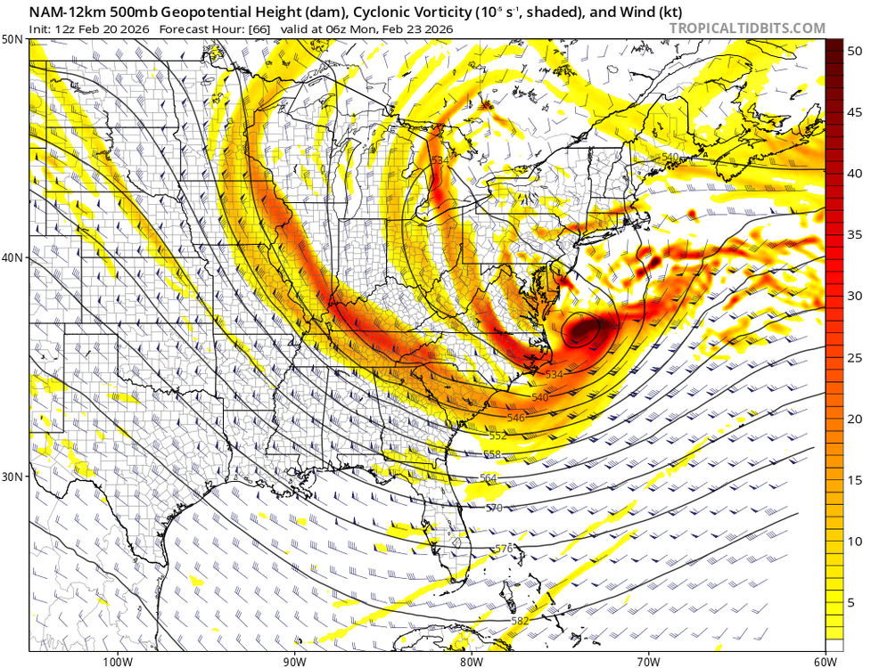
The reason for the sharp cutoff on the NW side is because the storm stacks and occludes around 12z on Monday. We could use another 50-75 mile shift NW to get into the high end stuff. You're also looking at near blizzard conditions for Long Island and coastal NJ.
-
Bid deformation band incoming. Still looks like a Central Jersey special but this is well North of the last run.
-
-
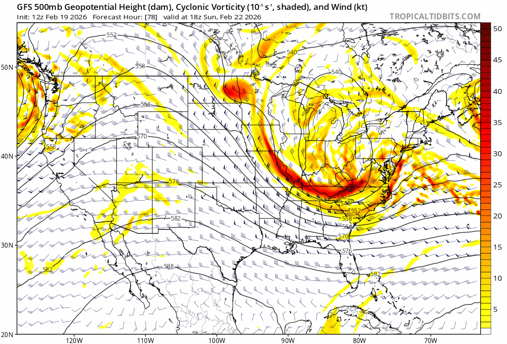
Pretty close to textbook for a big Noreaster.
-
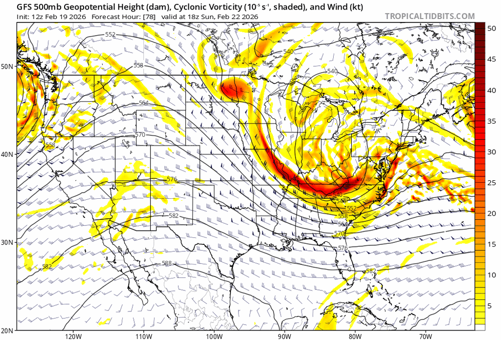
H5 on the NAM looks good. it digs a bit less which is better in this case and the trough is stronger and more negatively tilted.
-
The spread is crazy considering we’re under 72 hours.
-
-
Heavy snow Sunday night with near Blizzard conditions, especially South and East of the city.
-
Wagons North!
-
Much better look for us.
-
No real changes on the GFS through 60 hrs. Maybe just a hair slower at closing off the trough over the mid-west.
-
The 18z GFS is not a huge hit LOL, but it is a tick further North than the 12z run was. It would be enough for a low end warning level storm for most.
-
It's funny how I got killed a few hours earlier for saying that the early 12z suite was probably nonsense, and then the Euro came out, and it pretty much confirmed what I suspected. This could be a few inches, especially for Eastern areas, but I don't see how it's much more than that.
-
Color me shocked that the Euro isn't on board.
-
When we get a run where the SLP tracks inside the benchmark, then I'll get excited. Also, when something shows more than just a glancing blow from the deformation banding which largely remains offshore, even with today's 12z suite so far.
-
My past experience tells me otherwise, but let's see where we are at this time on Friday.
-
This is probably close to the ceiling with this unless there are a few significant changes.
-
I'm not writing this off 5 days out. I just know from experience that this setup favors SNE. Aside from a few runs here and there, most of the snow has been from the initial overrunning/inverted trough, rather than from the coastal itself, which develops too far offshore. Even the 18z GFS from yesterday, which was really tucked in at H5, had most of the precip offshore.
-
Just close enough to wave goodbye as it slams Cape Cod. Late developing Miller B's are never good for this area.
-
Yeah, and? The 500mb low passes well South and East of the benchmark. There is no mechanism to bring it North. The trough digs too far South.
-
I see the 12z GFS is further North. I just think, given this setup at H5 that this will develop/bomb out too far offshore. The overrunning precip to our West will dry up and everything will jump offshore. This favors SNE.
-
I was never excited about this threat. To me, it always looked like a late blooming Miller B/Inverted trough which is never good for us.
-
The storm on the GFS around 2/11 has some promise. It’s a similar setup to last weekend.
-
Anyway, looks like a threat of a few inches next Wednesday.