NJwx85
-
Posts
19,806 -
Joined
-
Last visited
Content Type
Profiles
Blogs
Forums
American Weather
Media Demo
Store
Gallery
Everything posted by NJwx85
-
https://www.threads.com/share/BAU6zWmE9q/
-
My guess is Cat 2 at landfall with numerous gusts over 100mph reported.
-
That’s not the northern eyeball. The eyewall is still well offshore.
-
Half canes are very common in these setups due to the downsloaping effect. Essentially the air is comparatively much drier over land and naturally gets wrapped around due to the counter clockwise flow. A very intense tight core sometimes can overcome this. That combined with the shear is why it’s weakening now or at the very least leveling off and that has been clearly in the tropical guidance for a few days now.
-
All of the really deep convection today has been on the Western side of the circulation. I believe the Eastern side has been getting choked off some by the drier air wrapping in.
-
Strong Nor'Easter/Hybrid Storm Late September 2026
NJwx85 replied to Rjay's topic in New York City Metro
No. This will just weaken and slowly pull away. -
Strong Nor'Easter/Hybrid Storm Late September 2026
NJwx85 replied to Rjay's topic in New York City Metro
I was out in Easton most of the day today. Sheet drizzle all the way out and back. It was surprisingly windy out there. Now steady rain in Rockland. -
Strong Nor'Easter/Hybrid Storm Late September 2026
NJwx85 replied to Rjay's topic in New York City Metro
Very rainy and windy overnight in Rockland. More heavy rain tonight and at least another 24 hours of this to go. -
Strong Nor'Easter/Hybrid Storm Late September 2026
NJwx85 replied to Rjay's topic in New York City Metro
Just getting started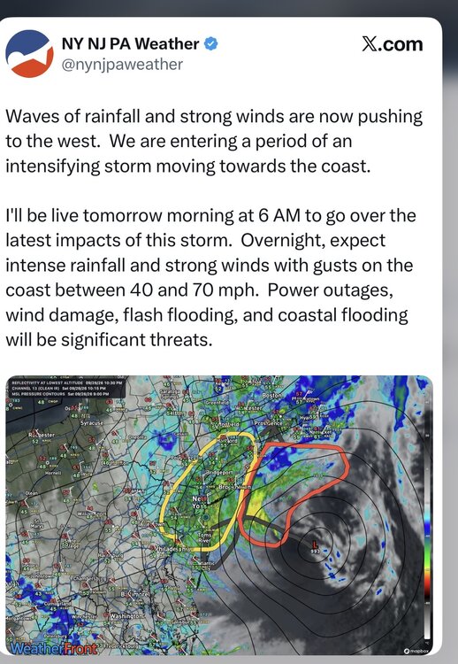
-
Strong Nor'Easter/Hybrid Storm Late September 2026
NJwx85 replied to Rjay's topic in New York City Metro
A lot of that falls tomorrow night into Monday.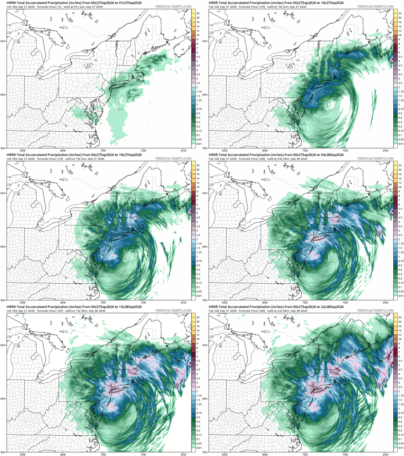
-
Strong Nor'Easter/Hybrid Storm Late September 2026
NJwx85 replied to Rjay's topic in New York City Metro
We’ve had quite a bit of rain in Rockland. -
Strong Nor'Easter/Hybrid Storm Late September 2026
NJwx85 replied to Rjay's topic in New York City Metro
Less lift. That will change as time goes on. -
Strong Nor'Easter/Hybrid Storm Late September 2026
NJwx85 replied to Rjay's topic in New York City Metro
This was the 12z EURO through 00z Tuesday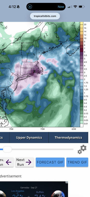
-
Strong Nor'Easter/Hybrid Storm Late September 2026
NJwx85 replied to Rjay's topic in New York City Metro
Radar is jacked -
Strong Nor'Easter/Hybrid Storm Late September 2026
NJwx85 replied to Rjay's topic in New York City Metro
Ummm, there’s convection firing near the center and quite a bit of lightning now.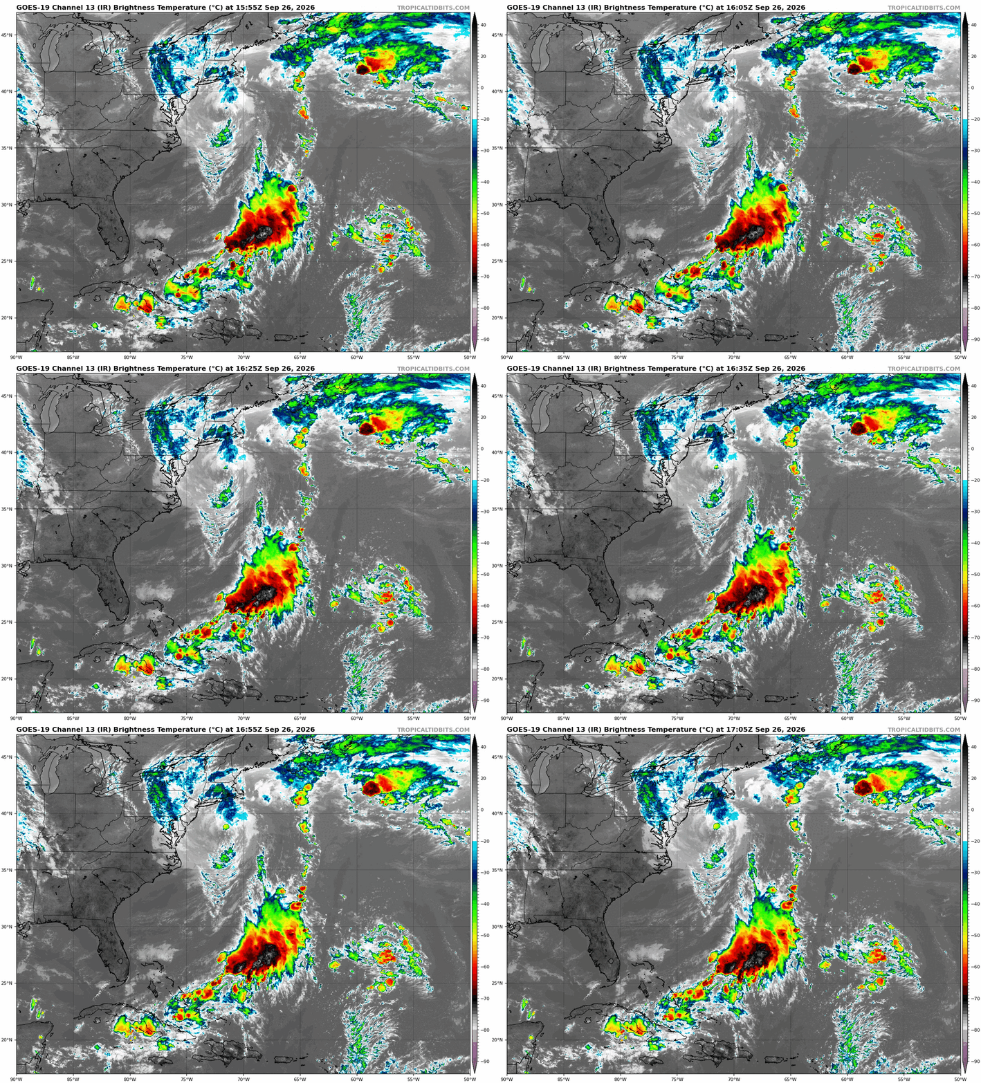
-
Strong Nor'Easter/Hybrid Storm Late September 2026
NJwx85 replied to Rjay's topic in New York City Metro
If you’re talking about 30 (White Horse Pike) most of that portion of the road is at sea level. It floods there during astronomically high tides. It used to be a great crabbing spot. Check out the High Point Pub in Absecon. Great wings, calzones and other food. It looks like a bar from the outside but there’s a large dining room in the back. And Ghilchrest for breakfast. Best blueberry pancakes you’ll have in your life. -
Strong Nor'Easter/Hybrid Storm Late September 2026
NJwx85 replied to Rjay's topic in New York City Metro
Did you miss all that rain over the sound? -
Strong Nor'Easter/Hybrid Storm Late September 2026
NJwx85 replied to Rjay's topic in New York City Metro
The only thing is, as it comes West, that will start the weakening phase. But there will be a window where things peak wind wise late tonight or early tomorrow morning. -
Strong Nor'Easter/Hybrid Storm Late September 2026
NJwx85 replied to Rjay's topic in New York City Metro
And I know I’ve been skeptical of this being tropical but the current radar does look more like a hybrid. -
Strong Nor'Easter/Hybrid Storm Late September 2026
NJwx85 replied to Rjay's topic in New York City Metro
Also I really don’t see much of a break. The low is stationary and the bands will continue to rotate in. It won’t be steady but it will be frequent. -
Strong Nor'Easter/Hybrid Storm Late September 2026
NJwx85 replied to Rjay's topic in New York City Metro
There’s some elevated instability. There will be some embedded thunderstorms in these bands. Wouldn’t be shocked to see a waterspout or two later try and come onshore. -
Strong Nor'Easter/Hybrid Storm Late September 2026
NJwx85 replied to Rjay's topic in New York City Metro
Raining here. We need an observation thread. -
Strong Nor'Easter/Hybrid Storm Late September 2026
NJwx85 replied to Rjay's topic in New York City Metro
Might just be my eyes deceiving me but this looks West of where it should be at this range. -
Strong Nor'Easter/Hybrid Storm Late September 2026
NJwx85 replied to Rjay's topic in New York City Metro
The high winds. It’s dangerous. -
Strong Nor'Easter/Hybrid Storm Late September 2026
NJwx85 replied to Rjay's topic in New York City Metro
The AC/DC concert at MetLife tonight has been postponed