NJwx85
-
Posts
19,685 -
Joined
-
Last visited
Content Type
Profiles
Blogs
Forums
American Weather
Media Demo
Store
Gallery
Everything posted by NJwx85
-
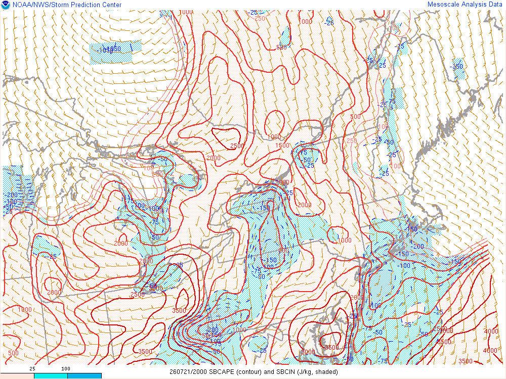
Believe it or not, the atmosphere is still fairly unstable West of the city. We shall see.
-
I think the tornado threat is over for the most part. The best parameters have shifted East and are mainly offshore. Also looks like the squall line threat for later is diminishing.
-
Would not shock me at all if we end up with 1 or 2 strong tornadoes.
-
Watch the storm near Allentown. That’s next to go boom.
-
4 separate tornado warnings now in NNJ and storms are training.
-
Source?
-
3 separate tornado warnings now, and the one in NJ was extended East.
-
-
The tornado warned storm looks legit on radar.
-

-
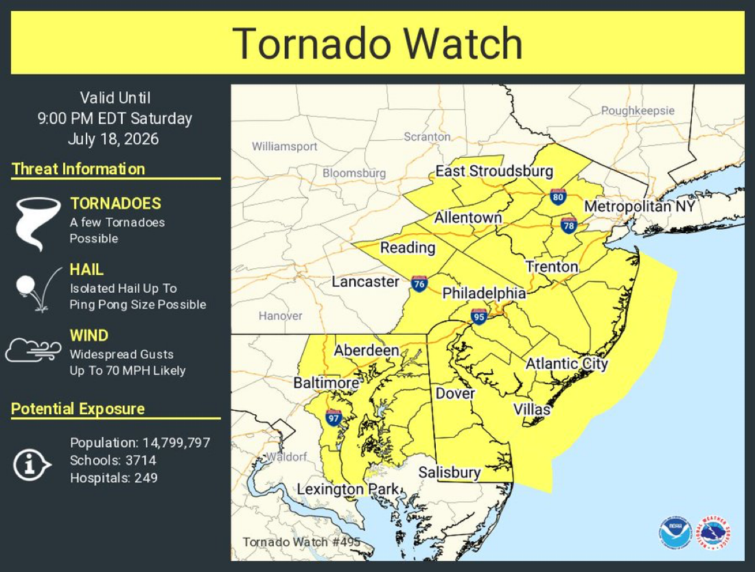
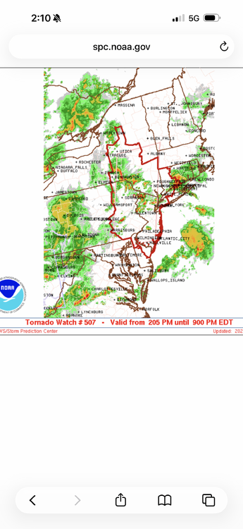
Tornado Watch
-
Tornado warning now in Western NY. Ontario County.
-
Tornado warning in Southern PA. Legit supercell. That’s what’s coming here. We just need the last of the crappy convection in NE PA to clear.
-
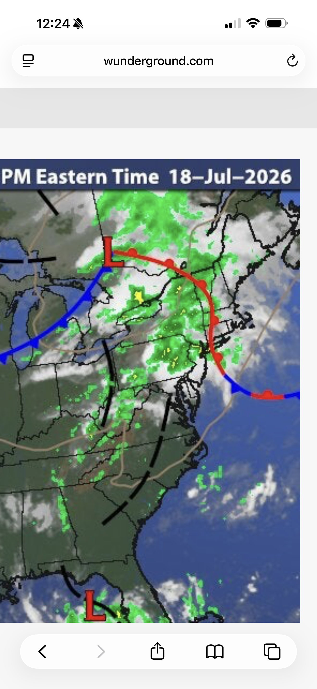
Our tornado/severe threat is currently back in Western PA. You can see some discreet cells popping up. SPC will be updating soon. In the meantime, the warm front is slightly over performing thus far. You can see the troughs over PA which will provide dynamics and veering winds.

-
Don’t you ever get tired of downplaying every event before it starts? All of this is following the forecast thus far.
-
Just wanted to clarify since some would assume it covered the entire days activities.
-
The steady rain in NE PA is drying up. All these things are great signs. Full steam ahead for mid to late afternoon.
-
This is only regarding the morning threat.
-
This is the warm front which sets the stage for later. Without it there wouldn’t be much of a severe threat later.
-
The Northern part of the line is warned now. 60mph winds and nickle hail.
-
The severe threat isn’t unitil mid afternoon. The only model thus far that has handled the convection ongoing reasonably well is the HRRR. All the ingredients are there but storm coverage will still be scattered. If the warm front gets hung up further South that would shift the main threat more towards Philly but SPC and NWS confidence is high which is why the elevated risk was expanded Northeast.
-
Severe threat is legit today. Storms will be dynamicly driven given the cold front. Veering winds could produce a few tornados. Main threat is damaging wind which looks higher end at the moment.
-
Up to 68 in Perth Amboy and most of coastal Monmouth County and Western Staten Island now pushing 70 degrees. Meanwhile Coney Island and the rest of the Long Island barrier islands are stuck in the mid to upper 40's. The warm front is into central New England but the wind is mostly Southerly. Some surface based instability is building just to our SW. I know the HRRR isn't particularly enthusiastic East of Morristown, but there is potential for a quick spin up ahead of the main squall line.
-
Not sure where exactly you're located, but Toms River is definitely on the Eastern edge of the threat area, hence the tornado watch.
-
Currently 64 in Keansburg with a Southerly wind, and 45 in Sea Bright with wind off the ocean.