NJwx85
-
Posts
19,663 -
Joined
-
Last visited
Content Type
Profiles
Blogs
Forums
American Weather
Media Demo
Store
Gallery
Everything posted by NJwx85
-
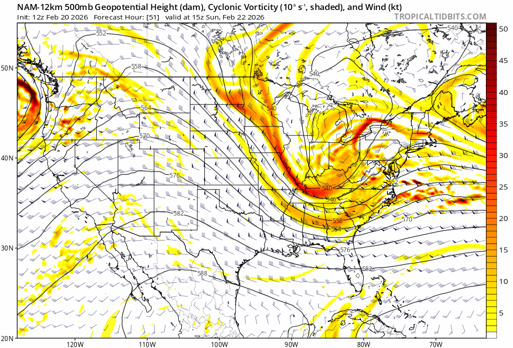
Just to jump on the wind potential again, no inversion so the stronger gusts should mix down well

-
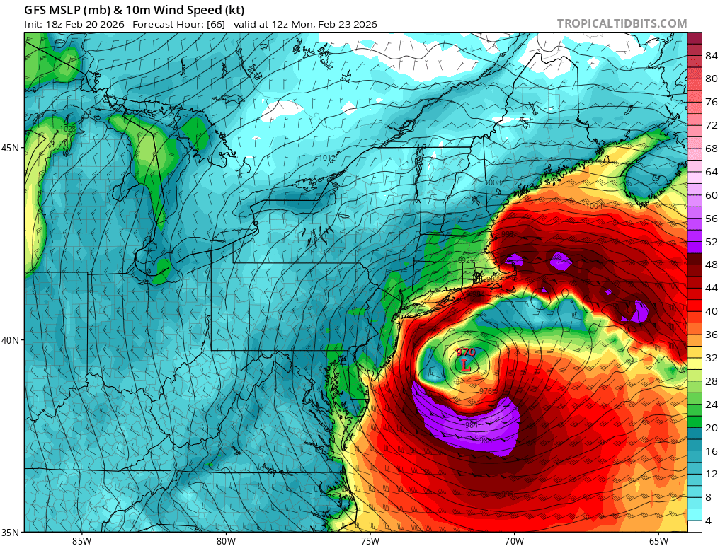
The wind isn't going to help things. Even the GFS has sustained winds of 20-30kts well inland Sunday night.

-
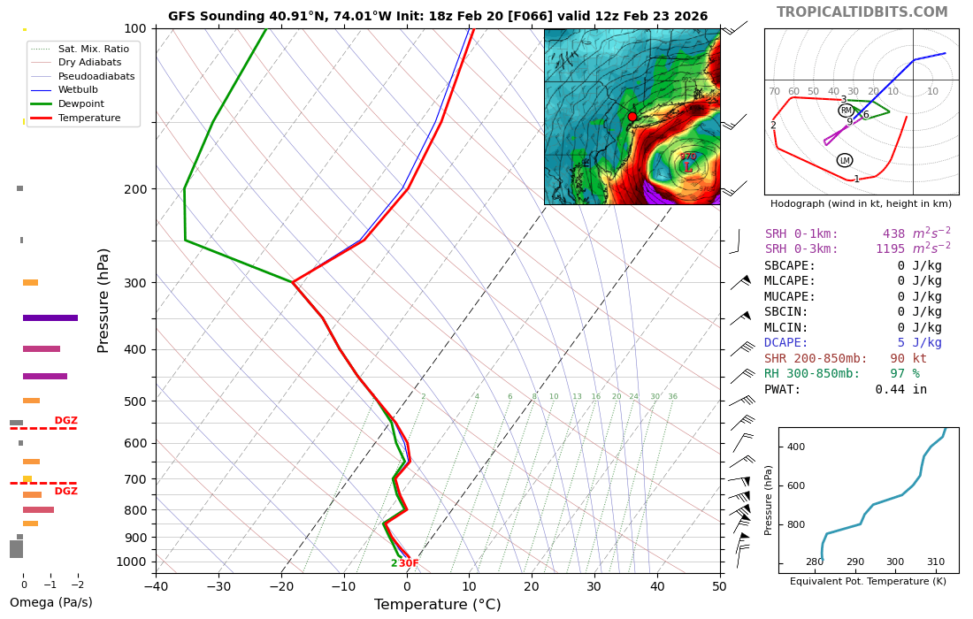
Yes, this is the type of setup where you can get thundersnow. The dynamics are through the roof.
-
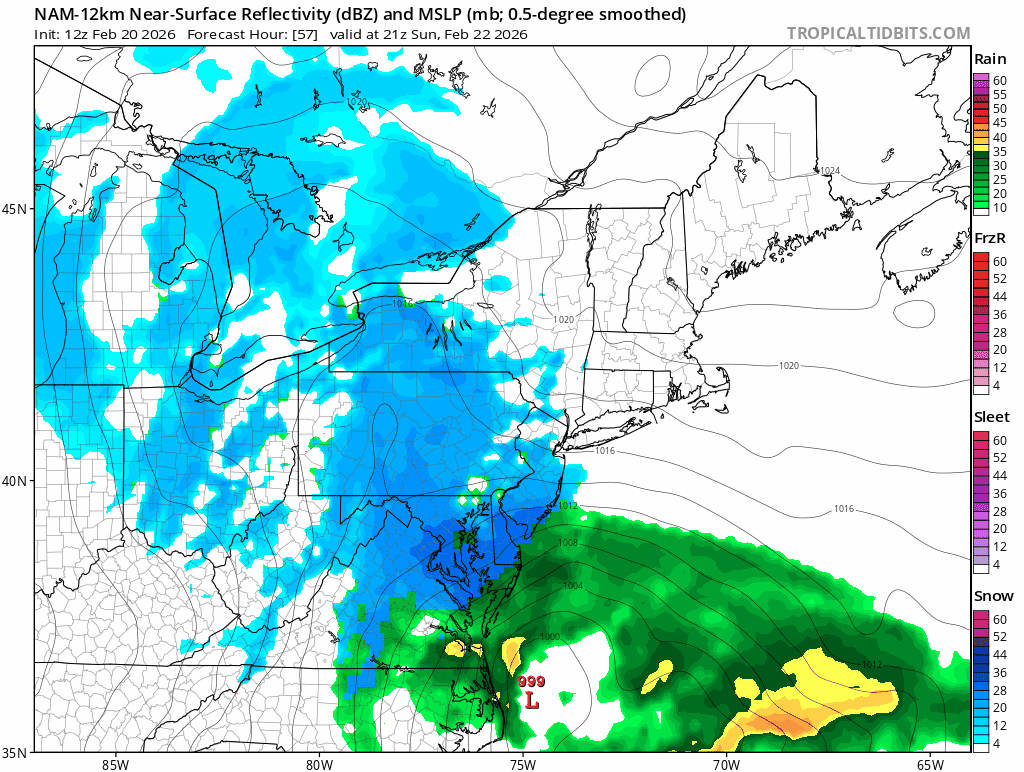
This run of the GFS is so tucked that coastal NJ probably dry slots very late Sunday night.
-
More tucked.
-
yes, I just updated.
-
This was the map that the NWS put out like 48 hours before. Then this: This was I think the final map, which still was too high.
-
I can honestly say, nobody here cares about what a TV met has to say. He can't go out and start talking about feet of snow at this range. Ever since they got burned so badly with January 2015, just about every public met has taken a very conservative approach until the very last minute.
-
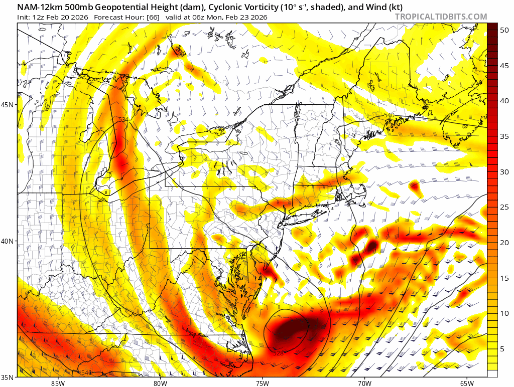
I think, could be wrong, that the NW cutoff will be less because this isn't a true Miller A. The inverted trough is still a bit of a wild card.
-
For this to be a big storm, we had to get at least one insane NAM run. If it looked more like the Euro I would have been worried. Now have to hope the GFS holds.
-
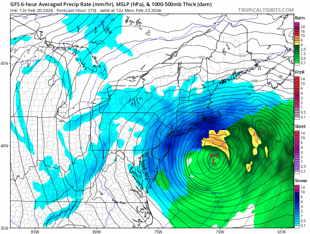
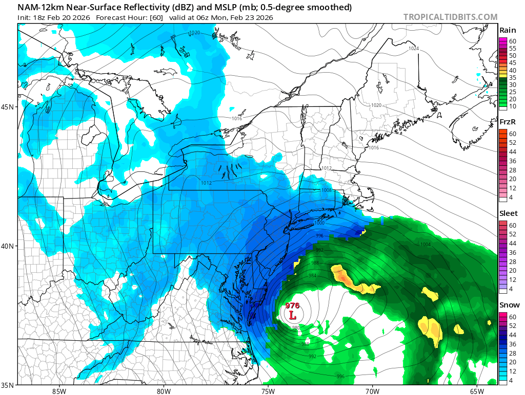
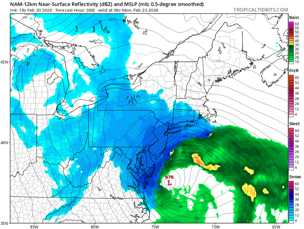
Just about the entire forum is 2"+ of liquid and the deformation banding is insane. Anyone under that band will get 2-4" per hour for several hours.
-
Put this one into the spank bank
-
As textbook as it gets for this type of system.

-
-
This is not enough the correct run.
-
This should be NW of 12z.

-
My first call:
-
That was a true Miller A with a big, deep trough that cutoff over the TN Valley, however the abrupt cutoff is similar to what we will see with this storm.
-
My wife teaches at a public school in Rockland County and her last day this year is June 26th, which is borderline ridiculous. When I went to school in Northern NJ we were done by the third week in June. They eliminated February Winter break in the early 2000's when we had a really bad winter and ended up having to give it completely back for snow days. I know NY still does the February break which I don't understand either. They got almost 2 weeks off at the end of January and then most years a week to ten days again at the end of March or early April.
-
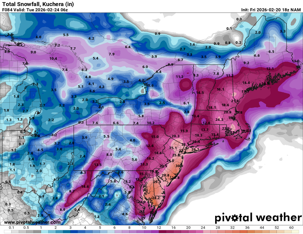
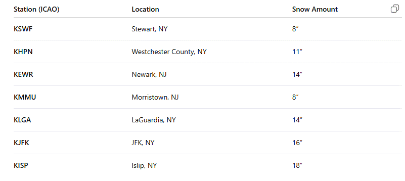
This is still playing it pretty conservative for our area. I told my Wife "12 to 18 inches" and she said, "In your dreams" LOL
-
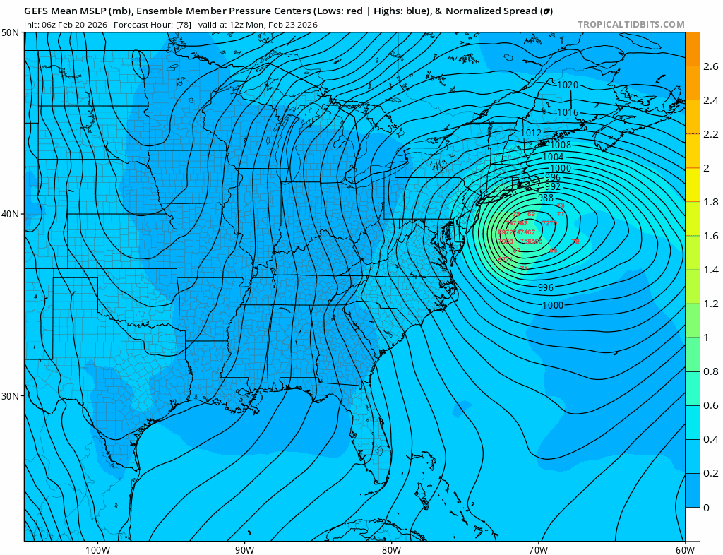
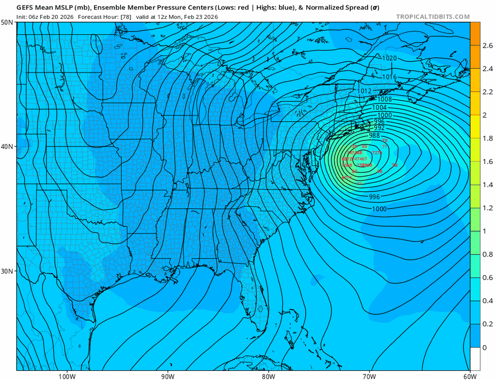
A lot more West leaning members in the GEFS than the previous run. Several are West of the OP.
-
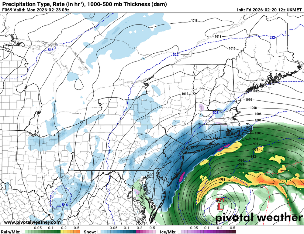
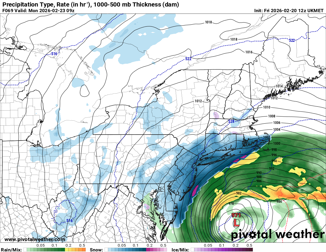
The 12z UKMET which has a known SE bias is well NW of the 00z run.