NJwx85
-
Posts
19,676 -
Joined
-
Last visited
Content Type
Profiles
Blogs
Forums
American Weather
Media Demo
Store
Gallery
Everything posted by NJwx85
-
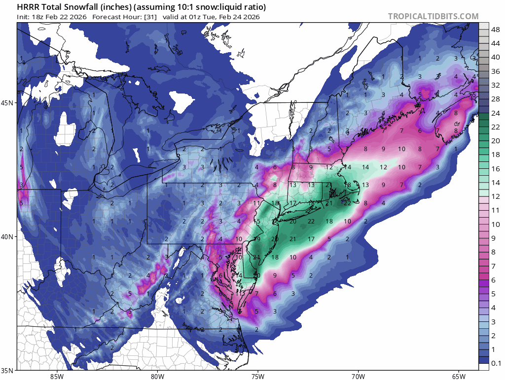
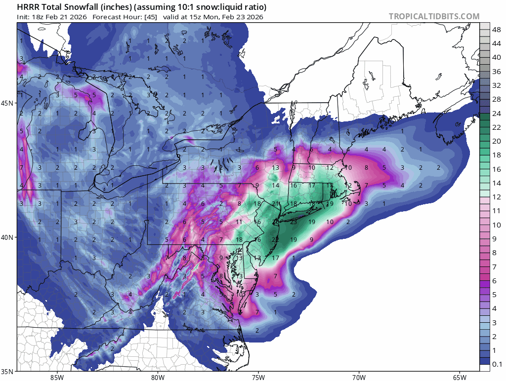
18z 10:1
-
I’ll post once it’s done.
-
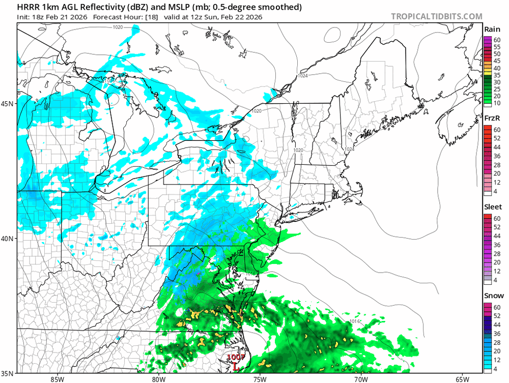
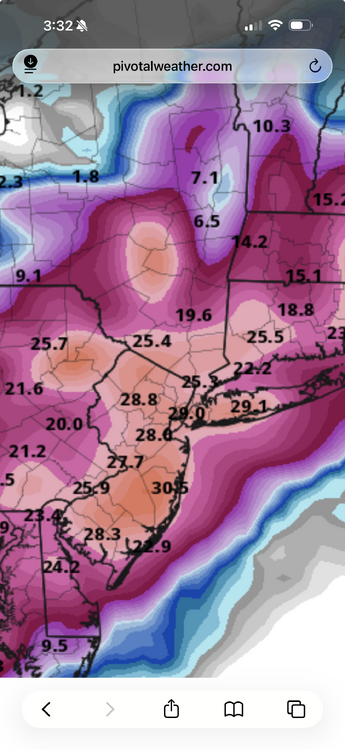
The 18z HRRR beefed up totals several inches for inland areas compared to 12z, which was still great.
-
It’s coming. People will be singing a different tune in 3 hours.
-
Another intelligent idiot that thinks they know better than the NWS. Where did you get your BS in Atmospheric Science?
-
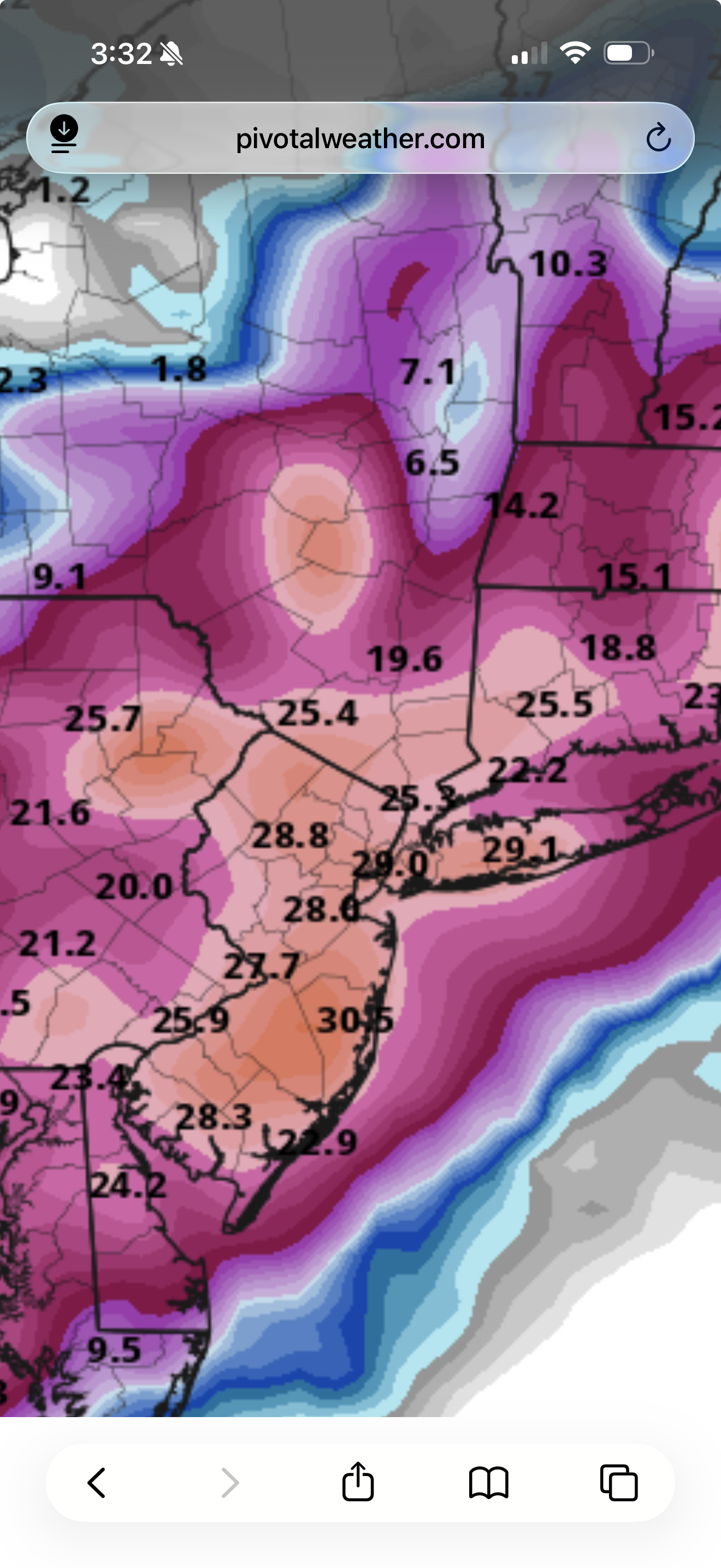
Oh no, only 16.8 instead of 17.5” for my backyard
-
There’s too much public access to models these days. Back when I first started with this hobby it was all behind paywalls. I use to pay for Stormvista so I could do PBP on here. Now Tidbits and PW are just as fast.
-
16z HRRR ticking back West again. All this pancaking is BS.
-
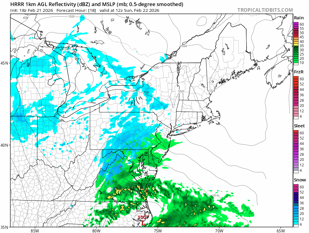
Just flipped here in the last 5 minutes from a very light non accumulating snow to moderate snow in Central Rockland.
-
Way to wait till the last minute, holy fuck
-
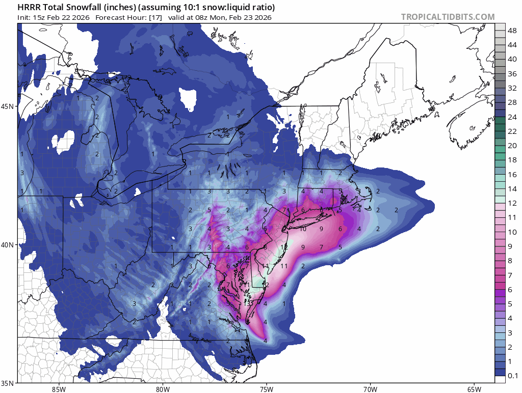
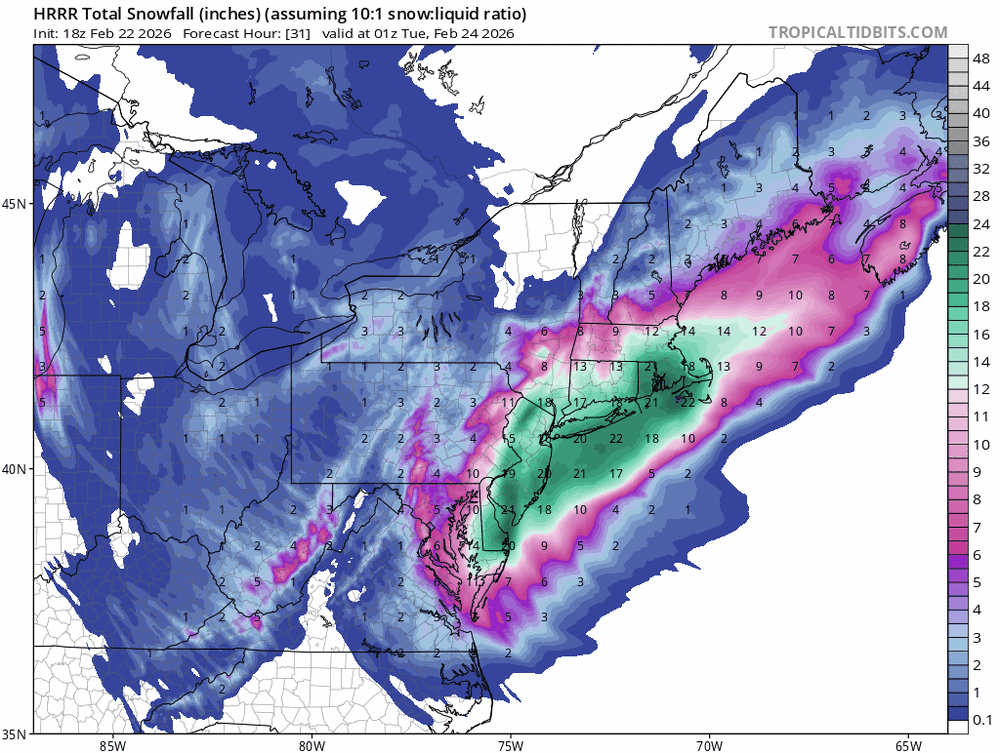
The radar looks good. Bands of snow back to Central PA. I still think there will be widespread totals of 18-24” and someone will crack 30”. NWS agrees.
-
I’m not worried about models pulling back. It literally happens every storm. This is a long duration event with explosive dynamics. There will be many surprise's.
-
I started off as wet snow. Already a slushy coating on the cars.
-
I miss Paul Kocin on TWC. Saw him years ago when he did a seminar at Kean.
-
Me too. And I missed the one in 2010 that destroyed DC.
-
I feel your pain. I was in Daytona for PD2.
-
You’re looking at the jet stream and pieces of energy traveling a long it in the mid levels of the atmosphere.
-
For whatever reason the RGEM has been stubborn with this storm. I think it’s suffering from convective feedback.
-
The GFS was terrible with Sandy. The Euro nailed it
-
3k
-
Boxing Day 2010.
-
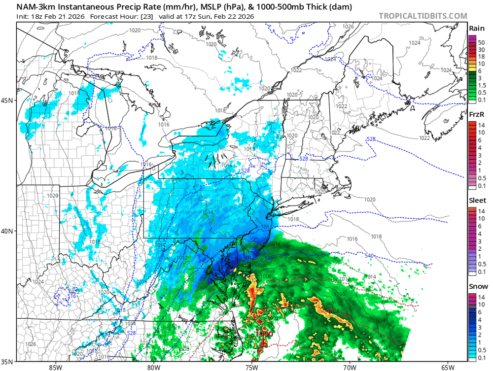
18z NAM Kuchera
-
The NAM is already more amped than 12z.
-
And still snowing.

-
Incredible, over 24hrs and still dumping.