NJwx85
-
Posts
19,676 -
Joined
-
Last visited
Content Type
Profiles
Blogs
Forums
American Weather
Media Demo
Store
Gallery
Everything posted by NJwx85
-
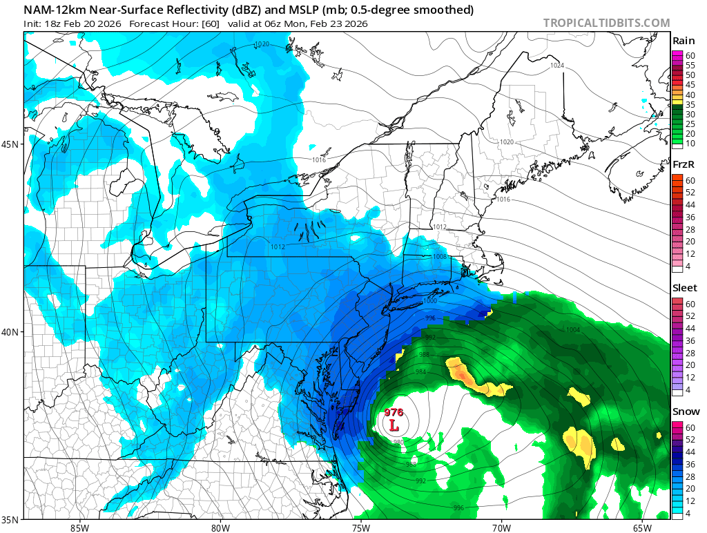
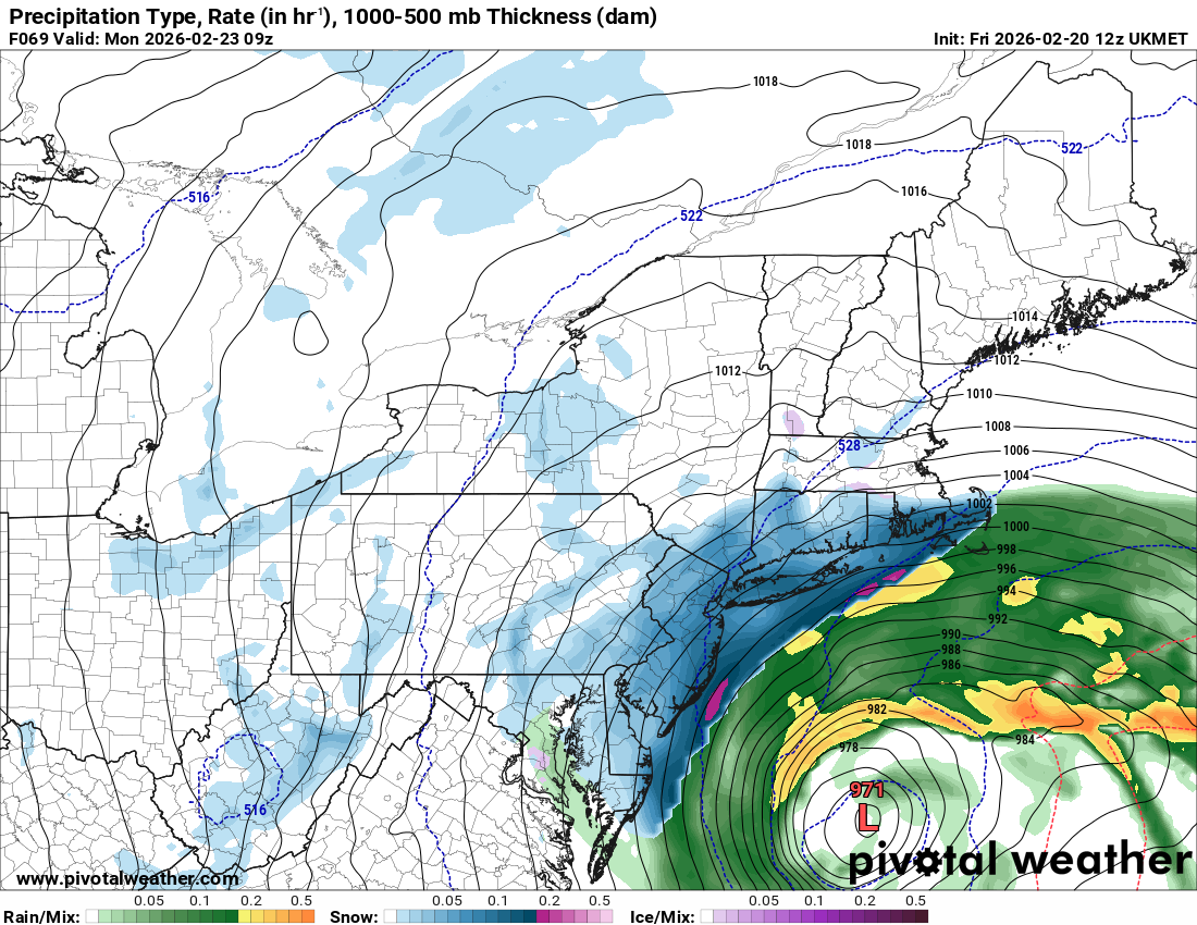
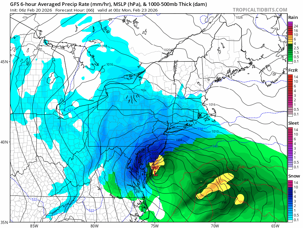
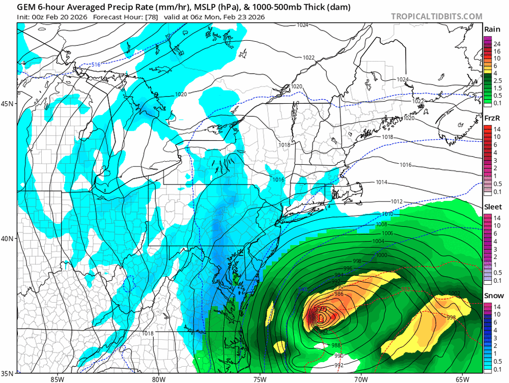
Just about the entire forum is 2"+ of liquid and the deformation banding is insane. Anyone under that band will get 2-4" per hour for several hours.
-
Put this one into the spank bank
-
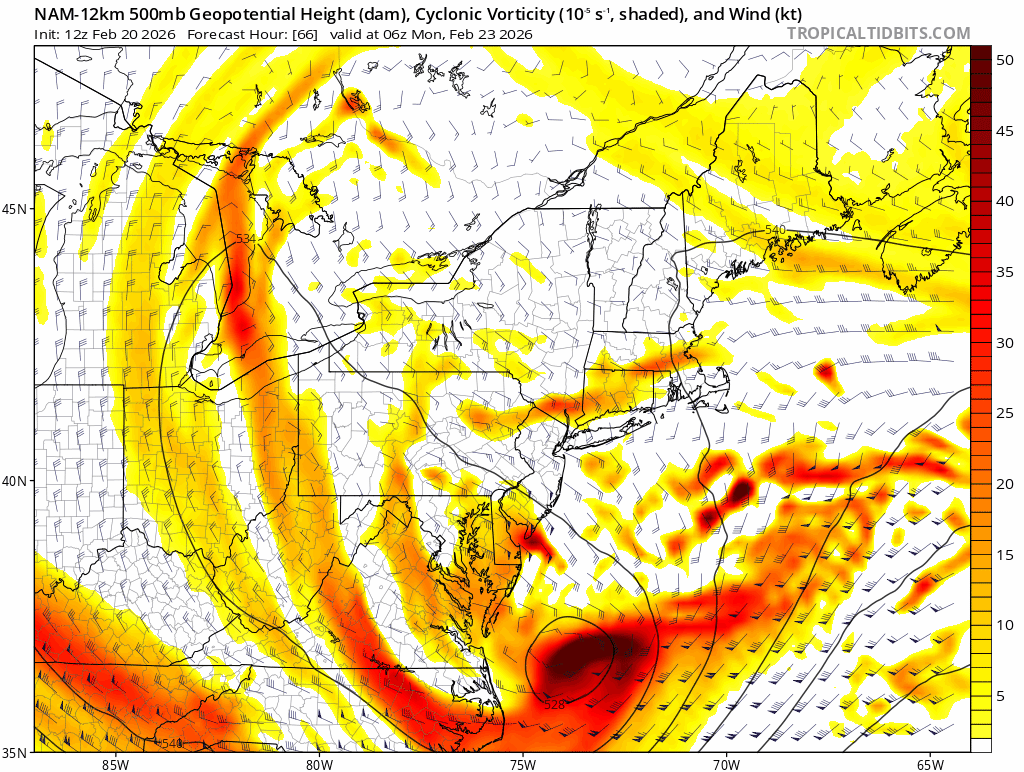
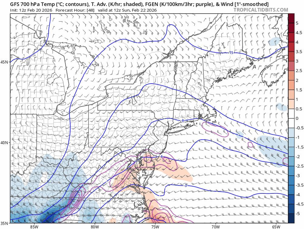
As textbook as it gets for this type of system.

-
-
This is not enough the correct run.
-
This should be NW of 12z.

-
My first call:
-
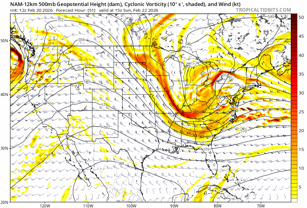
That was a true Miller A with a big, deep trough that cutoff over the TN Valley, however the abrupt cutoff is similar to what we will see with this storm.
-
My wife teaches at a public school in Rockland County and her last day this year is June 26th, which is borderline ridiculous. When I went to school in Northern NJ we were done by the third week in June. They eliminated February Winter break in the early 2000's when we had a really bad winter and ended up having to give it completely back for snow days. I know NY still does the February break which I don't understand either. They got almost 2 weeks off at the end of January and then most years a week to ten days again at the end of March or early April.
-
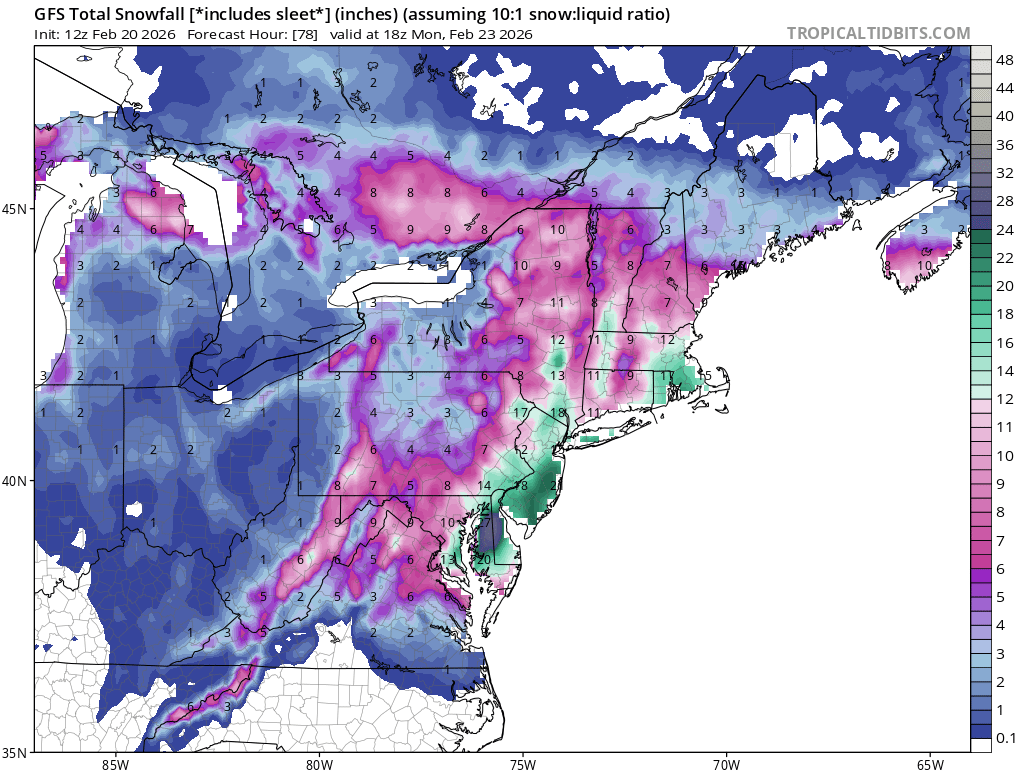
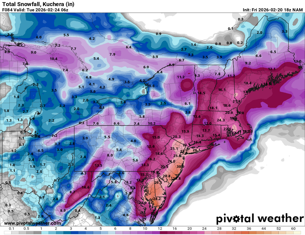
This is still playing it pretty conservative for our area. I told my Wife "12 to 18 inches" and she said, "In your dreams" LOL
-
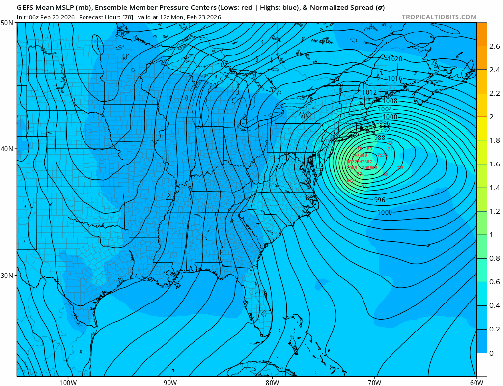
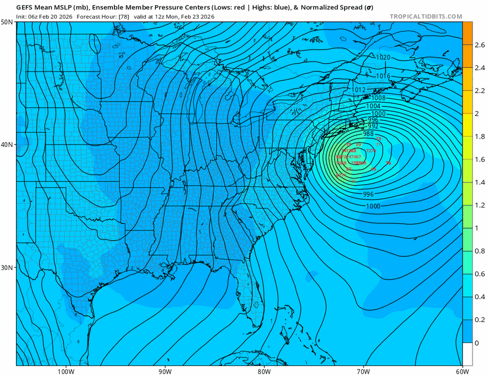
A lot more West leaning members in the GEFS than the previous run. Several are West of the OP.
-
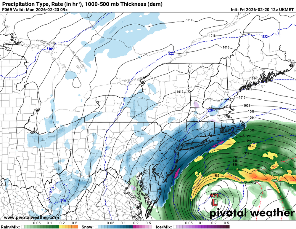
The 12z UKMET which has a known SE bias is well NW of the 00z run.
-
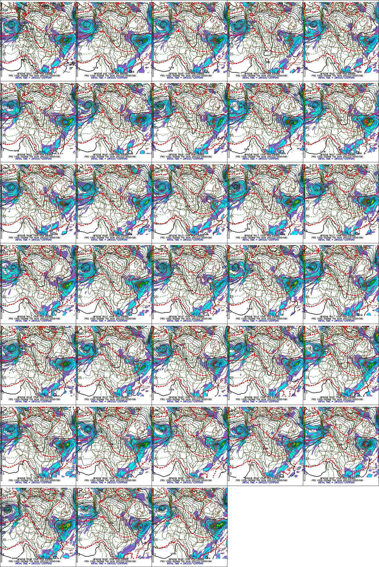
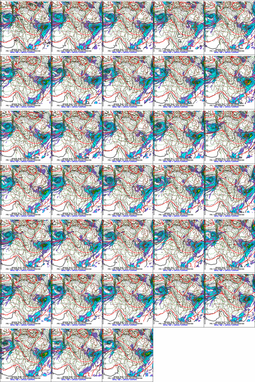
Hard to see, but here are the 12z GEFS at hr 60. Some big hits in there. GFS PRS ENSEMBLE (HOUR 60)
-
You're what's commonly referred to as a jinx.
-
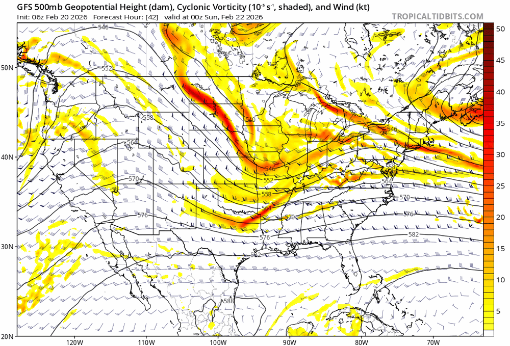
Canadian moving towards the GFS.
-
If the GFS is correct, it will be puking snow for about an 8-12hr period on Sunday night.
-
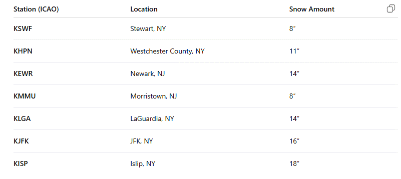
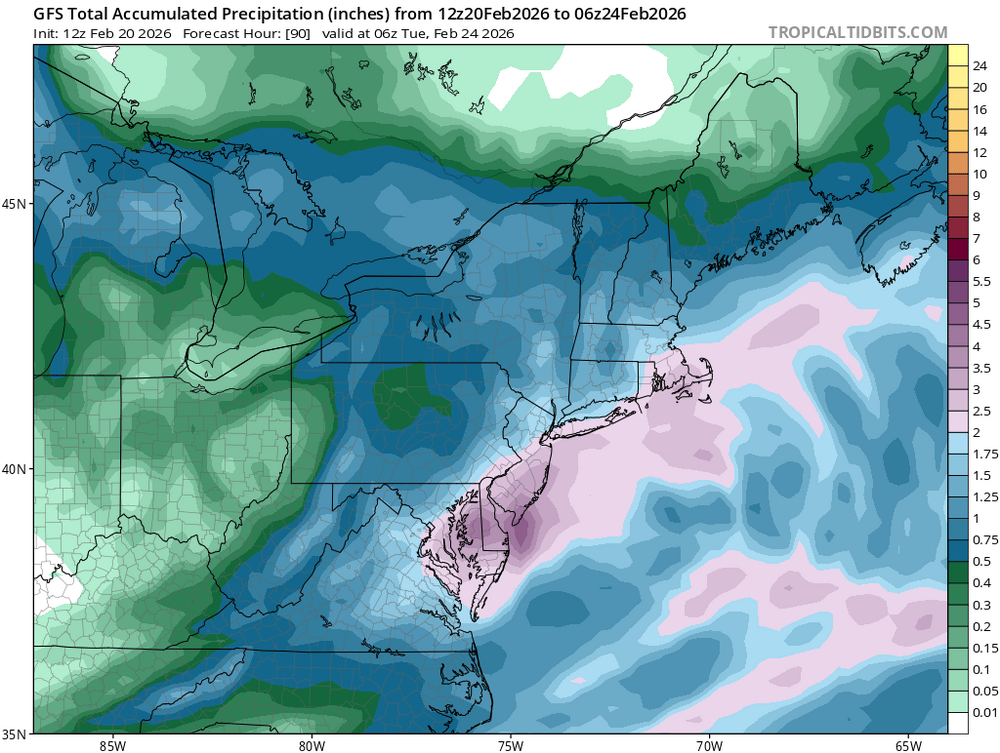
Okay, I'm officially excited. Almost 2" liquid into NYC and 1"+ back into PA and Upstate NY.
-
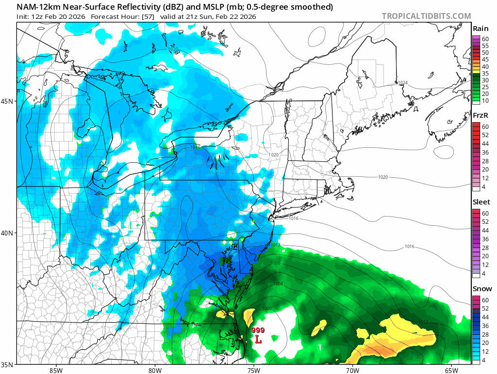
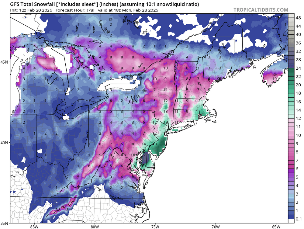
Since it will be asked, looks like start time would be Sunday early afternoon, from Southwest to Northeast. Heaviest snow would be Sunday evening/night with most of it over by this time on Monday with some residual bands possible as the storm starts to rot just East of the benchmark.
-
This run occludes about 6 hours later so the deformation banding is able to get further North and West. So just about everyone here would be looking at 12-18" with locally up to 30" possible under the heaviest banding, most likely Suffolk County.
-
I don't care what the clown maps show, 2-4" per hour under this banding.
-
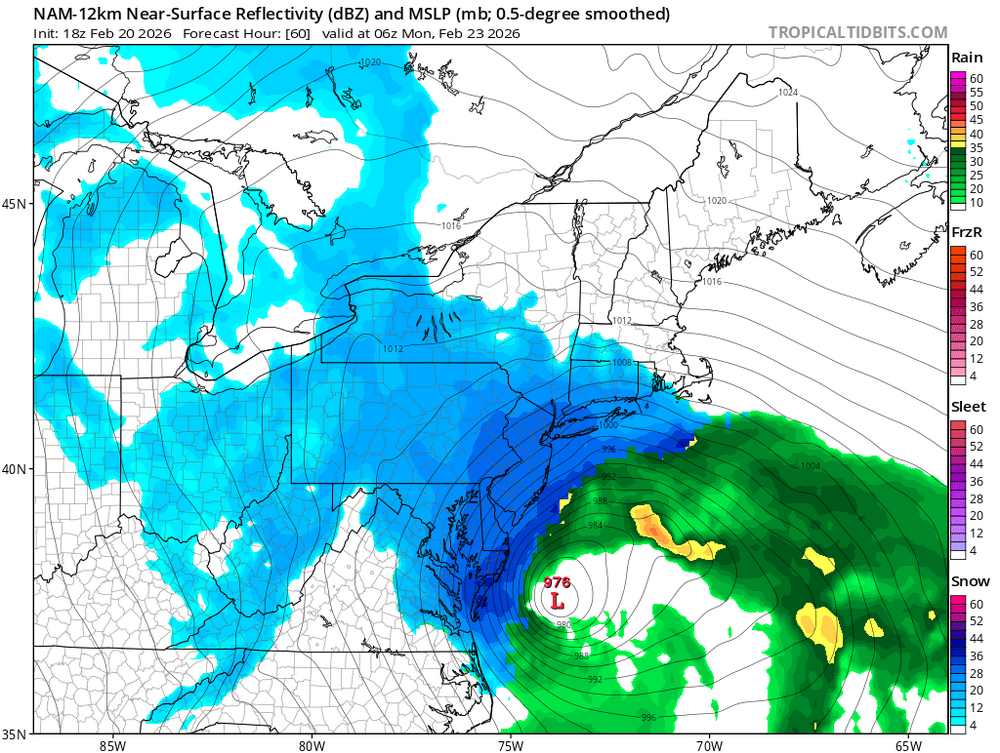
990mb to 976mb six hours later lol.
-
It's actually just a tick South so far.

-
I'm honestly a little shocked. I thought for sure that this would be the cycle that the GFS trended worse but it's already better early on.
-
I will say this and I don't care how arrogant it sounds, if you're worried about mixing in this scenario then you need to find a new hobby.