

Blue_Ridge_Escarpment
-
Posts
2,200 -
Joined
-
Last visited
Content Type
Profiles
Blogs
Forums
American Weather
Media Demo
Store
Gallery
Everything posted by Blue_Ridge_Escarpment
-

2020/2021 Fall/Winter Mountain thread
Blue_Ridge_Escarpment replied to Met1985's topic in Southeastern States
Flakes flying pretty good here now. Cold. -
2020/2021 Fall/Winter Mountain thread
Blue_Ridge_Escarpment replied to Met1985's topic in Southeastern States
I’m at just over 3,000 feet now ;) -
2020/2021 Fall/Winter Mountain thread
Blue_Ridge_Escarpment replied to Met1985's topic in Southeastern States
Models look to be playing catch-up today increasing qpf each run. You love to see it. -
2020/2021 Fall/Winter Mountain thread
Blue_Ridge_Escarpment replied to Met1985's topic in Southeastern States
This wind is absolutely brutal tonight. Notice the 3k NAM is showing a transition to snow overnight with some freezing drizzle the majority of tomorrow. -
2020/2021 Fall/Winter Mountain thread
Blue_Ridge_Escarpment replied to Met1985's topic in Southeastern States
Well hello GFS! -
2020/2021 Fall/Winter Mountain thread
Blue_Ridge_Escarpment replied to Met1985's topic in Southeastern States
Looks like I moved to the mtns just in time lol -
2020/2021 Fall/Winter Mountain thread
Blue_Ridge_Escarpment replied to Met1985's topic in Southeastern States
Not so much that’s it’s backing off moisture as it is the LP further east and not kicking the moisture back inland. -
December 8-10, 2018 Winter Storm
Blue_Ridge_Escarpment replied to Orangeburgwx's topic in Southeastern States
Nothing like the GFS joining the qpf party at the 11th hour. -
December 8-10, 2018 Winter Storm
Blue_Ridge_Escarpment replied to Orangeburgwx's topic in Southeastern States
Upslope enhancement? Sure seems like it! -
December 8-10, 2018 Winter Storm
Blue_Ridge_Escarpment replied to Orangeburgwx's topic in Southeastern States
18Z NAM has 2.5-3 inches of qpf here. Wow. -
December 8-10, 2018 Winter Storm
Blue_Ridge_Escarpment replied to Orangeburgwx's topic in Southeastern States
Ouch. Lights out for weeks if this verifies in S NC and N. SC -
December 8-10, 2018 Winter Storm
Blue_Ridge_Escarpment replied to Orangeburgwx's topic in Southeastern States
-
December 8-10, 2018 Winter Storm
Blue_Ridge_Escarpment replied to Orangeburgwx's topic in Southeastern States
Well at least west of 77, appears a tick warmer east of there as the LP is a touch north. -
December 8-10, 2018 Winter Storm
Blue_Ridge_Escarpment replied to Orangeburgwx's topic in Southeastern States
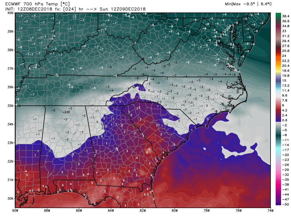
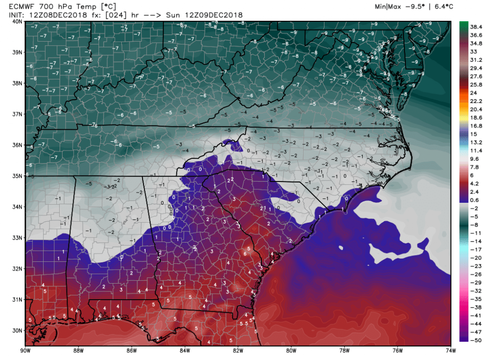
At 24 on euro, 850s colder everywhere. -
December 8-10, 2018 Winter Storm
Blue_Ridge_Escarpment replied to Orangeburgwx's topic in Southeastern States
QPF inceased as well! -
December 8-10, 2018 Winter Storm
Blue_Ridge_Escarpment replied to Orangeburgwx's topic in Southeastern States
The footprint of where the heaviest accum will be is the same as the NAM it’s just about half the amount. -
December 8-10, 2018 Winter Storm
Blue_Ridge_Escarpment replied to Orangeburgwx's topic in Southeastern States
RGEM is just crushing WNC at the end of its run. -
December 8-10, 2018 Winter Storm
Blue_Ridge_Escarpment replied to Orangeburgwx's topic in Southeastern States
ICON south this run and coming in line with other models. A consensus is building folks. Get prepared, stay safe, and enjoy! -
December 8-10, 2018 Winter Storm
Blue_Ridge_Escarpment replied to Orangeburgwx's topic in Southeastern States
Wetter and colder than 18Z for sure. The trend is our friend so far in the 0Z suite. -
December 8-10, 2018 Winter Storm
Blue_Ridge_Escarpment replied to Orangeburgwx's topic in Southeastern States
With Euro being the most consistent model for this storm will credence be given to that model going forward? Considering it’s in the euro wheel house right now. Thanks for answering these for us! -
December 8-10, 2018 Winter Storm
Blue_Ridge_Escarpment replied to Orangeburgwx's topic in Southeastern States
I’d love to see the faces of the night crew when they come in tonight to work on the AFD and maps and see what was put out this afternoon. -
December 8-10, 2018 Winter Storm
Blue_Ridge_Escarpment replied to Orangeburgwx's topic in Southeastern States
MUCH better GFS run. Colder aloft for sure. 540 dipping into N NC. Was in C VA last run. -
December 8-10, 2018 Winter Storm
Blue_Ridge_Escarpment replied to Orangeburgwx's topic in Southeastern States
Looks like two offices aren’t doing much collaborative work. Smh. -
December 8-10, 2018 Winter Storm
Blue_Ridge_Escarpment replied to Orangeburgwx's topic in Southeastern States
What are they looking at? Euro, UK, FV3, CMC all show a foot and a half here. -
December 8-10, 2018 Winter Storm
Blue_Ridge_Escarpment replied to Orangeburgwx's topic in Southeastern States
Can anyone spot the escarpment?