eyewall
-
Posts
12,552 -
Joined
-
Last visited
Content Type
Profiles
Blogs
Forums
American Weather
Media Demo
Store
Gallery
Everything posted by eyewall
-
Triangle folks this is your only hope:
-
Breaks of sun in Raleigh.
-
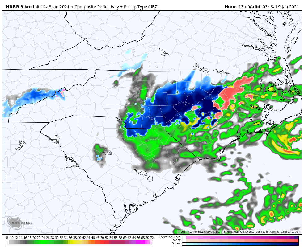
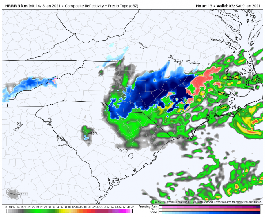
Rain and a little sleet in Raleigh. The dry slot is now coming through.
-
Agreed and there is quite a dry slot rolling through as we speak. Look the lower level WV on College of Du Page.
-
Yeah this isn't looking good and we started the event a few degrees warmer than forecast.
-
I have been MIA being too busy to get on here. My call at this point is: Western Mountains of NC to Pilot Mountain/Hanging Rock, and adjacent VA: 3-6 (locally 8) inches Triad to Danviile VA: 1-3 (locally 4) inches RDU: Dusting to an inch South and east of there: token flakes at the end
-
One thing to point out is this is not going to blanket accumulations. This is going to be more banded and scattered I think in terms of decent amounts. It will largely be rate driven without question.
-
The 18z GFS is definitely a better run. I only wish I could post weatherbell maps. GSO jackpots.
-
3-6 for the time being.
-
I will stick with 4-8 (locally 12) in the NC mountains, 3-6 foothills, 2-4 Triad, 1-2 slushy inches east of GSO to Raleigh and add 2-4 for Rocky Mount through Virginia Beach as my second rough call. Tomorrow I will begin the maps if warranted and the chance doesn't vaporize.
-
There will be adjustments. I am following today's trends closely. One thing that does suck on the 12z GFS aside from being a bit warmer is the loss of the second system. One thing I will say is we have to watch northeastern NC and southeastern VA for a secondary max as the surface low deepens while moving out.
-
That was a nice step in the right direction by the GFS. Right now yes I would say the NAM was probably too far south.
-
Rough first call for now would be 4-8 (locally 12) WNC Mountains, 3-6 Triad-Danville, VA, 1-3 east of GSO to Durham, <1 Raleigh
-
yeah hard to say where it goes from there but certainly the players are on the field at the end of the run.
-
At this point if even gets within close enough range to make a call map I will consider that a win.
-
Nothing a short drive can't take care of. It definitely looks like a north of I-40 west of I-85 event.
-
The 12z GFS was definitely in the right direction. It will still take a bit more to reel this one in though.
-
It would largely depend on the ULL dynamics and track for sure.
-
I remember that! I drove to into it also.
-
That is because of the SouthernWX forum which is like Parler for weather enthusiasts.
-
Yep, definitely would be rate driven with the ULL. It really is a nice track otherwise of the surface system.
-
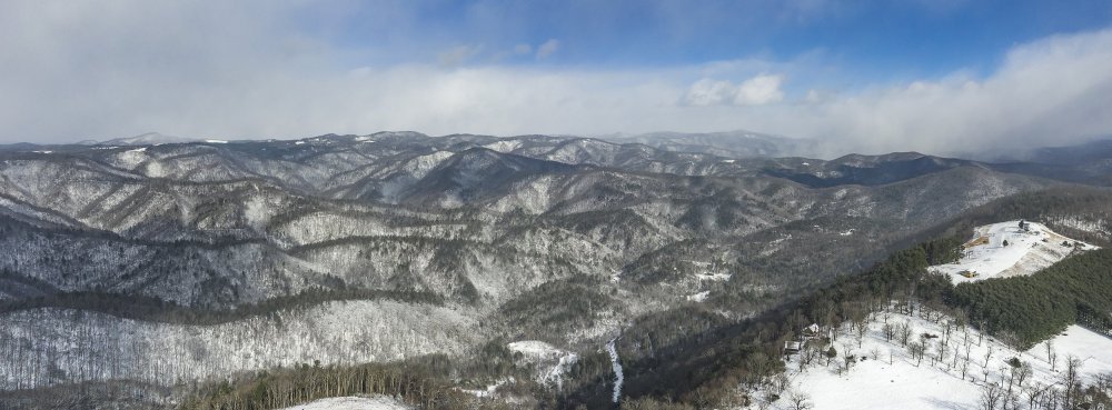
I think it is about zeroing out on snow given the potential even if it isn't 75F everyday. I went to the mountains on Christmas morning to enjoy that on the likely chance we get nothing in Raleigh this year.
-
There is no doubt it looks like complete crap and cutter city on the GFS. I was pretty confident RDU would zero out this year and so far that seems to be on track.
-
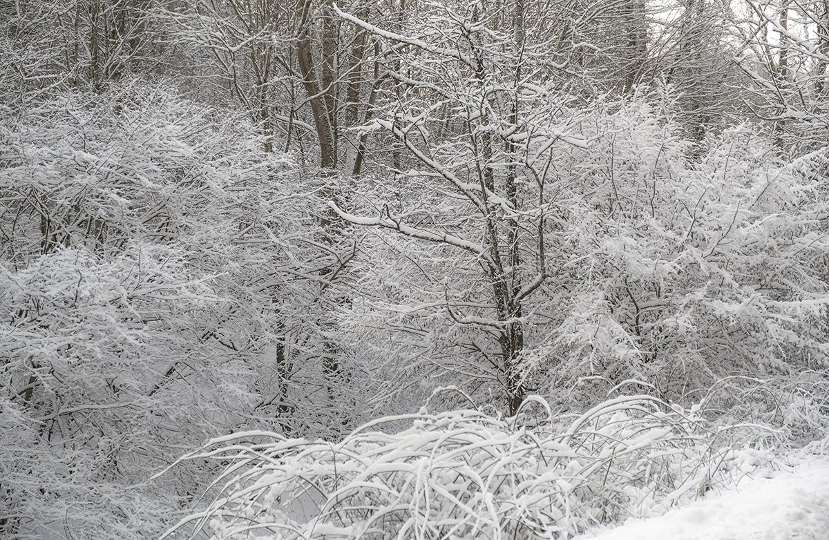
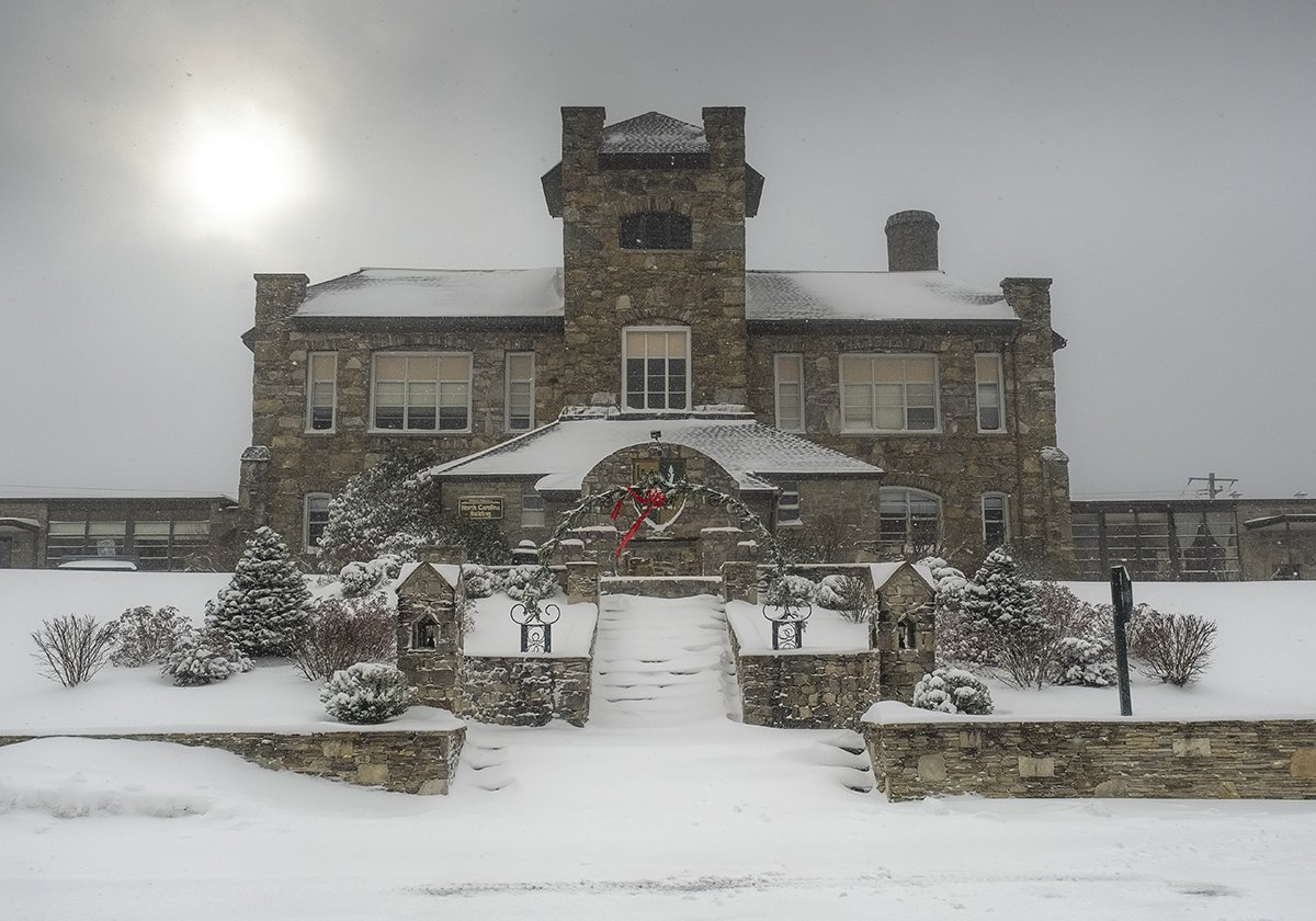
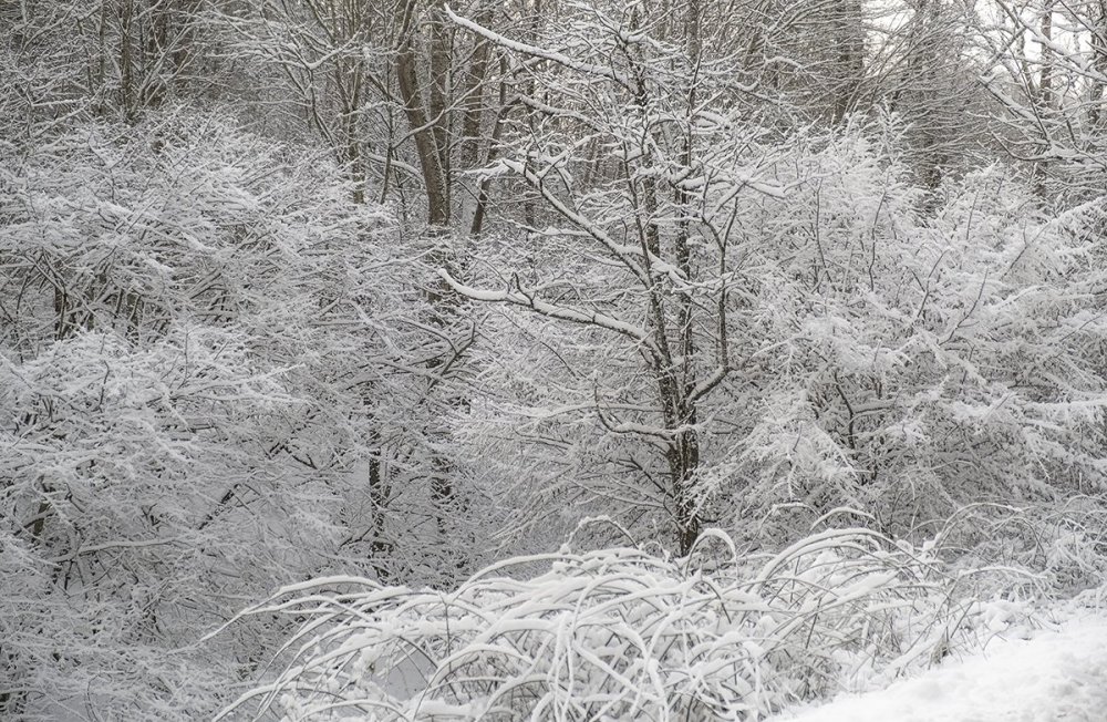
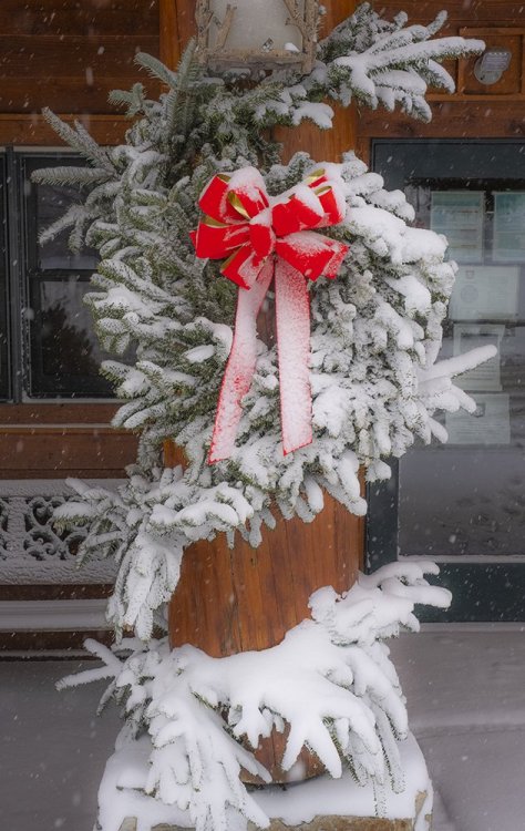
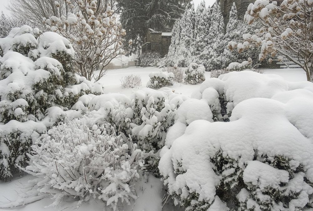
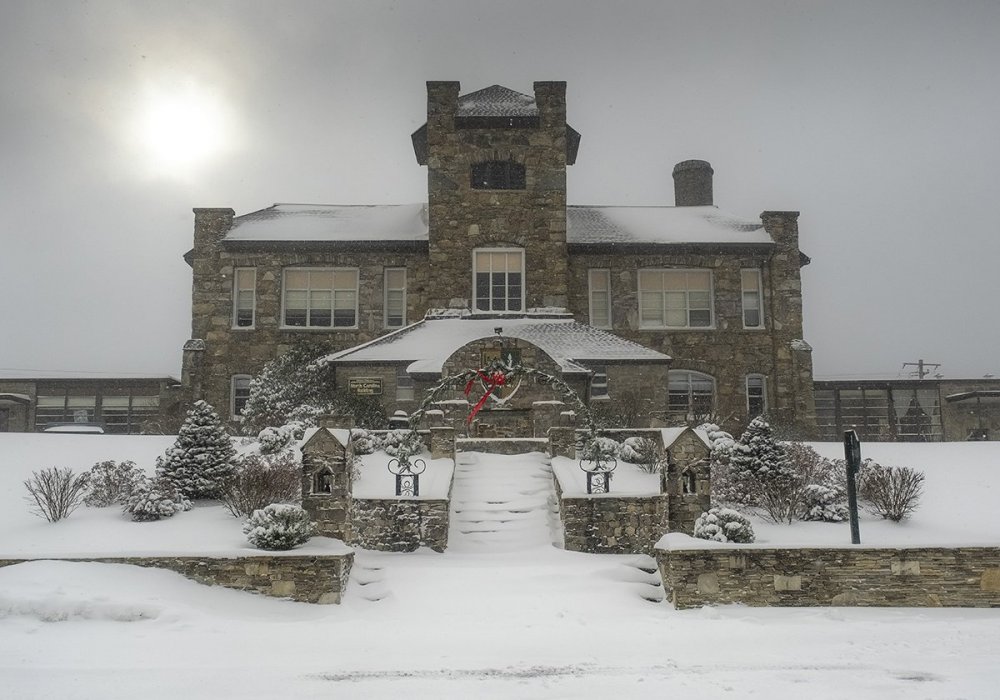
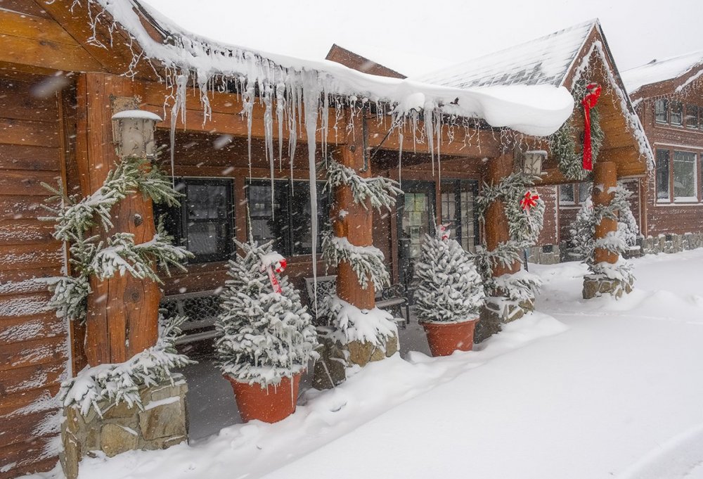
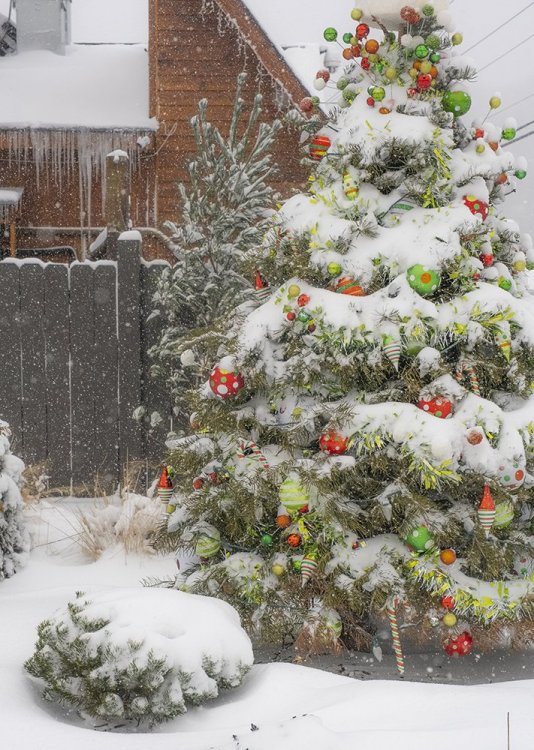
I didn't take a lot of shots as I was busy just enjoying it but here are a few (also some of the best shots out there were hard to get without getting the car stuck). Remember to click each photo to see it in full:
-
It was definitely a fun day. It didn't stop snowing most of the time I was up there today. It reminded me of VT upslope action. We even saw flurries when we left Raleigh early this morning.