eyewall
-
Posts
13,306 -
Joined
-
Last visited
Content Type
Profiles
Blogs
Forums
American Weather
Media Demo
Store
Gallery
Everything posted by eyewall
-
Potential 1/28-1/30 2022 winter storm
eyewall replied to Prismshine Productions's topic in Southeastern States
-
1/28-1/29 Winter Storm Obs Thread
eyewall replied to Prismshine Productions's topic in Southeastern States
Good luck all in this flizzard of the century! -
Potential 1/28-1/30 2022 winter storm
eyewall replied to Prismshine Productions's topic in Southeastern States
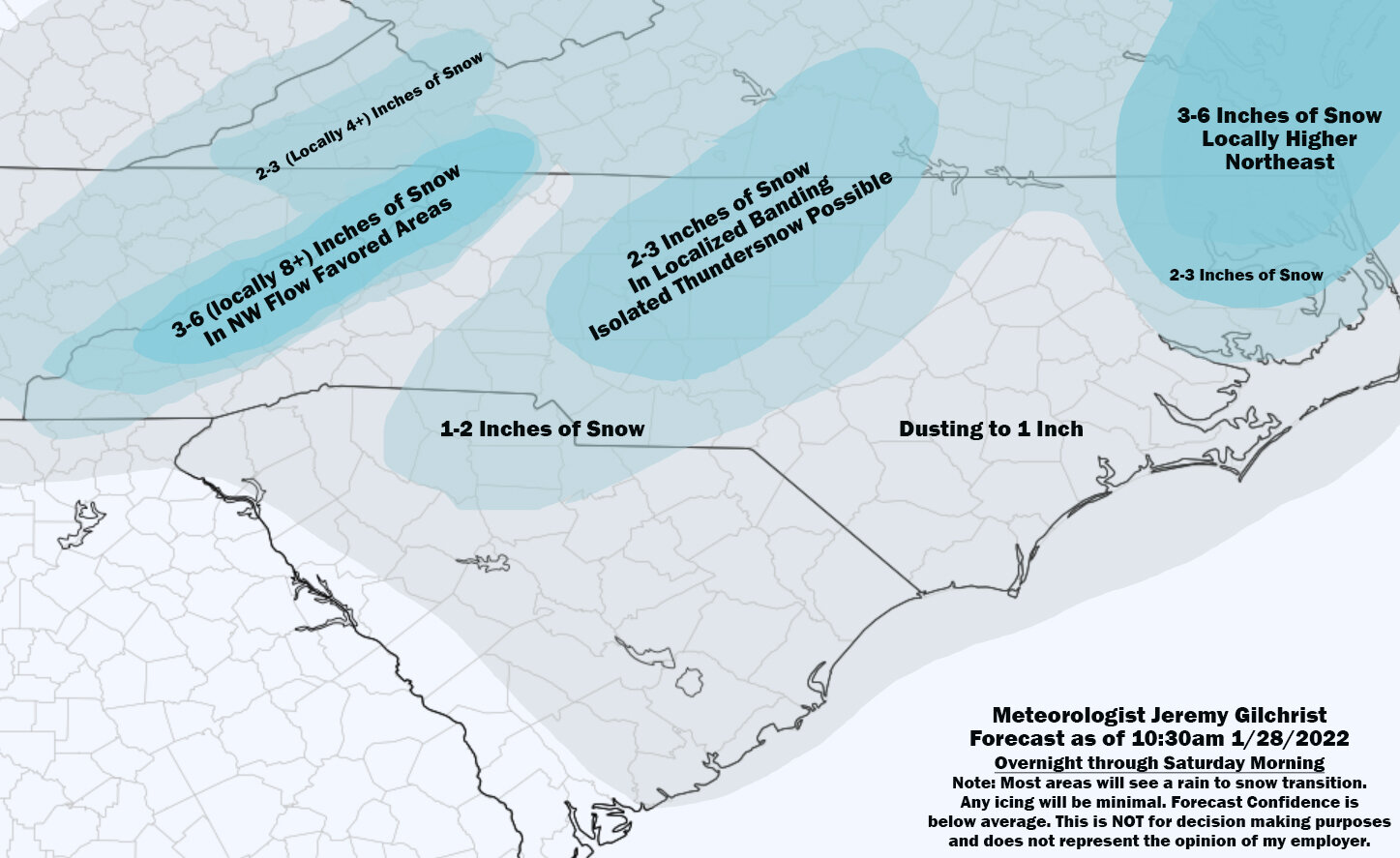
Final Call:
-
Potential 1/28-1/30 2022 winter storm
eyewall replied to Prismshine Productions's topic in Southeastern States
I will be making one more update to my screwcast soon. -
Potential 1/28-1/30 2022 winter storm
eyewall replied to Prismshine Productions's topic in Southeastern States
It is a glorified flizzard for most. I think that is why, but we will see who lucks out with any mesoscale features. -
Potential 1/28-1/30 2022 winter storm
eyewall replied to Prismshine Productions's topic in Southeastern States
Agreed. It will be no more than a flizzard for many while a lucky few cash in. -
Potential 1/28-1/30 2022 winter storm
eyewall replied to Prismshine Productions's topic in Southeastern States
And of course it hits a wall for us lol -
Potential 1/28-1/30 2022 winter storm
eyewall replied to Prismshine Productions's topic in Southeastern States
It is basically a mid-level dry slot that will be the problem. Wherever that sets up, you will have a screw zone. -
Potential 1/28-1/30 2022 winter storm
eyewall replied to Prismshine Productions's topic in Southeastern States
-
Potential 1/28-1/30 2022 winter storm
eyewall replied to Prismshine Productions's topic in Southeastern States
Yeah without sneaking a meso band in here it will be almost a non-event for Raleigh but it is what it is. -
Potential 1/28-1/30 2022 winter storm
eyewall replied to Prismshine Productions's topic in Southeastern States
-
Potential 1/28-1/30 2022 winter storm
eyewall replied to Prismshine Productions's topic in Southeastern States
It is looking more and more like Raleigh will be stuck in the screw zone between the late phasing coastal and the lee side low. -
Potential 1/28-1/30 2022 winter storm
eyewall replied to Prismshine Productions's topic in Southeastern States
While we sip our Maalox this morning I finally posted some video I took during the last event: As it stands if that lee side meso low continues to appear I will have to factor it in to my forecast update for sure. This is not an easy one. -
I loved when I used to have Mondays off when I lived up there. I would have smuggs almost to myself. There would still be visible areas of corduroy at last chair.
-
Potential 1/28-1/30 2022 winter storm
eyewall replied to Prismshine Productions's topic in Southeastern States
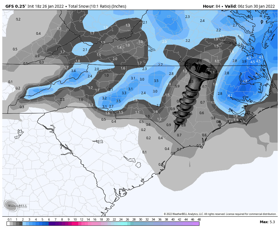
The take away from that GFS run is Raleigh jackpots. -
Potential 1/28-1/30 2022 winter storm
eyewall replied to Prismshine Productions's topic in Southeastern States
Wow this is going to be a meltdown in every subforum! -
Potential 1/28-1/30 2022 winter storm
eyewall replied to Prismshine Productions's topic in Southeastern States
The NAM has been on its own. -
Potential 1/28-1/30 2022 winter storm
eyewall replied to Prismshine Productions's topic in Southeastern States
Yep. I took that back then. -
Potential 1/28-1/30 2022 winter storm
eyewall replied to Prismshine Productions's topic in Southeastern States
March 2010 Mesoband: -
Potential 1/28-1/30 2022 winter storm
eyewall replied to Prismshine Productions's topic in Southeastern States
RAH makes no mention of the lee side low, but that is an interesting prospect. They do mention f-gen banding could surprised some people though. -
Potential 1/28-1/30 2022 winter storm
eyewall replied to Prismshine Productions's topic in Southeastern States
-
Potential 1/28-1/30 2022 winter storm
eyewall replied to Prismshine Productions's topic in Southeastern States
Cape Cod weenies will be happy otherwise it is a toaster sale. -
Potential 1/28-1/30 2022 winter storm
eyewall replied to Prismshine Productions's topic in Southeastern States
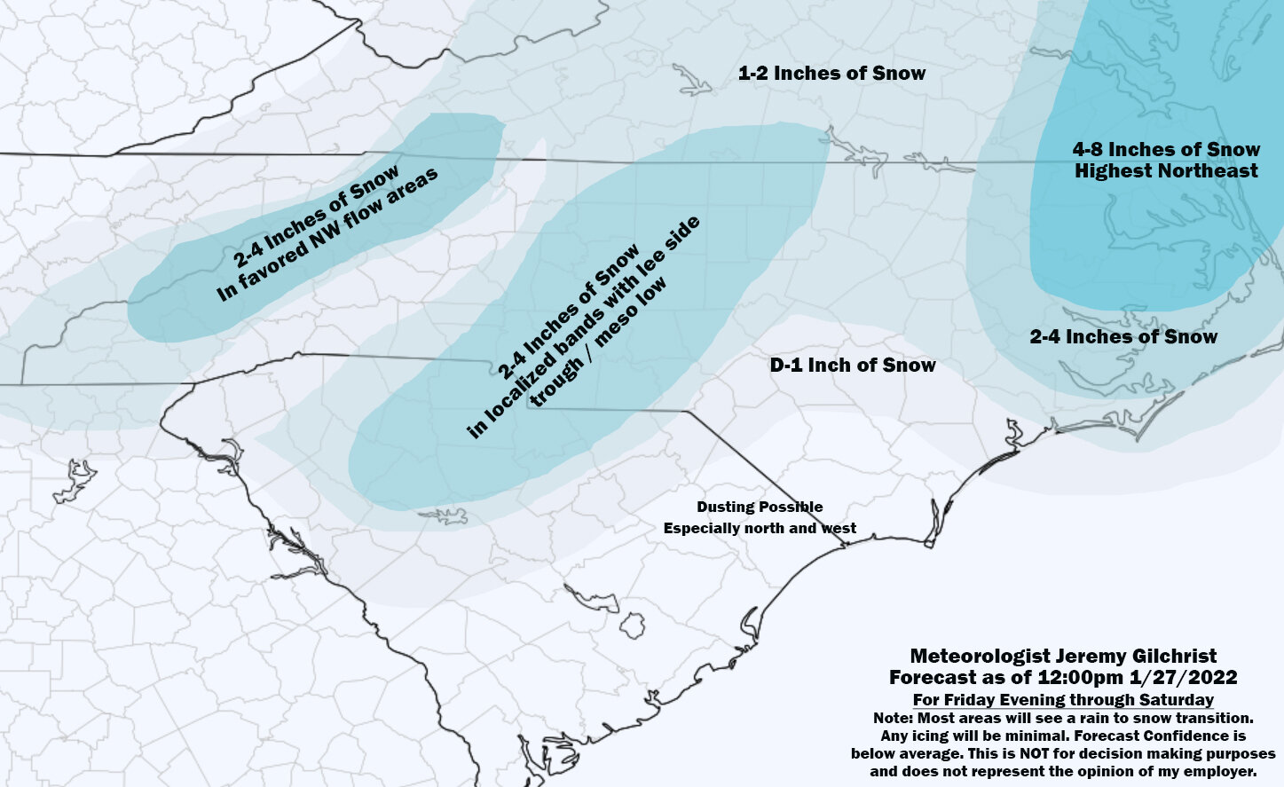
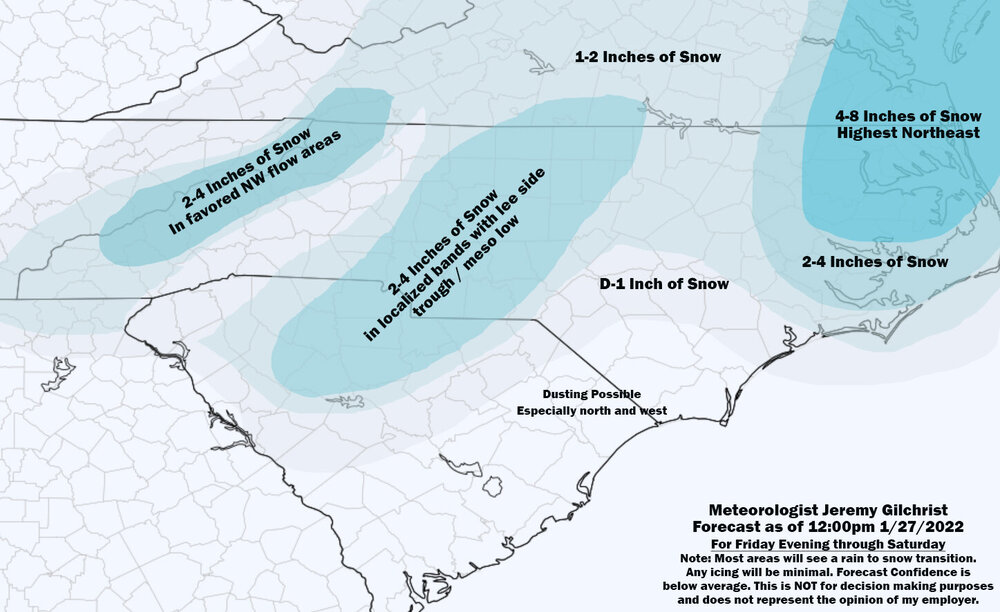
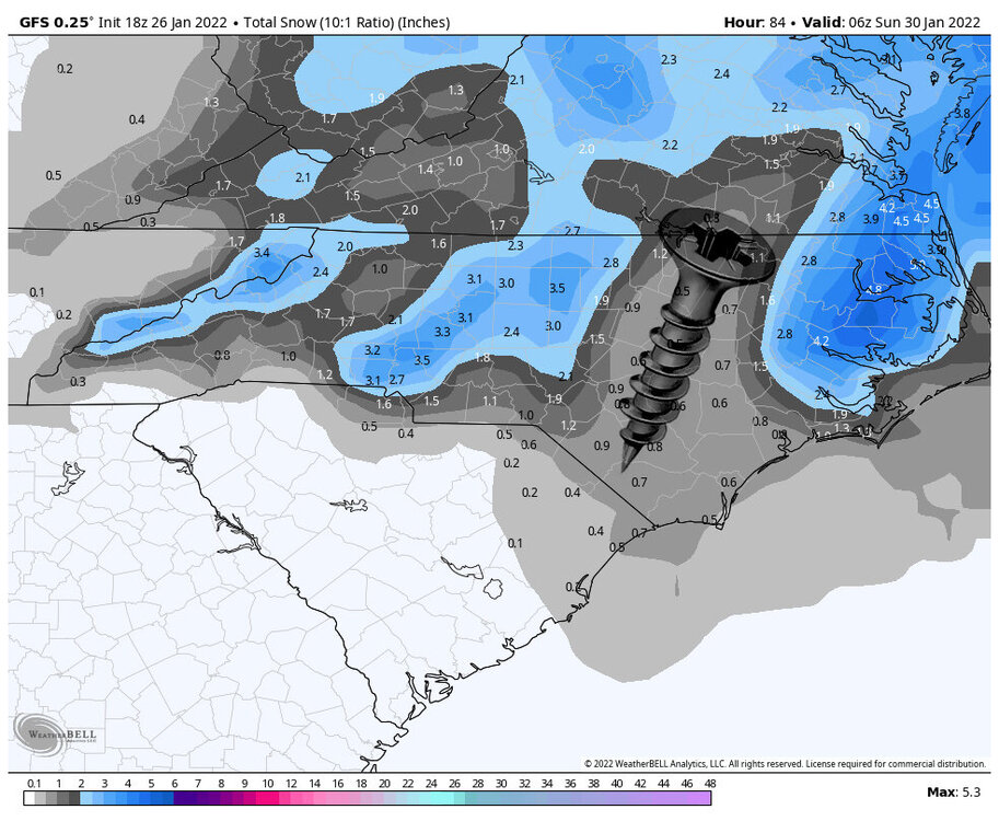
Got to love the central NC screw zone here: -
Potential 1/28-1/30 2022 winter storm
eyewall replied to Prismshine Productions's topic in Southeastern States
So close yet so far away. -
Potential 1/28-1/30 2022 winter storm
eyewall replied to Prismshine Productions's topic in Southeastern States
18z GFS rolling now