
sbnwx85
-
Posts
1,982 -
Joined
-
Last visited
Content Type
Profiles
Blogs
Forums
American Weather
Media Demo
Store
Gallery
Everything posted by sbnwx85
-

Winter 2025-26 Short Range Discussion
sbnwx85 replied to SchaumburgStormer's topic in Lakes/Ohio Valley
IWX just issued a Winter Weather Advisory overnight tonight and Tuesday for the areas that got hit with lake effect. It’s to cover the 35 mph gusts that will blow this stuff around. We’re already getting gusts of 25-30 mph and it’s creating whiteout conditions at times. May get a true ground blizzard in rural areas, especially overnight. -
1/24-1/25 Major Winter Storm - S. IL, IN, and OH
sbnwx85 replied to A-L-E-K's topic in Lakes/Ohio Valley
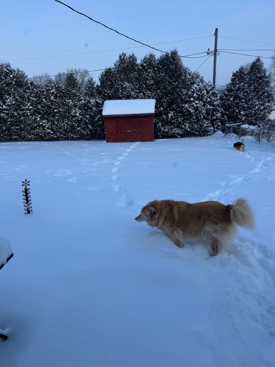
Hit the daily double last night with lake effect and added another 3.4”. 6.8” storm total. 11” snow depth. It’s the fourth time this winter we’ve had double-digit snow depth. #blessed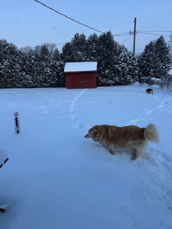
- 935 replies
-
- 10
-

-
1/24-1/25 Major Winter Storm - S. IL, IN, and OH
sbnwx85 replied to A-L-E-K's topic in Lakes/Ohio Valley
3.4” from the system. Standing by for the lake. -
1/24-1/25 Major Winter Storm - S. IL, IN, and OH
sbnwx85 replied to A-L-E-K's topic in Lakes/Ohio Valley
I see NYC has some mixing. Pretty happy about that -
1/24-1/25 Major Winter Storm - S. IL, IN, and OH
sbnwx85 replied to A-L-E-K's topic in Lakes/Ohio Valley
Eyeballing about 3” now. WSW are up just to my north and west for lake effect. The Advisory has been extended locally to account for the lake snow through tomorrow morning. Could see another 1-3”. -
1/24-1/25 Major Winter Storm - S. IL, IN, and OH
sbnwx85 replied to A-L-E-K's topic in Lakes/Ohio Valley
Seeing my Chicagoland friends cash in on some lake effect -
1/24-1/25 Major Winter Storm - S. IL, IN, and OH
sbnwx85 replied to A-L-E-K's topic in Lakes/Ohio Valley
We’re losing steam here as the banding is drying up on the north edge of the storm. Guidance shows another push of light snow moving through later this afternoon which should put us right near 3”. -
1/24-1/25 Major Winter Storm - S. IL, IN, and OH
sbnwx85 replied to A-L-E-K's topic in Lakes/Ohio Valley
At 2.2” with steady snow. Would be cool if the heavy stuff over the Decatur area would wing through here. -
1/24-1/25 Major Winter Storm - S. IL, IN, and OH
sbnwx85 replied to A-L-E-K's topic in Lakes/Ohio Valley
Been pixie dusting most of the night but banding is improving greatly to the southwest and moving this way. -
1/24-1/25 Major Winter Storm - S. IL, IN, and OH
sbnwx85 replied to A-L-E-K's topic in Lakes/Ohio Valley
DAB- so far. Better than I thought considering I expected snow to start around midnight. -
Picked up 0.8” yesterday (although that’s a guess with all the blowing and drifting). Sitting at 20” for the month. 19.4” of that has fallen since last Wednesday. Hard to believe we only have a snow depth of about 5” right now, but compaction is doing its thing. (SBN went from 17” to 7” snow depth from the 15th to the 16th!!) I’m sitting at 57.6” in my backyard for the season. (75” is my personal record). South Bend officially is at 62.2” for the season.
-
1/24-1/25 Major Winter Storm - S. IL, IN, and OH
sbnwx85 replied to A-L-E-K's topic in Lakes/Ohio Valley
Just as I was about to post that there’s nothing here yet, flurries began to fall. -
1/24-1/25 Major Winter Storm - S. IL, IN, and OH
sbnwx85 replied to A-L-E-K's topic in Lakes/Ohio Valley
I feel seen DISCUSSION... Issued at 224 PM EST Sat Jan 24 2026 Overall, no significant changes to the incoming winter storm. A wintry weekend is underway or imminent for much of the US. Low pressure over the TX/LA Gulf Coast slowly lifts north this evening with a modest precipitation shield extending into the mid- Mississippi valley where Arctic High Pressure has a grip over the Midwest. This high pressure limits poleward moisture transport this evening with its strong subsidence and bone-dry air mass (dew points in the 10s-to-teens below-zero). Forecast soundings do show saturation occuring prior to midnight ET for those along and south of US 24 allowing for about 1-2" by daybreak Sunday; armchair meteorologists may scoff Sunday morning about the lack of snow but more is on the way. Our primary period of prolonged, steady snowfall is during the day Sunday and tapering off after sunset. This is when a second, more potent low currently digging in over the Baja of California lifts northeast through the Tennessee River Valley. By this time, high pressure will have shifted northeast allowing for improved moisture profile locally, but still cannot rule out being "robbed" of some moisture transport with such a large precipitation shield across the S Southeast US. The 12z suite of forecast guidance generally stayed close to the existing forecast. There were some northward shifts in CAMs (as well as the NAM). Balancing the dry air mass, subtle northward shift of some guidance and reducing snow ratios a touch, we`ve generally held course with this afternoon`s forecast package. In coordination with neighboring offices, we did reduce the inherited 20:1 snow ratios (now capped at (17:1); likely over- boosted by the very cold air mass. Indeed, the 15k FT deep dendritic growth zone is impressive, but overall forcing in the column is modest as revealed by time-height cross sections. Nonetheless, a fluffy snow and a brief period 1" per hour rates. These rates are most likely around sunrise Sunday morning as an area of mid-level frontogenesis passes overhead. Wind gusts of 15 to 25 mph will result in areas of blowing and drifting snow, with easterly wind at the start of the evening "backing" (counter-clockwise) to become westerly by the snow`s end. A single band of lake effect develops Sunday night as this surface low becomes centered off the New England coast. The band tracks from the western Lake Michigan shore to the east which will limit residence time but 1" per hour rates are expected as the band swings through. Depending on its residence time for the Monday morning commute, additional winter weather headlines may be needed for Michiana. -
1/24-1/25 Major Winter Storm - S. IL, IN, and OH
sbnwx85 replied to A-L-E-K's topic in Lakes/Ohio Valley
Call in real jeopardy now -
1/24-1/25 Major Winter Storm - S. IL, IN, and OH
sbnwx85 replied to A-L-E-K's topic in Lakes/Ohio Valley
-
Planes landing at South Bend go right over where I work. When I was leaving I thought we had one coming right at me. I looked up and it was normal altitude, but the cold air must make the sound travel more efficiently. I thought I was going crazy but glad I’m at least not alone. Down to -6 now. HRRR has a low of -13 with snow pack and clear skies it is certainly possible. Record today is -17.
-
1/24-1/25 Major Winter Storm - S. IL, IN, and OH
sbnwx85 replied to A-L-E-K's topic in Lakes/Ohio Valley
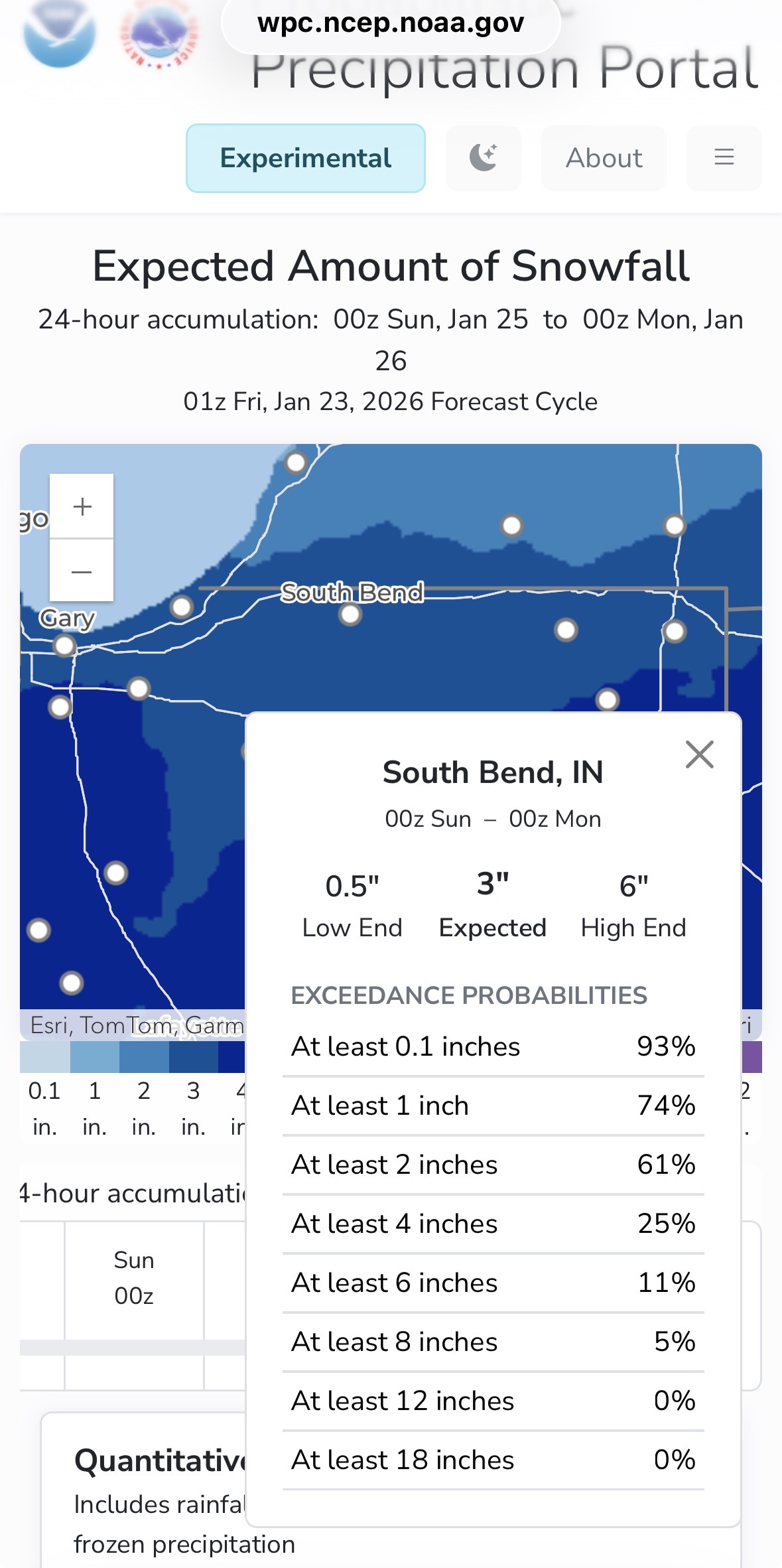
I think IWX upgrades watch to a warning then puts rest of its counties under an advisory for 3-6”. Although Berrien and Cass get that amount later with lake effect -
1/24-1/25 Major Winter Storm - S. IL, IN, and OH
sbnwx85 replied to A-L-E-K's topic in Lakes/Ohio Valley
And isn't this all really about the friends you make along the way? -
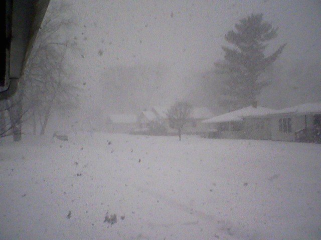
Brutal winter day again. Frigid, windy and lake effect snow. The flakes and the wind is probably breaking them apart but it’s making for low visibility at times. Also, the snow is developing just a few hundred feet above the ground so the radar doesn’t look impressive. Also, the sun peeks through between snow showers. Road salt isn’t working because of the cold so there are a lot of slide offs and crashes. I even had to help my gf who slid off the road in a neighborhood this morning. Very arctic feel today.
-
1/24-1/25 Major Winter Storm - S. IL, IN, and OH
sbnwx85 replied to A-L-E-K's topic in Lakes/Ohio Valley
Catching up this morning — too bad most guidance showing the drying trend on the north side of this system. Hopefully ratios make up for lack of QPF but 3” of system snow seems like a lock here. We’ll see what the lake can deliver on Monday. -
1/24-1/25 Major Winter Storm - S. IL, IN, and OH
sbnwx85 replied to A-L-E-K's topic in Lakes/Ohio Valley
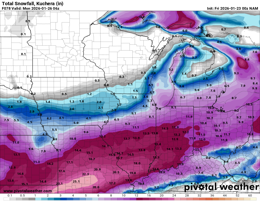
00z NAM is southeast. More in line with the Euro now.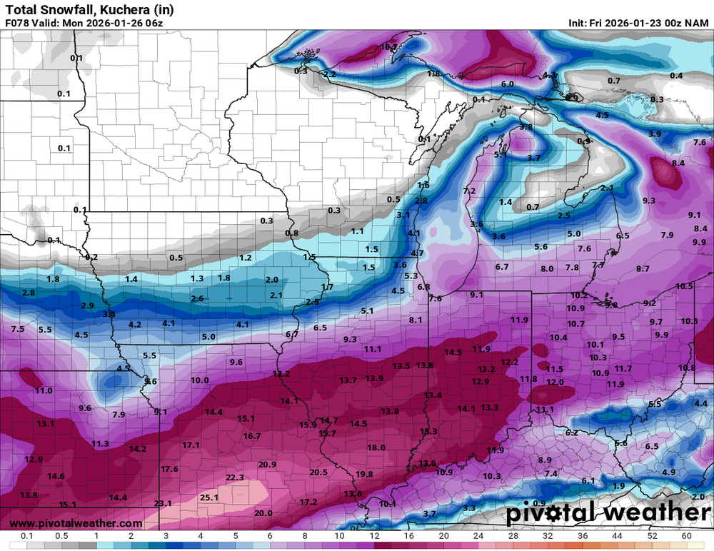
-
1/24-1/25 Major Winter Storm - S. IL, IN, and OH
sbnwx85 replied to A-L-E-K's topic in Lakes/Ohio Valley
Call looking money.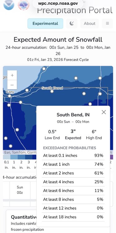
-
1/24-1/25 Major Winter Storm - S. IL, IN, and OH
sbnwx85 replied to A-L-E-K's topic in Lakes/Ohio Valley
Posting for posterity. Should continue to grow. -
1/24-1/25 Major Winter Storm - S. IL, IN, and OH
sbnwx85 replied to A-L-E-K's topic in Lakes/Ohio Valley
As good as that 11.2" looks over SB, the Euro is overdoing tomorrow's lake-effect locally. Probably subtract 4" from that for me. The lake-effect on Monday looks decent though. -
But like... a glacier?