sbnwx85
-
Posts
1,928 -
Joined
-
Last visited
Content Type
Profiles
Blogs
Forums
American Weather
Media Demo
Store
Gallery
Everything posted by sbnwx85
-

Winter 2025-26 Short Range Discussion
sbnwx85 replied to SchaumburgStormer's topic in Lakes/Ohio Valley
Final call of 1.8" on Sunday -
Winter 2025-26 Short Range Discussion
sbnwx85 replied to SchaumburgStormer's topic in Lakes/Ohio Valley
juiced af -
Winter 2025-26 Medium/Long Range Discussion
sbnwx85 replied to michsnowfreak's topic in Lakes/Ohio Valley
Hoping we can cash in on some short duration lake effect events following the clippers next week on this side of the lake. -
SXUS73 KIWX 051329 RERSBN RECORD EVENT REPORT NATIONAL WEATHER SERVICE NORTHERN INDIANA 826 AM EDT FRI DEC 5 2025 ...RECORD LOW TEMPERATURE SET AT SOUTH BEND FOR DECEMBER 5... A RECORD LOW TEMPERATURE OF 2 DEGREES WAS SET AT SOUTH BEND EARLY THIS MORNING. THIS BREAKS THE OLD RECORD OF 4 DEGREES SET IN 1899. $$
-
Great path except it dies as it gets here.
-
Mf’s have arrived.
-
Sure enough, got 3”. Three day total of 13.9”. 10” snow depth.
-
Kinda ripping. Getting some decent banding considering the high ratio snows. Might get 3”.
-
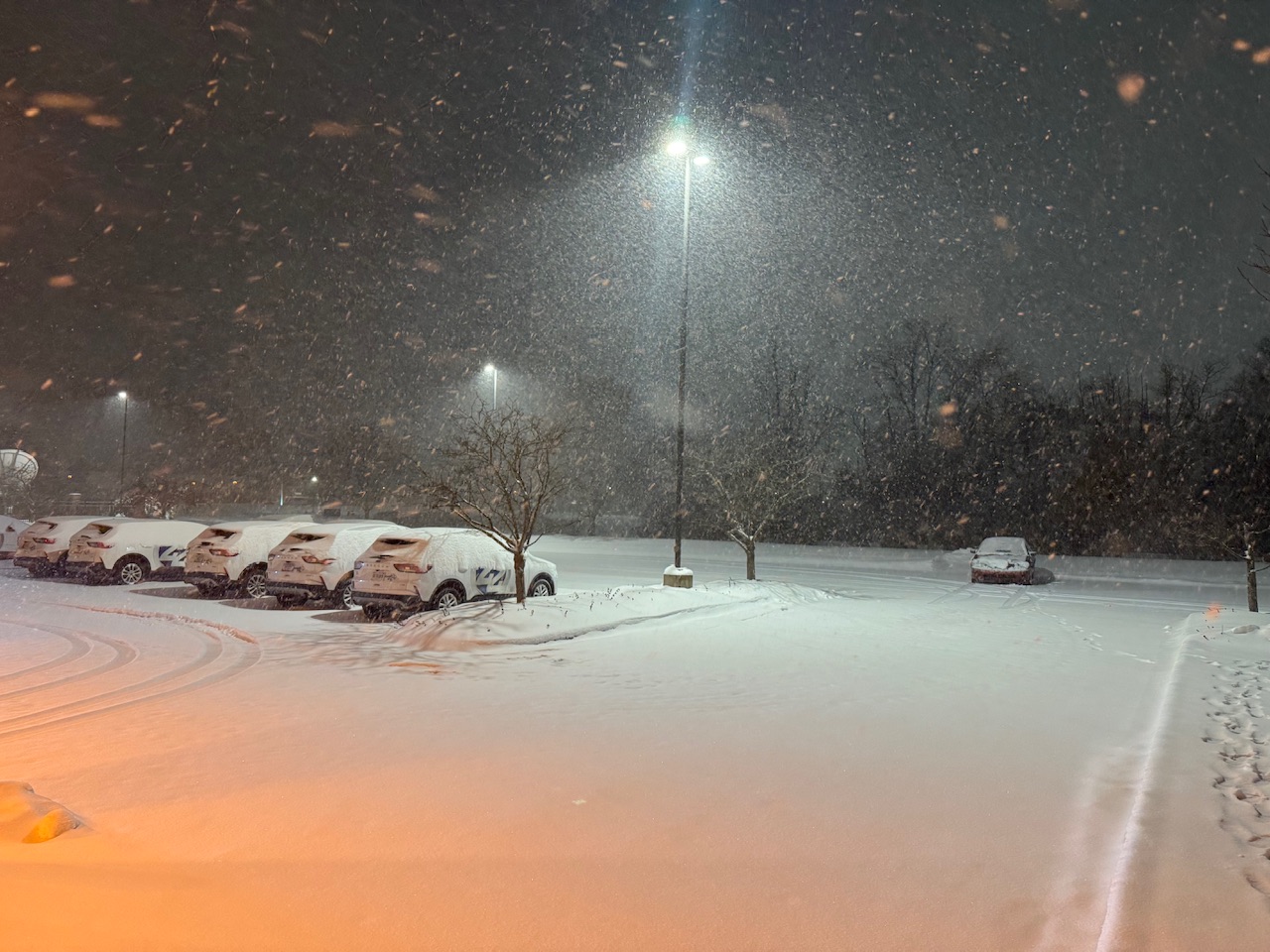
Took a little while but rates have improved over the last hour or two. Should end up with a couple of inches of fresh powder.
-
https://www.facebook.com/share/v/14TwtUcsdyu/ An interestingly angled lake-effect event happening in Muskegon tonight.
-
Winter 2025-26 Medium/Long Range Discussion
sbnwx85 replied to michsnowfreak's topic in Lakes/Ohio Valley
Parade of clippers would be nice to see for once. -
Added 2” today. Being my November total to 23.2” A November to remember for sure.
-
Looks like a solid 2-4” out this way.
-
One last hurrah.
-
Nov 28-30th Post Turkey Day Winter Storm
sbnwx85 replied to Chicago Storm's topic in Lakes/Ohio Valley
Storm total was 8.9” Any additional today I’m counting as lake effect. So far, 0.5” of lake snow. We lost about two inches to compaction so we have 7.5” on the ground currently. -
Nov 28-30th Post Turkey Day Winter Storm
sbnwx85 replied to Chicago Storm's topic in Lakes/Ohio Valley
8.8” in the backyard. -
Nov 28-30th Post Turkey Day Winter Storm
sbnwx85 replied to Chicago Storm's topic in Lakes/Ohio Valley
5.9” measures in South Bend at 7 pm. 10:00 update didn’t include a new South Bend measurement, but lots of 7-10” reports across northern Indiana. -
Nov 28-30th Post Turkey Day Winter Storm
sbnwx85 replied to Chicago Storm's topic in Lakes/Ohio Valley
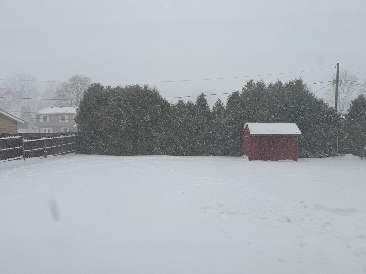
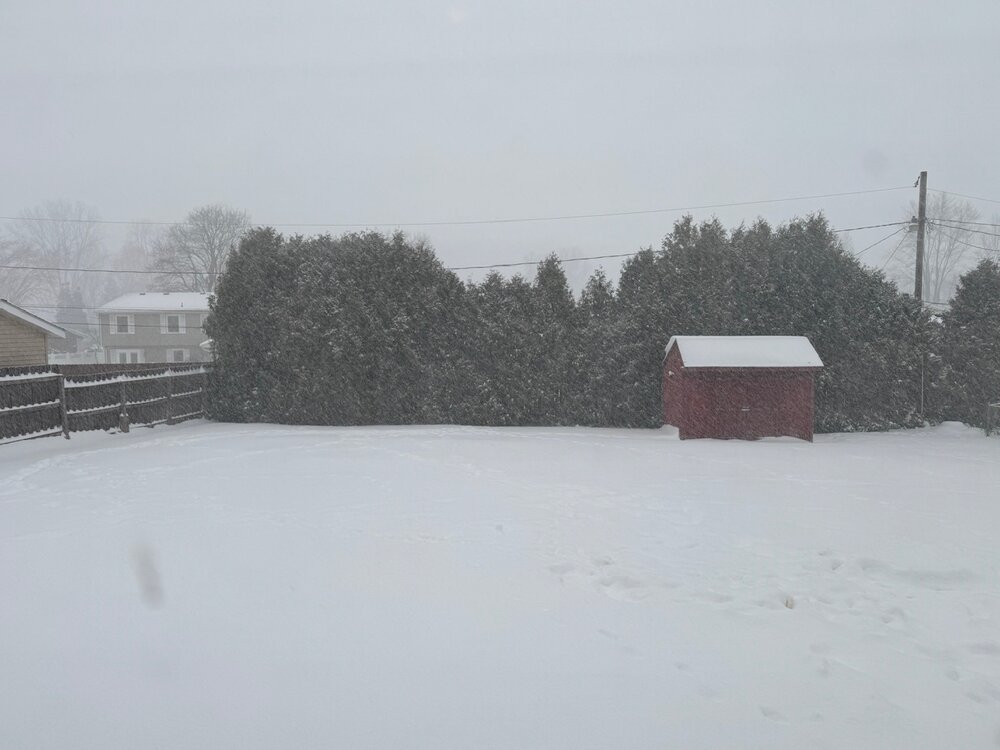
Had to go to work so I’m a little out of the loop on how the storm is evolving but stepped outside to major rippage. About 7” on the ground (despite our competitor measuring 1.1” ). Looks like a batch of dry air moving in before the final wave in Illinois slides through. 9” seems plausible. Then we’ll see what bonus we get from the lake tomorrow.
-
Nov 28-30th Post Turkey Day Winter Storm
sbnwx85 replied to Chicago Storm's topic in Lakes/Ohio Valley
Getting into the quality stuff now. Up to 3”. HRRR says 6” more before lake effect kicks in. -
Nov 28-30th Post Turkey Day Winter Storm
sbnwx85 replied to Chicago Storm's topic in Lakes/Ohio Valley
Thundersnow in Western Illinois.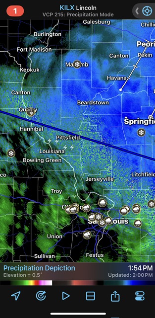
-
Nov 28-30th Post Turkey Day Winter Storm
sbnwx85 replied to Chicago Storm's topic in Lakes/Ohio Valley
Yeah we’re about to get a couple hours of good rates, a lull, and then the real show begins. -
Nov 28-30th Post Turkey Day Winter Storm
sbnwx85 replied to Chicago Storm's topic in Lakes/Ohio Valley
1/4 mile visibility at South Bend. Snow Freezing Fog 26°F -3°C Humidity 92% Wind Speed SE 13 mph Barometer 30.34 in (1028.7 mb) Dewpoint 24°F (-4°C) Visibility 0.25 mi Wind Chill 15°F (-9°C) Last update 29 Nov 11:54 am EST -
Nov 28-30th Post Turkey Day Winter Storm
sbnwx85 replied to Chicago Storm's topic in Lakes/Ohio Valley
Central Illinois getting clobbered Mesoscale Discussion 2239 NWS Storm Prediction Center Norman OK 1042 AM CST Sat Nov 29 2025 Areas affected...parts of IL...southeast IA...and far northeast MO Concerning...Heavy snow Valid 291642Z - 292145Z SUMMARY...Primary bands of moderate to sporadic heavy snow should pivot from south-central across southeast Iowa, and persist across much of central into northern Illinois through this afternoon. Rates around 1 inch per hour should occasionally occur. DISCUSSION...Long-duration snowfall event will persist through the afternoon, shifting eastward to the northeast of a surface cyclone near the western Kansas City Metro Area. Ongoing heavy snow band across south-central IA should largely pivot across southeast IA and perhaps expand as the strongest mid-level DCVA shifts across eastern IA this afternoon. Farther east, the persistent low-level warm conveyor will maintain a broad swath of moderate snow across central to northern IL. While the bulk of the ascent should remain beneath the dendritic growth zone centered around 550 mb, strengthening mid-level DCVA should foster sporadic bursts of heavier snow. Snowfall rates within these regimes should occasionally reach 1 in/hr.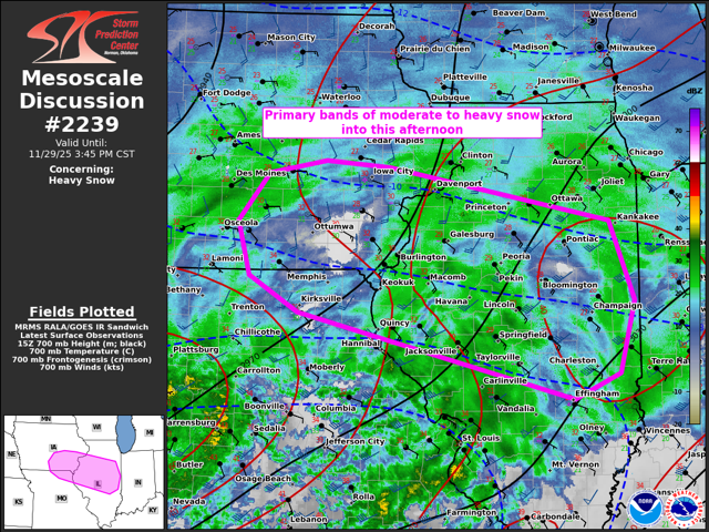
-
Nov 28-30th Post Turkey Day Winter Storm
sbnwx85 replied to Chicago Storm's topic in Lakes/Ohio Valley
HRRR picking up on a heavy lake effect band/mesolow swinging through Berrien County mid-late Sunday afternoon. Would be a mess with 10-12” already on the ground. -
Nov 28-30th Post Turkey Day Winter Storm
sbnwx85 replied to Chicago Storm's topic in Lakes/Ohio Valley
Things are on track here. It’s been snowing for a couple of hours and we have about a half inch so far. Consistently snowing with flake size and rate gradually improving. The radar looks great.