-
Posts
1,858 -
Joined
-
Last visited
Content Type
Profiles
Blogs
Forums
American Weather
Media Demo
Store
Gallery
Everything posted by sbnwx85
-
Areas affected...Parts of northeastern into central Illinois Concerning...Tornado Watch 255... Valid 160036Z - 160130Z The severe weather threat for Tornado Watch 255 continues. SUMMARY...Severe hail and damaging winds are the primary concern, though the tornado risk could increase with any sustained supercells over the next couple hours. DISCUSSION...Severe storms are tracking eastward along the north/south-oriented dryline feature across northeastern/central IL. Storms have increased in intensity/coverage over central IL (along the southern portion of the line), where large-scale ascent in the exit region of a midlevel jet is maximized amid strong buoyancy (around 3000 J/kg MLCAPE) and minimal inhibition. Given the strong buoyancy and 60 kt of 0-6km shear oriented perpendicular to the line, these storms will continue to pose a risk of severe hail and damaging winds. Sufficient low-level shear (around 30-kt 0-1km per ILX VWP) and rich boundary-layer moisture will also support a tornado risk, especially with any established supercell structures. Farther north into northeastern IL, storm coverage has been limited owing to weaker large-scale ascent. However, as the dryline feature intercepts the old lake breeze boundary, an uptick in severe potential will be possible over the next hour or two. Ample buoyancy/low-level moisture and sufficient low/deep-layer shear will support supercell structures capable of damaging winds, large hail, and a tornado or two. ..Weinman.. 05/16/2025
-
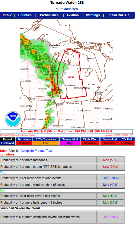
URGENT - IMMEDIATE BROADCAST REQUESTED Tornado Watch Number 256 NWS Storm Prediction Center Norman OK 820 PM EDT Thu May 15 2025 The NWS Storm Prediction Center has issued a * Tornado Watch for portions of Lower Michigan Lake Michigan * Effective this Thursday night and Friday morning from 820 PM until 300 AM EDT. * Primary threats include... A few tornadoes possible Scattered damaging winds likely with isolated significant gusts to 80 mph possible Scattered large hail and isolated very large hail events to 2 inches in diameter possible SUMMARY...Intense thunderstorms will spread east-northeastward this evening and overnight across much of Lower Michigan while posing a threat for scattered to numerous severe/damaging winds. Peak gusts may reach up to 70-80 mph. A few tornadoes may also occur within the line of convection. Large hail will be possible with any embedded supercells. The tornado watch area is approximately along and 60 statute miles east and west of a line from 60 miles north of Traverse City MI to 10 miles southwest of Kalamazoo MI. For a complete depiction of the watch see the associated watch outline update (WOUS64 KWNS WOU6). PRECAUTIONARY/PREPAREDNESS ACTIONS... REMEMBER...A Tornado Watch means conditions are favorable for tornadoes and severe thunderstorms in and close to the watch area. Persons in these areas should be on the lookout for threatening weather conditions and listen for later statements and possible warnings.
-
We're so back. Mesoscale Discussion 0798 NWS Storm Prediction Center Norman OK 0650 PM CDT Thu May 15 2025 Areas affected...Parts of western/central Lower Michigan into northern/central Indiana Concerning...Severe potential...Watch likely Valid 152350Z - 160115Z Probability of Watch Issuance...80 percent SUMMARY...A line of severe storms capable of producing embedded tornadoes, damaging winds, and large hail will overspread the area from the west into tonight. One or more watches will likely be issued for parts of the area. DISCUSSION...A broken band of severe storms, including several embedded supercell structures, is tracking eastward across far eastern Wisconsin -- posing an all-hazards severe risk. As an occluded surface front continues eastward, this line of storms, and potentially new storms in the pre-frontal warm-advection plume, will overspread western/central Lower MI and northern/central IN over the next few hours. Earlier diurnal heating of a moist boundary layer (middle/upper 60s dewpoints) beneath steep midlevel lapse rates is contributing to moderate/strong surface-based instability. In addition, 40-50 kt of effective shear oriented mostly perpendicular to the ongoing convection will support a band of severe storms with embedded supercells and bowing structures. Ample low-level SRH will support embedded tornadoes, with damaging winds and isolated large hail also possible. One or more watches will likely be issued for the area.
-
New MD out for Illinois. Monster hail possible. Mesoscale Discussion 0794 NWS Storm Prediction Center Norman OK 0322 PM CDT Thu May 15 2025 Areas affected...Parts of central and northern Illinois Concerning...Severe potential...Watch possible Valid 152022Z - 152215Z Probability of Watch Issuance...60 percent SUMMARY...Large to very large hail and severe winds will be possible with supercells that can develop later this afternoon. Watch timing is uncertain but is possible later this afternoon. DISCUSSION...Cumulus are developing along an eastward moving dryline near the Mississippi River. Ahead of this boundary, a strongly unstable airmass is in place (low 90s F temperatures and mid 60s to low 70s F dewpoints). With the strongest mid-level ascent to the northwest of the region, timing of storm initiation as well as storm coverage are uncertain. However, given the lack of MLCIN, a isolated to widely scattered development appears possible later this afternoon. 45-55 kts of effective shear will support supercells. The primary hazards will be large to very large hail and severe winds. The tornado threat is expected to be less than farther north given the slightly veered low-level winds and more sizable temperature/dewpoint spreads at the surface. ..Wendt/Mosier.. 05/15/2025
-
The first watch of the day is out. Public | Counties | Probabilities | Aviation | Warnings | Initial RADAR Hazard Tornadoes EF2+ Tornadoes Likelihood Moderate Moderate Severe Wind 65 kt+ Wind Moderate Low Severe Hail 2"+ Hail Moderate Moderate Note: The expiration time in the watch graphic is amended if the watch is replaced, cancelled or extended. Note: Click for Watch Status Reports. SEL1 URGENT - IMMEDIATE BROADCAST REQUESTED Tornado Watch Number 251 NWS Storm Prediction Center Norman OK 1245 PM CDT Thu May 15 2025 The NWS Storm Prediction Center has issued a * Tornado Watch for portions of Central Minnesota West-Central Wisconsin * Effective this Thursday afternoon and evening from 1245 PM until 800 PM CDT. * Primary threats include... A few tornadoes likely with a couple intense tornadoes possible Scattered large hail and isolated very large hail events to 3 inches in diameter likely Scattered damaging wind gusts to 70 mph likely SUMMARY...Rapid thunderstorm development is anticipated within a narrow warm sector moving into the region. Strong buoyancy and robust deep-layer shear will support supercells capable of all severe hazards, including very large hail from 2" to 3" in diameter, strong gusts, and tornadoes, a few of which could be strong. The tornado watch area is approximately along and 70 statute miles north and south of a line from 15 miles south southwest of Alexandria MN to 55 miles east of Eau Claire WI. For a complete depiction of the watch see the associated watch outline update (WOUS64 KWNS WOU1). PRECAUTIONARY/PREPAREDNESS ACTIONS... REMEMBER...A Tornado Watch means conditions are favorable for tornadoes and severe thunderstorms in and close to the watch area. Persons in these areas should be on the lookout for threatening weather conditions and listen for later statements and possible warnings. && AVIATION...Tornadoes and a few severe thunderstorms with hail surface and aloft to 3 inches. Extreme turbulence and surface wind gusts to 60 knots. A few cumulonimbi with maximum tops to 500. Mean storm motion vector 20035.
-
Yeah, let's get those soil temps up!
-
First time trying to grow grass. The rain and garden hose are getting the job done. Tomorrow’s rain will be welcome. Look at these little babies.
-
I'm worried I'll get stuck between the two risks. Maybe I can get initiation to occur overhead on Tuesday. The GFS is more hopeful than the Euro at last check.
-
Just got to work and the cell to my south is a real talker. Lots of rumbles.
-
Grass planting szn has started at the South Bend homestead. Sure sign of spring. Will I keep up with the dead patches caused by dog pee through the summer? Stay tuned.
-
You might squeeze a couple inches out this if it all goes right.
-
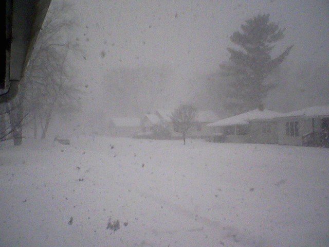
Snowing big wet flakes here. I miss the tornadoes.


